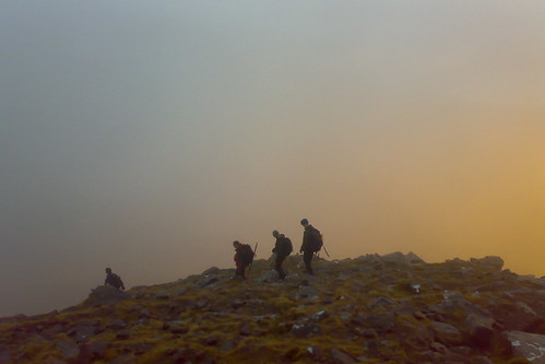
I had an unusual Hogmanay this year – up in Torridon with JOK. We stayed in Kinlochewe, by Loch Maree, and celebrated New Year itself at the Kinlochewe Hotel.
It turns out that quite a few JOKers are closet Munro-baggers. It was great to get out on the hills and climb some Munros, my first multi-day Munroing trip for nine years, I think. I climbed six new Munros, and also climbed Beinn Alligin again – this time, it was misty on the ridge, but still an exciting walk. I decided not to accompany some of the more dedicated Munroists on one of the days, when they climbed five of the Fannichs – not a bad round for midwinter. We didn’t have much in the way of snow, apart from on the way back on the last day.
I definitely need to get back and starting climbing Munros on a regular basis again. Why? Because “they are there.”
Photos from the trip – mostly taken with my cameraphone.
Day reports for the week – on my Attackpoint training journal.
I’m currently building a website that maps my climbed Munros, I will post about it in due course. I hope to eventually make it usable by anyone for tracking their Munro climbing.
Here’s some pseudo-3D geovisualisation of some of the routes we took. The pictures are screenshots from Google Earth, with my route shown in red, having been recorded with my Garmin Forerunner 305 GPS receiver. Not entirely coincidently, I spent Christmas evaluating a dissertation, an assessed part of my MSc course. The topic – Use of 3D geovisualisation to plan hiking routes. It was written before the days of Google Earth, so was quite prescient.
Beinn Alligin: December 31st

Our horseshoe route.

Our steep route down from the first Munro.<br /
Moruisg: January 2nd

Our route around Moruisg and the neighbouring Munro.

Looking along the ridge from the first summit.
Beinn Tarsuinn: January 3rd

Our route, looking from the A9 towards the summit.

View from above the summit, looking back along the approach route.
One reply on “Hogmanay in Torridon”
[…] Once again I was up in the Scottish Highlands with JOK. We were staying in Onich, on the Glen Coe to Fort William road, but most of our mountaineering was in Glen Coe itself, apart from one day in Ardgour. It was generally cold but clear, with a decent amount of snow on the hills, and a biting northerly wind at times, so days were generally quite short but very scenic. […]