Categories
Uncategorized

Worst First Leg Ever?

I seem to fairly regularly screw up the first leg on orienteering courses. Often, the shorter the first leg, the worse the mistake. It’s as if I need a moment or two on a course to “warm up” my navigational abilities, just like I need a moment or two before the start to warm up my muscles.

Sunday (Day 3 of the JK) was a particularly bad example. There were a lot of factors against me – I was late for my start, I had just cycled 12km uphill from the station to the event arena, it was my third really early start in as many days so I was very sleep deprived, it was snowing, windy and very cold, there was no club tent to change in as it was so early, my thumb-compass had developed a large bubble in it, and my left inside knee started hurting a lot while jogging to the start line. This was worrying – I freak out every time my knee hurts, after a long and frustrating recovery from a previous knee injury in 2003.

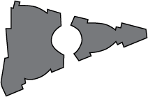
So, I was not best prepared for what was going to be a 12.7km cold, wet slog over exposed moor and forest. I rushed through the start, without having time to warm up, check the sample map or check the start direction. As I picked up my map, I was relieved to see the first control was a straightforward 200m away. I carelessly charged forward, and completely missed it:

Ashdown Leg 1 Mistake

Ashdown Leg 1 Extract

10:15 for a 200m leg. My official split is 13:15 as I was three minutes late off the start. After this rather unfortunate start, and concerned about the knee, I decided to bail – I diverted to the last third of the course, ambled around it, getting even colder in the process, limped back to the finish and now-erected club tent, gratefully accepted an early lift to the station, and spent the rest of the day in the warm and the dry.

Categories
Notes

Mystery Building

Here’s a mystery building for you – can you guess what it is? It’s in the City of London.

Categories
Uncategorized

Layers used in the City of London Map

Here is how I am layering the City of London map, which I am creating using Adobe Illustrator and the MapStudio plugin. I’m basing the features/colours on the ISSOM2007 spec, as much as possible.

Layers

Layer Main Colours Features
O-Courses Purple, Brown Courses, Corrections, Northing Lines
Tunnel Walls Black Dots, Brown Showing runnable routes below main level. May use thick brown lines to show tunnel entry points.
Point Features Black, Green Statues, Fountains, Ornamental Pillars, Lifts*, Stairwells, Distinctive Trees
Buildings Dark Grey, Black Buildings
Construction Black, White Construction Sites and Hoardings
Barriers Black, Dark Green Uncrossable Barriers (Walls, Gates and Railings), Crossable Fences, Hedges, Historic Stone Walls
Low Walls Light Grey Crossable Walls
Out of Bounds Land Olive Green Permanent Out-of-Bounds Open Areas
Water Blue Lakes, Rivers, Water
Steps Dark Grey Staircases, Steps
Underpasses Light Grey Underpasses, Building Canopies
Vegetation Dark Green, Light Green, White Flowerbeds (OOB), Woods
Open Land Yellow Accessible grassy areas
Pavement 10% Brown Pavements, Pavement-level Roads (May be revised to simply be thin lines show significant paved areas separated from the road.)
Road 20% Brown Roads (Colour may be changed to match the Pavement colour, to aid clarity)

Line widths

Linear Feature Width
Steps, pavement edges, underpass boundaries 0.07mm
Out-of-bounds (OOB) boundaries**, crossable fences, building boundaries, prominent boundaries within OOB areas 0.14mm
Underpass dots (dot diameter) 0.2mm
Crossable walls, uncrossable*** barriers (fences/walls), stairwell sides and separators, construction site boundaries 0.35mm

*These will probably be removed from the map in a later revision. You can’t really use one competitively!

**In some cases, no line is used (e.g. driveway) or the wall-line is used (obvious wall blocking use of OOB area as a run-thru.)

***Crossable underneath the barrier if dotted lines indicate a passageway underneath the main running level.