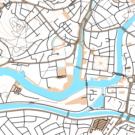
I’m hoping to do some significant work on OpenOrienteeringMap (more information) in the near future.
Below is a summary of the major features that I am hoping to include, and you are invited to leave your feature requests as comments here too. (I may eventually get around to formalising this in a code repository.)
High Priority
- [1] Editing of control locations, numbers and number positions for existing maps, via the web interface.
- [1] Saving of existing maps, via a short URL.
- Applying out of bounds points (e.g. gates), lines (e.g. major roads) and areas (e.g. closed parks) to the maps.
- [1] Addition of a new style – Street-O Enhanced, which builds on the Street-O style but adds parks, open areas and other useful features.
- Addition of a new style – Urban Adventure, which includes street names for the larger roads.
- [1] Automatic creation of the clue-sheet.
- [1] Assignment of points values to the controls. This will help with the clue-sheet creation and potential future route-analysis applications.
- Optional colouring of control circles based on points values.
- Better match of the look of the web preview and the final PDF.
- A basic how-to guide.
- Inclusion of a OpenStreetMap editing 101 guide.
- Output of a high-resolution raster (e.g. JPG) of completed maps and “blank” maps, for embellishment in Purple Pen etc.
- [2] Automatic daily refresh of the data from OpenStreetMap.
Medium Priority
- [2] Increase contour widths and/or darken colours.
- More configuration options, e.g. railways on/off, contours on/off.
- Import/export of courses, probably via text config file.
- Allow separate start and end points.
- Creation and setup of an alternative tile rendering source.
- [2] Use source code management for the website and the stylesheets.
- [2] Better usage tracking and statistics.
Low Priority
- Use OS Open Data Vector Map District as alternative data source – misses out paths/parks, but complete coverage for roads.
- [1] Apply OpenOrienteeringMap logo and branding.
- Create point-to-point courses, with straight lines between each line.
- Use SVGs rather than raster graphics for points and complex lines.

7 replies on “OpenOrienteeringMap – Thoughts on a Version 2”
[…] About a year ago, I mentioned that I would be spending a bit of time rewriting OpenOrienteeringMap (OOM). The web application, which people use to create printable simple “street orienteering” (or Street-O) maps for use in low-key events such as the SLOW Street-O series events, has been around for a bit, and was not the most intuitive or prettiest application to use. […]
Ollie – sounds great! Your ‘High Priority’ list includes pretty much all the things I can think of that I would have liked to see added to the software. Whilst I can see that others would like the option to edit courses in Purple Pen, I think it’s brilliant to be able to do the whole creation of the maps/courses directly within OOM without needing any external software, which also makes it appear more user-friendly for more novice street-O planners. Look forward to seeing the update in due course.
Oliver — Thanks for all your work on OpenOrienteeringMap — it is wonderful app. I use it all the time, and I know others that do too.
I tend to agree with Sean. My preference would be to make it easier for people to create courses in Purple Pen, and use your time to improve map creation and rendering flavors.
To use PP today, I take screen shots from OOM, piece them together in InkScape and save that to a pdf file that I then use as the base map in PP. It is more complicated than that, because I have to do some tedious manipulations to get the scale just right. Maybe there is a better way?
Just a thought – if you are producing a PDF from your stitched together screenshots, why not just produce the PDF from OOM directly? You can produce the PDF without circles/courses in it – just uncheck “draw controls”.
As it’s a vector PDF, you can zoom in as far as you need to, if you need to have a very large image as the basemap. Plus it has a scale bar so that should help too.
Thanks for nice work with the OpenOrienteeringMap. My highest priority is better contours (does not look good here in the Bergen, Norway area) – but I guess getting a good data source is not easy..
I think it’s a great innovation. Purple Pen has really helped us in DFOK as it allows anyone to produce the course and takes the strain off the one or two people with the OCAD licence. With this it means we could do street maps of almost anywhere without waiting for the people with OCAD or mapping skills to get the time. Excellent.
My first priority would be the ability to export the map file in JPEG format so the course can be produced in purple pen. Purple Pen has a number of features that this system doesn’t have.. such as the ability to mark on extra text (advertising future events, organisers phone number etc) and mark roads as OOB where they are dangerous.
Espen Isaksen, the guy behind turkompisen.no is working on maps with contours based on ASTER data.
Kartverket might have a contours only free for non-commercial use webservice too, but I doubt it.