The National Library of Scotland (NLS) yesterday unveiled a HUGE collection of maps that they have digitised and placed online. The maps, covering England and Wales, are historic Ordnance Survey maps that are between 60 and 170 years old and are at a high resolution. The scale is 6-inch-to-the-mile and covers the whole country. At the moment each map can be viewed by clicking on the appropriate box on an online map, they plan to undertake further work to join many of the maps together to create a single scrollable historic map of the whole country this summer.
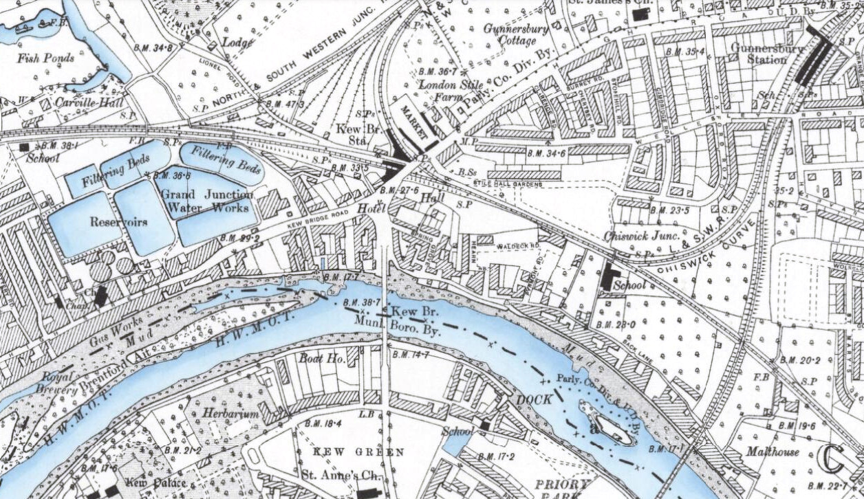
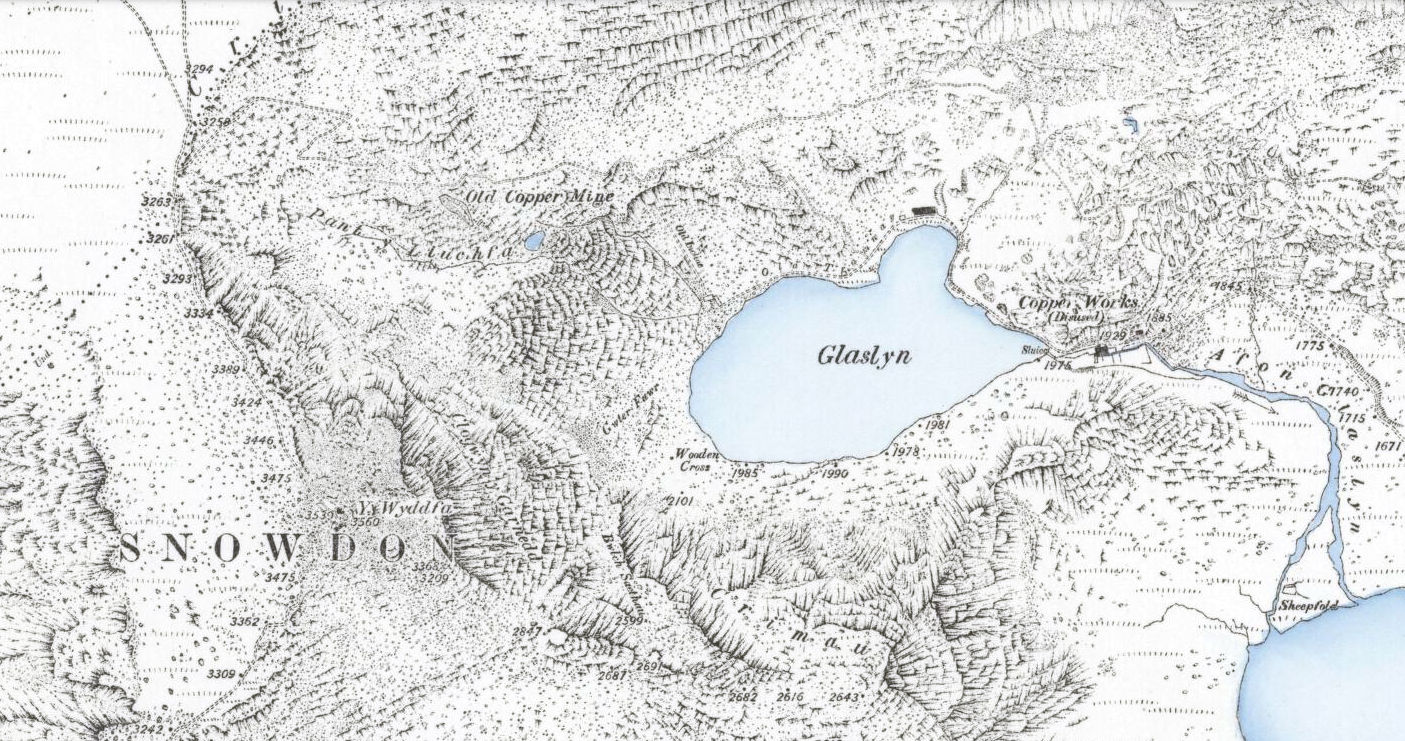
The extract above, of the Kew Bridge area in 1899, is from this map (I’ve shifted the white balance.) Some of the maps have some rather nice colouring for water – with the blue colour being augmented by some subtle shading on the riverbanks. The same effect is see in a Snowdon map (extract below), from 1889.
I featured an earlier release of Victorian 60-inch-to-the-mile maps, for London, on Mapping London. The number of retweets and Facebook likes for this posting was unprecedented for the blog, suggesting a huge interest in high quality scans of historic maps.
Here’s their press release, includes the reason why the NLS is including maps from outside Scotland!
New map resource – OS six-inch England and Wales, 1842-1952
We are very pleased to announce the availability of a new website resource – zoomable colour images of the Ordnance Survey’s six-inch to the mile (1:10,560) mapping of England and Wales. All our map digitisation work in recent years has been externally funded, hence the recent expansion of our map images beyond Scotland.
This is the most detailed OS topographic mapping covering all of England and Wales from the 1840s to the 1950s. It was revised for the whole country twice between 1842-1893 and between 1891-1914, and then updated regularly for urban or rapidly changing areas from 1914 to the 1940s. Our holdings are made up of 37,390 sheets, including 35,124 quarter sheets, and 2,237 full sheets.
The maps are immensely valuable for local and family history, allowing most features in the landscape to be shown. The more detailed 25 inch to the mile (or 1:2,500) maps allow specific features to be seen more clearly in urban areas, as well as greater detail for buildings and railways. However, most topographic features on the 25 inch to the mile maps are in fact also shown on the six-inch to the mile maps.
The easiest way of finding sheets is through a clickable graphic index using our ‘Find by Place’ viewer: http://maps.nls.uk/openlayers.cfm?id=39&zoom=6&lat=53.39954&lon=-3.0305
This allows searching through a gazetteer of placenames, street names, postcodes and Grid References, as well as by zooming in on an area of interest with smaller-scale locational mapping as a backdrop.
The sheets are also available via county lists: http://maps.nls.uk/os/6inch-england-and-wales/counties.html
We plan to also make georeferenced mosaics available of the series by the late summer.
OS six-inch England and Wales home page: http://maps.nls.uk/os/6inch-england-and-wales/index.html
Further information: http://maps.nls.uk/os/6inch-england-and-wales/info1.html

5 replies on “37000 Old OS Maps”
The Snowdon map is almost more art than map. Thanks for sharing the work of the NLS.
Alastair Majury
Brilliant, we are so grateful for the use of this website as to an aid to history, archeology and geology.
Thank you,
[…] See also this similar effort with Victorian Ordnance Survey maps. […]
[…] (Found via oobrien.com) […]
[…] 3. National Library of Scotland (NLS) släppte en skitstor samling gamla kartor. 37000 kartor som är mellan 60-170 år gamla har digitaliserats och gjorts tillgänglig via internet. Läs mer här. […]