I fixed my GPS yesterday, and finally got around to installing the mounting kit for my bike. As I’d missed my morning 5K time trial race, I thought I would finally get out on my bike and map the streets around where i live, for Open Street Map. This project is aiming to build a public-domain, copyright free map of the world. It was started by UK mapping enthusiasts and still has a lot of focus on the UK – its first conference was in Manchester last weekend, which is what got me thinking about it. I’ve been listening to the conference recordings over the last few days.
London in general has quite good coverage but there are plenty of gaps where I live, so I concentrated on my immediate local area. Execution consisted of cycling along all the streets – generally down the middle of them although swerving for cars – and photographing street signs for later annotation. My GPS recorded my position every second. Later I uploaded the GPS track to Open Street Map and then used the online Potlatch Flash map editor to add in, extend and annotate the streets. The results should appear on the main map within the next week – after then, parts of London E1 and E2 should be showing many more streets than before.
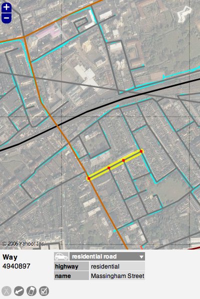
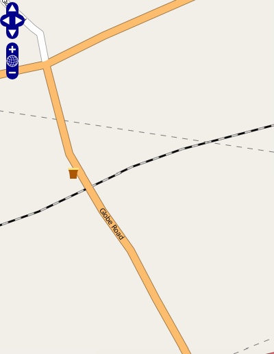
The first picture is from the editor, Potlatch. The lines in blue are my GPS tracks. The grey lines are roads I’ve added. One is selected, showing the attributes (in this case, the street name.) The satellite imagery in the background provides a useful check that the GPS tracks are accurate. The second picture is the equivalent view on the map itself – once my edits go through, this part of the map should look considerably more complete.


2 replies on “Open Street Map”
Thanks David. Yes, I used the aerial imagery as a safety check when creating the roads from my GPS traces. The combination of the GPS traces and the imagery means I can be pretty sure things are correct. The imagery is not always up to date though – one of the roads I added is only a few weeks old. So, for this street at least, OSM is the only online atlas that has it.
Note that you no longer need a GPS to help out with OpenStreetMap. You are permitted to used the Yahoo! Aerial Imagery directly to trace out roads. You still need to either know, or go there to find out, the names though!