Categories
Notes

Map of Maps

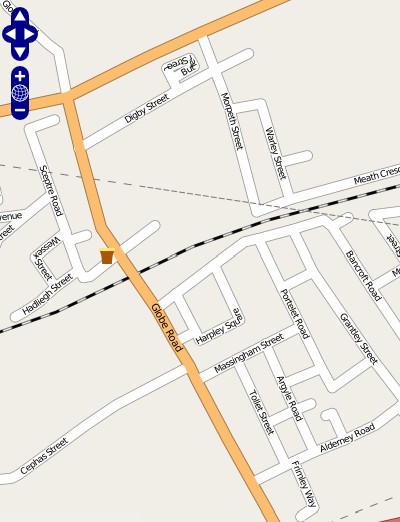
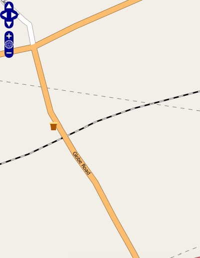
I’ve added a Map of Maps to go alongside my UK O-Events Map page. Both pages look similar as they have the same structural layout and stylesheet. The Map of Maps shows you your nearest orienteering maps registered with BOF, and from this lists your local clubs – possibly useful for someone wanting to join their local club or an existing orienteer moving house.

The Map of Maps page is much slower to render as it has to parse 3000+ maps. For each one it takes the OS grid reference, works out the latitude and longitude* and then the distance from your postcode, before ordering everything to find the 100 closest to you, showing them on a map, and on a handy table with weblinks to each club.

Map of Maps

The main problem remaining is the quality of the source data – there are numerous grid reference mistakes, many maps don’t have grid references at all which means they will never show up – there are spelling and capitalisation inconsistencies, entities listed in the clubs field which are not actually clubs, and older revisions of a particular map remaining alongside the newest one.

Most of these I’ve been able to deal with in an elegant way, by creating my own clubs database table with the appropriate metadata. The one hack I’ve had to leave hardcoded into the page is NOC, which is normally Nottingham Orienteering Club, but is also the National Orienteering Centre for some Scottish maps (and so not a club.) It also appears as NATCEN. Grr!

The initial work is now complete – it took a couple of days of effort, including quite a lot of learning about PHP arrays and lamda functions – I’d managed to get away with not using these before. I also took the opportunity to tidy up my existing code, into something which was more efficient, with a lot less duplication and sloppy coding, which I’ll be able to extend easily for future mashups.

The next feature will be a slightly more intelligent “local club” calculation, based on the number of maps a club has, weighted by their proximity to you, rather than simply the club with the closest map being your “most local club” in the present form. I also need to automate the collection and processing of data from BOF, although this is lower priority as I’m only planning on sync’ing with them every few months, unlike the events map which is sync’d, in theory, on a weekly basis.

Announcement of my original Map of Maps, way back in 2004 – before Google Map Mashups took off.

*Technically minded readers will realise I could do this when doing the initial load of BOF data into my database. I could – it’s on the list, and will be done if the Map of Maps page performance gets worse.

Categories
Notes

Fame at Last ;-)

…I’m in the picture on the front page of the OpenStreetMap wiki.

OMG Ponies!

(For the archives: Direct link to the photo.)

Categories
Notes

Events Map Update

{Updated] I’ve added a new feature to the events map – filtering by club or region. This only works on the table at present, not on the map. The filtering is done client-side, i.e. by your web browser, using Javascript. Choose a club, or a region, from the drop-down at the top of the table, and the table should dynamically redraw itself to only show the relevant rows. Let me know if this feature doesn’t work for you, or you see bugs I’ve missed.

[Update – It looks like this feature wasn’t working in Internet Explorer 7, this was due to a bug which I’ve now fixed! I’ve also made the drop-down lists more readable.]

In addition, the webpage is now W3C standards compliant (XHTML Strict and CSS.) If that means nothing to you, you just need to know that it means it should work well, and look the same, regardless of which web browser you use. Less than 2/3rds of visitors use Internet Explorer, now. Cosmetically, you’ll see a little different, but I had to rewrite quite large parts of the page in order to get it to pass the W3C tests. This spring-cleaning means I’ll find it easier to add new functionality in the future.

BOF have overhauled their website, including their fixtures page. This breaks the script I use to pull updates from their page to the events map, so updates won’t work until I’ve figured out how to parse the new page. I’ll take a look at this next time their fixtures page is updated.

Categories
Notes

City of London Orienteering Map

I’m going to have quite a lot of spare time over the next year (more on that shortly) and one of the projects I’m planning on doing is creating a City of London Orienteering Map, to ISSOM spec, for a possible future sprint orienteering race. There is already an orienteering map of the area, although it is simple (black & white, with roads features shown as lines.)

The City of London is an ideal area for a sprint orienteering race – a maze of historic winding roads, lots of interesting features, and best of all it is very quiet traffic-wise on Saturday and Sunday mornings.

This map shows the planned area I am going to survey. The light blue area is my initial target area (Smithfields, St Barts, St John Street, Barbican, The Square Mile north of Bank, Moorgate, Liverpool Street, Charterhouse, Tower 42 and the Gherkin.) A future extension might include some of light green area (the area between Bishopsgate and Commercial Street, the Tower of London, St Catherine’s Dock, Shad Thames, Millennium Bridge, Bankside, The Tate Modern, St Paul’s Cathedral and the Pool of London.)

The undoubted highlight will be the Barbican Complex, confusing at the best of times. I don’t think I’ve ever not got lost wandering around the Barbican area. The network of bridges above the busiest roads will be a feature too. Other interesting areas in the initial map will be Smithfields Meat Market, St Bart’s Hospital, and Guildhall.

I will probably be using Adobe Illustrator and the MapStudio plugin to create the map, as OCAD does not run well on Macs. Here’s a previous map I created with it – although this was done in a couple of hours based on a very short survey!

I’ve been to a few sprint races recently – Oxford, York and Kingussie to name but three. I’ll also be going to Warwick and Lincoln, and back to Oxford, soon.


ISSOM map samples from York, Scarborough, Sheffield and Wapping. The last is just east of the City of London.

And after the City of London there’s always Canary Wharf…

Categories
Orienteering Events Log

Back (Part 2)

Back from the Scottish Six Days, my second week’s orienteering this summer. Now at my parents’ house near Edinburgh, currently planning shows to see at the Edinburgh Fringe Festival over the next three days. To be precise, I’m lazing about while Alex and Nick are doing the planning…

Summary of the Scottish Six Days – great areas, especially Culbin (Thursday) and Anagach (today). Living in a huge Victorian mansion deep in a valley in the Highlands was rather special – the grand dining room with chandelier and paintings of various classical types was memorable – as were the sumptuous meals cooked by Tim and CJ. One particular meal finished at midnight. The midges were a bit of a menace, especially on the last day when they knew we were leaving. And it was a shame it rained on four of the six race days – though it wasn’t that bad when you were out on the forest. I got an opportunity to practice my race photography skills with my new SLR camera. Framing and focusing were difficult but I got a few good shots.

Categories
Notes

OO Cup Maps

I’ve put my maps from the recent OO Cup 5-Day event in Slovenia on my Routegadget install here. You can also view the maps individually (1, 2, 3, 4, 5.)

Here’s my favourite part out of all the OO Cup areas this year. One word: Karstastic.

Categories
Leisure

OSM Update

The rendering for my first mapping for Open Street Map project has now appeared on the online service:

Compare with what it was like before:

My next OSM contributions will be some alpine roads in northern Slovenia. I got some good GPS traces for many of the roads I travelled on during last week’s holiday. Here’s a Google Earth view of one of the traces (in blue) – note I’ve tilted the viewpoint so you can see the shape of the hills and why the road had so many hairpins:

Categories
Notes

Back

Back from an awesome 5 days of orienteering at the OO Cup in northern Slovenia. Had some time to be a tourist too.

I will (of course!) write up each day in full when I get the time but, to sum up the week in a few phrases: Rustic chalet on remote farm, alpine shepherd houses, cows with cowbells, Lake Bled with fairy-tale island, negative karst terrain (the contours go down, not up!), a gorge and a cave, hairpin bends on mountain roads, hot and sunny to cold and wet in 24 hours, a walk in the mist, huge portions of food at amazing prices, some new Slovenian roads to be added to OSM in due course, a random biker bar, and some of the most enjoyable orienteering courses I’ve ever done.

Now back in London for a day or so, then up to Scotland to prepare for the Scottish 6 Days. I’ve just heard I”m going to be living in a remote Victorian Highland lodge for the week there – Glentromie Lodge, several miles down a winding country road deep into the Cairngorms. Possibilities for some Munro-ing, if I’m not too exhausted from the racing… or maybe just some Geographing and OSMing. Hoping for another memorable week.

Categories
Notes

Holiday

My race itinerary for the next fortnight:

26 July, 12:58 – M21A, Velika Planina North, Slovenia.
27 July, 12:38 – M21A, Velika Planina South, Slovenia.
28 July, 13:56 – M21A, Letus, Slovenia.
29 July, 12:48 – M21A, Zavodice, Slovenia.
30 July, 10:24 – M21A, Ticjak, Slovenia.
1 Aug, 19:15 – Clued-O, Sheen Common, London.
5 Aug, 12:45 – M21S, Alvie, Scotland.
6 Aug, 13:20 – M21S, Balavil, Scotland.
7 Aug, 10:05 – M21S, Inshriach West, Scotland.
8 Aug, 16:00 – Open, Kingussie Sprint Race, Scotland.
9 Aug, 10:54 – M21S, Culbin, Scotland.
10 Aug, 11:35 – M21S, Camerory, Scotland.
11 Aug, 12:13 – M21S, Anagach West, Scotland.

Categories
Orienteering Events Log

Race 16: Nonsuch Park

The sixteenth and last of my preparatory races before the OO Cup and the Scottish 6 Days. This was a “Frolics” race put on by Mole Valley at Nonsuch Park in south-west London – I was running for SLOW and will have hopefully counted for the team for the Frolics trophy.

See my Attackpoint log for the details of how I raced. I ran with GPS, here’s a Google Earth extract of my route between 6 and 8 – also you can see my small mistake on the approach to 6. From 6 to 7, I kept left of the trees – at this kind of year, the undergrowth can be venomous. On the approach to 8, I got caught up in the very rough open – knee high grass!