Peter Reed has been doing some excellent work comparing the Department of Transport measured road lengths by English county, and comparing them with the total lengths of roads in OpenStreetMap.
This has only recently become possible to do with spatial data purely in OpenStreetMap, because the English counties have now been completely added to the project. This last step was harder than it might seem because there is no freely available definitive source for boundaries in the UK (which is just plain odd.) Instead, it was necessary to use a combination of local knowledge, examining signs and council objects on the ground, and trace from out-of-copyright maps, to form the boundaries.
Peter’s choropleth map is excellent and deserves a wider audience, here is a smaller version of it (click through to see the large version, which may also have been since updated.)
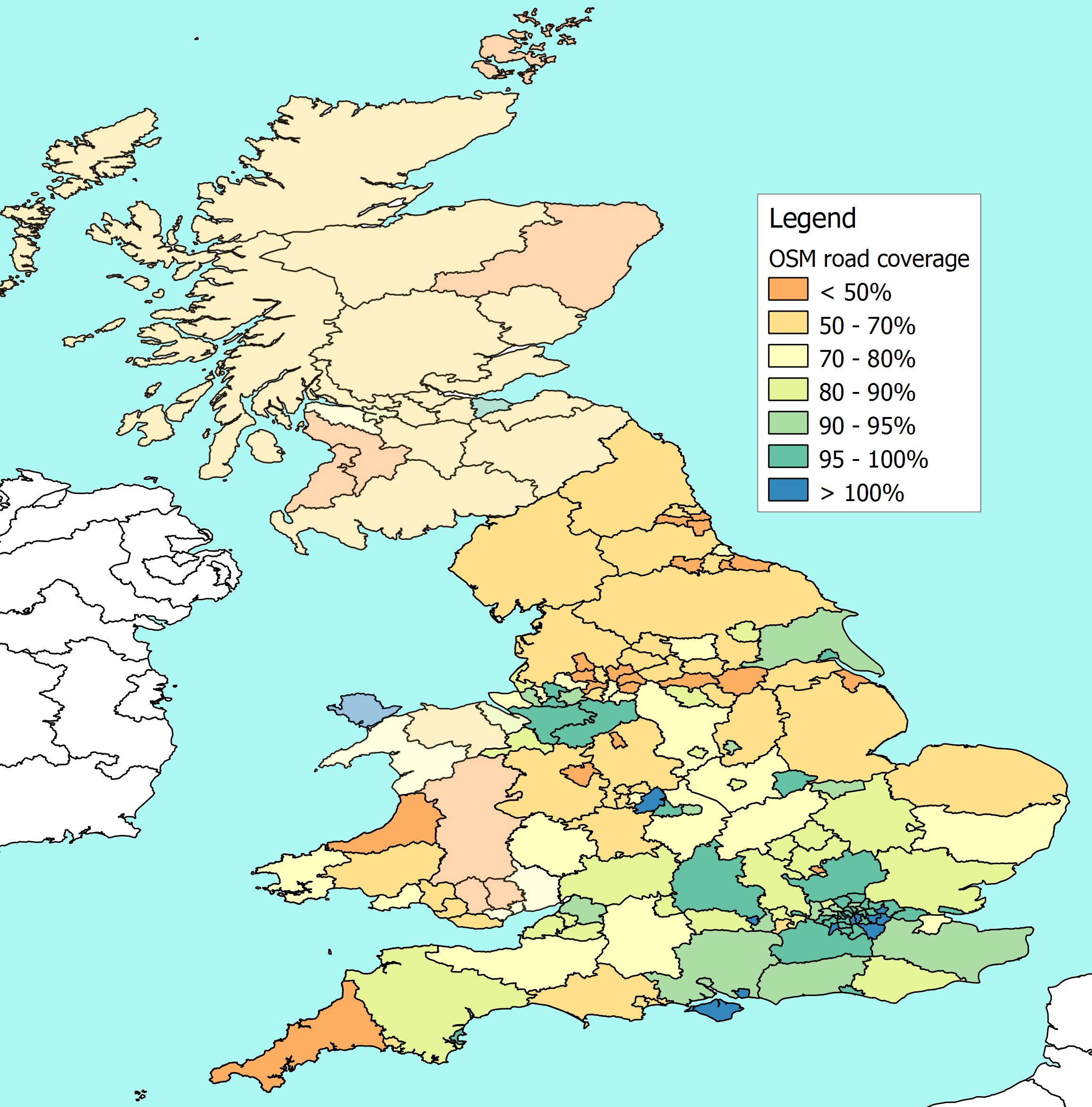 Choropleth of OSM road coverage vs Department of Transport figures, by Peter Reed.
It is encouraging to see many areas at nearly (or over) 100% coverage, there are a number of reasons why coverage might be more than the Department’s own figures, due to more up-to-date information, counting of slip roads, and mis-tagging private roads as public on OSM, so the map’s figures should be taken with a pinch of salt.
The Welsh and Scottish county boundaries are not yet complete in OpenStreetMap so the coverage analysis cannot yet be completed.
Muki has also (with a student) done OSM road coverage analysis, using equal area blocks rather than county-based units.