 I produced this data map which forms the front cover of this week’s British Medical Journal (BMJ). The graphic shows the volumes of Barclays Cycle Hire bikeshare users in London, based on journeys from February 2012 to January 2013 inclusive. The routes are the most likely routes between each pair of stations, as calculated using Routino and OpenStreetMap data. The area concerned includes the February 2012 eastern extension to Tower Hamlets (including Canary Wharf) but not the December 2013 extension to Putney. The river was added in from Ordnance Survey’s Vector Map District, part of the Open Data release. QGIS was used to put together the calculated results and apply data-specified styling to the map.
The thickness of each segment corresponds to the volume of cyclists taking that link on their journey – assuming they take the idealised calculated route, which is of course a not very accurate assumption. Nevertheless, certain routes stand out as expected – the Cycle Superhighway along Cable Street between the City and Canary Wharf is one, Waterloo Bridge is another, and the segregated cycle route south of Euston Road is also a popular route.
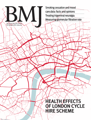
The graphic references an article in the journal issue which is on comparing health benefits and disbenefits of people using the system, with comparison to other forms of transport in central London. Pollution data is combined with accident records and models. The paper was written by experts at the UKCRC and the London School of Hygiene and Tropical Medicine (LSHTM) and I had only a very small part in the paper itself – a map produced by Dr Cheshire and myself was used to illustrate the varying levels of PM2.5 (small particulate matter) pollution in different parts of central London and how these combine with the volume of bikeshare users on the roads and cycle tracks. The journal editors asked for a selection of images relating to cycle hire in London in general and picked this one, as the wiggly nature and predominant red colour looks slightly like a blood capillary network.
A larger version of the graphic, covering the whole extent of the bikeshare system at the time, is here or by clicking on this thumbnail of it:
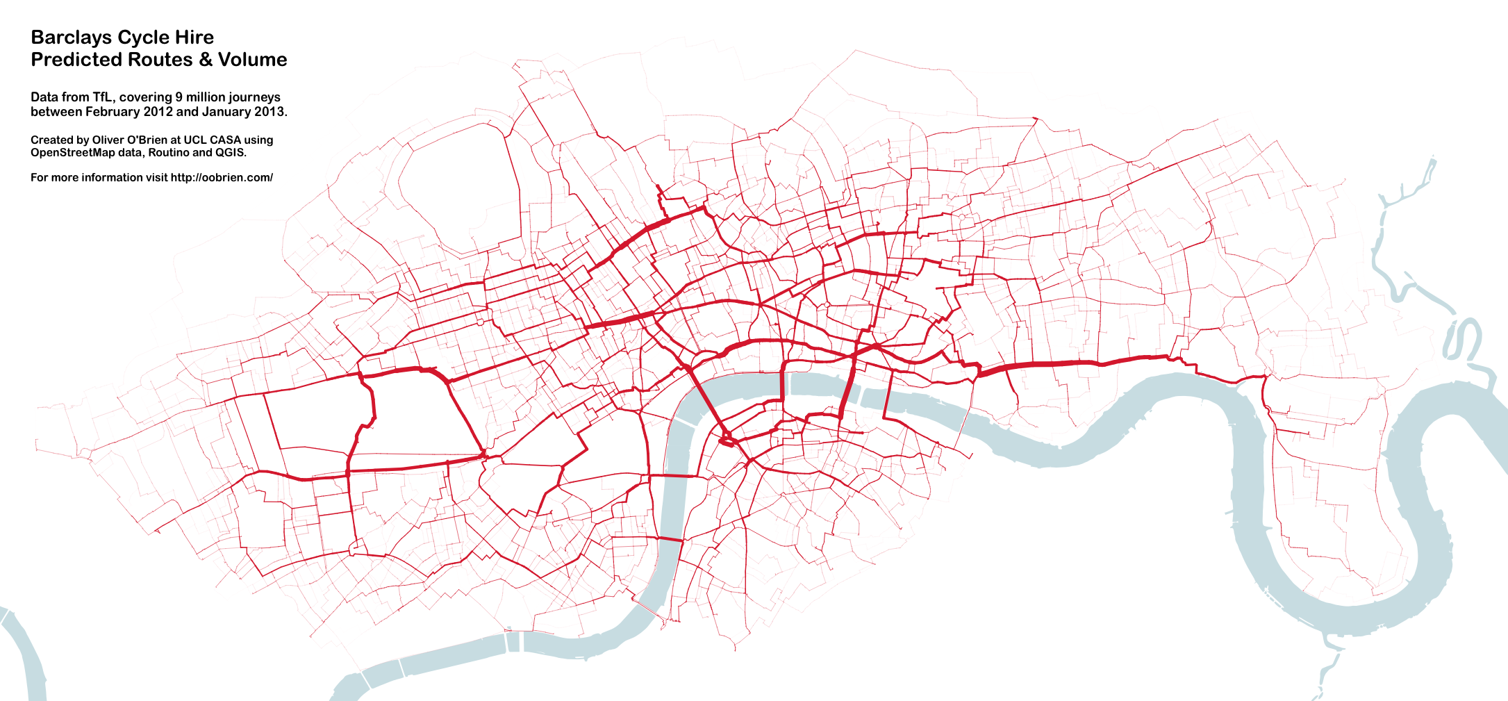
Very rare journeys, such as those from London Bridge to Island Gardens, have faded out to such an extent that they are not visible on the map here. An example route, which the map doesn’t show due to this, goes through Deptford and then through the Greenwich Foot Tunnel.
For an interactive version of the graphic (using a slightly older dataset) I recommend looking at Dimi Sztanko’s excellent visualisation.
9 replies on “London Cycle Hire on the Cover of BMJ”
[…] thanks to Oliver O’Brien for the use of his map. Click below to read the study (full […]
[…] option and it should be thought of as part of someone’s journey across London, and as a life benefit, not as a tourist attraction. The system should also look expand into these areas iteratively […]
[…] journey data available from Transport for London’s Open Data portal. It’s an update of a graphic I’ve made for journeys on previous phases of the system in London (& for NYC) – but this is the […]
[…] on from my London bikeshare journeys graphic, here is the same technique applied with the data released by NYC Bike Share (aka Citi Bike) […]
[…] Center for Advanced Spatial Analysis looked at the Barclays Bike System in London this week. Oliver O’Brian mapped the routes of hired cycles throughout one year from beginning of 2012 to beginning for 2013. The […]
[…] thanks to Oliver O’Brien for the use of his map. Click below to read the study (full […]
[…] Popular cycle hire routes, mapped. […]
Hey, I think I would have been the rider who went from London Bridge to Island Gardens via Deptford and the Greenwich Foot Tunnel; kind of weird riding a hire bike out of its natural habitat for so long.
Indeed – the danger is, if you got a mechanical, you’d have to wheel the bike for miles!