I attended the Big Data and Urban Informatics workshop in UIC Chicago in early August. My previous blog post outlined my presentation at the workshop. Here’s my notes and thoughts on some of the other talks that I attended.

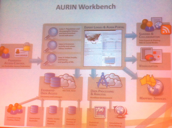
- Above, the AURIN Workbench is a sophisticated platform for city authorities in Australia to output their data and visualise it through a portal. It’s an academic and commercial partnership. A key focus is data consolidation and normalisation, to allow for straightforward comparisons. This is a challenging aspect with so many data sources, from many authorities and places, and as such there is a large team of people involved with the ever-necessary data processing.
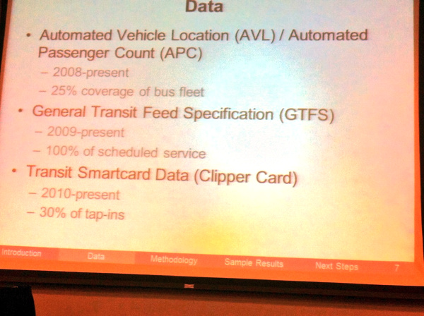
- CASA scholar Greg Erhardt presented on Ph.D work, below, combining together public transport datasets for San Francisco, to build up a multi-modal database. One particular challenge is the incomplete adoption of smartcard-based travel. Here in London, we are lucky that the Oyster-card usage is so high, that it forms a near-complete picture of public transport usage in many parts of London. This is not the case in San Francisco and many other cities.
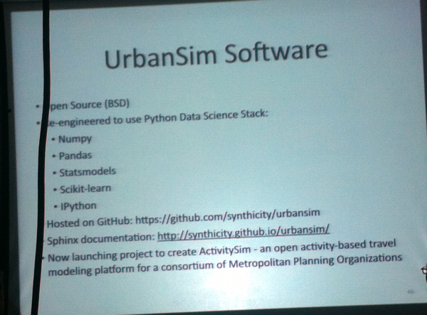
- An update on UrbanSim (picture at bottom), one of many urban models, a reworked version of which now uses the Python Data Science Data Stack and is hosted on GitHub – both of these potentially opening the model up to discovery, use and adaptation by new groups. ActivitySim is launching as part of the project – this will be an open activity based travel demand model, to complement UrbanSim’s land-use focus.


I saw several other interesting talks and presentations, and it is interesting to see just how much activity is going on in the urban informatics spaces, particularly with the ever-increasing volumes of so-called “big data” becoming increasingly easily available for researchers and visualisers.