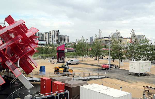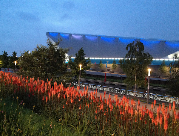
Categories
Olympic Park

Legacy Timetable

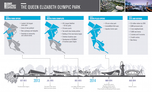
Here’s the announced timetable for the transition and reopening of the Olympic Park and a few other Olympic-related venues:

  • 8 September 2012 – Lea Valley Whitewater Centre reopens
  • 10 September 2012 – Lee Navigation Towpath reopens
  • Late September 2012 – Northern Retail Lifeline and Angel Road access to Stratford City reopens
  • 30 September 2012 – The Greenway (except at Stratford High Street) and the View Tube reopens (some reports say the beginning of December instead.)
  • February 2013 – Canal Park opens
  • Spring 2013 – Temple Mill Lane reopens
  • 27 July 2013 – North Park and Multi-Use Arena (aka Copper Box) reopens, London Lions move into the Copper Box, Waterden Road opens
  • Summer 2013 – East Village (aka the Olympic Village)opens
  • 4 August 2013 – Ride London race starts from the Olympic Park
  • September 2013 – East Marsh reopens
  • December 2013 – Velo Park and Eton Manor reopens
  • Early 2014 – White Post Lane reopens
  • March 2014 – South Plaza, Aquatics Centre, Orbit, IBC/MPC reopens (although this brochure says 2013 for the Orbit and the South Plaza
  • August 2014 – Stadium reopens
  • Late 2014 – The Greenway (at Stratford High Street) reopens
  • 2014 – First houses in Chobham Manor (site of the Basketball Arena) finished

Categories
Olympic Park

A Change of Direction

Regular readers will have noticed that my last seven posts, and the great majority of posts this year, have been about the Olympic Games – specifically, the Olympic Park in East London. I’ve been pretty excited about London 2012, but I’m just as excited about what comes next for the Queen Elizabeth Olympic Park, to give it its post-games name. Yep Sport started as an orienteering events and training blog – but Attackpoint largely serves that purpose for me now, so while I’ll continue to mention orienteering, cycling, running, hillwalking and OpenStreetMap from time-to-time, I’m going to focus more closely on what happens to the Olympic Park in the next few years – and not just because I think it will make an amazing venue for a future orienteering race to complement the City Race that I co-founded in 2008.

I already have a couple of ties to the Olympic Park. Until recently, I lived just the other side of Victoria Park, and could see the lighting gantries of the Olympic Stadium, under construction, from my kitchen window. I’m now further up the Lea Valley but still just a short cycle ride away from the Park. Also I was responsible for naming one of the five neighbourhoods that will be built, over the next 15 years, in the park – namely East Wick – it’s the bit east of Hackney Wick appropriately enough, and I like the name “Wick” as I spent a year near Wick in the far north of Scotland. Coincidently, my current duties as an Olympic volunteer, or Games Maker, have me working by the International Broadcast Centre (IBC) in the north-west part of the park – which is the bit that will become East Wick.

At the moment I’m gathering some links relevant to the legacy plans for the park.

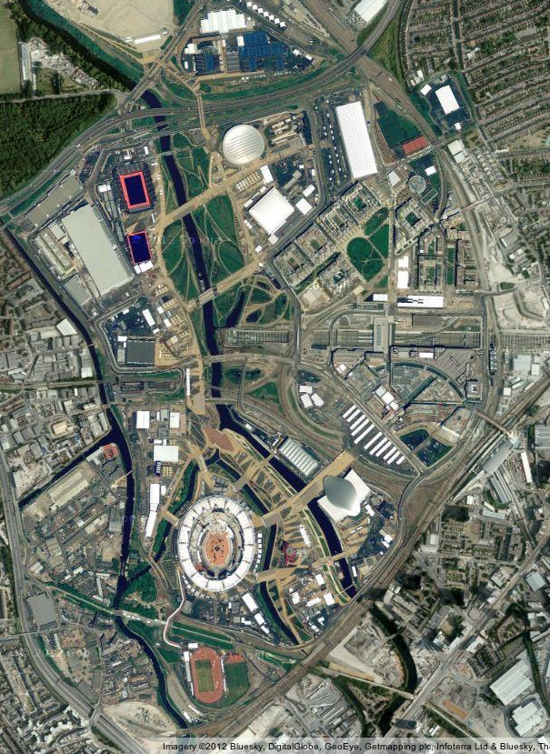
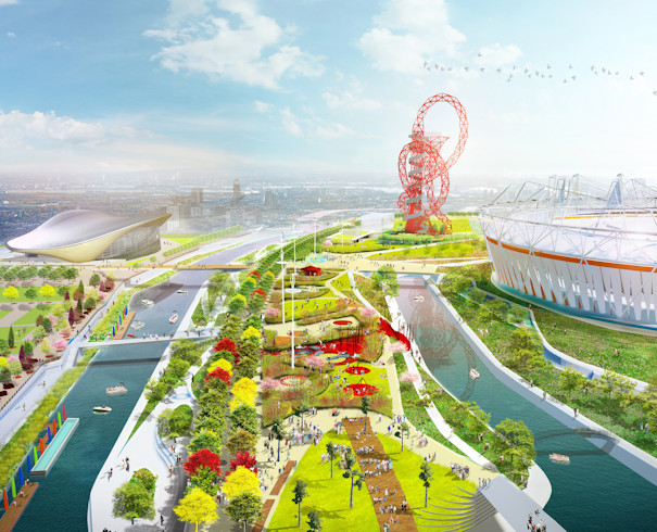
Top: CGI image from the LLDC website. Bottom: Aerial image of the park just before the Olympic Games, from Google Maps.

Categories
London

Olympic Venue Tweets on CityDashboard

There’s a new, temporary panel on the London CityDashboard which shows Twitter activity at the London 2012 venues. The panel is using data from new Twitter collector tools in the Big Data Toolkit, which being developed by my colleague Steven James Gray as part of his PhD.

For each venue, the collectors count the number of Tweets in the last hour that have latitude/longitude information stamped on them, that are located within an area radiating around the centre of each stadium or arena. Unfortunately this excludes the majority of relevant tweets, as most mobile Twitter applications don’t include this information by default – stadium designs can also interfere with the accuracy of the GPS on mobile phones – when I was in the Velodrome for a test event, my iPhone was convinced I was in, ironically, Beijing, and nothing could be done to convince it otherwise.

Nonetheless, the tweets that the collectors do manage to capture still give an indication of how lively and busy each venue is. A collector covering the whole Olympic Park is also included – this includes the venues within the park and also the various promenades and green areas. Most people, before or after visiting the venue they have tickets for, are remaining in the wider park.

On the way we discovered an obscure Twitter bug: including a search radius that spreads across the Prime Meridian (0 degrees longitude) causes an error to appear from Twitter – fixing the centre of the search point on the Meridian itself works around this bug. Until we spotted the but, the Greenwich Park collector was always reporting zero, as the Meridian line goes through the park.

After the Olympics, we hope to reuse the collectors to give an indication of Twitter activity in certain key London hotspots, such as Shoreditch and Covent Garden. Potentially, we would be able to include a similar panel for the other seven UK cities on CityDashboard.

Over at the Big Data Toolkit blog, Steve talks in detail about the Twitter collectors.

Categories
Leisure Olympic Park Orienteering

The Queen Elizabeth Olympic Park – A Tangible Legacy

The London Legacy Development Corporation, who have the job of turning the Olympic Park into a public park post-games, have released a tantalising artist’s impression of the Olympic Park as it might look in Spring 2014, when much of it will have opened to the public as a public park.

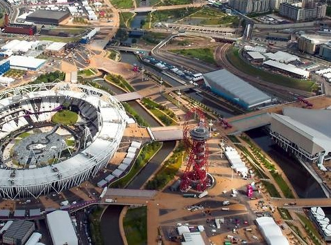
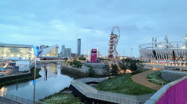
Here’s a recent view, taken just a few days before the start of the Olympic Games:

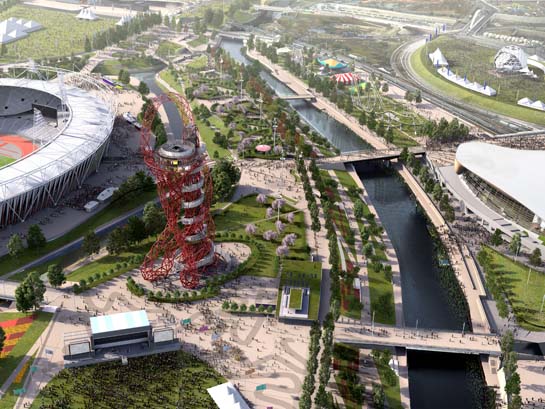
Here’s the LLDC’s image of the park in 2014:

The main differences are the removal of the temporary spans on the bridges, making them more slender, and the greening of much of the tarmac/concrete plazas with natural features. The temporary seating stands around the Aquatic Centre disappear, as does the whole Water Polo arena. Bridge “C” between the stadium “island” and the rest of the park has disappeared completely too. The huge “Spotty Bridge” has also disappeared, with just two slender bridges on either side of it remaining.

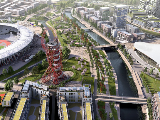
Here’s what the park might look like in 2030, with the addition of various blocks of housing – this is a modified version of the above image:

It looks like the park will be an exciting location for a future park orienteering race, possibly making a compelling weekend by combining it with an associated City Race.

Top photo: Dominic Lipinski/PA. Other images: London Legacy Development Corporation.

Categories
Olympic Park

Olympic Bling – Pin Trading at London 2012

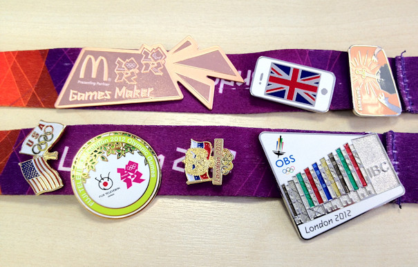
The medals aren’t the only shiny things at London 2012. Pin trading is a long Olympic tradition, and while, for the first week, I was mildly curious about the lanyards of some of my fellow volunteers being adored with various badges, a couple of donations meant that I was hooked by the middle weekend of the Olympics.

Above is the current set on my lanyard.

Everyone seems to have different rules for trading pins – I’ve made up my own, which means my collection tends to have smaller and more specialised pins than most others:

  • A – 1 point for every fixing on the back of the pin
  • B – 1 point if the pin has recessed/embossed sections
  • C – 1 point if the pin has no sponsor words or logos on the front
  • D – 1 point if it mentions “London 2012”
  • E – 1 point if it has the Olympic rings (standalone)
  • F – 1 point if it has the London 2012 logo
  • G – 1 point if has a country’s flag on it
  • H – 1 point if it is individually numbered

So far, my pin trading narrative has been:

Pin Trade Type Who Points
Games Maker colour Given LOCOG 4 (AABF)
Apple iPad (black) Given Friend 3 (ACG)
Apple iPhone (white) Collected Apple Store 3 (ACG)
Russian flag Given Journalist 5 (ACDEG)
NBC Swapped iPad (3pts) Army soldier 3 (ACD)
Sverige Swapped Games Maker (4pts) Army soldier 2 (AC)
Apple iPad (white) Collected Apple Store 3 (ACG)
Samsung (Sherlock) Collected Samsung booth 1 (A)
USA flag Swapped Sverige (2pts) Volunteer 4 (ACEG)
Saudi Arabia NOC Swapped NBC (3pts) G4S guard 3 (ACE)
Samsung (Shakespeare) Collected Samsung booth 1 (A)
Games Maker bronze Given LOCOG 4 (AABF)
OBS IBC building Swapped Saudi Arabia NOC (3pts) Collector 6 (AABCDE)
Samsung (Umbrella) Given Friend 1 (A)
Samsung (King Arthur) Swapped Samsung (Umbrella) (1pt) Bus despatcher 1 (A)
Fuji Television Swapped 3x Samsung + iPad (6pts) Bus despatcher 5 (ACDFH)

Some people are weighed down with around 20 pins dangling around their necks, while some hide them away on their bags (which is the only place where we are officially allowed to have them) and others don’t have them at all…

Where to get pins

The main area for “professional” pin traders is not the offical venue – the Coca-Cola Pin Trading building near the Orbit – but actually it’s at what is perhaps the most exciting area of the whole games. The area is a small 200m long, 30m wide concrete plaza. On the south side is Stratford International station, with the Javelin high-speed trains to King’s Cross. On the north side is the slightly useless Stratford International DLR station. To the east is an entrance for athletes to the Olympic Village, and to the west is the media entrance to the Olympic Park and the shuttle buses that run to various park venues and the Main Press Centre.

The area is accessible without a ticket to events in the Olympic Park – and so is the best place for non ticket-holders to see athletes, particularly as the press often use this “neutral” area to carry out interviews with their athletes. On the south side of the plaza, adjacent to Stratford International, is where 10-15 pin traders have set up their collections.

To start a collection off, the Samsung and Apple stores, at Stratford City, are giving away pins at a steady rate. Some collectors will swap these for a big collection of old (pre-2012) Olympic pins, and you can go from there.
Categories
Bike Share Olympic Park

How to “Boris Bike” to the Olympic Park

Yes! It is possible! There may not be any Barclays Cycle Hire docking stations in the Olympic Park itself, possibly due to “Barclays” not being the official financial services provider of the Olympics but more likely because of the logistics of rebalancing flows to/from major events and the safety aspects of a crowded space, but that doesn’t mean you cannot “Boris Bike” to near the edge of the park. Even better, you get to use one of the two quieter entrances to the park, avoiding the huge queues and crowd mechanics of the approach from Stratford through Westfield.

The above map is adapted from my live docking station map and shows the nearest docking stations to these two park entrances. Cycle to these docking stations, leave the bike at one of them, and then follow the arrows to walk the final kilometre or so.

  • Victoria Gate (west entrance). The docking stations on Old Ford Road and Roman Road are not far away, and these generally have plenty of spaces during the day, filling up in the evening as commuters return home – so if you are journeying to them to visit the park, you have a good chance of finding a free space, and similarly there should be bikes for you to hire on your return in the evening.
  • Greenway Gate (south entrance). This is the route for people walking from West Ham station – but this is a long walk, and you might as well walk from the nearest Barclays Cycle Hire docking stations which are about the same distance away – on Bow Road and Bromley High Street. However you do have to cross the notoriously unpleasant Bow Roundabout, which has no pedestrian crossings, to be able to pass along Stratford High Street. Also, these docking stations have generally been full during the day, for recent days, suggesting some are already using this route.

Both entrances are likely to be quick ways into and out from the park. If you have your own bike, there is a large secure cycle park in Victoria Park, from where you can walk to Victoria Gate.

There are several Olympic venues in Central London, which can therefore also be approached by Barclays Cycle Hire bikes, but be warned TfL is removing the docking stations that are very near, or inside, the venues themselves. A full list is here.

Background map based on OpenStreetMap data and designed by The Guardian.

Categories
Olympic Park

Olympic Park T Minus 5

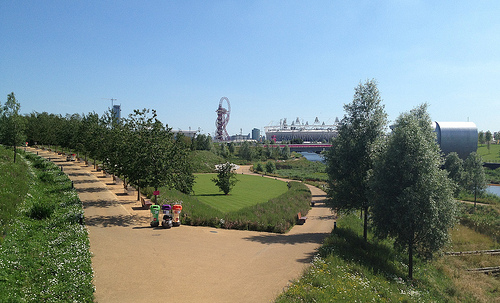
Here are some photos from the Olympic Park, on a sunny Sunday with just five days to go until the opening ceremony. If the sun stays around, it will be a lovely park to wander around in.

The park is looking lovely:

Some mysterious art here:

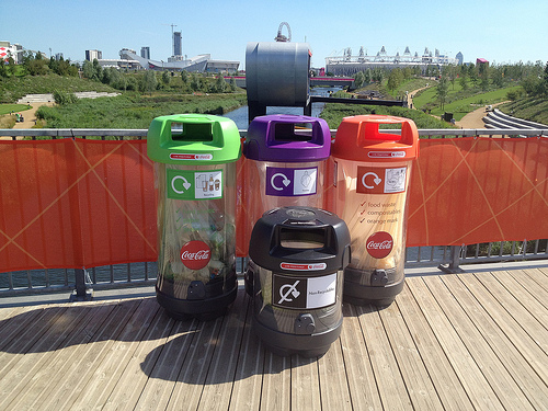
Each set of recycling bins, throughout the park, include a dedicated poncho bin – hopefully these will not need to be used:

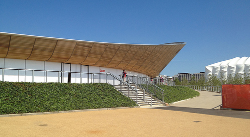
The Velodrome is looking as graceful as ever. White boards cover the windows, no peeking in!

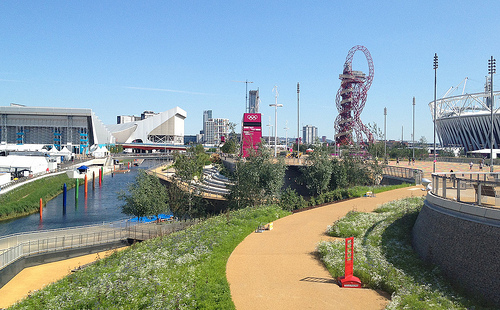
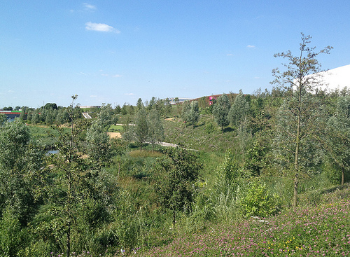
Parts of the Olympic Park are very green indeed:

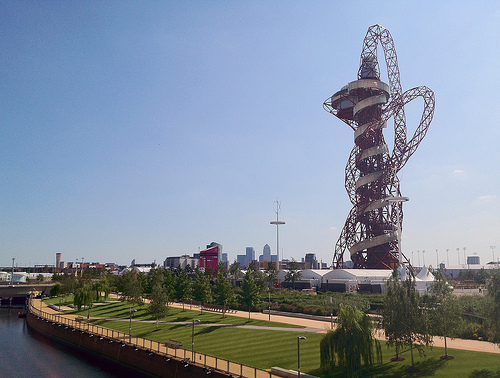
Further down, the Orbit is accompanied by its own garden:

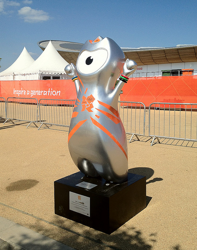
Wenlock might be around for longer than I thought:

Here’s the full album.

Categories
Data Graphics

Six Degrees of Twitter

This is my Twitter social graph. Click on the graphic to see a larger version.

Key

The font sizes for the names correspond to the number of followers, while the colour ramp (light grey to yellow to blue) is proportional to the number of listings per follower. That is, someone who has a small number of followers, but has been listed by many of those people (and others) will appear bright blue. This is designed to be a very simple measure of value and influence – you can have a few number of followers, but if many of those have considered you to be an authority in a subject (and are themselves switched on enough to know about Twitter listing) then you can be considered to be a more influential Twitterer. I bet you most of the “celebrity” accounts will therefore score poorly here, while experts will be picked out. Bad luck BTTowerLondon.

How this Compares to other Social Graphs

To make the graph, I have taken the subset of people that both follow me and I follow back. I’ve then looked at connections between these people. Doing this in Twitter is a similar idea to what has been done in Facebook and Linked-In before except that:

  • The groups that appear will be quite different to what appear in Facebook. Facebook is a social network for friends, whereas Twitter is more of a social network for interests.
  • Twitter’s connections are asymmetric (you can follow people who won’t follow you back, and vice versa) which means you have to think about exactly what you are mapping.
  • It’s much more of a fiddle in Twitter because you have to query each person’s connections separately.
  • Twitter’s rate limits (for unauthenticated connections) are aggressive – a maximum of 150 requests an hour from a single IP. Luckily I have access to nine Linux machines which run my Python scripts nicely.
  • The lack of the equivalent of Facebook “apps” that do this kind of visualisation automatically, mean you have to do it yourself. I produced the visualisation in Gephi, which is powerful but tricky to get to grips with.

There is one great thing though:

  • You can build up these kinds of visualisations for anyone, not just yourself, as the raw information is accessible to anyone.

Community Classification

My Twitter network is more homogenous than I thought – a big blog of tech/geo, with the orienteers forming the main breakaway group, and some slender strands of friends on either side. Networks of friends which don’t share any connections with the other groups, will not be connected at all and will float away.

Below is a hand-done, rough community classification. Again, please click for a larger, more readable version. If I pulled in more of the metadata (profile and qualitative/quantitative) from Twitter for each person, then this could probably be done automatically – enough people in the CASA cluster, for instance, will mention CASA on their profiles, for it to be detectable, showing such people as CASA-linked even if they don’t say so themselves.

  • A – The Neogeo (Geography+Technology) community
  • B – OpenStreetMappers in London and elsewhere
  • C – The Open Data movement
  • D – Data visualisation and data journalism
  • E – UCL CASA, UCL Geography and associates
  • F – London general
  • G – East London
  • H – Running
  • I – Orienteering
  • J – Non-techy friends
  • K – Techy friends
  • L – An unlinked group of non-techy friends There are a couple of other such groups.
  • M – People unconnected to themselves and the others
  • N – Bike share operators

The last group is small – I follow a lot more of them, but generally these “official” accounts don’t follow back.

Categories
Olympic Park

Olympic Park coming Together

Final preparations are being made in the Olympic Park – barriers and diggers are moving away:

…the flowers are coming to full bloom (no doubt helped by the excessive rain over the last few days):

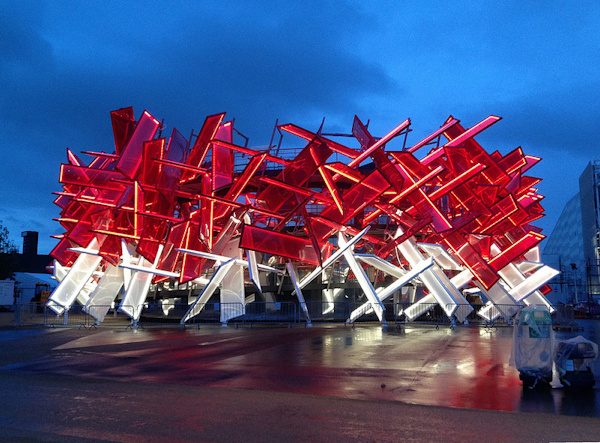
…the temporary sponsor pavilions, entrance gates, signposts and watchtowers are springing up (this is the fantastic looking Coca-Cola Pavilion by Pernella and Asif, alumni of the Bartlett at UCL):

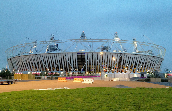
…and the plastic wrap around the stadium is finally appearing:

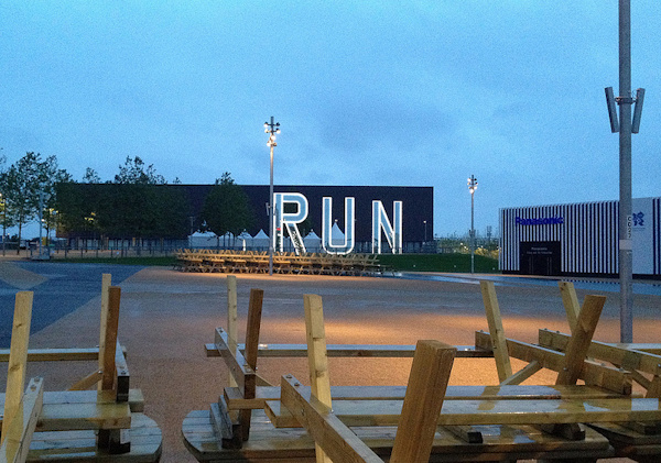
…along with some bespoke art (this is RUN by Monica Bonvicini):

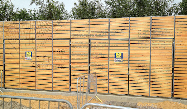
…in some unusual places (some work by Lemn Sissay on a transformer unit):

It’s all coming together!

Latest album, & all my Olympic Park photos so far.

Categories
Bike Share Conferences

Velo-City Preview

[Updated] I’ll be presenting at Velo-City in Vancouver later this week. Velo-City is the “world’s premier cycling planning conference”. It is likely to have a significant bike-sharing flavour – the lead sponsor being PBSC which designed the 6000-odd “Boris Bikes” (aka Barclays Cycle Hire bikes) that are a distinctive sight in central London, as well as equivalent systems in Montreal, Washington DC, Minneapolis, Boston and (shortly) New York City – known generically as Bixi bikes. Vancouver does not have a bike-sharing system of its own, but PBSC have imported a whole load of their Montreal bikes for delegates to borrow for the week, although a recent collar-bone break means I unfortunately won’t be taking up the offer. I did however spot a PBSC/Bixi bike “in the wild” in Vancouver’s beautiful Stanley Park – see above.

I’ll be talking about some new insights into bike-sharing cities worldwide that have been revealed by my Bike Share Map, as part of a three-part presentation on looking at bike-sharing cities at different scales – my co-presenters being the author of the Bike Sharing World Map, and the software developer behind the B-Cycle bike sharing systems.

My presentation is on Wednesday morning (Pacific time) and I’ll write/tweet about it on the day, wifi-access permitting.

To prepare for the presentation, I’ve added a few new cities to the Bike Share Map: Suzhou, Zhongshan, Wujiang, Shaoxing and Heihe in China; and Kanazawa in Japan. One early insight coming from these new maps could be that the Chinese really do work hard (if you excuse the gross overgeneralisation) – typically 11 hours between morning and evening commuter peaks, and seven days a week!

Hehei is shown below – it’s right on the Russian border, opposite a much larger Russian city – hence the Cyrillic (although no bridges across the river near there!)

Note that, in the maps of the Chinese systems, the docking station locations are slightly misaligned with the background maps because of location obfuscation carried out by that country – I’m using OpenLayers rather than the Chinese-based map service that corrects for the errors. The resulting offset is typically only 1-400m though so you can still get a good idea of the shape and size of each system.