Categories
Leisure Olympic Park Orienteering

The Queen Elizabeth Olympic Park – A Tangible Legacy

The London Legacy Development Corporation, who have the job of turning the Olympic Park into a public park post-games, have released a tantalising artist’s impression of the Olympic Park as it might look in Spring 2014, when much of it will have opened to the public as a public park.

Here’s a recent view, taken just a few days before the start of the Olympic Games:

Here’s the LLDC’s image of the park in 2014:

The main differences are the removal of the temporary spans on the bridges, making them more slender, and the greening of much of the tarmac/concrete plazas with natural features. The temporary seating stands around the Aquatic Centre disappear, as does the whole Water Polo arena. Bridge “C” between the stadium “island” and the rest of the park has disappeared completely too. The huge “Spotty Bridge” has also disappeared, with just two slender bridges on either side of it remaining.

Here’s what the park might look like in 2030, with the addition of various blocks of housing – this is a modified version of the above image:

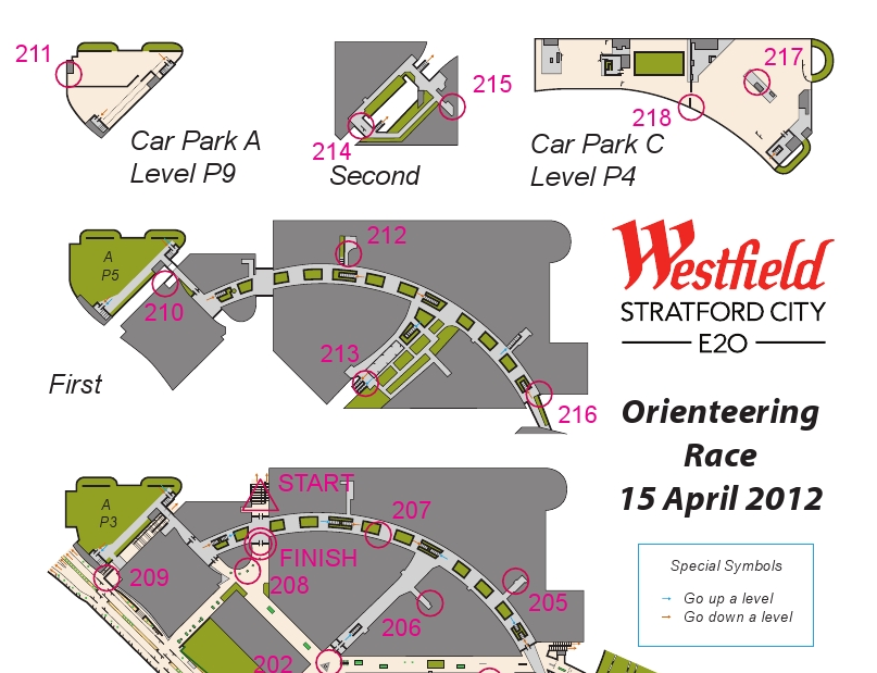
It looks like the park will be an exciting location for a future park orienteering race, possibly making a compelling weekend by combining it with an associated City Race.

Top photo: Dominic Lipinski/PA. Other images: London Legacy Development Corporation.

Categories
Olympic Park Orienteering

Stratford City Race

Yesterday was the Stratford City orienteering race, organised and planned by Josh Jenner, with the map done by myself. The map was a real fiddle to do, requiring four site visits and many hours in front of the computer to build up the six mapped levels (the top half of the is shown above) but the race went well in the end, with no major complaints, only minor ones (a few people found the level change arrows hard to spot, and some people didn’t spot some Out of Bounds areas and so ended up in an area that wasn’t mapped to detail.)

The weather was great (cold and clear outside, warm inside!) and nearly 100 people raced in five waves, including, notably, a wheelchair competitor. Not many “regular” orienteering areas are both wheelchair friendly and traffic free. I did have to hang some of the controls very high though – a couple over six foot off the ground – to use suitable mounting points. The centre management were enthusiastic about the race, and another edition is possibly in the future – possibly using a different format to keep the idea fresh.

After the race, two of the controls were missing – it turns out that one of the collectors had kept one by mistake, and the other had been retrieve by a concerned member of the public (it wasn’t locked down to the chair) and handed in to security, so eventually we were reunited with them all – a good thing as the control boxes are very expensive! The centre was, as expected, almost deserted for the earlier waves, but from 11am it started to get a good busy and it was a good thing the orienteering was out of the way.

I managed to get a run in myself, taking part in the last wave. I was strictly non-competitive, as I knew exactly where all the controls where and the best route to take between them. Despite this I was still beaten by Ed. My route was around 5.5km, I don’t think it would have been possible to visit all the controls and run in under 5km, which is not bad for a site that is only 400m across. The format of the race was score, i.e. controls could be visited in any order.

Some photos from me are here, and more photos and the results are on Josh’s website.

Thanks to Josh for the concept and organisation, and Westfield centre management for letting it happen and giving us full reign through the centre and even control suggestions!

Categories
Olympic Park Orienteering Orienteering Events Log

Five Level Orienteering – Stratford City Race

If you thought the Barbican’s three levels were tricky to orienteer through, then you haven’t seen anything yet – there will a race taking place in and around the Westfield Stratford City retail complex in east London, on Sunday 15 April. The race will be over five levels of the indoor shopping centre area, plus the surrounding outside area.

The race is being organised by Josh Jenner, his website has full details and entries are open. I’m doing the map, which will be a 1:4000 A4 full-colour ISSOM map on waterproof paper. As you would expect, there are a number of special measures need for the event. The event is pre-entry only and it will be a mass start 45 minute score, with five “waves” starting between 9am and 10am – the early finish is needed to ensure that orienteers will have the space to run in, before the crowds arrive for the midday opening of the larger stores. Stratford City gets amazingly busy inside on a Sunday afternoon!

This will be the closest you will be able to get to the Olympic Park on an orienteering race for a few years to come – the park surrounds the triangular site on two sides, with the Athletes Villages to the north and the Olympic Stadium and the Aquatic Centre to the west. It’s the first orienteering race to take place here (the development has only been open for a few months) but it may well also be the last ever race here – with Sunday trading laws due to be relaxed for the Olympics and possibly becoming permanent after them, there may never be another opportunity to run around Westfield Stratford City free of crowds!

Categories
OpenStreetMap Orienteering

OpenOrienteeringMap – Thoughts on a Version 2

I’m hoping to do some significant work on OpenOrienteeringMap (more information) in the near future.

Below is a summary of the major features that I am hoping to include, and you are invited to leave your feature requests as comments here too. (I may eventually get around to formalising this in a code repository.)

High Priority

  • [1] Editing of control locations, numbers and number positions for existing maps, via the web interface.
  • [1] Saving of existing maps, via a short URL.
  • Applying out of bounds points (e.g. gates), lines (e.g. major roads) and areas (e.g. closed parks) to the maps.
  • [1] Addition of a new style – Street-O Enhanced, which builds on the Street-O style but adds parks, open areas and other useful features.
  • Addition of a new style – Urban Adventure, which includes street names for the larger roads.
  • [1] Automatic creation of the clue-sheet.
  • [1] Assignment of points values to the controls. This will help with the clue-sheet creation and potential future route-analysis applications.
  • Optional colouring of control circles based on points values.
  • Better match of the look of the web preview and the final PDF.
  • A basic how-to guide.
  • Inclusion of a OpenStreetMap editing 101 guide.
  • Output of a high-resolution raster (e.g. JPG) of completed maps and “blank” maps, for embellishment in Purple Pen etc.
  • [2] Automatic daily refresh of the data from OpenStreetMap.

Medium Priority

  • [2] Increase contour widths and/or darken colours.
  • More configuration options, e.g. railways on/off, contours on/off.
  • Import/export of courses, probably via text config file.
  • Allow separate start and end points.
  • Creation and setup of an alternative tile rendering source.
  • [2] Use source code management for the website and the stylesheets.
  • [2] Better usage tracking and statistics.

Low Priority

  • Use OS Open Data Vector Map District as alternative data source – misses out paths/parks, but complete coverage for roads.
  • [1] Apply OpenOrienteeringMap logo and branding.
  • Create point-to-point courses, with straight lines between each line.
  • Use SVGs rather than raster graphics for points and complex lines.
Categories
Orienteering

City of London Race 2012

Yes, the fifth running of the City of London Race, the world’s second biggest standalone urban orienteering race, will be happening, & as for previous years, I will be occasionally be blogging about it, as the mapping progresses.

Here’s the new bit I am planning on mapping this year (in red), along with what is already mapped (in green). The mapped area now far exceeds what will fit on the A3+ paper, so the red section actually represents around a third of the what will appear on the 2012 map. Another important caveat is that access agreements are still being negotiated, so it is not a 100% certainty that this is what this year’s map will look like.

The areas:

  1. Hatton Garden. London’s jewellery and diamond quarter, with an interesting set of side-alleys.
  2. Gray’s Inn and surrounding area – the former subject to access.
  3. Great Ormond Street – the area around the famous children’s hospital.
  4. Mount Pleasant – the area around the huge Royal Mail facility.
  5. Lincoln’s Inn – subject to access.
  6. Corram’s Fields. A backup area, in case we have to move our race HQ to around here – this is not our Plan A though, and we are keeping our preferred race HQ venue under wraps for now – it is cool though! Junior courses would then be in this park, which is particularly apt as adults are only allowed into the park when accompanied by a child!

Map from Cloudmade, contains OpenStreetMap data.

Categories
Orienteering

Open Orienteering Mapper

Thomas Schöps is developing a suite of open-source tools, Open Orienteering, including an application for creating orienteering maps called Open Orienteering Mapper (not to be confused with my own OpenOrienteeringMap. He is updating his blog regularly with development process, and today announced an alpha release of Mapper. The application runs on both Windows and Linux and shortly, following an imminent patch, Macs. The impact of a completely free, cross-platform application for creating “proper” orienteering maps, should not be underestimated. Having used both OCAD (PC only, expensive) and Illustrator/MapStudio (expensive) to create/edit maps in the past, and having failed to get Inkscape/MapStudio to work, I am quite excited about this. At the moment, ISOM maps can be created, but there are plans to include ISSOM (sprint standard) symbols sets soon. I am looking forward to creating my first OO Mapper map!

A not of caution – if you want try the software, be aware that is in an early (alpha) state and that you will need to have development tools installed in order to retrieve it (through git) and build and run it – the application is not ready yet for non-developers!

Mapper, along with the other applications in the Open Orienteering toolset, is being managed through Sourceforge and there is a bug tracker which already contains lots of ideas for further expanding the application.

Categories
Orienteering

Athlete Stats for UK Orienteers

I’ve been mining the British Orienteering event results pages and have produced a websites presenting the results in a more effective way – i.e. athlete focused rather than event focused. I’m also having a go at recalculating the ranking score based on this data.

http://oobrien.com/stats/

Unfortunately there are a couple of flaws:

  • The BOF ID is not available on the source website, so I have had to construct a key based on name (which can be misspelled on results uploads from time-to-time) and club (ditto). This mainly works, except where people change club, in which case their results, run under other clubs, that contribute to their ranking score, won’t be included.
  • It turns out that, with each new result upload, all the ranking points for all events going back the whole of the last year – possibly more – are recalculated. This has the effect of old scores drifting slightly – I wasn’t expecting the points to fluctuate in such a way. The effect is mainly small – so far one of my scores has drifted by 1 point – but another person’s score has drifted by 7 points. I could mitigate this by scraping all results over the last year every night, but this would put strain on BOF’s servers and they would probably not appreciate it – it would be over 5000 page requests over the course of several hours. So, instead, I’m updating the most recent 25 events nightly and may manually resync the whole year on an ad-hoc basis. The result is that, after a while, the scores don’t match precisely with those on the source website.

The toughness scores for each event are just a bit of fun and based on the details of the course, not how well people did on it. The urban shading is also just based on the name of the event, rather than any specific metadata on the event that I am accessing. Such metadata may be available in the event details section of the source website but I am just using the results information here.

The collation of a large number of results has highlighted various data problems, such as results appearing as HH:MM rather than MM:SS, or x,xxx km instead of x.xxx km. Unfortunately one of my own (few) event result uploads suffered the first problem. This doesn’t affect the points at all, because the times within each course are only used on a relative, not absolute, basis, but it does preclude me, for example, totalling the “yearly run hours” for each athlete, without cleaning up the data on my side.

You can see the stats here – type in your name and club to see your stats. See the notes on the search page, e.g. most Level D events not included. You can also compare two people, looking at where they ran the same courses at the same event.

Categories
Orienteering

Manifesto for a New Type of Orienteering Club

I’ve had an idea for a new type of orienteering club for London. One with a slightly different focus to the current ones. My inspiration is City Runners and Centrum OK, and to a lesser extent Stragglers RC and Fetch Everyone.

  • Its aim would be member training, socialising and attending external events in a coordinated way, rather than putting on events.*
  • Its initial life would be as an community orienteering group (it is unclear whether such entities can be affiliated to the national federation) moving to full club status when membership numbers – and so finances – allowed, and certainly before it put on public events. Alternatively, and probably more likely, it could exist as a satellite of another club, such as MADO, which is/was a satellite of HOC.*
  • Membership would be very cheap – say £4 (+national/regional membership) or even free – it would be the cheapest way to be a member of an orienteering club and a national federation – especially as local-level national/regional membership is also free for the first year, making membership completely free for new people.**
  • It would potentially affiliate also to England Athletics – although as community running group rather than as a full running club.*
  • It would be an open, geographical club with core membership intended to be in, but not limited to, London Zones 1-4, or people who are otherwise very well connected to the centre of London.*
  • It would be called something like Central London or Cross River, to reflect its central London focus. Acronyms for the club name would be avoided as far as possible.*
  • It would have little kit of its own. It would probably have a small set of training flags, possibly acquired through the “Year in a Box”, bought from the national federation.
  • It would have a significant sponsor.
    PROMOTION

  • Promotion would be entirely online. It would have a small, low-key website, an announcement email list, a Facebook group and probably a Twitter account.*
  • Its primary form of promotion, announcements etc would be through the Facebook group.*
  • If funds allowed, a limited amount of advertising would be placed through Facebook and Google Adwords.
  • It would not have a paper newsletter, print flyers or indeed have any paper presence.*
    EVENTS AND TRAINING

  • It would in fact run some events, membership willing, but these would mainly be in the Street-O format (both score and point-to-point). Eventually it would put on a couple of Park Race style events in the summer time, once a small number of parks had been mapped by members of the club and members had gained the necessary qualifications.***
  • Professional mappers would not be employed. If possible, the club’s maps would be produced using FOSS.
  • As soon as its finances allowed, first-claim members would be able to attend all events put on by the club for free.
  • Its members would be actively encouraged to regularly take part in local events put on by the other London clubs and, if available, join such clubs as second-claim members.
  • It would eventually have a club kit but this would be in the form of runners’ technical tops rather than orienteering kit or runners’ race kit.*
  • It would have a club night run from a regular and central London location, probably a friendly pub. This would often take the form of a run rather than technical training.*

Inspired by:
* City Runners
** Stragglers
*** Centrum OK

Photo by timbobee.

Categories
Orienteering

The State of British Orienteering, in Wordles

Here’s some Wordles that I’ve created with the runs and events data available on the British Orienteering website, based on 166,000 runs on 5000 courses across 600 events between January 2010 and now.

1. Courses put on by clubs:

vs Actual runs done, by course:

…which shows that we put on a lot of Orange and Yellow courses, but really everyone wants to run Green or Blue.

2. Actual runs done, by club of the runner:

vs Actual runs done, by organising club:

…which shows that some clubs are mainly about organising events (e.g. HOC), some are mainly about running in events (e.g. BOK), but most are about both.

3. Finally – which regions see the most number of runs?

S(OA) = Scotland, W = Wales. The rest are English regions: NE/NW/SE/SW, EA (East Anglia), SC = (South Central), YH (Yorkshire/Humberside), EM/WM (E/W Midlands). While large events that rotate around the regions on a multi-year timetable will distort this, some very large events (e.g. the Scottish 6 Days) don’t appear on British Orienteering’s system as having a region associated with them, so will not appear in the above Wordle.

Categories
Leisure Orienteering Orienteering Events Log

Orienteering Update

My autumn went roughly as planned, in terms of orienteering races, until early December where I got the first in a number of very minor injuries that were nonetheless enough to keep me from running. However I was still able to walk so made it up a number of Munros during a new year trip to the Highlands.

I think I’m almost back to being able to run now, although I have dropped in fitness slightly. Here’s my race plan for Spring 2012:

  • Tue 10 Jan – SLOW Marylebone Street-O
  • Sun 15 Jan – MVOC Holmbush
  • Sat 21 Jan – EUOC Edinburgh City Race
  • Sun 22 Jan – EUOC Holyrood Park
  • Thu 26 Jan – CHIG Victoria Park Street-O
  • Sun 29 Jan – BKO Concorde Chase?
  • Thu 2 Feb – SAX Sevenoaks Street-O
  • Sun 5 Feb – DFOK Chelwood
  • Tue 7 Feb – SLOW Brockley Street-O
  • Sun 12 Feb – CHIG Claybury
  • Sun 19 Feb – CompassSport Cup Qualifier
  • Sun 26 Feb – SLOW Wimbledon
  • Sat 3 Mar – St Andrews Scottish Sprint Champs
  • Sun 4 Mar – St Andrews City Race
  • Sat 10 Mar – Varsity Match at Burnham Beeches
  • Sun 11 Mar – Varsity Match Relays
  • Tue 13 Mar – SLOW Street-O
  • Sun 18 Mar – DFOK Mereworth?
  • Wed 21 Mar – Possible Munro trip
  • Sat 24 Mar – British Sprint Championships, York
  • Sun 25 Mar – British Middle Championships, near York
  • Sun 1 Apr – Waltham Half Marathon
  • W/e 6-9 Apr – JK, Scotland
  • Tue 10 Apr – SLOW Street-O
  • Sun 15 Apr –
  • Sat 21 Apr – JOK Chasing Sprint
  • Sun 22 Apr – Back to London to help at the London Marathon?
  • Sun 29 Apr –
  • Sat 5 May – British Championships, Lake District
  • Sun 6 May – British Relays, Lake District