Categories
Uncategorized

QM Race – Map Done

A week until the event. The map is done, now it needs to be edited and corrected!

Here’s a MOO card for the event that I designed, and would have bought to promote it, except it would have taken too long to be delivered 🙁

Hope you like it! I might do one of these for the City Race.

QM race

Categories
Uncategorized

One Map, One Week

I’ve set myself the challenge of drawing a complete ISSOM sprint map in seven days.

The event is on the evening of Tuesday 8 July and it’s a sprint race at the Queen Mary (University of London) Mile End Campus, and Mile End Park, which is immediately to its east. The fast running through the ceremonial park should counterbalance the intricate sprint terrain in the university campus.

Anyone who thinks it’s a “bit grim” out in East London is going to be in for a pleasant surprise if they come along. It’s a great little area.

The total area of the map is 30 ha (10 ha on the campus and 20 ha in the park) – it fits nicely on an A4 sheet at 1:4000. I had planned to make it fit on an A5 sheet but got my scale calculations wrong.

Here’s my progress so far.

Day 1: Surveyed 14 ha, drawn 7 ha.
Day 2: Surveyed 6 ha, drawn 4 ha.
Day 3: Surveyed 4 ha, drawn 3 ha.
Day 4: Surveyed 0 ha, drawn 3 ha.
Day 5: Surveyed 6 ha, drawn 5 ha.
Day 6: Surveyed 0 ha, drawn 3 ha.

Once again, I’m using Adobe Illustrator with MapStudio to do the drawing.

Categories
Uncategorized

An Uneven Distribution of Orienteering Events

timbean talks about Orienteering Blackholes – places in the UK where not much goes on – at least this time of year – in terms of events.

Looking at my Map of Orienteering Events, there certainly are some interesting patterns – the icons show events happening in the next ten weeks. The big clusters are around London, the Severn Estuary, and the Peak District. Hardly anything is going in East Anglia (possibly due to vegetation at this time of year), North Wales, or Hampshire/Dorset.

Surprisingly, very little is happening in Scotland either – considering that Scotland remains in condition until later in the summer, and that the best terrain in the UK is up here, it is odd that so little is going on. Maybe the Scots are bad at registering their events with the BOF, from which the map is largely derived? I certainly know some of the SE region clubs are, because I supplement the official listings with information gleaned from club websites – for the London area only.

Orienteering Event Distribution in the UK

Categories
Uncategorized

Brill

This Tuesday, I headed off to Oxford for an informal evening event put on by TVOC at Brill village. The event is held every year, and I’ve been quite a few times in the last few years. Unfortunately Brill is not an easy village to get to – long ago, the London Underground used to stretch out that far – these days it’s a train out to Oxford, then an hour long cycle ride eastwards, over several hills and through several picturesque villages, before a final 80m ascent into the village itself. There are two things I always remember about Brill – the windmill and the nettles. This year, the nettles weren’t too bad, and the windmill looked very picturesque in the warm evening sunlight.

The map is another interesting thing about this race. Brill has a huge village common – bigger than the village itself. Part of the common extends right down the hill. The map is drawn, rather uniquely, with a contour interval of 1.67 metres. This year, the map was pre-printed (although we were still using pin-punches.) The map almost fits onto an A5 sheet, at 1:5000, so it really is a small area.

Brill Map

The race format was a mass-start, three loop race. Having arrived exhausted, and slightly late, I was allowed a breather before heading off into the common. The effect of three loops over the same area meant that the common was pretty thoroughly visited, as the aerial photograph of my race shows:

Brill Route

The colours correspond to my heart-rate. A couple of features stand out – the climb to the finish/loop changeover point with me finding the climb tough (red) every-time I approached it, and my extended pause (blue-green) at the northern end of the course, when I thought I had missed out an earlier control.

For some reason, the weather is always very nice for the Brill race. Hopefully next year’s will continue in the tradition.

Categories
Uncategorized

Worst First Leg Ever?

I seem to fairly regularly screw up the first leg on orienteering courses. Often, the shorter the first leg, the worse the mistake. It’s as if I need a moment or two on a course to “warm up” my navigational abilities, just like I need a moment or two before the start to warm up my muscles.

Sunday (Day 3 of the JK) was a particularly bad example. There were a lot of factors against me – I was late for my start, I had just cycled 12km uphill from the station to the event arena, it was my third really early start in as many days so I was very sleep deprived, it was snowing, windy and very cold, there was no club tent to change in as it was so early, my thumb-compass had developed a large bubble in it, and my left inside knee started hurting a lot while jogging to the start line. This was worrying – I freak out every time my knee hurts, after a long and frustrating recovery from a previous knee injury in 2003.

So, I was not best prepared for what was going to be a 12.7km cold, wet slog over exposed moor and forest. I rushed through the start, without having time to warm up, check the sample map or check the start direction. As I picked up my map, I was relieved to see the first control was a straightforward 200m away. I carelessly charged forward, and completely missed it:

Ashdown Leg 1 Mistake

Ashdown Leg 1 Extract

10:15 for a 200m leg. My official split is 13:15 as I was three minutes late off the start. After this rather unfortunate start, and concerned about the knee, I decided to bail – I diverted to the last third of the course, ambled around it, getting even colder in the process, limped back to the finish and now-erected club tent, gratefully accepted an early lift to the station, and spent the rest of the day in the warm and the dry.

Categories
Uncategorized

Layers used in the City of London Map

Here is how I am layering the City of London map, which I am creating using Adobe Illustrator and the MapStudio plugin. I’m basing the features/colours on the ISSOM2007 spec, as much as possible.

Layers

Layer Main Colours Features
O-Courses Purple, Brown Courses, Corrections, Northing Lines
Tunnel Walls Black Dots, Brown Showing runnable routes below main level. May use thick brown lines to show tunnel entry points.
Point Features Black, Green Statues, Fountains, Ornamental Pillars, Lifts*, Stairwells, Distinctive Trees
Buildings Dark Grey, Black Buildings
Construction Black, White Construction Sites and Hoardings
Barriers Black, Dark Green Uncrossable Barriers (Walls, Gates and Railings), Crossable Fences, Hedges, Historic Stone Walls
Low Walls Light Grey Crossable Walls
Out of Bounds Land Olive Green Permanent Out-of-Bounds Open Areas
Water Blue Lakes, Rivers, Water
Steps Dark Grey Staircases, Steps
Underpasses Light Grey Underpasses, Building Canopies
Vegetation Dark Green, Light Green, White Flowerbeds (OOB), Woods
Open Land Yellow Accessible grassy areas
Pavement 10% Brown Pavements, Pavement-level Roads (May be revised to simply be thin lines show significant paved areas separated from the road.)
Road 20% Brown Roads (Colour may be changed to match the Pavement colour, to aid clarity)

Line widths

Linear Feature Width
Steps, pavement edges, underpass boundaries 0.07mm
Out-of-bounds (OOB) boundaries**, crossable fences, building boundaries, prominent boundaries within OOB areas 0.14mm
Underpass dots (dot diameter) 0.2mm
Crossable walls, uncrossable*** barriers (fences/walls), stairwell sides and separators, construction site boundaries 0.35mm

*These will probably be removed from the map in a later revision. You can’t really use one competitively!

**In some cases, no line is used (e.g. driveway) or the wall-line is used (obvious wall blocking use of OOB area as a run-thru.)

***Crossable underneath the barrier if dotted lines indicate a passageway underneath the main running level.

Categories
Uncategorized

East End Orienteering: Beckton District Park

Well I never thought I would be orienteering in true Eastenders country, but CHIG (Chigwell & Epping Forest OC) launched their new permanent orienteering course at Beckton District Park last Saturday with a score event, held in conjunction with Newham Fit Club – a collaboration between the borough council and the local NHS trust. This must be the best value orienteering event I’ve ever been to – free, with free map & pencil, free water at the end, a free goodie bag with “runner’s” water bottle, free medal and certificate of completion, and, apparently, for earlier runners – a free T-shirt. The only other event with this kind of value is the Bushy Park Time Trial (and the other UKTT events.)

The event was a one hour score around all 23 of the permanent markers. I ran around in 21 minutes, covering 4.3km according to my GPS. I thought it was a good time, but a couple of others also clocked 21 minutes, so I ended up first equal. Results here and my writeup here.

The area is never going to compete with CHIG’s prime area, Epping Forest, but it’s a nice enough little park, the area around the pond is probably very pleasant on a hot summer’s day, although the A13 thunders by just to the north.

Beckton District Park orienteering
The interesting middle section of the course. Yellow arrows show locations of the permanent control posts. My later long run back to the north part of the map for the final controls, is also shown.

My GPS curiously recorded about half my run as being under sea-level. While the park is certainly only a few metres above the Thames Estuary, it isn’t flooded yet. GPS altitude calculations are so inaccurate…

Beckton area
The park in relation to the Thames and other major landmarks in the area.

Beckon District park is my nearest “active” orienteering area – it’s a short cycle away along the Greenway. Victoria Park is closer, but there hasn’t been an event there for many years, due to, I think permissions problems. I would love to approach Tower Hamlets borough council and suggest a similar kind of collaboration with my club SLOW for “Vicky Park” although it would be a lot of work to put the pieces together and the map would need quite an update – and it’s an LOK rather than a SLOW map anyway.

Categories
Uncategorized

Early 2008 Plans

Saturdays am – Bushy Park Time Trial 5K
Saturdays pm – City of London map fieldwork

26 Jan – EUOC Edinburgh City Race
27 Jan – EUOC District, Holyrood Park
3 Feb – GO “OO Trophyâ€? Regional, Woolbeding Common
10 Feb – TVOC “Chiltern Challengeâ€? Regional, Downley
12 Feb pm – SLOW Street-O, Notting Hill
17 Feb – SO District, Clapham Wood?
21 Feb pm – LOK Street-O, Hampstead
23 Feb – CHIG Local, Beckton Park
24 Feb – LOK Regional, Holmbury
2 Mar – SAX Regional, Mill Bank & Whiteley
9 Mar – SARUM National, Great Ridge?
11 Mar pm – SLOW Street-O, Putney
16 Mar – CHIG District, Epping NW OR BUSA Sheffield
21-24 Mar – JK, Surrey
25-30 Mar – Varsity Match, Sweden
5 Apr – British Elite Middle-Distance Championships, Tamworth?
6 Apr – British Sprint Championships, Warwick
8 Apr pm – SLOW Street-O, Lambeth
13 Apr – (Nothing planned yet)
17 Apr pm – LOK Hyde Park Score
19-20 Apr – British Championships, Culbin
25 Apr-1 May – Course fieldtrip, Lake District

Categories
Uncategorized

Map of Maps – Corrections Please!

[Updated] I’ve now added an “Alert” button beside each map listing on the Map of Maps page. I’ve also fixed the Alert mechanism for the Fixtures page, which was broken for the last month or so due to technical changes by my website host.

If you spot a map in the wrong place, please use the alert button and let me know!

[Update – Confirmed the alert mechanism is working successfully. Send them in!]

Categories
Uncategorized

Race 13: Great Capital Run 10K

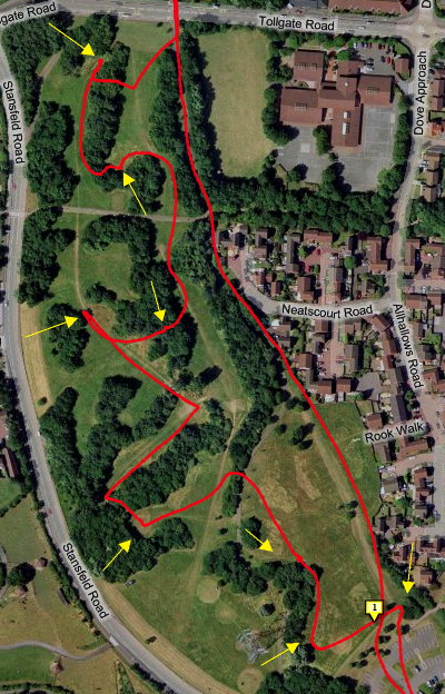
BUPA Great Capital Run – run by the same organisation that does the Great North Run, this new race was 10K around Hyde Park. Just one lap, although the course doubled back for quite a lot of its length, with (generally slower) runners coming the other way.

I have nothing but praise for this event. Seeded start waves meant I was across the start line in 5 seconds, and apart from the very first corner, there was never anyone immediately in front of me slowing me down. The course was well laid out, there were drinks points at 5.5km and 7.5km, and a run-through shower at 6.5km. These were much appreciated as it was warm (20C), and the course had several long sections which weren’t shaded. There were no queues for baggage, nice goody bags with food and drink, and a good finish commentary. I didn’t spot any celebraties, although Myleene Klass started us off.

I was aiming for 40 minutes, and planned to do 4 minute Ks. The start was fast, as I expected, as I was running with people who were about my speed. After then, I eased back only slightly, and went through 5km at 20:05 – just five seconds down on my target. However I didn’t do a negative split here – I tired a lot between 6km and 7km – even the slight change of pace at the water stop took a few seconds out of me.

I finished in 40:36, according to my stopwatch and the chip timing – just outside my 40 minute target, but a personal best by 83 seconds. I finished in 91st place out of around 6600 runners. Winning time was 29:22. I think (from memory) my 1K splits were: 3:50, 4:00, 4:10, 4:00, 4:05, 4:10, 4:20, 4:10, 4:10, 4:00. The finish was tough, there were 800m, 400m and 200m countdown markers, but the last 400m were on a (very) slight hill, and the last 200m really felt a lot further than 200m! So, overall, very pleased.