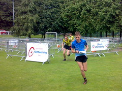
This was my summer orienteering holiday. I last went to the French back in 2003. This time, the races were on the Larzac Plateau, in the Massif Central in south central France. It was the combined SLOW and JOK holiday, and OUOC were also there, so there were plenty of people I knew who I could run against.
We stayed in chalets on the edge of Millau – coincidently near to the famous McDonalds (Google it if you don’t know the story) and also with a stunning view across the valley to the Millau Viaduct and to the line of cliffs, spotlit at night, that reminded me of the Hollywood sign (but without the sign, if you know what I mean.) The town centre was a 15 minute stroll away along the river Tarn, just downstream from the spectacular Gorges du Tarn that we explored during the rest day.
I was a bit worried about the heat – southern France away from the coast in August can be very hot indeed. Some starts were as early as 8am where you could escape from the heat, while others were as late as midday, by which point it could be getting very hot. As it happened, it was indeed hot, at least for the first part of the week, but it didn’t affect my running too much. The terrain was so incredibly technical that you couldn’t run fast and get hot, anyway. You could be out for a long time though – I managed to run 13km for my 7.3km Day 6 course, such was the technicality and my ineptitude.
Day 1
The first day was due to be near Millau, but was switched after land access problems to La Salvetat. This was the only day on a 1:10000 map, and the detail was certainly intense. I was totally not prepared for the slow-speed technical orienteering needed, and it was pretty hot, so I made three huge mistakes of 10 minutes each. Some of the controls were well hidden, which I thought was a bit mean – one was on a path in a giant patch of green vegetation, I must have run within two metres of it, several times.
H21A: 8.1km, 300m climb, 23 controls. 143 runners.
Selected results:
32 Matt Lyle (OUOC) 1:28:50
41 Phil Marsland (JOK) 1:34:42
44 Tim Beale (OUOC) 1:36:46
52 Charles BG (SLOW) 1:40:08
52 Chris Embry (OUOC) 1:40:08
64 Simon Evans (SLOW) 1:45:51
69 Ollie O’Brien (JOK) 1:48:12
71 Hedley Proctor (JOK) 1:49:30
75 Pete Huzan (JOK) 1:52:53
82 Ian Webb (OUOC) 1:56:19
Day 2
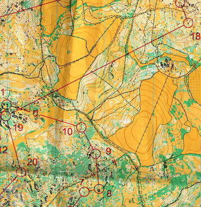
This was the first of three days in the same area, near Cornus. Today’s map was La Tour des Aiguillons and was the north-east of the area. The map for each of these three days was 1:7500. It was, for me, the day when I was most affected by the heat. After a smooth first part of the race, I made a huge error on leaving No. 18, heading south instead of south-west, somehow running around the wrong hill and ending up 500m off the straight line. I managed to visit No. 9 (and almost No. 8) again, during this big mistake, which cost me over 10 minutes. However, unlike yesterday, this was the only boom. Everyone did better too though, and I finished in virtually the same place on the leaderboard.
H21A: 7.9km, 225m climb, 28 controls. 145 runners.
Selected results:
21 Phil Marsland (JOK) 1:12:22
26 Simon Evans (SLOW) 1:14:03
33 Chris Embry (OUOC) 1:15:51
44 Charles BG (SLOW) 1:19:33
50 Matt Lyle (OUOC) 1:22:08
54 Tim Beale (OUOC) 1:23:52
68 Ollie O’Brien (JOK) 1:28:22
71 Hedley Proctor (JOK) 1:30:11
77 Pete Huzan (JOK) 1:33:16
83 Ian Webb (OUOC) 1:35:10
Day 3
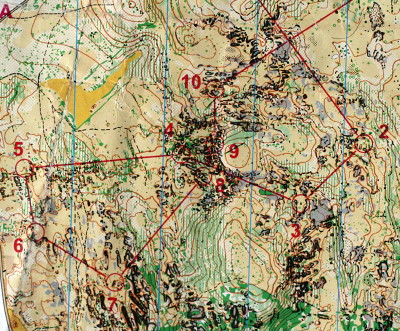
The map name today was Les Rocs de Louradou, and these certainly were the feature of the map. The land in the Larzac Plateau is largely limestone, resulting in distinctive features we saw every day – no water features, poor, scrubby grassland, low trees, and bare rock, with small caves and arches – the planners made good use of these last two features. Today’s map also included rock pinnacles – generally not accessible but useful for navigation. There was a “rock garden” between controls 9 and 10 and on the way to 17, that was rather spectacular. Today was the latest start and so hottest run, but my best result and my favourite day – maybe running in the heat isn’t so bad after all? I was very grateful when the water-point came, though. I held it together and had no big mistakes, for the first time. But a succession of silly errors right at the end, at the last three controls, blew six minutes, and made what would have been an amazing result just a good one.
H21A: 7.9km, 250m climb, 27 controls. 145 runners.
Selected results:
14 Chris Embry (OUOC) 1:17:42
21 Phil Marsland (JOK) 1:20:45
24 Ollie O’Brien (JOK) 1:23:58
25 Matt Lyle (OUOC) 1:24:00
30 Simon Evans (SLOW) 1:26:30
45 Ian Webb (OUOC) 1:36:58
58 Pete Huzan (JOK) 1:42:59
87 Tim Beale (OUOC) 2:00:48
90 Hedley Proctor (JOK) 2:04:34
Charles BG (SLOW) MP
Days 4-6 to follow…
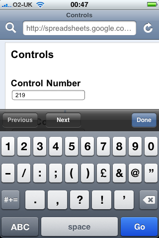
 Google Docs are not yet editable on the iPhone, however it turns out that forms are – the forms are a simple HTML form that loads really well on the iPhone. I added my own Google email address as a collaborator for the workbook – under the “Share” tab, choose “Invite people to fill out a form”. This automatically creates a form webpage, with a field for each column heading – and adds a “Timestamp” column to the original spreadsheet, recording when each form entry was added. Then, by going to the iPhone and clicking on the emailed link, I can start entering the data, in a structured way.
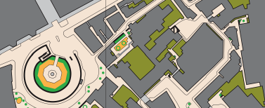
