OpenOrienteeringMap (not to be confused with the new OpenOrienteering Mapper project) is an orienteering map of the world, based on OpenStreetMap data. There are various formats including “Street-O Plus”, “Street-O Lite” and “Pseud-O”. Version 4, a rewrite and update of the project by David Dixon, is now the live version, replacing mine. David also maintains a blog on the project.
The Street-O map formats contain the level of detail equivalent to Street-O maps used for informal orienteering races around the streets of London and other urban areas in the UK and around the world. The Pseud-O map is a less serious map (as the level of detail in OSM is not sufficient for “proper” orienteering maps) but attempts to emulate the look and feel of standard orienteering maps.
Both maps make (loose) use of the ISOM and ISSOM orienteering mapping specifications, particularly the colours and the styling. Measurements are less likely to be within spec, due to artistic considerations and limits of standard screen resolutions.
When first accessing the website, you start zoomed out. Pan and zoom to your area of interest, then zoom back in a few times until you start seeing the orienteering map. Alternatively you can jump to a UK postcode, by typing it in at the top right.
Because the maps are based on the “Tile Mapping Service/XYZ” standard, they are viewable only at fixed scales. The current scale is displayed on the bottom right of the map. The most relevant scales for orienteering are 1:7000 and 1:14000 – these are the scales you will see for the third and fourth-most zoomed in levels (16 and 15), assuming a 72dpi screen. When you produce a PDF map from OOMap, they will be at the scale you choose (e.g. 1:10000).
Some areas of the UK are still missing much detail. You can help build the free map of everything in the world by contributing to the OpenStreetMap project, by surveying your local area and adding the roads, land types and other data into the project. Your updates are pulled straight into the project, as it now uses the OSM master global database. There used to be quite a delay before edits appeared.
There were various editions for countries (updating daily) plus a global version which only updated every year or so – as it used a copy of the global OSM database which takes at least a week to rebuild. Version 4 consolidated these editions into one global one.
The UK edition received some funding towards continued development and hosting costs – British Orienteering funded it from 2012 to 2014, while the Orienteering Foundation funded it in 2017. Subsequent hosting/development costs have been supported by ads.
Note that I cannot help fix the data – this should be done with the editing tools in OpenStreetMap – however if you have made a significant improvement to an area and would like it reflected in OOM before the next data refresh, by all means let me know.
For bug reports or to send new patches, please use GitHub: https://github.com/oobrien/oomap.
OpenOrienteeringMap is giftware. If it’s useful for you, it helps you run a successful event, or saves you time mapping, please buy me something on my gift-list or a coffee. Or buy yourself something through my Amazon store link.
- OpenOrienteeringMap
- Mapnik stylesheets for the maps – open source
- Announcement on blog (version 1 – 2009)
- Announcement on blog (version 2 – 2013)
- Announcement on blog (version 3 – 2020)
- Announcement on my work blog
- Announcement in my OpenStreetMap diary
- Some unrelated work people have done with orienteering maps and OSM

237 replies on “OpenOrienteeringMap”
Thanks for your continued hard work on this. We use it regularly for street O events, and support you each time. I have a quick question. If I am rendering a map using the standard format, is there any way to put darker green areas in an area of green woodland?
Many thanks
Is it just me or is there a problem with the website? I’m trying to plan SLOW’s next StreetO but can’t zoom in a map. Please help. It’s urgent!
Hi Rebecca, yes, the old server that the tiles were created on is being upgraded, which unfortunately broke things. I’ve now repointed OOM to David Dixon’s excellent upgraded version.
Hello,
Thank you for creating this marvellous tool, and for maintaining it for so long.
I wonder if you have a key to the features/colours?
I would happily paste it over an exported map after selecting an area.
Also, it doesn’t seem to be working today when I zoom in, maybe my browser.
Thanks,
Matt
Hi Matt, the old server that the tiles were created on is being upgraded, which unfortunately broke things. I’ve now repointed OOM to David Dixon’s excellent upgraded version. Thank you for the idea about a key, please the feature request as an Issue at https://github.com/oobrien/oomap
Hi Oliver
I am struggling to zoom in on OOM to get any detail for a map.
Not sure why this is the case?
Kind regards
Hi Richard, the old server that the tiles were created on is being upgraded, which unfortunately broke things. I’ve now repointed OOM to David Dixon’s excellent upgraded version.
[…] Kartenmaterial von OpenOrienteeringMap […]
Good Morning
First I would like to thank you for the initiative, this easy to use and simple map generator was a great idea.
second, I would like to inform you that there is an error when saving the map, it saves but does not generate the pdf and displays an error on the screen
thank you no more
Hi,
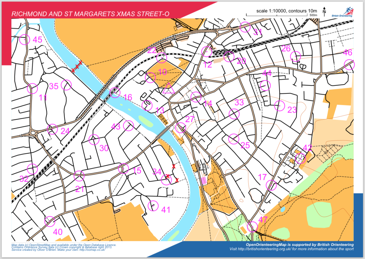
Having decided to walk (I don’t run) all the streets of the town of Cheltenham, I found the Open Orienteering Map, set at a scale of 1:10000 to be ideal for route planning, walking and recording of results.
While walking I have noted a number of comments/ additions/ quibbles (delete as appropriate) and wondered if you might be interested in my comments.
As a starter, I noted that a narrow “back alley”, running between Priory Walk and Carlton Street has been omitted. It runs parallel to Priory Street, and lies just to the west of Highbury Congregational Church.
If you are interested in such comments, please let me know. If you are, it would save a lot of text if I could email copies of marked up, annotated, maps to you. Is there any way I can do this?
Best wishes,
Jim Linton
Extra Detail
I have found an issue with recent oom pdf and kmz files. I understand that the data is based upom OpenStreetMap but where I live, Florey ACT, someone has inserted all the houses and started to put the fences between houses. This does not show up in the Srett-O and Street_o xrails versions of oom but is does in the Pseudo-O version. We use the Pseudo-O for our MapRun Street O events when we do not have an up to date OCAD map. The Pseudo-O vesion of oom allows us to see the private properties whicg are OOB. The fence detail can apprear to be paths on the map unless you zoom all the way in. Is there any way that it is possible to choose which details are to be shown on the map.
great job but… what’s about the contour lines? is there a easy way (for dummies) to print a complete map to explore the country? thanks
Hi, thanks for your work, this is amazing. I have a recent problem to download my pdf, the following message appears any time :
Mod_python error: “PythonHandler renderer::handle”
Traceback (most recent call last):
File “/usr/local/lib/python2.7/dist-packages/mod_python/apache.py”, line 398, in HandlerDispatch
result = obj(req)
File “/home/ollie/www/maptiler/renderer.py”, line 61, in handle
req = handlePDF.processRequest(req)
File “/home/ollie/www/maptiler/handlePDF.py”, line 19, in processRequest
outf = createImage(path, ‘pdf’)
File “/home/ollie/www/maptiler/handlePDF.py”, line 333, in createImage
ctx.show_text(text.upper())
Error: input string not valid UTF-8
Can you help me ?
Hi, can you get contours from WMS service? In the Czech Republic it could be possible use the map service: https://eagri.cz/public/app/wms/plpis.fcgi?language=eng&version=1.3.0&service=WMS&request=getCapabilities, layer “VRSTEVNICE_5M_V2” for 5m contour interval. It can be served as png. Example – GetMap 5m: https://eagri.cz/public/app/wms/plpis.fcgi?language=eng&width=919&height=907&bbox=-744082.7323672858%2C-1068302.5821590002%2C-742244.498940819%2C-1066488.3517805396&crs=EPSG%3A102067&format=image%2Fpng&request=GetMap&service=WMS&styles=&transparent=true&version=1.3.0&layers=VRSTEVNICE_5M_V2&_ts=1642967788578.
Thanks
Hi, I’m trying to make a map for use with UsynligO. Creation of the map works like a breeze, but somehow the map file seems to lose it’s georeference or doesn’t get one. I kind of presumed that this would carry over from OSM but can’t get it to work. Any hints on workflow? I looked at all the support info already, but don’t understand how I should apply this to an OOM pdf. As I’m Dutch, I may not fully understand how to proceed… sorry. Can you help?
Hey there when I try to zoom into the map it goes completly blank, what should I do?
This can happen if there’s a server issue – hopefully it was a short-lived one. Everything looks fine now.
Would be nice to include opentopomap to get the contours.
Hi,
Is it possible to add an XML 3.0 export as in OCAD ? It’s very useful for creating courses in other applications (SI-Droid, Vikazimut, …).
Bravo for work.
I am very happy with your site oomap.
But now a get error onthe site, a hope that You can help:
Mod_python error: “PythonHandler renderer::handle”
Traceback (most recent call last):
File “/usr/local/lib/python2.7/dist-packages/mod_python/apache.py”, line 398, in HandlerDispatch
result = obj(req)
File “/home/ollie/www/maptiler/renderer.py”, line 61, in handle
req = handlePDF.processRequest(req)
File “/home/ollie/www/maptiler/handlePDF.py”, line 19, in processRequest
outf = createImage(path, ‘pdf’)
File “/home/ollie/www/maptiler/handlePDF.py”, line 333, in createImage
ctx.show_text(text.upper())
Error: input string not valid UTF-8
Hi Tommy, I suspect this is a diacritic in your map title that it’s not liking (it’s not particularly set up for diacritics, I’m afraid). If you let me know your proposed map title, I can investigate further and see if I can fix it.
Hello, I regularly make updates and fixes for my city (Neuville-de-Poitou, France) on OpenStreetMap.org but when I use oomap.co.org they don’t appear. Is this normal? This is a shame because your website oomap.co.uk is very useful for me to run and find my way around areas not mapped in IOF format. By thanking you in advance for your response, continue to grow your website. Happy New Year’s Eve, Nicolas JIMBLET
Hi Nicolas, the Global edition of OOMap doesn’t update regularly from the database, but only once a year. The individual country versions (Ireland, UK, Denmark, Australia) do update daily. There isn’t a France one currently as there hasn’t been the demand for it.
The annual update of the global database is underway but takes a couple of weeks to process, so as long as you did your edits before 21st December, they should appear on the map next wek.
Hi Ollie, this is just to comment your reply ‘there hasn’t been the demand for it’.
In fact, there are many users in France of your site (maybe you can see it with the quantity of connections), as this is very useful for a link with new apps such as Navitabi app. From one year now, the development in France is fantastic. For example, we have created in this app around 1000 races !
Having regular updates like in England would be fantastic ! How could we motivate our demand ? Thanks for thegreat job your are doing, anyhow !
Hi pauly, I’ve a proof-of-concept fork of oomap that provides global contours and up-to-the-minute mapping:
http://oomap.dna-software.co.uk:8888/
I’m working with Ollie to integrate some of these updates into his main site.
I’m also French and I’m interested in having the outlines.
Thank you in advance for your work
Hi Ollie
Can’t see m to add postboxes at the moment. The plaques add okay.
Keith
Around Harrogate we have an increasing number of houses where they have put their drives on OpenStreetMap. These are generally tagged as access no, highway service and service driveway. These are appearing on OOMap as a road like any other which can be difficult to interpret. Is there a method of tagging that would mean that they would not appear on OOMap?
Hi Ollie. Can’t load postboxes today. Any issues?
Cheers
Keith
Hi Keith, these are working now – I think there was an issue a couple of months back, for a bit.
Wonderful page! Would be great to have contours on the international maps
OpenCycleMap appears to have international contour lines
Hi Tom – please see my reply above – direct link /oom/#comment-46143 – short answer is the OCM ones are commercial and so not freely/easily available.
Hello,
what about the contours; how is it possible to bring them into the maps?
br Rudi
Hi,
The “plaques” button is useful – we have a local set – but the database seems out of date. Doesn’t look like that comes from OSM – can you point me to a way to contribute more plaque locations? Thx.
Hi Rik, it is OpenPlaques – https://openplaques.org/
Hi Oliver,
I’m not sure if there is a glitch in the site. When I try to zoom into an area it goes blank. The closest I can get is where the measurement marker on the bottom left corner says 2km.
Thanks,
Sean
Hi Sean, yes sorry there was a server issue this morning which was causing problems. It is fixed now, let me know if you are still seeing blank maps.
Hi Ollie
Is there the ability to do line courses or is it just score?
Cheers, Jeremy
Just score. The website is modelled on the SLOW Street-O series which has always been score based.
Hi,
I hope this finds you well and I amazed at what you have achieved!
I have been doing a lot of re mapping on open street map of an area in West Yorkshire I would like to use for a street/Public Rights of Way event. However when I create the map PDF the footpaths appear to merge into the walls along side them. Is there any way of making it so that the footpaths on the pseud O map could be in a different colour than the black dashed line?
Kind Regards
Graham Lloyd
Ah, that is annoying! Can you use the Street-O map style as that doesn’t I think show walls?
Ollie, Can the App include gates that are across paths and roads as a gap in that route as we are often finding a route shown on a map generated in your App is not passable?
Hi Phill, this is a tricky one, as for the SLOW Street-Os in London (for which the website was designed) gates generally are passable by pedestrians but not by cars. Even though OSM tagging should help with this, it is generally not granular enough for London. I appreciate other areas may be better. The best way to fix this is to manually put red Xs across crossings which are not passable, using the OOM website.
Hi Ollie
Can you give me a contact for the IE version of OpenOrienteeringMap? I would like to explore some Ireland North / South cooperation on this if possible.
Charlie Reid
NIOA MapRunF Group
Hi Charlie – the contact is me – the IE version is not sponsored.
Hi Ollie, Thanks for your fantastic resource. I’ve been using it in conjunction with MapRun to create socially-distanced-friendly orienteering events in the Yorkshire Dales. I think your original intention was to support urban orienteering but I’m using it more in a rural / upland environment. In some areas this works fine because walls, streams, crags etc provide enough detail on the map. But in other areas the maps can be a bit blank! I wonder if you would be able to map some more of the landform features supported by openstreetmap? For example survey_point, sinkhole (as a depression?), cave. These have existing orienteering map symbols.
Hi Ollie – I can’t remove the Google Ad block on the right of my screen. Is this a setting on your website – if so, how can I remove it as it’s blocking the information table. Thanks.
Ollie,
Excellent to see output in KML & KMZ. Makes Maprun events even easier to set up. Could I suggest the means to add a separate finish and would it be possible to have a white shadow around the control numbers as especially on the pseudo-O map numbers can be difficult to read on the olive green background.
I have also problem with polish-characters in race name. Instead of getting “ą” I got “%U0119”. Regards!
Hi! I have on my map area with tag leisure=sports_centre. Unfortunetly it’s all black when I use PseudO layer. Is any chance to do something with it. It contains more objects, and now they are invisible 🙁
I agree with Ted, or even the 1:40,000 being available for the UK maps would be good. and the Global maps don’t seem to have the contours on them.
Hi Ollie. Thank you so much for this resource.
Is it possible to have an extra resolution, 1:50,000? This would enable BikeO- currently we cross the map too quickly!
Thanks
[…] could orient your map if you know where you’re on your own map. After you know where you’re on the map and […]
Hi, Ollie.
Thank you for your work, it’s a wonderful resource. I’m hoping to show a group of physical education teachers how to use OOM as a starting point for creating their own schoolyard maps. I’m having trouble getting the orienteering-level map to open, however. When I start to zoom in, I end up with just a gray screen when the scale on the bottom left gets to 2K. (However, Blueprint works fine). I tried Washington DC, Boston, and then the UK – same result. I am using Chrome, and I also tried using Internet Explorer. Is something not working right, or do I need to do something differently?
Thanks much,
Tori
Sorry about this, this was due to a file moved by mistake yesterday. I have reverted the move now and it should be working again.
Hi Ollie – looks like the same issue is there again today at the same zoom levels. Checked across different versions and different browsers and the same issue persists
Cheers
Simon
Hi Simon, thanks, yes there was a database issue this morning but it should be resolved now – let me know if you are still seeing the issue.
I am trying to create an orientation map in Formentera (Balearic Islands, Spain). Map ID: 5df28e0fb7d60. The problem is this: I cannot see the entire area of land because there is a green layer (belonging to the underwater area) and it overlaps the land area. Is there any possibility to remove this layer?
This area is tagged leisure=nature_reserve. I’ve now removed it from the renderer now on the basis that nature reserves can be lots of terrain types (e.g. partially sea in this case!)
Hello dear OLer
Thank you for the great program. It is very helpful. I have two concerns: Would it also be possible to have height lines in Germany – as in the UK?
Is it possible to output the card for further processing – so that you can improve the map with OCAD or OMapper?
That would be super awesome for the school operation!
LG Dirk
No plans for non-UK height lines (unless you have a good free contour set available in GIS format for DE – let me know if you do!)
Re map improvements, edit the original OpenStreetMap and the changes should appear in OOM within 2 days.
Contour question
Ollie, there are contours on the OpenStreetMap cycle maps of Ireland and everywhere else. Is there any way of importing the contours to OOM, or basing the OOM map on the cycling map rather than the standard map?
Curiously, there are no contours on the OOM’s of the Isle of Man or Northern Ireland, which I would have thought would be covered by the same conditions as other British Orienteering regions.
Hi John. The OSM contours are autogenerated from spot height (LIDAR) plus some custom work to smooth them and make them look better/remove anomalies. It’s quite a lot of work to generate these. I could get the OSM/OCM ones directly but they are a commercial product and not free. The UK dataset is pre-made as contours and comes from a free and open data set from the Ordnance Survey (which only covers GB – NI has its own national mapping agency OSNI, and the Isle of Man is also different – and not part of the UK).
Ollie
After marking a few Street-O answer sheets on Tuesday, I wondered if any future update to your (of course excellent) product could include a Points column at the rhs of the Clue Sheet. First 2 columns (No. & Score) could easily be narrower so that width of main (Description) column is not reduced.
Dave
First of all congratulations for the Open Orientering map software
My name is Fernando, I am from Argentina and I need to know if it is possible to access some more updated version of the maps of my country
In case these versions were for sale agardecere I report the price of them
from already very much grabbed
greetings
Blue dot does not allow me to drag map. Help!
Hi Ollie and OOMAP
python module error message and other probs when attempting uk street-o map export. Raising here in the hope that it is easy to fix.
Hi Jakob, just a temporary thing I presume, as it’s looking fine now.
Hi Ollie,
Another glitch with the UK basemap today – no hurry here so will try again tomorrow,
Cheers,
David
Thanks – yes looks like something is wrong. Looking into it now.
This is fixed now. The morning database rebuild seems to be failing more frequently – but then running fine whenever I’m looking at it!
Thanks Ollie – Always the way! Confirm working here too now.
Hi Oliver,
A huge thank you for your amazing page! I started to host a monthly orienteering event in Freiburg, Germany and it wouldn’t be possible without oomap.co.uk!
However, during the past two days I am getting a weird error message whenever I’m trying to download the pdf-map. It starts like this:
MOD_PYTHON ERROR
ProcessId: 22958
Interpreter: ’tiler1.oobrien.com’
ServerName: ’tiler1.oobrien.com’
DocumentRoot: ‘/home/ollie/public_html/maptiler/’
URI: ‘/pdf/’
Location: None
Directory: ‘/home/ollie/public_html/maptiler/’
Filename: ‘/home/ollie/public_html/maptiler/pdf’
PathInfo: ‘/’
Phase: ‘PythonHandler’
Handler: ‘renderer::handle’
If you need more information about the error (like a screenshot) feel free to send me an email!
Best
Lukas
Thanks, having a look now.
Hi Ollie,
The UK basemap data looks missing today (13 May) – could you please have a look? Thank you!
Hi David, UK basemap looking fine today.
Hi, if you see if I enter the openorienteeringmap and I go to the UK, for example oxford, they go out to the contour lines, and if I go to global, those details do not come out in Argentina, that’s what I wanted to ask you, it’s probably a streetmaps problem
.a hug and thanks for answering me.
Hi, yes contour lines are only available for the UK OOM, and are from our national mapping agency’s open data platform (OS Open Data). They aren’t in OSM. It is possible to create a global set of contour lines using SRTM-type datasets but this is very computationally intensive and results in contour lines which can look a bit jagged. The UK data is a pre-smoothed set of proper contour lines which was easy to integrate in, so I did.
Hello, I have been able to generate only the pdf of the map recently, not the jpg or Worldfile (jgw) files. Is this a known issue? On clicking ‘Get JPG’, I get taken to a white screen with ’tiler1 O’Obrien’ in the address bar, but nothing happens.
Thanks for the error report, I wasn’t aware of this, and will look into it now.
Hello, my name is Pablo Liska, I’m from Cordoba Argentina and we are trying to indroduce this beautiful sport. My question is if you can improve some images of my province, because in the maps of northern Europe there is a big difference. Could you have better details in the area of Cordoba? Thank you and I hope your answer
Hi – is there a significant difference in the detail level compared with OpenStreetMap? If so, I can do a bulk upload from the whole world. This will take a few weeks to run but should then improve the OpenOrienteeringMap map. Please give me an example on OpenStreetMap of where there is a big difference.
Hello, just found this, what a great resource. Similar to the post-box format, could you pull data from this project: http://www.bench-marks.org.uk/ ?
Hello,
I’m struggling to make this work for me. Any advice appreciated. I’m trying to make some simple maps for a DofE training walk.
Francine
Hi Ollie –
rather excitingly I’ve just tried zooming in to create a course… all the contour lines are there, which is awesome, however, there are no roads, paths, or any other detail at all… which could make a street-o quite entertaining,
Ive previously used this tool for street-o, so Im guessing there must be a layer not clicked on or something?
Hi Tim, thanks, and apologies for the delay. It looks like the daily download of data was taking much longer, this then missed a cut-off time for processing on my server, so there were empty tables in the database. I have now adjusted the timings and things should be OK, however please let me know if not.
Oliver, Hi. Thanks for the great system, It’s becoming a common map format used with the maprun smartphone App for StreetO. (www.maprun.club) .
We need a geo-ref’d map for the App – so we take the OOM output via OCAD to produce a KMZ, but I was looking to streamline this by creating the KMZ directly from a jpg + jpgw exported from OOM.
Could you please confirm that the easting and northing in the jpgw’s produced by OOM are valid. eg for a map in Keswick (UK), the Northing is 7,286,738, whereas I was expecting something like 6,051,xxxx. Also the Easting is Negative and quite different to what I get from OCAD. I’ve tried a copy of other locations too. Let me know if I am missing something here. Any help would be greatly appreciated.
Hi Peter. The JPGW coordinates are in Web Mercator (EPSG:3857) rather than British National Grid (EPSG:27700). This would explain the difference. The maps in OOM are produced to the Web Mercator coordinate reference system.
Hello
I am from Canada,
What could be the reason why the “Save and get PDF” is gray and not accessible.
Thansk
Martin
Magog,QC
Hi, you probably need to place a sheet on the map first. Once you’ve done this, the PDF produced will cover the area of the sheet. See the tip at the top right of the screen.
This may sound daft but I can get a map on my screen ok but I cannot see how to set a course or indeed to even print it.
Just follow the tips in the coloured box on the top right of the screen. Click to drop a sheet of paper on the map, then click to add controls to the sheet, and then finally click “Save ang et PDF” to get a PDF map that you can then open in Reader or Preview (or others PDF viewers) and print from there. Printing directly from the website is not advised.
[…] Kartenmaterial von OpenOrienteeringMap […]
Hi – Could you contact me with regard to your version of OSM for orienteering
Zooming in enough to get a useable map, it just gives me a blank screen!
Hi Ollie,
I am having trouble using oom. I have used it before with this postcode, but it is now coming up with an error.
Unfortunately that postcode could not be found. An error occurred.
Unable to find that postcode in the database.
I am not working on anything urgent, just trying to get a small group of friends into the sport. I will try again in a couple of days just in case there’s a glitch.
Kind regards
Debbie
Hi Debbie – this was a bug, thanks for letting me know. It’s now fixed.
Hi Ollie
To return to the ‘private’ issue again, around here there are a number of private driveways (i.e. effectively part of private gardens) appearing in OOM. They are tagged in OSM as ‘access=private’ , ‘highway=service’ ‘service=driveway’. I would have thought that this combination could perhaps be excluded from OOM?
Hi Alan – but could you not run up these driveways, e.g. if you have a clue asking for the door colour? The access=private/highway=service combination I generally interpret as no access for cars but access for people on foot.
Hi,
thank you for your great effort. I’m trying to get the map in japan, I got the usual map view with OOM, but when I created a pdf I got only controls.
I can get the pdf of the map in Toronto, Canada or somewhere else in Europe, but not in japan.
Any suggestions?
Thanks!
Hi Hiro, thanks, that is strange indeed. I can’t immediately see why that is happening, so I will need to investigate further on the server, I will be able to do this early in the new year.
Hello Ollie,
Map data seems to have sorted itself out with the daily reload. All looks ok now.
Thanks for a great application of Open Street Map.
Peter
Thanks, and sorry this caused a problem right before your event. I don’t currently have monitoring set up for the daily GB rebuild and am planning to set one up in the new year. As an emergency back up, you could always use the Global edition of OOM, which uses a database that gets rebuilt yearly rather than daily, It doesn’t include contours, or the latest mapping updates, but should otherwise be similar. Currently, OOM will not load UK-edition controls onto a global map, so you would need to rebuild this course. I have also raised a ticket to allow this.
Hello Ollie,
I seem to be suffering a similar problem with map data today as Maire Convery and George Engelhardt reported on 24 August 2016.. I’ve been working on a street-o map of part of Crawley for my local scout group (for tonight(!) and tomorrow night) and where the map printed fine with controls and all the mapped features yesterday, I get a brown only version (with controls today).
On the screen, all looks fine until you get to the largest scale zooms, when all of a sudden the main map goes, leaving only contours and controls.
When I load map IDs none of the controls are shown on the map, neither can i add any. All controls appear on the control sheet.
Hi Justin – thanks. This was a bug in the new v3 which has soft-launched. It’s now fixed.
Hi Oliver,
Could you please update RU-NIZ region of Russian Federation. We are planning to ran a little event at the end of September.
Many thanks for your great OOM service!
Sure, the update is underway. The process should be finished in around a week, at which point I’ll make it the live database.
Process is still running! Looks like it takes two weeks to complete now. I will check again Monday and make it live assuming it has finished – hopefully in time for your event. I can’t currently do a country-only update, unless there is a country-specific version of OOMap, at the moment there is only one for the UK and Ireland.
Update has completed now – it took 1225383 seconds (or just over 14 days). The new database is live.
Hi Ollie, we have a few highways tagged with “tertiary_link” that aren’t rendered by OOM. These particular roads aren’t really link roads so I can change the underlying data, but flagging so other similarly tagged roads can be included in OOM too. Thank you!
I don’t know whether anyone else has had this problem, but I have just called up my latest version of my map of Clayagte for a street O on 6th September, and none of the streets are there. The contours are there, and the controls are there, but there are no streets and no vegetation colouring. I’ve tried zooming out and zooming back in (it’s all there two zooms out), but it vanishes when I zoom back in again. I’m going away for ten days tomorrow and I really need to have this ready to print before I go. Help!
Hi George, should be working OK now. Looks like there was a problem with the daily database rebuild which has fixed itself.
Yes, it is working now. Thanks for looking into it.
Hi,
I’m struggling with OOM this morning. Earlier, I got the usual map view but when I created a pdf I got only contours (and controls). Now when I zoom in I only see contours and not streets. I’ve tried different computers and different browsers.
Any suggestions?
Thanks!
HI Maire, looks like a glitch with the daily rebuild of the database – I’ve checked now and it should be fine.
Some paths on a course map, although they will appear on the screen, will oddly disappear when printed.
I tried deleting the affected paths in OSM and re drawing them. I have tried re plotting the courses . Neither worked. It is the same paths each time .
I have resorted to creating a blank PDF and using this in Purple Pen, which works OK with all paths in place. The print range differences result in loss of Title or credits at bottom !
Hi John, can you send me exact details of the affected paths? The printed version should always be identical to the ones displayed on the website, except that the website caches old tiles and it’s possible that you are seeing those. You need to wait a couple of days when adding to OSM, before they appear on the PDFs. Thanks, Oliver (o.obrien at outlook.com)
hi Oliver
There are 3 areas , I know of that are affected.I have put a control circle on the affected path which disappears upon printing a course map.
57cle80153dec
57cle8b5563d4
57c1eb52f2787
The affected paths mostly NOT recent updates.
On the 3rd map it seems to affect nearly all the grey line underpasses… I can only see ! that is not . There may be more on this map , but this is for a up and coming activity, which i will work in Purple pen to produce the courses.
This map is too busy to use in OOM irrespective of missing paths . I am using PP uncrossable boundary symbols to show the edge of the underpass ramps.
For the second map , I added missing paths paths by hand (No 2 was just a short bit at the end)
John
It’s that time of year again for me to organize our Urban-O so I went straight to your website to get an updated map.
At first everything looked fine until when I switched to the same mode I used last year (PseudoO), the map is now covered with green circles!!
Is it possible to turn them off?
Hi Chris, sounds like your area has been well-mapped with individual trees! I know they can look a little large at certain zooms. I’m looking into this.
Hey Ollie, any luck on getting rid of the trees?
Louisville, KY USA
Also, do you know how recently the data for that area has been updated?
thanks!
Hi,
Could you tell me if there are issues with the server? I’m only seeing blank tiles when I zoom in to street level
Thanks
Working now, thanks
Ollie
Was trying to use OOM yesterday to create a street map for an evening event for one of my club colleagues and kept getting the blank pink squares when I zoomed in. The same is happening this morning. Is this a problem with the tile server mentioned in previous posts?
Thank you
Hi,
i want to report a bug, trees are buggy big on 40k and 20k.
They scale up and stay big.
Greets
Hi Colin, please file this on https://github.com/oobrien/oomap and I’ll take a look.
Hi,
I have used this successfully in the past but this evening when I tried to load a saved map or to zoom in on the same area I only get contours. Any idea what I am doing wrong.
Thanks,
Sarah
Hi
Great map resource – however, today and last night the map disappears when you zoom in to get the orienteering map. Just wondered if there was a problem
Cheers
Steve
Yes, the tile server was powered down as the building it was had electrical works on the Tuesday morning. Should have been all fine by mid-morning.
Hi Oliver,
I’m wondering whether you can assist with a conundrum please? I’m in the process of cobbling together a Street O in Faversham for the current Kent Night Cup series. Setting up a score course using your fantastic tool has been really easy. The resulting PDF looks very fine, however, when I print off a copy some of the footpaths disappear.
I’ve tried to print via both of my printers and I get the same missing paths. Any ideas what I’m doing wrong?
Thanks
Brendon
Hi Brendon, that sounds very odd. Could you email me the PDF concerned and detail which of the footpaths are disappearing when printing? I’ll see if I can replicate the problem. My address is o.obrien (at) outlook.com
Your mapping program looks to be just what I was needing for my Urban-O this month. My club’s current map is very out of date and I was trying to figure out how to update it! Now I can, though my problem is that our maps have always been at a 1:12000 scale (which I guess is weird) – is there anyway I can set the scale at that ratio?
Or at least some kind of custom ratio? I can’t quite get all the roads I want @ 10000 and 12500 seems to be too much.
oh and possibly some non-A3 & A4 paper sizes?
Hi Chris, 1:12500 is very similar to 1:12000 – it only shows 8-9% more land. Re custom paper sizes, which sizes would you be interested in. Both custom scales and custom sizes are relatively straightforward to program but take a certain amount of time and also potentially adding in more buttons would clutter the interface somewhat.
Hi Ollie, I found out our map scale had been wrong the whole time!
Also, the paper size didn’t seem to matter much, we figured it out after exporting to pdf and messing around with some settings, though it kept wanting to cut off the right/bottom edge.
Unfortunately I couldn’t figure out how to move controls once I’d placed them on your website. I ended up exporting the map to Purple Pen, but thanks so much for at least getting me a great template to start from! The countdown is on for our event: https://www.facebook.com/events/1578272869099946/
Hi Chris – you can’t move controls once replaced, but you can delete them and place new ones nearby with the same numbers – it’s only a couple more clicks than dragging them, as long as you remember the number/score/clue. Regarding sheet size, it’s possible that you were going for printing on US paper sizes. These aren’t quite the same as standard A3/A4 sizes. Finally, regarding margin cutoff, it’s important to print the sheets with no margin, otherwise they will misalign or shrink slightly.
Hi
Why am I not able to see the orienteering map when I zoom in close. Because I need to continue making my orienteering map with the control sites for a club night on Wednesday.
Thanks
Oliver
Hi Oliver – The tile server was offline on Monday morning, following an unplanned powercut at the weekend. The server did not come up cleanly following the powercut, so Monday morning was spent recovering it. It should all be fine now.
Hi Oliver
Greetings from the sunny Gold Coast of Queensland where the magnetic declination is 11 degrees East.
Have you thought of including a rotation parameter when generating a map?
I want to be able to load the map into OCAD as a background map and geo-reference it, so a Lat/Long grid of some sort would also be very useful. I concede that this makes the rotation unnecessary.
Better still, a geo-referenced JPG download would be perfect!
Cheers
Mark
Hi Mark, I haven’t ever thought about that, the project was developed primarily for Street-O maps in London in the UK, and opening it up to the rest of the world is a bit of a bonus. However, I do appreciate that magnetic declination is indeed not as small everywhere as it is in London, so it’s a feature certainly worthy of consideration if a sponsor could be found for the necessary development time.
Hi, anychance you could update the area around low cranecleugh. I have updated some new buildings and tree lines in that area and was looking at putting up a few orienteering courses.
Thanks
Hi – this should be on there now – there’s a 24-48 hour lag. If there’s still detail missing (and check on the PDF map – your browser can cache some old image tiles) then let me know a very specific example (e.g. paste in a zoomed-in link from OpenStreetMap showing the new detail) and I’ll do a forensic investigation.
Hi Oliver, a greeting from Colombia, wanted to ask if you plan on creating users can update the OOM from each country, popr example in the Global Map, so you wont have to do if you can not work.
a greeting
Jorge Aldana
Hi Jorge
I’ve published the stylesheets online as open data – https://github.com/oobrien/oomap – so these can be used if people want to set up local instances of OOM.
My current system is very bespoke (and hacky) so it’s not practicable for me at the moment to put the entire system online – however, apart from these stylesheets, it is mainly off-the-shelf – the bespoke/hacky bit is just putting it together.
I am happy to update the global database more frequently than once a year, if I know that it is being regularly used outside of the UK. Additionally, if specific countries/orienteering federations are interested in custom additions, that is something I can potentially set up too.
Is there any style that you could import to Osmand android app?
I would be nice to use the app and get the map with orienteering style.
Hola Oliver, un saludo desde colombia, quería preguntarte si piensas en crear usuarios que podamos actualizar el OOM, desde cada pais, popr ejemplo en el Mapa Global, para que no tengas que hacerlo tu si no poder colaborar.
un saludo
Jorge Aldana
———-
Hi Oliver, a greeting from Colombia, wanted to ask if you plan on creating users can update the OOM from each country, popr example in the Global Map, so you wont have to do if you can not work.
a greeting
Jorge Aldana
[…] OpenOrienteeringMap […]
It looks like OOM is still set up as a score event format, with a common start/finish. Is that correct?
In looking at OOM, if I switch from StreetO to PseudO two closely spaced North-South parallel lines appear running through the centre of the UK, with similar parallel lines running East-West. I am sure this has been asked before, but what are these and can I get rid of them before saving a map for use?
Thanks for help.
Hi Ian – yes, OOM is set up for Score as that is the format that most Street-Os here in the UK use. Adding a point-to-point version would be quite a bit of work as it would then be more than simple point data. It’s something I can do but it’s a couple of days’ work and I can’t yet justify spending the time on it with various other projects on the go.
The north/south and east/west parallel lines are artifacts of the coastline data files which are split up into blocks – in the PseudO view I include a black border around the coastline. Unfortunately this means the border appears at the edges of each block, as well as on the coastline itself. I was aware of the issue but I don’t think it was raised as a bug before so I hadn’t addressed it. I have now made some changes to the style and layer files for PseudO – specifically, layering the coastline edges so they are draw underneath the land blocks and extrude out from them, rather than being on top as before. I’ve also made water lines borderless to prevent the quirk where their borders are drawn in wider river channels, estuaries etc. This looks better but is slightly less ISOM.
[…] Tanken är att OOM ska kunna användas till att orientera på gator och parker i stadsmiljöer. I områden där OSM är bra uppdaterad kan detta fungera bra men i Trollhättan där OSM inte är så detaljerad blir det ganska kasst. På bilderna här har jag använt en version som kallas StreetO, det finns en version som kallas PseudO som mer liknar en vanlig orienteringskarta. Läs mer om OOM. […]
Hi
There was one other item I thought that I had raised , but is not in the list above is fences themselves . Fences put on street map are shown as walls
Hi John – I’ve fixed this now. If it’s tagged as barrier=fence, it now shows up as a fence, not a wall.
Hi
Exploring the use of oomap for POTOC
oomap will hide railway tunnels , but not canal tunnels … even a disussed canal is shown as surface feature .
I have also contacted about football fields being shown as fenced enclosures when very few are .
Hi John, I’ve fixed both of these now – canal/river tunnels are no longer shown, and football pitches are no longer shown with fences around them.
Hopefully just completed another OOM map for an event later this month. OOM excellent as always! Further to previous discussions, I note that a (private) farm track which is highway = track and which is tagged access = no and comes up with the ‘brown splodge’ marking on OSM still seems to appear on OOM. Does OOM not currently ignore features with ‘access = no’? I seem to remember from our previous discussions that it should. No urgency – can live with it for current event.
Hi Peter, it doesn’t, because sometimes access=no ways are still actually accessible on foot. I’ve deployed a new feature which means you can manually block out a known OOB route by adding red crosses to the map.
Hi,
OOM crossed the channel again !
That’s a great news.
May I suggest a few improvements ?
Tag Access=private -> overwrite with 709 for an area
Tag Landuse=orchard -> use of 412
Tag Landuse=forest -> use of 406 instead of 405
Tag landuse=wineyard -> use of 413
For water if tag intermittent=yes -> use of 307 or 311
Yet the PseudoOmap is astonishing !
If I can help, let me know.
Many thanks,
Daniel (DF45@OSM)
Hi Dan – Thanks, I’ll look into incorporating those in due course. If you are familiar with Mapnik XML stylesheets, then it would be a great help if you were able to incorporate these changes into a GitHub pull request for the appropriate files at https://github.com/oobrien/oomap – that way I can just pull, test and release, rather than coding them myself.
[…] OpenOrienteeringMap […]
Yes, my other (highway) changes rippled into OOM.
I assume it’s something like OSM waterway changes are not implemented at every OOM update.
If the changes are coastline changes, then yes they won’t be included. This may well be the case for the tidal Thames section. The coastline is only very rarely updated, as it comes from a Shapefile rather than from the OSM database directly, for efficiency reasons.
Used a map generated from OpenOrienteering Map for first time last night. Absolutely ideal for a small street score event. Total prep time = 5 hours (provided you use a bike to find control sites)
[…] OpenOrienteeringMap […]
In readiness for the SLOW Street-O I’m organising in Twickenham, I looked at OOM for the area. Why can’t I get Eel Pie Island ( http://www.openstreetmap.org/way/26932726 ) to appear on a pdf map? Islands at Brentford with I believe identical attributes (eg http://www.openstreetmap.org/way/224302536 ) appear on OOM. My last relevant OSM changes were 5 days ago, so I’d expect them to have rippled into the OOM database.
That is very odd, I haven’t a clue why! I wonder if Your other updates have presumably made it in?
Love this new version, such an easy use program! well done!
Just a minor thing: Any chance Irish maps can get the IOA logo instead of the BO one??
Appreciate it!
It would be a bit cheeky of me to do that, as British Orienteering paid for the development of version 2 (the current version). I’m using the OSM datafile that happens to include Ireland, which is why you get it as a free bonus. There’s also no obvious Ireland/non-Ireland flag in the data, as it’s physical data rather than administrative.
Hi Ollie
I did a load of updates to OSM yesterday in preparation for an event tomorrow night. I thought I read somewhere that there was an automatic daily update done in the morning but nothing seems to have changed is OOM yet. Can you clarify the position regarding updates please?
John
Yes, there is a daily update – however I had to move the start of the daily load from 7am to 2am, recently. This means that it misses the daily 6am upstream file release, so you may have to wait an additional day.
Also your browser may have cached the old tiles. Test by generating a PDF – that should always go direct to my database, and not use caching.
Hi Oliver!
This is truly brilliant and I’ve been able to use it to get our clubs kids out and used to O mapping. The only problem we’ve had is that contours don’t show up in our area (Dover & Folkestone) and it can’t be down to a lack of hills here! Is it something we’re doing wrong? I’ve had a look and the contours seem to disappear in a N/S line just east of Ashford?
Apart from that it’s great and you have our thanks. Vic.
Thanks, that sounds like a definite bug – I’ll take a look!
Hi Vic, this is now fixed – contours should extend throughout the country now!
Hi Ollie,
We’ve got a small night o event planned on Thursday (20th) and have been making quite a few changes to OSM but have just now noticed the message saying you arent currently pulling updates through.
Any idea when you will and/or I assume its not possible to just pull one small area of ST16 through if I ask really nicely? 🙂
Kelvin
Sure, I’ll kick off an update now.
Thanks, really appreciate it. Saves us having to do a load of manual map updates!
The new look is great – but damn you for making the changes the day after I print my street o map!
The new look is part of the new release. It’s a bit that’s rolled out early for testing. The other bit (the new website) will be rolled out in phases – Phase 1 is coded and so will hopefully be rolled out in the next week, once it get signed off. Phase 2 (persistent saving, cluesheets) to follow!
Hi Oli, wondering if this is a rendering oddity.
This map :- http://oobrien.com/oom/uk.php?zoom=16&lat=51.74878&lon=-0.35317&layers=B00FFTFFFF includes a number of what look like fenced areas, but are in fact leisure=pitch in OpenStreetMap.
On the ground they are just football pitches marked out in the park so the tagging seems appropriate, but the rendering isn’t. Any thoughts?
Kevin
Hi Kevin
Yes, that’s the way I’ve set that tagging up for OOM’s terrain layer – I’ve assumed there are fences around pitches, but this is quite often not the case. I could get rid of that particular bit of tagging but it would be good to delineate pitches from open land some how. Maybe showing a path going around the perimeter?
Yes, I have the same problem with the south of France, just pink & no street map.
Have mentioned this about 6 months ago, but still no luck………………
Fran
Hello,
I seem to experience some problems creating Street-O maps for Brussels (I tried via the belgium.php, global.php and uk.php), The UK.php does make the maps in London. The Global.php also has problems in Paris for example.
When zooming in the whole area gets a nice pink color, no Street-O map however…
Best regards,
Alistair
Hi, is it possible to get the Mapnik style file source for this map somewhere? I would like to make a training orienteering map in Krkonoše, Czech Republic, but I can’t since the global service is down.
Hi Oliver!
This is the best enhancement I ever seen in this category! I wish you the best wishes for a happy progress.
Yes, I really miss it too.
I live in Sweden so Europe will be great if that will be up n working : )
Have you consider some possibilities to donate for your projects? I guess we are many folks out there that appreciate your work and want to encourage you going forward
All the best,
Peter
Hi Oliver,
This is by far the best enhancment I ever seen in this category!
I really miss it too. I’ll be happy to to donate to your progress if the Northen Europe / Europe will be up and running again 🙂
All the best
Peter from Sweden
Hello,
tried little testmap in germany by the fly but got this error message (dont know anything about Phyton):
MOD_PYTHON ERROR
ProcessId: 21435
Interpreter: ‘casa.oobrien.com’
ServerName: ‘casa.oobrien.com’
DocumentRoot: ‘/home/ollie/public_html/’
URI: ‘/maptiler/pdf/’
Location: None
Directory: ‘/home/ollie/public_html/maptiler/’
Filename: ‘/home/ollie/public_html/maptiler/pdf’
PathInfo: ‘/’
Phase: ‘PythonHandler’
Handler: ‘renderer::handle’
Traceback (most recent call last):
File “/usr/lib/python2.7/dist-packages/mod_python/importer.py”, line 1537, in HandlerDispatch
default=default_handler, arg=req, silent=hlist.silent)
File “/usr/lib/python2.7/dist-packages/mod_python/importer.py”, line 1229, in _process_target
result = _execute_target(config, req, object, arg)
File “/usr/lib/python2.7/dist-packages/mod_python/importer.py”, line 1128, in _execute_target
result = object(arg)
File “/home/ollie/public_html/maptiler/renderer.py”, line 59, in handle
req = handlePDF.processRequest(req)
File “/home/ollie/public_html/maptiler/handlePDF.py”, line 50, in processRequest
outf = createPDF(path)
File “/home/ollie/public_html/maptiler/handlePDF.py”, line 148, in createPDF
mapnik.load_map(map, styleFile)
RuntimeError: Postgis Plugin: PSQL error:
ERROR: relation “planet_osm_polygon” does not exist
LINE 2: from planet_osm_polygon
^
Full sql was: ‘SELECT * FROM (select way,”natural”,waterway,landuse,way_area
from planet_osm_polygon
where waterway in (‘dock’,’mill_pond’,’riverbank’,’canal’,’river’)
or landuse in (‘reservoir’,’water’,’basin’)
or “natural” in (‘lake’,’water’,’land’,’marsh’,’scrub’,’wetland’,’glacier’)
order by z_order,way_area desc
) as water_areas LIMIT 0′
encountered during parsing of layer ‘water_areas’ in Layer at line 266 of ‘/home/ollie/production/maptiler/styles/streeto_global.xml’
MODULE CACHE DETAILS
Accessed: Mon Nov 26 20:51:05 2012
Generation: 2
_mp_e7f8d206af4dc7e51841871b7f166ea5 {
FileName: ‘/home/ollie/public_html/maptiler/gen_tile.py’
Instance: 1
Generation: 1
Modified: Sat Nov 24 01:47:51 2012
Imported: Mon Nov 26 20:48:42 2012
}
_mp_be664c449fcc8992b2de2509ea296aa6 {
FileName: ‘/home/ollie/public_html/maptiler/handlePDF.py’
Instance: 1 [IMPORT]
Generation: 3
Modified: Sat Nov 24 01:48:22 2012
Imported: Mon Nov 26 20:51:05 2012
}
_mp_e72dc1c33a5050165fac52e925ffacbb {
FileName: ‘/home/ollie/public_html/maptiler/renderer.py’
Instance: 1
Generation: 2
Modified: Sat Nov 24 01:48:34 2012
Imported: Mon Nov 26 20:48:42 2012
Children: ‘/home/ollie/public_html/maptiler/gen_tile.py’
Friends: ‘/home/ollie/public_html/maptiler/handlePDF.py’
}
Does it only work in UK-Version?
Regards Siegfried
Hi Oliver, is there any chance taht in the near future OSM global will be working again ?
I’m realy missing it !
Regards Gerrit
I’ll see I can free up some disk space – sorry for the extended outage, Gerrit!
p.s. There’s a better chance that a Europe-only version will be up as that will take up a lot less disk space than a global one – would this be OK for you?
Oliver,
Europe-only would be fine for me, i live in The Netherlands.
Hi Oliver,
is there any chance that in the near future OSM global will be available again ?
Regards, Gerrit
Hi again, Oliver.
I have just discovered that if I use the UK OOM and drag southwards from, say, Newry, I will arrive in the Republic with an OOM, so – problem solved!
John
Hi Oliver. Are there any plans to restore the global version of Open O-map? Or is it possible to restore certain areas separately on a rotating basis(Europe this month, North America next month, or something?). It’s a great asset which I use for doing training maps and want to use for night street-O.
(PS I enjoyed my second London City race & have pencilled in 21st Sept 2013 already)
John McCullough
3ROC
Dublin
Hi John,
The UK version is misnamed – it should actually cover Ireland too, as I used the British Isles OSM data download for the most recent DB update, rather than the Great Britain one.
The are no plans to restore the Worldwide one. The work server I was using has been coopted by a colleague for an Olympics-related work project over the summer, and there simply isn’t enough server-grade hard disk space on it for the complete OSM global DB (~400GB+) at this time.
Hi,
It would be really useful to save/create a map in another form other than PDF. I would like to be able to make some additions to the map I create (i.e. labels, show changes to boundaries that have occurred since area originally mapped), but I am unable to do this in PDF format.
Hi
What other formats would be useful for you?
PLEASE READ BEFORE COMMENTING
OOM Worldwide is currently offline due to server space issues.
OOM UK is currently not updating – an old copy of the DB is available but it is from ~March 2012. A new version of OOM UK should be online soon, complete with updating database – this has been delayed by City Race organisation so now looking at October 2012.
Hi Olly
I am new to all this
How long does update from OSM take to appear on OOM?
I put some changes on a bit of Shrewsbury last week- they are on OSM but not yet(?) on the Orienteering map
This whole thing is amazing thanks for setting it up
Adrian
Hi
For a few weeks now we can’t zoom in to places in the south of France and Monaco in order to make an oom.
When you zoom in the screen just goes blank, it reappears when you zoom out again.
Thanks
Fran
Is your April 4 2012 note (re no updates to Open Street Map being shown on OOM) still valid? This presumably does mean that development of further OOM’s is on hold for now? Any timeline for possible removal of the licence restriction?
Thanks
Ian – stay tuned, I should have some big updates within the next week.
Ok, how do you update the map. Not being a computer geek I can’t see how you do it. I need to up date several maps by adding streets for various orienteering club nights.
Cheers
Hamish Lead Community Coach North.
Hi Hamish
You update the map through OpenStreetMap – http://osm.org/ – the updates should then flow through although currently that doesn’t happen – however with luck things should be back to normal within the next week.
I have been trouble trying to produce a map in the global setting. I am trying to see Ottawa Ontario Canada. The PDF has an MOD_PYTHON ERROR when you hit create PDF.
Hi Wolfgang – I’m afraid the global map is currently non-functional – I’ve had to temporarily remove a database that it needs. I’m hoping to have it back in the next few weeks.
Hi,
I’m trying to create a pseud-O map for an event, but when I click the create pdf button, I get a street-O version of the map. The map is the right area and shows the controls, but is the wrong type.
Any assistance appreciated.
Kevin
Hi – you need to choose “Pseud-O” from the drop-down on the map creator panel, not from the radio buttons which are for what’s displaying on screen. Yes, sorry, I know that this is dead confusing, and this will be made much more obvious in Version 2 that I am working on this summer.
Hi Oliver,
I’ve just noticed something that looks odd (to me) in the Street-O rendering of tunnels. I was just starting on a map for HH summer series and comparing the two options below, the Street-O version is generally nicer, but the tunnels don’t work:-
http://tinyurl.com/84lpdgj
http://tinyurl.com/6u7orok
In the Pseudo-O map you can see the large road is marked as being in a tunnel, but on the Street-O map it looks like it’s on the surface. The Psuedo-O map is the best representation of reality – the road is in a tunnel that runs under a shopping centre and there is no sign of it on the surface. Is this is a feature of the spec for Street-O maps (and hence actually correct for this type of map), or a rendering oddity?
I’d like to use the Street-O version, but don’t think I can like this as it will be realy confusing on the ground for runners.
Hi Kevin
It is a total mystery to me why this is happening for the Hatfield Tunnel – it doesn’t seem to be happening for most of the other tunnels. On both renders, the tunnel should only be shown as a series of grey square dots – not as the road line as well.
If you look at http://casa.oobrien.com/maptiler/streeto/17/65517/43588.png then it working fine but http://casa.oobrien.com/maptiler/streeto/17/65449/43434.png which is your tunnel, is not rendering it as a tunnel. I’ve checked the tags in the database and they are correct.
Investigating further…
Turns out the problem was that the “relation” which links together the various ways that make up the A1 (M) had a highway=motorway tag on it, causing it to be rendered as a separate above-ground motorway on both my map and the general OSM one, this was obscuring the tunnel underneath. Another contributor has now deleted the tag to fix the issue in this case.
[…] Sample PageMeOpenOrienteeringMapEpic CyclesLand’s End to LondonPrologue: Land’s EndDay 1: Land’s End and Lizard […]
Hi Ian:
1 – there is currently no separate finish indication, it is assumed that it is where the start is marked. This is because OOM is based on the Street-O maps that SLOW produce/use for their series, and we have always run the start and finish from the same place. Separate starts and finishes will be available in a future update to OOM.
2 – OOM is designed for score courses only currently. Again, something that I should be able to put into a future version.
3 – Please don’t edit OSM with orienteering-only information, i.e. OOB areas. Instead, you’ll need to post-edit your maps (e.g. red pen on the printed copies) to show such areas. As with the above points, marked OOB areas will be available in a forthcoming update to OOM, and this one is very near the top of the list, so it will appear sooner than the others.
thanks for help
Maybe I’m missing it somewhere, but when setting up an O course:-
a) can you input a separate finish or is it assumed that’s where the start is?
b) how do you link between controls ie 1 to 2 to 3
c) if there are special things, such as out of bounds, I guess those have to be input into Open Street Map and then deleted if removed?
Henrik – not currently but will look into it.
Srinivas – Orienteering maps do not show street names. The context layer is just intended to help you line up the orienteering map online to specific streets, before producing the PDF of it.
Why the labels for city/street names are not displaying in PDF when i do create PDF
Thank you very much! I will definitely use this for some trainings with my club!
I see that power=minor_line is not rendered right now, maybe it could be rendered in the same way as power=line?
Thanks again!
I would love to see an update of the OOM map in Sweden. I have made some major additions to OSM and can’t wait to see them in OOM!
Daveb – Hmm, not sure about that – what is a path and what is a road? I generally think of roads as things where you might expect to meet cars moving along them, rather than being defined by surface or width.
Hi,
This is a great project.
I noticed that streets in my town centre (Lichfield), which are pedestrianised are appearing as foot paths whereas they are roads for the prupose of orienteering. They are marked on open street map as highway – pedestrian. Should these not appear as roads?
See this link for a description of ‘highway – pedestrian’
http://wiki.openstreetmap.org/wiki/Tag:highway%3Dpedestrian
Thanks,
Dave
John – Hi, sorry, I was being too lazy to check properly. After a power problem last weekend, the updates weren’t flowing through, until I fixed the problem yesterday. It’s caught up now.
John – your browser is probably caching the old images. Try closing and reopening your browser (although sometimes this will still result in the old ones being used – Chrome is quite bad at this. Try Firefox?) The new data should appear when you create a PDF from the data.
just had another look and some have appeared but not others…Might be just a matter of time?? Am using the uk version of open o ( Ithink)
i have added some footpaths to the open streetmap of rugeley but when i generate a streeto map or a pseude o map these are missing?? except preexisting ones.
ant suggestions as to what i am doing wrong?
Which features in particular? Can you see them in OpenStreetMap (http://osm.org/) for the corresponding area? If so, let me know and I’ll add them into the stylesheets for OOM so that they come in there.
Alternatively, are you looking at OOM in the “Pseud-O” mode? By default, PDFs are created in the Street-O style, you need to manually select “Pseud-O” from the second box – the one that appears when you choose “Create Map”. Then, the PDF should look the same as the version on screen.
Dear Brian,
I only discovered oom recently, and it is very usefull for us, ardf fanatics. ardf is amateur radio direction finding. As we are not real orienteerers, we have no time or skills tp make good orienteering maps, and most of us used openstreetmap to set up a competition. We do not really need all the details, because we more rely on the radio signals. With oom we now have a great tool to help us learn real orienteering maps used for bigger competitions.
The one thing that i mis though is north magnetic lines, every 500m or so. That is something we can add by pencil, but if you could print it on the map it would be very usefull.
thanks
Marc Vanhalst ON6HI
ARDF manager Belgium
http://www.ardf.be
I’m having a problem with OOM.
When i elect to create a PDF of a map I have set up, the PDF has none of the orienteering conventional signs (landscape features etc) on it.
This is really beautiful, not to mention great. In my classification it’s one of the very best examples of innovative use of OSM data / how OpenGeoData allows just about anything one wants to do with it.
One question, though: How / how often do you update the data? I see that you ask people to ask you to update if they have done “significant mapping in a given area” — but I’d love to know what kind of system (if any _system_ / standard procedure) you have in place for updates so I don’t need to bug you (when an update is possibly just around the corner).
Thanks!
Ps. Please consider installing some WordPress plugin that allows commenters to subscribe to comments via email.
Truly amazing. Thanks for making this great resource available. I now have the first ever O-map of my home town, in just 5 minutes work!
any way of exporting the generated map to a file that can then be uploaded into OCAD and custom-edited with additional symbols ?
Good evening!
Can I trace a route?
and put signs on the map
how do I do?
Hi,
OpenOrienteeringMap is a dynamically generated site and also does not store data itself – the data source is OpenStreetMap. As such, it is not suitable for archival.
My contact details can be found in the “Contact Me” link on the top right.
Regards,
Oliver
Hi,
I posted a comment on your site last month, but did not receive a reply.
My previous comment was as follows. I would be very grateful if you could consider it:
The British Library would like to invite you to participate in our web archiving programme. We select and archive sites to represent aspects of UK documentary heritage and as a result, they will remain available to researchers in the future. The British Library works closely with leading UK institutions to collect and permanently preserve the UK web, and our archive can be seen at http://www.webarchive.org.uk/.
Please can you supply us with an email address, so that we can have the relevant information sent out to you.
Regards,
Permissions Officer (pp. Alison Hill, Curator)
Web Archiving, Room 150, Floor 2
The British Library
96 Euston Road
London
NW1 2DB
Tel: 0843 2081144 (ext. 7211)
Fax: 020 7412 7691
E-mail: web-archivist@bl.uk
UK Web Archive: [http://www.webarchive.org.uk/]
Would you give access to the code for your setup? I especially like the functionality to create a map. I’ve compiled a list of services using OSM and yours is one of the better more functional ones.
The list:
http://goo.gl/XvxaK
[…] & original post: http://blog.oobrien.com/oom/ full credit to Ollie […]
[…] details of the construction are in a posting and information page on my personal […]