Categories
Uncategorized

An Uneven Distribution of Orienteering Events

timbean talks about Orienteering Blackholes – places in the UK where not much goes on – at least this time of year – in terms of events.

Looking at my Map of Orienteering Events, there certainly are some interesting patterns – the icons show events happening in the next ten weeks. The big clusters are around London, the Severn Estuary, and the Peak District. Hardly anything is going in East Anglia (possibly due to vegetation at this time of year), North Wales, or Hampshire/Dorset.

Surprisingly, very little is happening in Scotland either – considering that Scotland remains in condition until later in the summer, and that the best terrain in the UK is up here, it is odd that so little is going on. Maybe the Scots are bad at registering their events with the BOF, from which the map is largely derived? I certainly know some of the SE region clubs are, because I supplement the official listings with information gleaned from club websites – for the London area only.

Orienteering Event Distribution in the UK

Categories
Notes

Trail Challenge

(10534)

Last Tuesday was the first Trail Challenge of 2008, organised by SLOW, in Bushy Park, one of London’s Royal Parks. I volunteered to be course planner, to get some planning and organisational experience ahead of a couple of races I will hopefully be putting on later this year. This meant I didn’t get to run, as I was out putting out controls and guarding them. However, it was a good opportunity to take some photographs on what was another warm and pleasant summer’s evening.

As is traditional for the Bushy Park race, the route included an (optional) water splash, which I was surprised to see most (~70%) of competitors taking – as it was early in the race, and not that shallow!

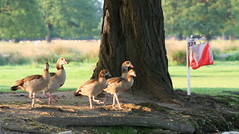
Time to Reclaim the Control (10446)The first control was also quite a spectator friendly one – beside the Duck Pond. The local residents (i.e. the aforementioned ducks) weren’t too happy with the crowd of runners suddenly appearing, and noisily reclaimed their spot once the racers had moved on. The park was, as usual, brimming with wildlife, with several large herds of deer providing an unmarked obstacle. I also spotted a few regal swans and a large heron.

More details about the race – you can also see the routes I planned from here.

Categories
Leisure

London to Brighton

My housemate, who has only recently taken up cycling, cycled from London to Brighton on Sunday. Can’t be having that! So, I set off on Wednesday afternoon, quite late in the day, from home, with the aim of hopefully getting to Brighton, or at least a long way out of London, by sunset.

I did it! Although it did get pretty dark at the end. My route was exactly 100km, and took just over 5 hours moving time – adding in my many stops at traffic lights in London, a number of short rest breaks and a long (30 minute) break for lunch, I took 6h 20m. This was my longest ever day bike-ride – beating my 87km from Weston-super-Mare to Bath a couple of years ago.

At the Start - London to Brighton CourseMy route was copied from Adrian Fitch’s website: See here for the route, which I converted to TCX using the extremely excellent Bike Route Toaster and programmed it into my Garmin Forerunner 305 GPS, which then gave turn-by-turn instructions, with a countdown and a satisfying beep as I passed each junction. Apart from a couple of missed turns which I was soon alerted to, it worked very well – just as well, as I deliberately didn’t bring a map.

My route was very similar to the 2007 London to Brighton “official” cycle ride route, apart from my 13km prologue to get to the start. The only apparent differences are: (a) I cut off the Garratt Park corner just after Clapham Common, (b) I bypassed Hayward’s Heath to the east taking a route through Wivelsfield Green, and (c) I went over, rather than around, Hollingbury Hill on the outskirts of Brighton.

The worst section was going through south London – very stop-start. Carshalton, which I’ve never been to before, was very pretty though. There were a few big hills – getting through the North Downs, up Turner’s Hill, and up Ditchling Beacon, were the most notable ones. After the highest point (224m) it was a very nice, fast descent down into Brighton. I got caught in one rain shower, going through Ditchling village, but it stopped as I started the big ascent. It was pretty much dark as I hit the outskirts of Brighton. I’m pleased that I didn’t have to walk the bike up Ditchling Beacon – I was expecting it to be The Ultimate Challenge but it really wasn’t too bad in the end.

Taking my time from Clapham Common, which is where the official race starts (although their route is, as noted, slightly different) I did the 87 km in around 4h 25m, although this doesn’t include stops/breaks – with them, I took 5h 36m.

Next up will have to be the 2007 TDF Stage 1 route – although at >200km, I think I’ll need to do a truncated version.

My photos.


Red is >25km/h, Blue is <15km/h

Categories
Uncategorized

Brill

This Tuesday, I headed off to Oxford for an informal evening event put on by TVOC at Brill village. The event is held every year, and I’ve been quite a few times in the last few years. Unfortunately Brill is not an easy village to get to – long ago, the London Underground used to stretch out that far – these days it’s a train out to Oxford, then an hour long cycle ride eastwards, over several hills and through several picturesque villages, before a final 80m ascent into the village itself. There are two things I always remember about Brill – the windmill and the nettles. This year, the nettles weren’t too bad, and the windmill looked very picturesque in the warm evening sunlight.

The map is another interesting thing about this race. Brill has a huge village common – bigger than the village itself. Part of the common extends right down the hill. The map is drawn, rather uniquely, with a contour interval of 1.67 metres. This year, the map was pre-printed (although we were still using pin-punches.) The map almost fits onto an A5 sheet, at 1:5000, so it really is a small area.

Brill Map

The race format was a mass-start, three loop race. Having arrived exhausted, and slightly late, I was allowed a breather before heading off into the common. The effect of three loops over the same area meant that the common was pretty thoroughly visited, as the aerial photograph of my race shows:

Brill Route

The colours correspond to my heart-rate. A couple of features stand out – the climb to the finish/loop changeover point with me finding the climb tough (red) every-time I approached it, and my extended pause (blue-green) at the northern end of the course, when I thought I had missed out an earlier control.

For some reason, the weather is always very nice for the Brill race. Hopefully next year’s will continue in the tradition.

Categories
Notes

Spring

Oops, I forgot that my Twitter account posted all my updates on this blog – hence all the recent posts aren’t very substantive.

Just a quick update on the City of London orienteering map work. Here’s the progress so far:

View Larger Map

The grey areas are the remaining bits, I’m hoping to get them done in June. Green are the nicest areas, red the worst.

Here’s the events I’m hoping to do soon:
13 May pm – SLOW Trail Challenge at Bushy Park (planning)
17 May – JOK Chasing Sprint at Bloom Wood (helping+running)
20 May pm – TVOC Summer Series at Park Wood
26 May – EBOR Park Race at York
5 June pm – LOK Local at Hampstead Heath
7 June – WRE Sprint at Shrewsbury
8 June – HOC National at Brown Clee
10 June pm – TVOC Summer Series at Wittenham Clumps

As always, my map of forthcoming orienteering events is an invaluable planning tool!

Categories
Notes

b28


Photograph by Bossanostra.

Categories
Notes

OSM London Summer Mapping Marathon

Just noticed that there’s going to be a series of mini-mapping parties on summer evenings, around central London – the roads are traced, so it’s all about adding street names and POIs (Points of Interest.)

Details.

I can’t make the first one but am going to try and be at some of the others.

Maybe, by the time Autumn comes around, I’ll be able to generate maps for the SLOW 2008-9 street-O series, off OSM, rather than off Ordnance Survey maps as is (I think) currently done.

SLOW Street-O map segment:

Corresponding area in OpenStreetMap:

Categories
Orienteering Events Log

Lambeth Street-O

Lambeth Street-OHere’s my route around Lambeth last night, during the final SLOW Street-O of the series this year. The race was during daylight hours – which was good, as some of the areas around the bottom of the map are not places I would want to be in after dark.

Highlights included the Oxo Tower and the Oval cricket ground – which I failed to recognise on the map until I got there.

I ran 11.5km, in 60:14 – so incurring a 10 point penalty for being late back. I finished fourth, my best result of the series, although Nick and Paul weren’t running, and Mike was demoted to fifth in somewhat controversial circumstances.

Event Log

Categories
Uncategorized

Worst First Leg Ever?

I seem to fairly regularly screw up the first leg on orienteering courses. Often, the shorter the first leg, the worse the mistake. It’s as if I need a moment or two on a course to “warm up” my navigational abilities, just like I need a moment or two before the start to warm up my muscles.

Sunday (Day 3 of the JK) was a particularly bad example. There were a lot of factors against me – I was late for my start, I had just cycled 12km uphill from the station to the event arena, it was my third really early start in as many days so I was very sleep deprived, it was snowing, windy and very cold, there was no club tent to change in as it was so early, my thumb-compass had developed a large bubble in it, and my left inside knee started hurting a lot while jogging to the start line. This was worrying – I freak out every time my knee hurts, after a long and frustrating recovery from a previous knee injury in 2003.

So, I was not best prepared for what was going to be a 12.7km cold, wet slog over exposed moor and forest. I rushed through the start, without having time to warm up, check the sample map or check the start direction. As I picked up my map, I was relieved to see the first control was a straightforward 200m away. I carelessly charged forward, and completely missed it:

Ashdown Leg 1 Mistake

Ashdown Leg 1 Extract

10:15 for a 200m leg. My official split is 13:15 as I was three minutes late off the start. After this rather unfortunate start, and concerned about the knee, I decided to bail – I diverted to the last third of the course, ambled around it, getting even colder in the process, limped back to the finish and now-erected club tent, gratefully accepted an early lift to the station, and spent the rest of the day in the warm and the dry.

Categories
Notes

Mystery Building

Here’s a mystery building for you – can you guess what it is? It’s in the City of London.

Mystery City of London building