I’ve just cycled from Land’s End to London, taking a meandering route and covering 1012km (630 miles) over the course of 10 days. And I did it without any maps. Instead, I used the “Courses” functionality in the Garmin Forerunner 305 sports GPS unit.
The courses were TCX files, generated at BikeRouteToaster using the routing supplied by Google Maps and Cloudmade (OpenStreetMap data) – I alternated between the two depending on which showed the best looking cycle routes or most complete coverage of country lanes. Google’s road coverage is more complete but it’s API can (currently) only route journeys based on rules optimised for cars. OpenStreetMap still has big gaps in coverage in parts but is pretty good and showing dedicated cycle paths, in particular the flat (a luxury in Devon/Cornwall!) “rail trails”.
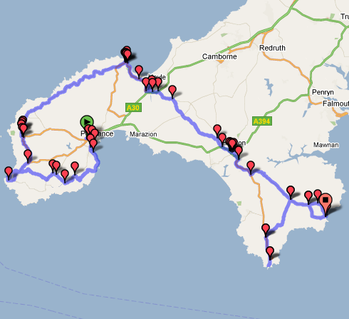
The first day’s route, as viewed in BikeRouteToaster
The TCX files are XML and are made up of two parts – the route itself, which is represented on the Forerunner unit itself as a meandering line, and turn indicators, which are derived from the data and in most cases are right – a spurious “straight on” indicator often appears when the country lane changes name, but most junctions are detected, apart from where the main road typically turns and the minor road carries straight on. This does result normally in a couple of unplanned detours, particularly for very shallow junctions where both the road and the junction turn in similar directions, where the route line does not help, but in general it means you can do a complete cycle without having to get a map (or smartphone) out at every junction.
One problem is restricted memory in the Forerunner 305, and that the use of this limited space doesn’t necessarily correspond the size of the data in the TCX files. For example, the turn directions took up around 10% of the space of the route lines in my TCX file, but appeared to take up double the space of the route lines on the device. By removing turn directions from the TCX files, reducing their files sizes by only 10%, I was able to store more than double the number of route lines.
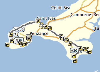
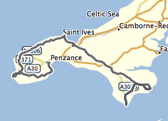
The first day’s route in Garmin Training Center, before and after the turn directions were removed.
Older versions of the Garmin Training Center (sic) application, used to upload the TCX files, would fail silently, without loading all the files, when the memory limit was reached, and the current web-based uploader tool also gives an unobvious error message when the device runs out of space on uploading. However, the latest version of Garmin Training Center includes a pre-processing tool that examines the TCX files and only lets you upload files which collectively don’t exceed the limit – using checkboxes a useful “full bar” indicators. With this, I was able to see what files I could include, and that by removing the (relatively small sized) turn indicators, I was able to load in almost all 10 days worth of files.
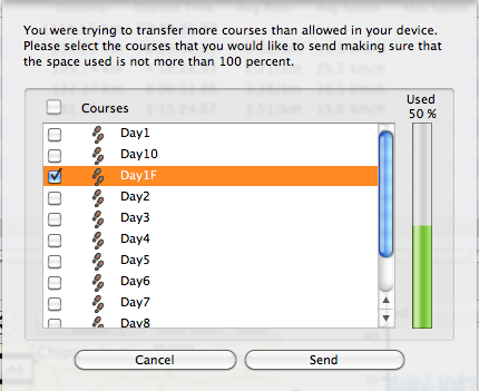
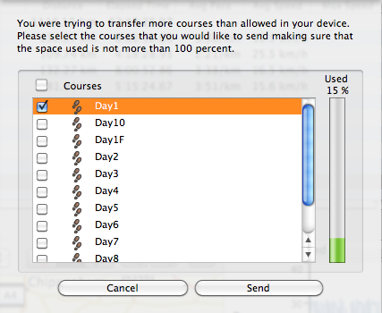
The Garmin Training Center upload screen, before and after the removal of the turn-based directions, showing the difference it makes to the capacity used on the device (A striking difference, given that the turn-based directions only take up ~10% of the original TCX XML file.)
3 replies on “Long Distance Routing with the Garmin Forerunner 305”
BikeRouteToaster is a great site but sadly underused, we always highly recommend it for anyone.
Re the memory issue with the 305, might be time to bit the bullet and upgrade to a 405 especially as you can now pick one up for under £200
Well I guess the battery inside the garmin bit the dust, it only gives a readout for 5 mins. if I’m lucky. I changed the battery on the chest strap there was no change. I think I can get a battery for about $20 but then I have to buy the proper tools to connect the battery and after all that with time and energy I might as well send mine in and get a re-issued used one for… i think $70… aren’t there any garmin repair shops out there… i did clean all post, no good.
The Garmin 305 is a great bit of kit. I have been using mine for over two years now and don’t know what I would do without it!