I presented a talk on geodemographic mapping, at a visual methods workshop “In/Visibility and Difference” which took place in Berlin at Bard College (formerly the European College of Liberal Arts). The workshop was organised by the TransformIG project at Humboldt University in Berlin, which was also the venue for the keynote part of the meeting. Thank you to the organisers for organising an interesting and intensive workshop which presented a wide variety of visual and geographical techniques which are becoming key ways to structure and analyse sociological studies.
I structured my talk into four sections:
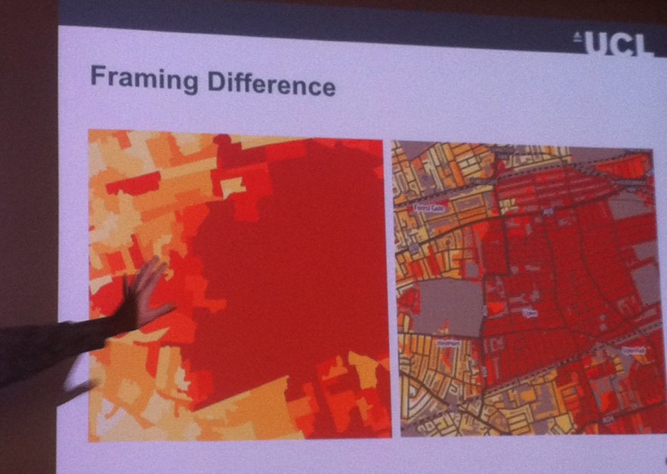
- An primer on improving choropleth mapping of socioeconomic data, moving beyond the basic “heat map” by adding regular geographical feaures (see photo below), labels and clipping coverage to populated areas, to explain the demographic patterns and highlight external influences. This is the technique used by DataShine to display Census 2011 aggregate statistics, and CDRC Maps to show geodemographics. I also outlined alternative approaches used by other research groups, such as cartograms and dot density maps.
- A tour of the geodemographic maps in CDRC Maps, including the Output Area Classification and a map of the latest Index of Multiple Deprivation. I also touched briefly on the problems of geodemodemographic classifications, where good/poor fits to the classification are typically mapped identically, and the “second choice” classification doesn’t get shown, showing some techniques to try and map these subtleties.
- An introduction to more novel methods of mapping demographic data, such as Lives on the Line and Tube Tongues, but highlighting the shortcomings of such maps too.
- Finally, a brief mention of mapping more novel datasets, showcasing the Twitter language maps for London and New York – again discussing the flaws as well as strengths of such maps.
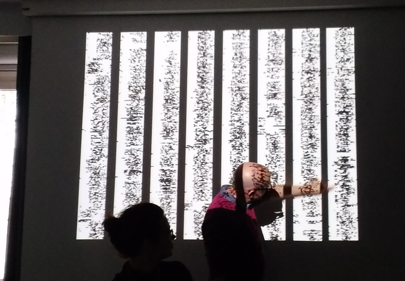
I found many of the other talks very interesting – particularly the work by plan b – two performance artists who have essentially tracked their entire outdoor life over the last 8+ years, both creating GPS traces which they have turned into artworks at various scales and on mediums (including a 3D mould), but also temporal activity indicators which they have grouped together into small multiples. They term these the “birch trees” due to their characteristic stripy white/black columns (see top photo). I also liked the striking pictograms created by Migrantas who have created simple and powerful graphics, from stories from the migrant community in Berlin and elsewhere. Their work can be seen on billboards and walls in various places across the city. There was a good talk by Stefan Lindemann on “SuperLUX”, focusing on linear development along commuter lines to Luxembourg City and corresponding population changes – essentially an international take (due to the country’s size) of the more recent “Northern Powerhouse” project to connect the cities of the north of England.
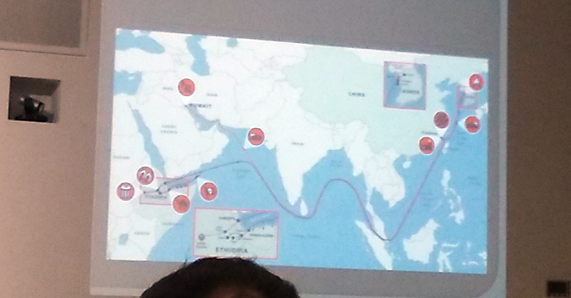
There was one more map “treat” for me at the workshop – the closing keynote given by Caroline Knowles included her investigative journalistic project where she tracked the complete journey of a pair of flip flops – from oil in Kuwait, to factories in South Korea, then to and through the markets in east Africa, to the consumer, and then finally to the rubbish dumps of the region. A map illustrating the life cycle of the flip flops is below.
Thanks to Agata Lisiak and the TransformIG team for inviting me to speak at the workshop and the opportunity to learn as well as disseminate. (Photo credit for the top photo: Agata).
One reply on “In/Visibility and Difference – Visual Methods Workshop in Berlin”
Thanks for the update and Lives on the Line and Tube Tongues are great examples to have used. Regards, Alastair Majury