The City is extremely built up, with skyscrapers and tower blocks in all directions. This means that a GPS receiver was always going to suffer, with signals bouncing off windows – the so-called “multipath” effect, caused by urban canyoning. I noticed this when carrying out early experiments to see if I could map the City from “first principals”, i.e. using a GPS. Walking past the Gherkin produced particularly dramatic effects. In theory, running should reduce the effect but it will still be considerable.
Nick Barrable has uploaded his GPS track from the City Race, and also drawn his actual route. The difference is striking – although some of the discrepancy may be due to the way the GPS track is georeferenced with the background map, I suspect a lot of multipath signals are happening too.

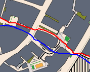
Nick’s GPS is sure he went around the other side of the Natwest Tower. It’s in blue, the actual route taken is in red.

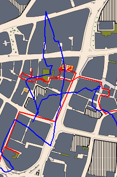
In the narrow Venetian-style alleyways around Cornhill, the errors are large.

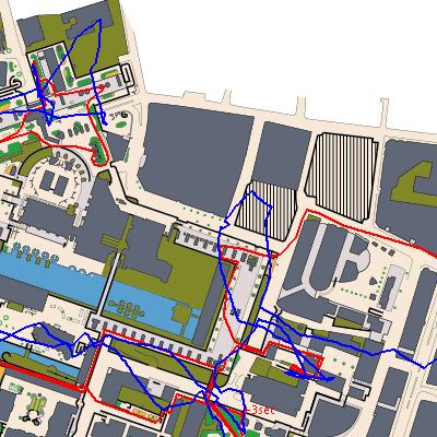
In the Barbican, the GPS track is way off.