I was the Czech Republic over the weekend, at Doksy, which is north of Prague and near the German border, for the 2011 orienteering Varsity Match. After a “model event” on the Friday to familiarise ourselves with the sandstone terrain, the match itself was on Saturday, and a 3×2-man relay on the Sunday.
The sandstone terrain is quite distinctive – lots of rock pillars and cliffs, generally 5-10 metres high. The cliffs occur in lines, meandering horizontally but generally at the same height. This means that natural terraces between the cliffs provide opportunities for fast, level running, in terrain that first glance looks intimidating. Groups of rocks often have distinctive horizontal breaks, often occuring at right-angles to each other, resulting in “sandstone cities” – passages which can be navigated along between the rocks. The passages are generally less than a metre wide with vertical rock on either side. Careful mapreading is required to ensure the route followed doesn’t lead to a dead-end or a rocky drop, but the modern maps we used during the weekend have been produced to a very high standard by the stanstones.cz team.
The model event had plenty of controls in “theatrical” locations such as narrow rock passages, with some crag-hopping possible in a couple of locations. The actual varsity match though was mainly about good route choice, i.e. go through the complicated terrain, or go around, or (sometimes) choose a shorter but steeper way around. As I was walking the course (as injured) I generally opted to go straight – less walking, and also generally the more scenic option.
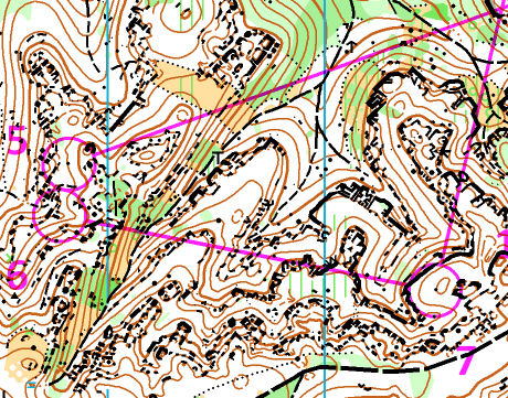
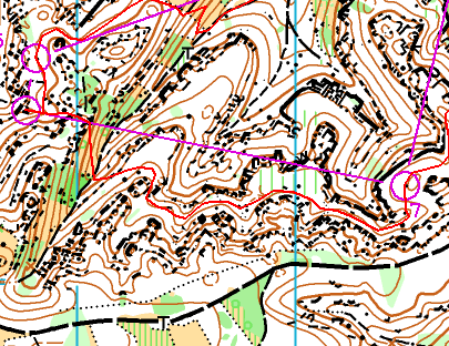
Here’s my route between 6 and 7, following a terrace between two sets of sandstone cliffs. You can also see some sandstone cities, NW of No. 7, although my route didn’t visit them.
