Categories
Bike Share Data Escooters

Zag Daily

You may be wondering why it’s been so quiet on Bikesharp, the last couple of years… well the reason is that I have been a data journalist on this topic for Zag Daily, an online magazine focusing on shared electric micromobility, particularly in Europe and especially in the UK. So I’ve been writing about the UK e-scooter trials, how bikeshare in the UK is going electric, European market summaries, and various other data-driven aspects of how the industry is evolving and developing, here and around the world.

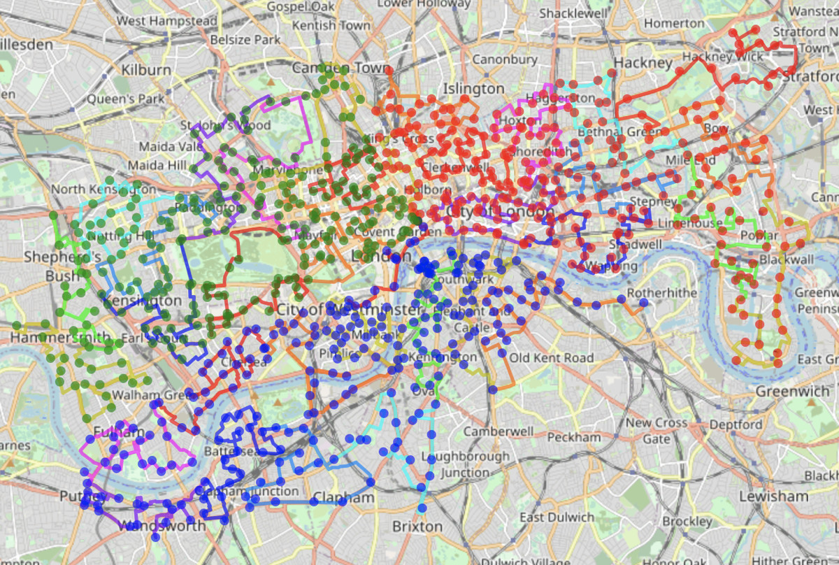
So far, I’ve had over 70 articles published there, and also supply the live data feed, updated daily and showing the numbers of e-scooters, operators and cities in the UK e-scooter trials – see the numbers panel on the bottom right of the front page. I’ve also published some maps showing the extent of the trials, you can see a variant of one of them here.

See the latest news at https://zagdaily.com/

Categories
HS2 London

Colne Valley Viaduct: 1 Year In

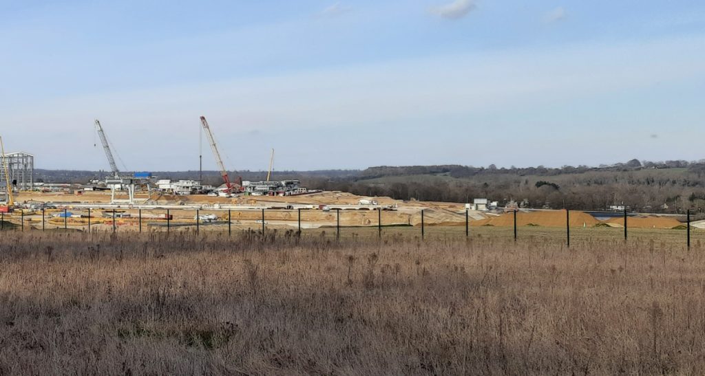
It’s just over one year since I last had a detailed look at the worksite for the forthcoming Colne Valley Viaduct, and I was back last week to see what’s changed.

Launch Girder

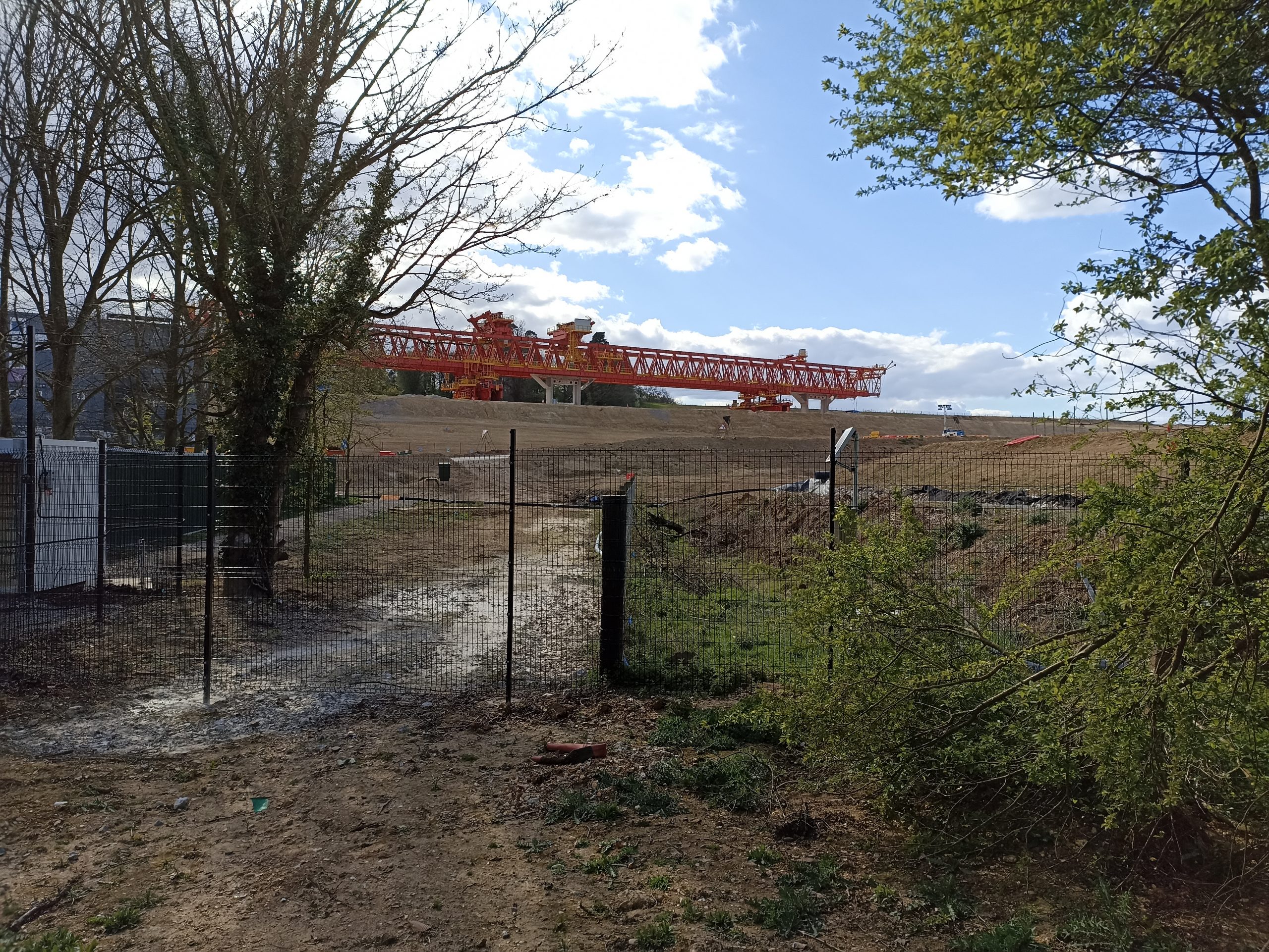
The viaduct is being built north to south, and this striking red structure, the launch girder, has just been assembled on the earthworks leading to the northern end. It will soon take a slow journey, sliding the couple of miles across the viaduct, atop the newly created piers, building the main bridge deck from the precast sections being created at an onsite factory.

The launch girder sitting on the northern viaduct embankment.
Unusual site speed restriction sign.

Piers

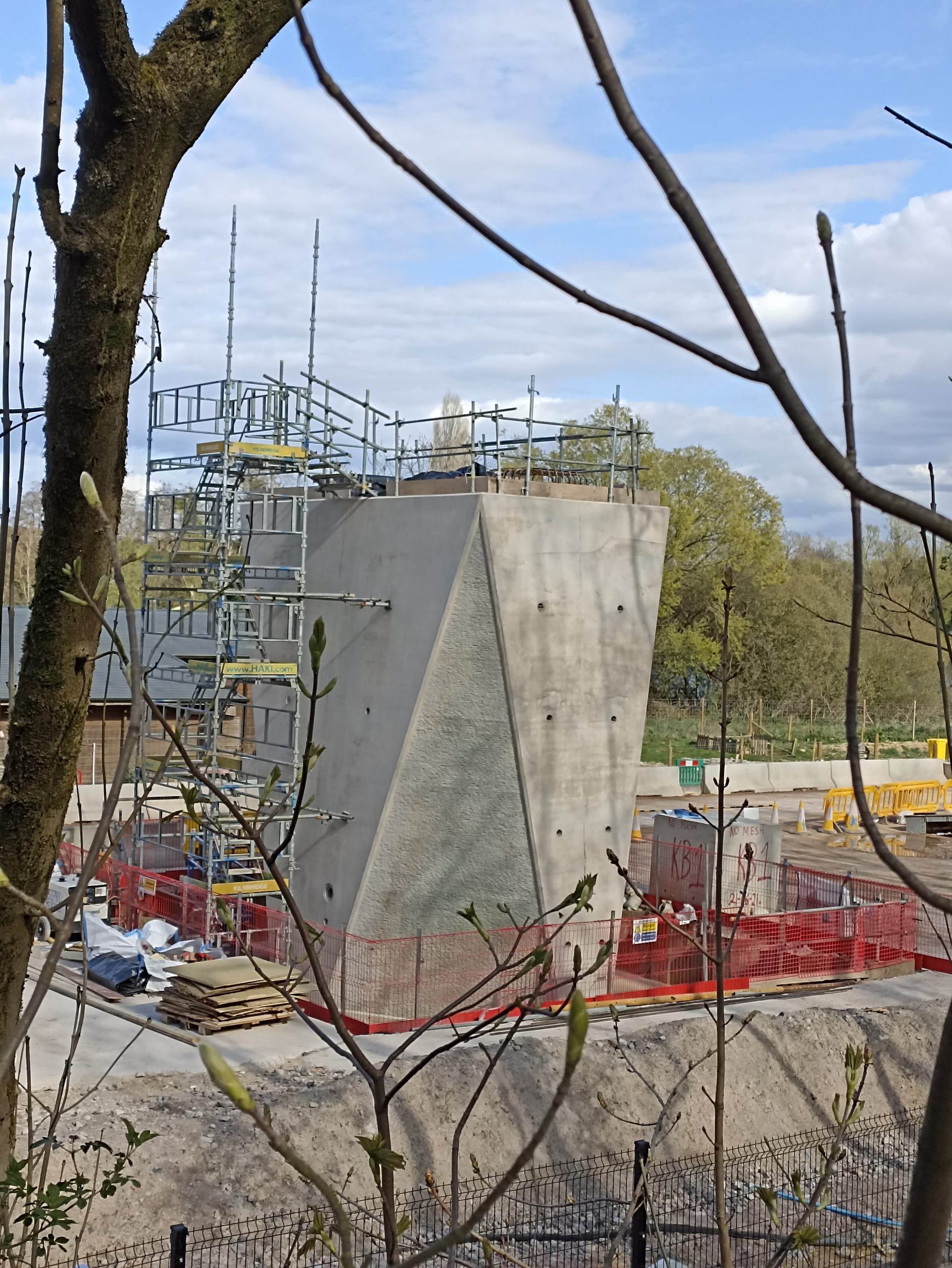
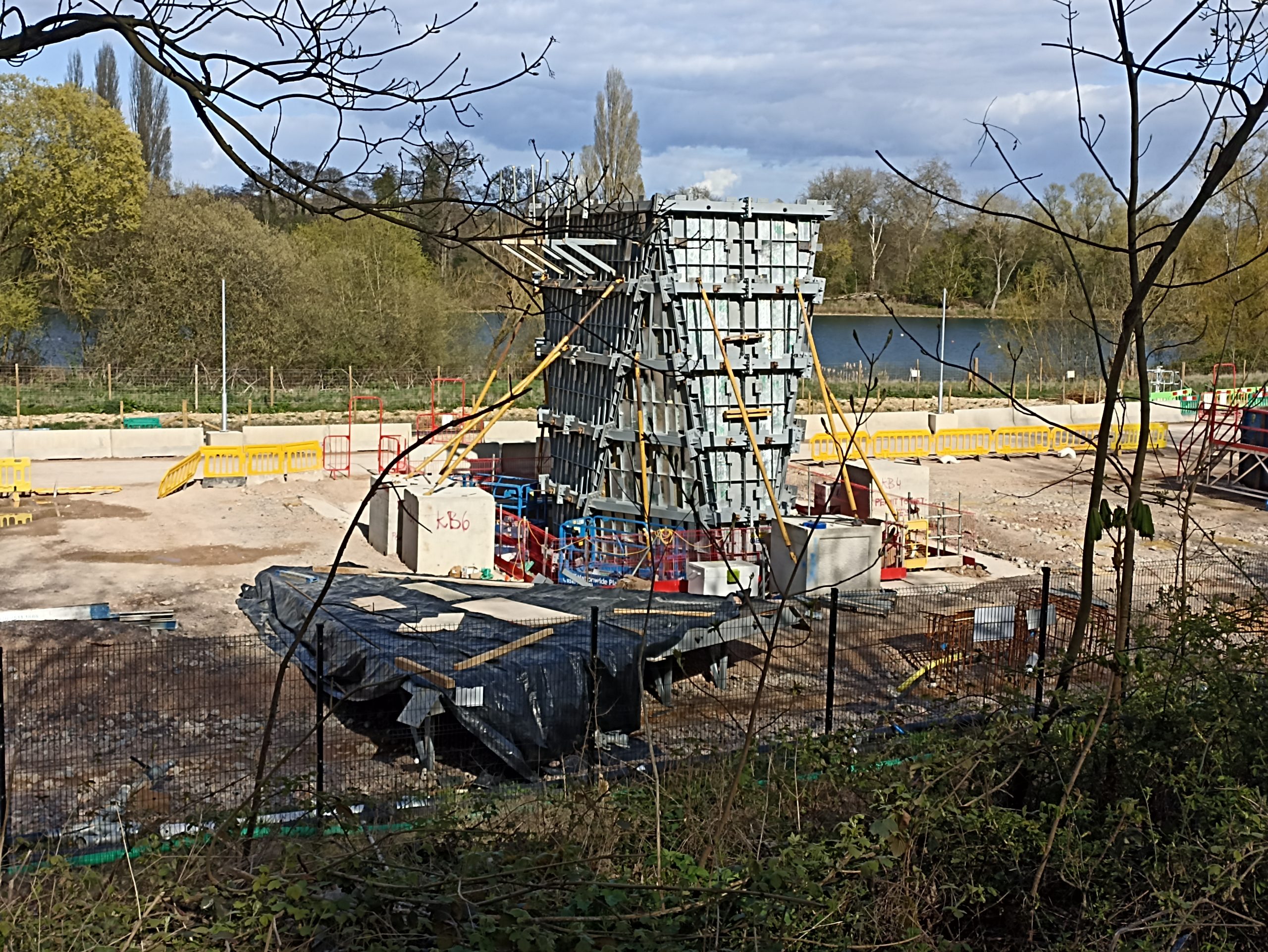
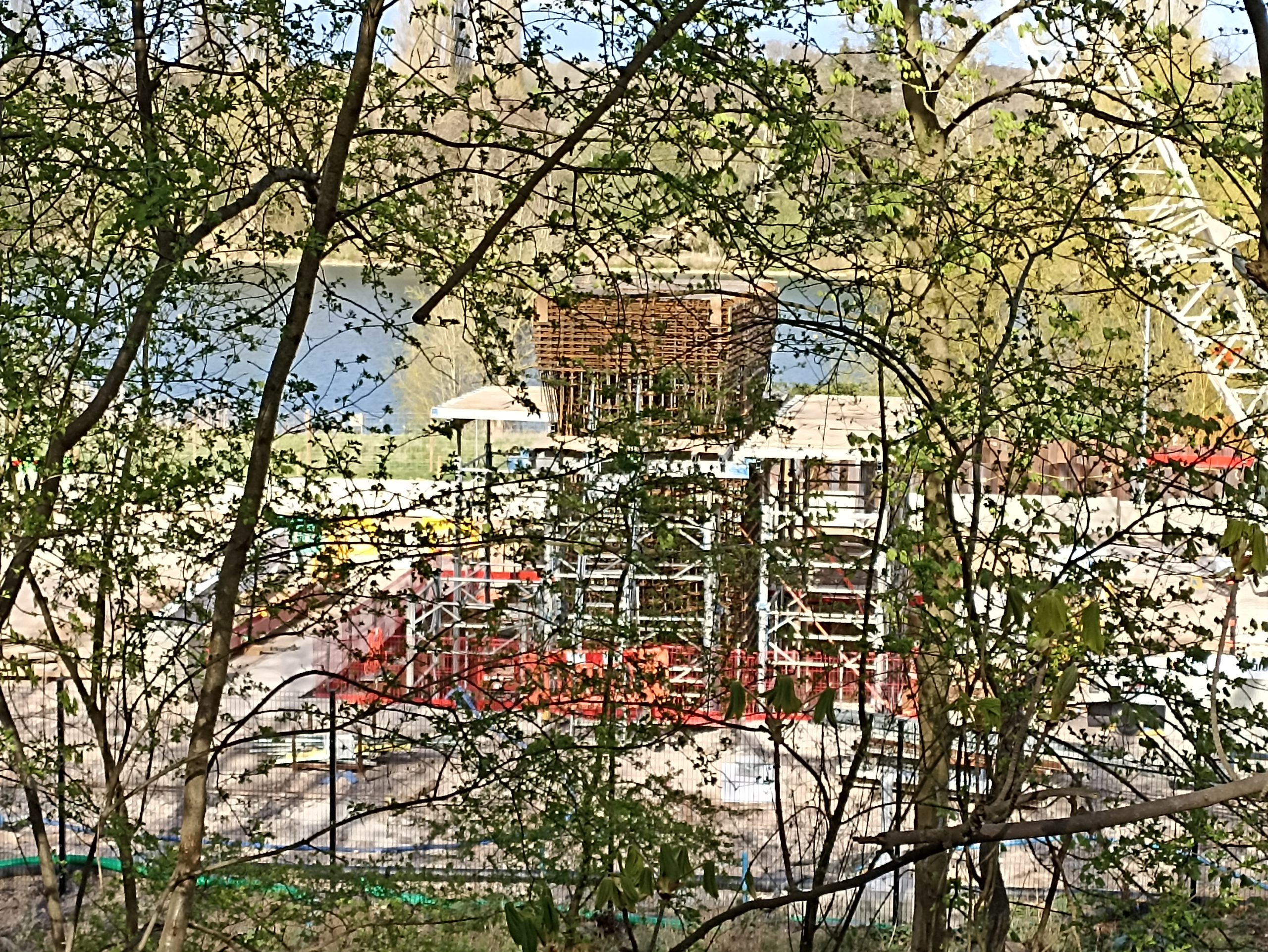
These are now appearing regularly, in various stages of completeness stretching along the first part of the viaduct. The plan I believe is to create one a week.

The second pier.
The sixth pier, with concrete surface texture detail visible.
The seventh pier, being shuttered while the concrete sets from being poured. The ex-Denham Water-ski Club hut is behind.
Rebar for the eighth pier in place, nearly ready to be shuttered.

The pair either side of the A412 (Nos. 3 and 4) have a different design, as they are angled, to support the viaduct which will cross the road here at a severe skew angle.

Grand Union Canal

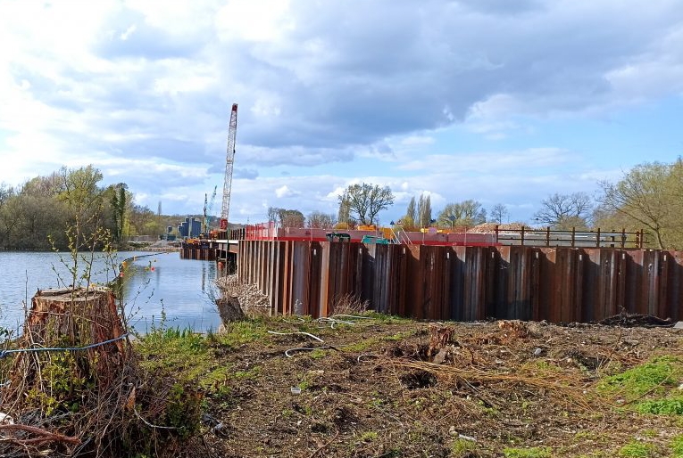
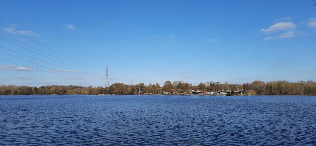
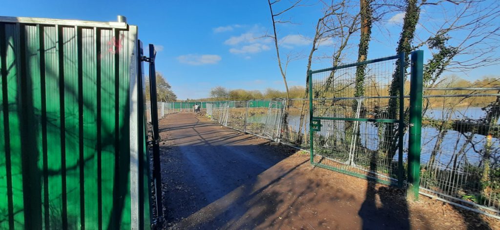
The Grand Union Canal is one crossing that needs to stay open as much as possible – so the haul road will not cross it. Instead, two haul roads will meet either side of it. Here, the photo shows the southern limit of the northern haul road pontoon on Savay Lake, with the forthcoming piers of the viaduct due to appear on the left.

Southern end of the northern haul road, by the Grand Union Canal towpath.

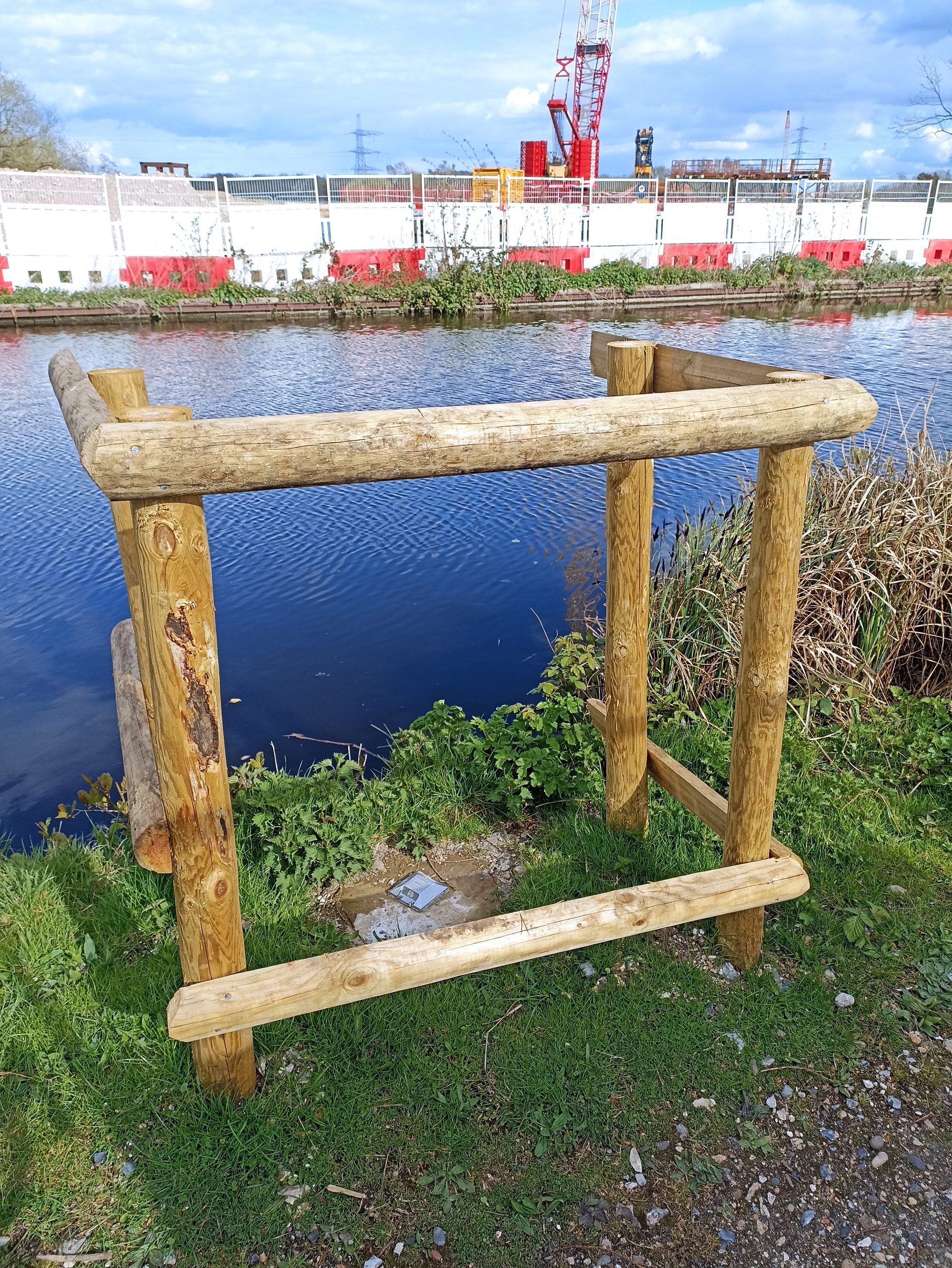
Reflectors for a survey robot have been embedded beside the canal here on its towpath here, at the point that viaduct will cross, to check there’s no movement or subsidence of the canal or towpath here when the piers or viaduct deck go on – particularly important as the land and lake to the west of the towpath is slightly below the canal level.

Survey reflector on the towpath.

Haul Road Pontoon

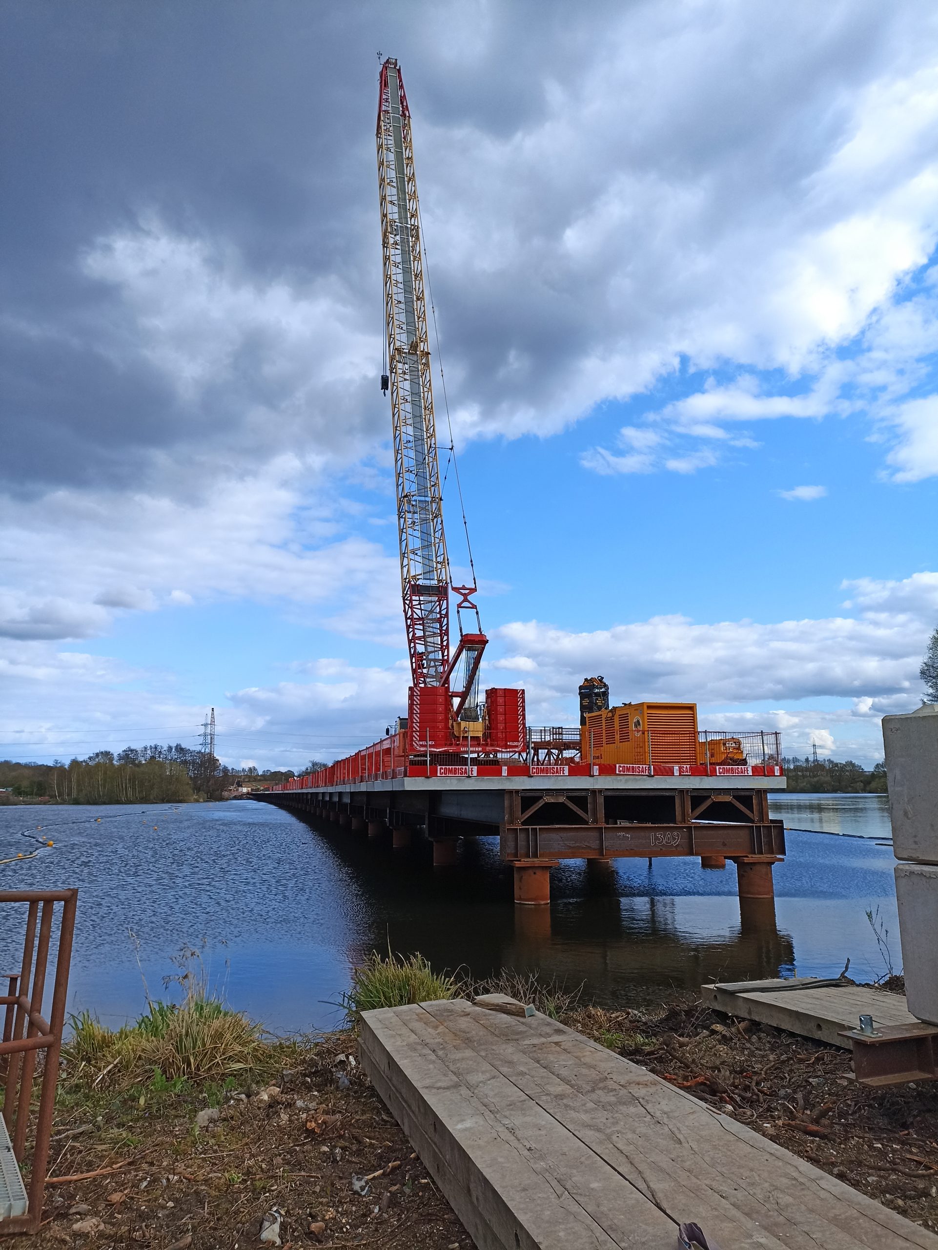
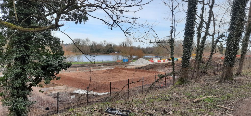
On the other side of the canal, another haul road pontoon, coming across Broadwater Lake from the south and London. It may advance a little bit more, across the track and cycle route here, and up to the other side of the Grand Union Canal. The viaduct piers will be on the right. It will likely be over a year before these ones get constructed, as this is the southern end of the viaduct. The closed, but not yet relocated, Hillingdon Outdoor Activity Centre, is just to the right of the far end of the pontoon here – spared a direct hit by a late design change in the HS2 route, but still likely to move to be on a different lake.

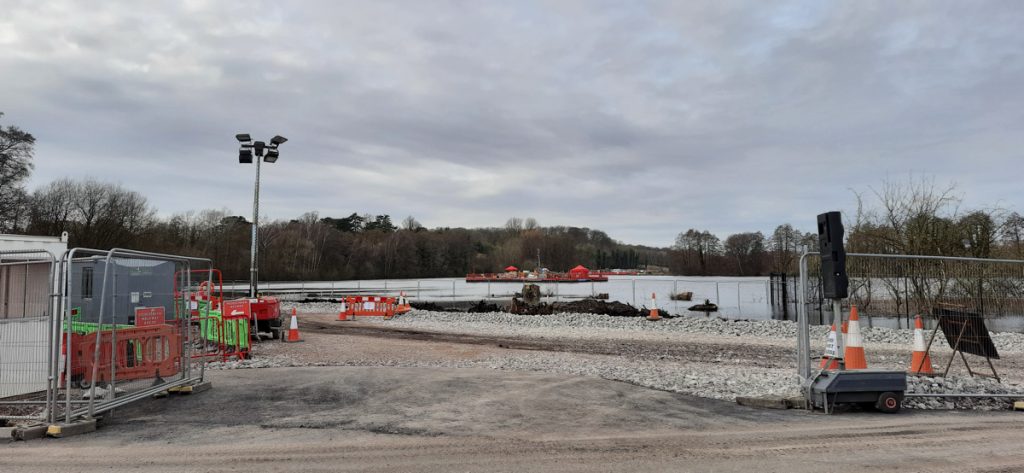
The haul road crossing Broadwater Lake.
Southern haul road pontoon – current end.

Categories
CDRC Geodemographics

Introducing Mapmaker

I’ve been based at the ESRC Consumer Data Research Centre, a multi-university (UCL/Liverpool/Leeds/Oxford) lab focused on research and provision of specialist UK consumer datasets, since 2015. One of my first outputs was to adapt DataShine, which I’d created in 2013 as part of a previous UCL project, to produce CDRC Maps – to map some of the open datasets we held, and aggregates of some of the more interesting socioeconomic datasets that we produced from the controlled collections.

CDRC Maps is an OpenLayers-based “slippy” (pan/zoomable) map website consisting of pre-rendered raster tiles of choropleth maps of consumer metrics, layered under another raster “context” layer containing roads and labels, and a mask which results in only building blocks being coloured by the underlying choropleth. It served its purpose of showing impactful, pretty and effective maps of our UK socioeconomic datasets, but being a raster based map, with billions of tiles sitting on one of our old servers, it has been showing its age for a while.

The modern web mapping toolstack has moved on, with the rise of powerful web browsers with fast vector rendering, responsive design for smartphones and tablets, and comprehensive GUI frameworks that elevate regular Javascript. CDRC’s requirements have evolved too, with a desire for map visualisation that includes downloadable snapshots, basic analytical functions and filters, rather than the simple view-only concept of CDRC Maps, and a need to embed the map in stories and dataset records, rather than only sitting standalone.

CDRC Maps has also long been hosted directly at UCL, on a local development server. CDRC is a data research centre not a technology centre and there is a desire for use to our server infrastructure for data primarily. The website has long been the most popular public website for CDRC and also is prone to usage spikes due to mass media often finding that maps are a quick way to illustrate a story – or be the story – compared with raw datasets that are less immediately accessible with media deadlines. It was clear that an external host for the sites itself, and ideally the data that powers the site, would be preferable.

To address this and bring CDRC Maps up to date with the new data platform, the centre commissioned Carto and Geolytix to produce CDRC Mapmaker during late 2020. The developers created a Node.js based website that uses the Vue templating framework. Mapbox GL JS 1 is used for the map controls/canvas and the vector tile rendering. The map framework has recently become non-open but there is an open fork, MapLibre, which we will take a look at in due course. The development toolchain has also been brought up to date with industry practice, with proper source code management, continuous integration, rapid development/testing on localhost, and deployment through GitHub.

Map config is in Javascript but this component is separated from the templating Vue/Javascript allowing configuration and setup of new maps to be discrete from the main code itself.

Data is completely separated from the code and there is no server-side processing element for the code. (We do also use an external service, Google Analytics, for our stats). The data is hosted on Carto’s data platform, where a number of datasets are loaded, and also a postcode lookup table. Carto is in fact built on PostgreSQL/PostGIS and provides a management GUI to allow these to be managed independently of the map code.

While the complete (albiet minified) code, config, fonts, images and stylesheets are less than 4MB, the datasets themselves use approximately 7GB of space on the Carto servers. Each geography used (MSOA, LSOA, OA, local authority) has four spatial data files, representing the unmasked choropleth along with three levels of clipping – urban extent (towns/cities), detailed urban (village level) and individual building blocks.

The application is structured around presenting two types of maps – metric maps (which show a various continuous variables associated with a particular dataset, sliced into groups) and classification maps which categorise areas into a single value (sometimes with a hierarchy of levels) and generally include a pen portrait description of the category.

We were delivered six functioning maps and I have gradually worked on extending the codebase and GUI functionality to encompass the wider variety of maps that were on CDRC Maps and that are listed in CDRC Data. Quirks of each additional map have actually meant minor changes to the code in each case to accommodate them, but I am hopeful now that the codebase is broad enough to allow for additional maps to be added in the future with minimal effort.

For this first release of Mapmaker, there are around 30 maps, covering CDRC classifications such as Consumer Vulnerability and the Internet User Classification (IUC), CDRC metric products such as Access to Healthy Assets and Hazards (AHAH) and Residential Mobility (Churn) and some popular government datasets like the Index of Multiple Deprivation (IMD), VOA building ages and Ofcom broadband speeds/availability.

Users can filter maps based on one or more classification categories or on multiple metric value ranges, and a PDF report can be easily produced with a view of the current map, a key and accompanying text and direct link. Clicking many of the maps will not only present the metrics or portrait, but include statistics on proportions in the current administrative area or a custom drawn region. The user interface is deliberately simple with standard pan/zoom controls, map selector, postcode search and layer toggles – that’s it. Planned development in the short term will include an even simpler UI to allow for easily embedding the map in CDRC Data and other CDRC data-led outputs.

CDRC Maps is currently still available for the limited number of maps that show datasets not included on CDRC Data, and it does have the advantage of a pure raster display meaning that some of our controlled datasets which require limited dissemination can be included in this way – on CDRC Mapmaker we would be delivering the dataset to the user’s browser, which is not ideal. Our plan is to de-brand CDRC Maps to provide a home, outside of the core CDRC output, for these legacy maps, in the same way that we have a GitHub repository storing some of our older datasets no longer on our main sites. CDRC is now nearly 8 years old and as the centre’s focus has been refined, not all our older assets have remained central to its mission, but for research reproducibility and historic linking purposes, it is important to preserve these.

We hope CDRC Mapmaker forms a useful visualisation tool for some of CDRC’s many data assets, and its filtering and reporting functionality allow CDRC’s data to be viewed and used in new ways.

Categories
HS2 London

HS2: The Colne Valley Western Slopes

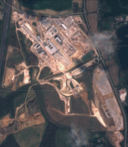
Satellite imagery of the Colne Valley Western Slopes worksite in early April 2021, from Sentinel. The tunnel portal is at the top-left (NW corner), just before the M25 motorway. © Sentinel Hub.

High Speed 2 (HS2) will leave London by curving away from the Chiltern Main Line, across the Colne Valley on what will the the UK’s longest railway viaduct. It crosses the Greater London boundary before briefly coming back to ground level and then on into the Chiltern Hills in a long tunnel.

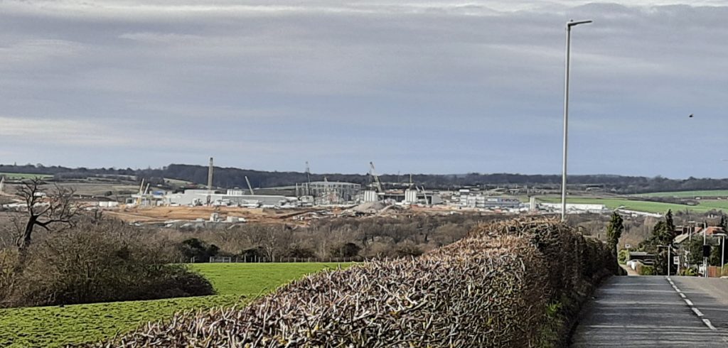
The place between the viaduct and the tunnels is called the Colne Valley Western Slopes. It is here that Align JV, who are building the viaduct in one direction towards London, and the Chiltern tunnels in the other direction towards Birmingham, have created a huge construction site to assist in building both. The site covers several square miles of what were arable fields, and is highly visible from Harefield, a village on the other side of the valley:

The Colne Valley Western Slopes construction site, from Harefield village to the north-east.

The Colne Valley Western Slopes site is very large for several reasons – it houses factories to construct the concrete segments both for the tunnels and the viaduct deck and also the launch podium for the tunnel boring machines (TBMs). It will also be able to comfortably accommodate the chalk spoil coming from the TBMs. Having the production and spoil deposition both on site will substantially cut down on lorryloads bring concrete in and chalk out of the site. A private “junction” has been created on the adjoining M25 motorway, to provide a suitable route for the lorries that do need to arrive.

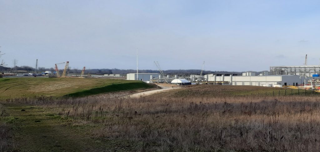
The upper part of the construction site (focusing on the tunnel itself) viewed from the south-west. The two TBMs (tunnel boring machines) are being reconstructed by the two huge cranes on the left, prior to launching the Chiltern Tunnels boring later this spring. The large factory on the right is the concrete tunnel lining creation plant.

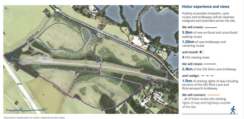
The opportunity is being taken, post construction, to not just restore the arable farmland beforehand, but instead create a large-scale nature habitat – to partially offset HS2’s undeniable impact on the natural environment. HS2 have recently unveiled their detailed plans for the site, which include reconnecting two public paths that have been severed, and plans for new forest to help screen noise and improve biodiversity. A number of set-piece views of the line are also being designed.

Plan for the restored and added path network on the Colne Valley Western Slopes site. Drawing © HS2.
The middle part of the site. A balancing pond, to manage drainage, is being constructed on the right. The concrete “roadway” running through the centre of this picture, with a crane on it is the route of the railway. It will launch the tunnel boring machines to the left, and the viaduct construction girder to the right. The lower part of the site (to the right of the photo) will be mainly used to place the spoil from the tunnels.

A common design style for the tunnel portals, the viaduct, and a new road bridge to accommodate a rerouted road, Tilehouse Lane, that sits in the centre of the site, has been adopted. The design is modern and sophisticated, without distracting from what should return to a natural, rural environment post-build.

HS2’s common design for the three structures in the area – white concrete structures with distinct (~30 degree) angles, forming the tunnel entrance, bridge parapets and viaduct ends and piers. Drawing © HS2.
HS2’s plan for the eventual look of the site (looking from the south-west). The diversion of Old Shire Lane, to pass under the start of the Colne Valley Viaduct, causes the U-shaped path seen at the forefront. Tilehouse Lane’s new alignment results in the new bridge, crossing the line in the distance. The tunnel portal is at th far end. Drawing © HS2.

Categories
HS2 London

HS2: The Colne Valley Viaduct

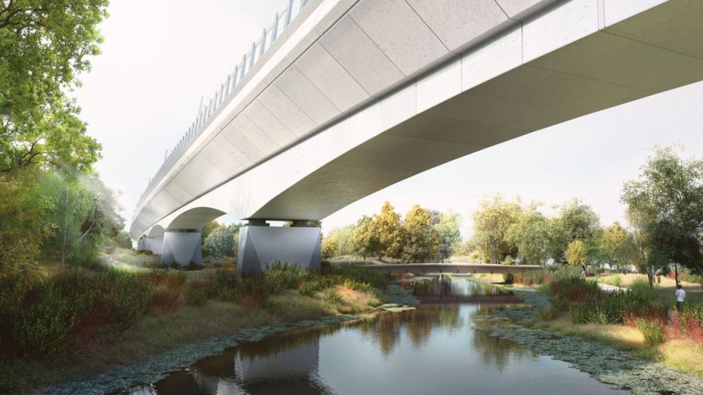
HS2 drawing of the Colne Valley Viaduct crossing the Colne River (slightly realigned here) with a planned foot crossing of the river within the Broadwater Lake Nature Reserve here, which will be added. This will be point 5 on the enumerated satellite image below. @HS2.

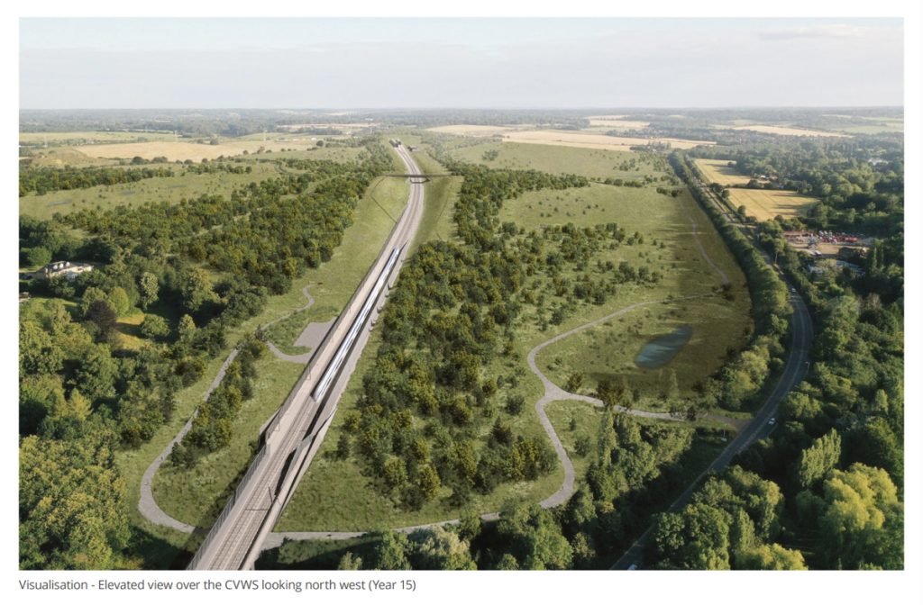
In the first post in a mini-series, I looked at how High Speed 2 is impacting West Ruislip and Ickenham. In this second piece, I move slightly west, to look at the Colne Valley Viaduct. At 2.2 miles long, this will be one of the biggest structures on the entire line. The viaduct is what carries the line away from the existing Chiltern Line it has been sitting beside, and outside of London altogther, into the Chiltern Hills. As a symbol of leaving/arriving in the capital, and the scenic nature of the valley it crosses, the Colne Valley Viaduct has the potential to be a “tourist attraction” of the railway – both for the people on it, and also users of the natural park that sits underneath it.

The Colne Valley is a very “wet” valley – it was extensively mined for gravel, and as a result there are numerous lakes. The viaduct crosses a number of these, as well as clipping some natural woodland that has gradually built up. A slight planned route change (moving the curve around 100m north) since the initial plans a few years ago, has resulting in less ancient woodland being destroyed, but the line does still pass close to a number of nature reserves, including through one – Broadwater Lake Nature Reserve – that it has unfortunately closed for many years, and outdoor leisure facilities (two of which are in the process of moving).

Harefield No. 2 Lake, the pylons to be moved, and Hillingdon Outdoor Activity Centre, are visible from the National Cycle Route 6 track. The viaduct will pass right across this picture. Points 13-15 in the satellite image below.

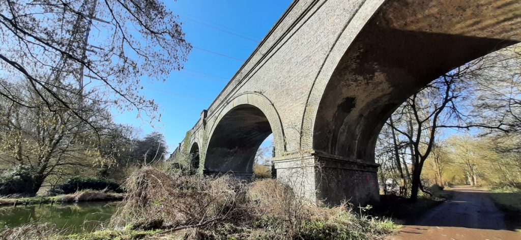
It’s not the only railway viaduct in the valley, here’s the Chiltern Main Line viaduct just to the south – incidentally the electricity pylon here will be going soon as part of a power rerouting for the new viaduct, so this particular view will improve soon:

Older viaduct carrying the Chiltern Main Line across the Colne Valley, seen from National Cycle Route 6 beside the Grand Union Canal.

Piling for the piers of the viaduct begins this month and is set to take a number of years, the work moving from west to east, with haul roads currently being built underneath the viaduct. The concrete structures are being built on site. The haul roads will build out from each end, meeting either side of the Grand Union Canal. This break will mean as short as possible a closure for the canal itself – it will only need to close when the deck building girder is directly above it.

The viaduct beside the A412 North Orbital Road, and Denham Waterski Lake (point 3). A strip of trees, forming part of Battlesford Wood, stood here once. There will be a new path and maintenance road here, formed from the haul road underneath the viaduct, which will connect across a new bridge to Broadwater Nature Reserve, opening up more walking routes across the Colne Valley here.

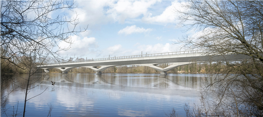
The large, curving and highly visible nature of the viaduct has meant that it has been possible to justify creating a design for it that is not just a simple set of vertical piers. Instead, sweeping arches will carry the line through the woodlands and across the waterways and lakes.

HS2 illustration of the crossing of Korda Lake (point 8) by the viaduct, viewed from south of point 7. © HS2.
The viaduct will cross Moorhall Road (from where this photo is taken) and Korda Lake, here, directly overhead. A test piling rig is visible in the middle of the lake. Looking towards point 8 from point 9.

The viaduct will have sound barriers but they will mostly be transparent, except for the section facing a new housing development at Denham Film Studios, so that passengers will be able to enjoy the extensive views across the lakes at ~200mph. At this speed, it will take less than a minute to complete cross the valley on the viaduct. As the viaduct is “bookended” by long tunnels at either end, it will be the most obvious visual clue to south-bound passengers that they are about to arrive in London.

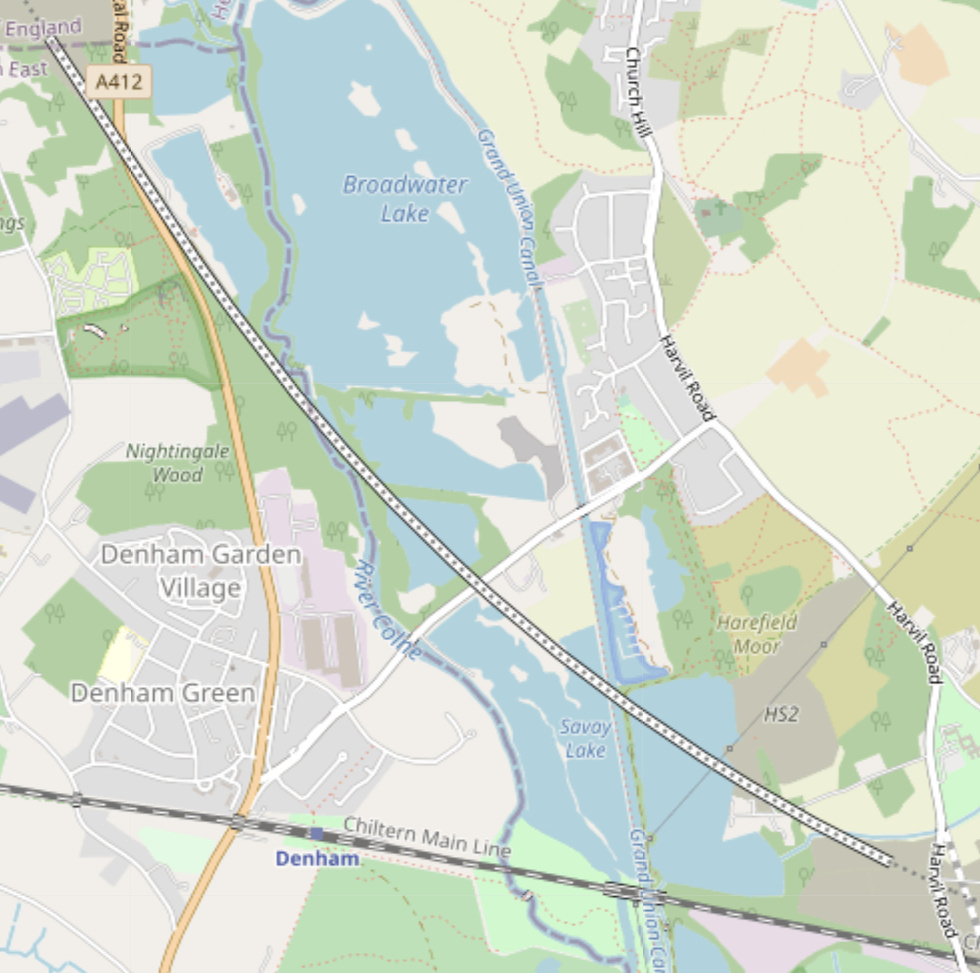
Route of the Colne Valley Viaduct, on OpenStreetMap. The Greater London border follows the River Colne here and so crosses the structure.
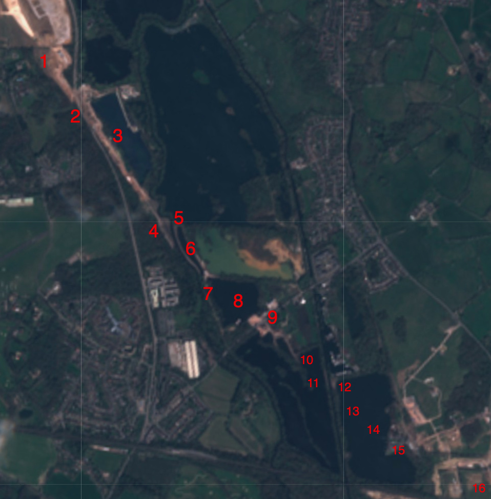
Satellite photograph of the construction worksites along the Colne Valley Viaduct, in early April 2021. © Sentinel Hub. Number key below.

From west to east, the main crossings and affected waterways and buildings are:

  1. Old Shire Lane, a bridleway that also forms the Hertfordshire/Buckinghamshire border. It is currently closed. It will be diverted in a loop to pass under the start of the viaduct. It is due to reopen in towards the end of 2021. A diversion route is further south, via Wyatt’s Covert.
  2. The A412 North Orbital Road. An unpleasant, fast road, which is made even worse at the moment by high dust levels and HS2 construction trucks.
  3. A narrow strip of woodland beside a lake, and the Denham Waterski clubhouse, which is about to be demolished and has a brand new replacement on the opposite shore.
  4. Battlesford Wood, just north of Denham Film Studios.
  5. The River Colne, which will be rerouted slightly here to flow more perpendicularly between two piers of the viaduct. A bridge will also be built here, to connect Battlesford Wood and a new path under the viaduct to the A412 and Wyatt’s Covert, to a nature reserve and Moorhall Road.
  6. Almost the full length of Long Pond (called Long Lake on some maps).
  7. A narrow nature reserve, Broadwater Lake Nature Reserve, which is unfortunately closed for the duration of HS2 construction but will have improved access links afterwards (see above).
  8. Korda Lake – HS2 goes diagonally right across this fishing lake.
  9. Moorhall Road, which goes between Denham Green and South Harefield.
  10. A corner of Savay Lake.
  11. The Grand Union Canal and towpath. A new pier on to Savay Lake will be built here, opening up a view.
  12. A track just east of the canal, that forms National Cycle Route 6.
  13. Diagonally right across Harefield No. 2 lake.
  14. Under a line of pylons that is getting rerouted further east, as it will be too close to the viaduct structure.
  15. Right over the top of Hillingdon Outdoor Activity Centre, which is also closing and moving to an as yet announced location.
  16. The viaduct finally touches down in fields just before Harvil Road.
Here’s where HS2 crossings National Cycle Route 6, between Harefield No. 2 Lake and the Grand Union Canal. Point 12 in the satellite image.

For the last piece in this mini-series, I focus on the huge worksite for both this viaduct and also the Chiltern Tunnels – the Colne Valley Western Slopes.

Categories
HS2

High Speed 2 in Hillingdon

There’s a big building project underway at the moment, High Speed 2 (HS2), and it’s taking a big dent out of my local borough, Hillingdon in west London. Hillingdon is where the forthcoming railway line will burst out of its tunnels from central London, before curving away from the Chiltern Mainline it has been running beside, onto a long viaduct across the Colne Valley, and out of the borough into another set of tunnels by the M25 orbital road, passing beneath the Chiltern Hills on its way to Birmingham and beyond.

Related major works currently include rerouting a large power line that would otherwise run across the viaduct, rerouting gas mains and water mains, straightening and rerouting several roads, building new electricity substations, building or enlarging various access roads for the above, building a “haul road” to run underneath the viaduct for constructing it, creating a factory for the concrete parts for the tunnels and viaduct, and building a long electrical supply cable to power the tunnel boring machines. Plus associated patching up of the existing infrastructure such as footpaths, bored out earth storage and the start of post-project landscaping.

It’s surprisingly hard to find out exactly the true extent of what is going on, at the current time. It’s a hugely complex project, and HS2 comms are therefore having to run local engagement activities in many different sections, all at the same time. The Hillingdon version is a bit of a mess, with updates coming as an incoherent set of PDFs and maps of various formats.

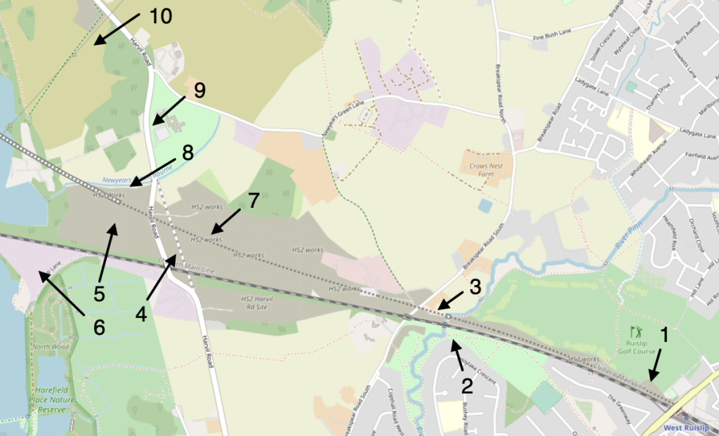
To see what’s going on, I took several trips around the area, crossing most of the places where the line will pass. There is no unified map showing the current areas under HS2’s control, so there were some surprises, with the “orange army” and green security fencing appearing in unexpected locations.

My intention is to visit the construction areas fairly regularly over the next few years, and see how they are changing. It’s fairly easy for me to get there and it’s a pleasant enough cycle.

Starting at the point where HS2 emerges from tunnels, opposite West Ruislip station on the Central Line (and beside and just to the north of the Chiltern Mainline). There will be a tunnel portal here but work here is much less advanced than at the tunnel at the other end of the Colne Valley.

The western tunnel portal for the tunnels from Central London, at West Ruislip.

Ruislip golf course is closed, with HS2 taking a bite out of its southern edge (although the rest of it seems intact, so it’s odd the whole thing is closed). So, I took a route on the south side of the Chiltern Mainline insetad. It was rather a pleasant route, meandering through suburbia, woodland and grassy fields, passing a cricket pitch at one point, before suddenly you are at the River Pinn (of Pinner fame) and on the Celandine Route, a waymarked long distance through the borough. HS2 hoarding appears immediately on the other side of the nice bridge here, but the paths have been upgraded by the company contractors, having turned into a quagmire earlier in the winter.

The Celandine Route passes underneath the Chiltern Mainline (and then a future bridge under HS2), beside the River Pinn. HS2 have kindly upgraded the path here after churning it up.

There is a short public footpath, U46, which I took here to get onto Brakespear Road South. This footpath runs directly underneath the HS2 route, so will vanish soon and will only reappear after works are finished, rerouted slightly to the north. For now, the path has HS2 fencing on both sides, accompanied by various dire warnings about a High Court injunction being in force to stop protestor camps (re)appearing in this area.

U46 public footpath, directly underneath HS2, and hemmed in by construction fences. It’s not long for this world.

Crossing underneath the existing bridge for the Chiltern Mainline, I took another right of way (U50) which goes through rather waterlogged fields, before ending up at Harvil Road. This is not a pleasant road to cycle along, as the HS2 construction camps run for almost a mile, and the road itself is narrow and twisty (it is getting straightened and rerouted as part of the HS2 works).

Sheet piling at the beginning of the Harvil Road straightening works.

First you pass the worksite for the straightening work and a major water main rerouting, on the right. Then you pass a huge cutting (at least 20m deep) being dug out, then space for a power plant for powering the line, then the line itself, and finally further up on the left an access road being created for the the viaduct works, and one for the powerline rerouting and substation building.

There is, I think, an old public footpath that will be gone for ever, as it will sit under the line and the power plant. Another one nearby, across Harefield Moor, has been rerouted.

Works at Harefield Moor, with a half-built pylon, the start of the diversion, visible to the left of the current one. There should be a reinstated public bridleway here, soon, giving access to the Colne Valley lakes.

Finally, down to the Colne Valley itself and its forthcoming viaduct, but that’s for the next post…

HS2 in Hillingdon (west) – 1: Future portal for the tunnels to central London. 2: Existing bridge (and future bridge) on the Celandine Route at the River Pinn. 3: Path U46. 4: Harvil Road straightening. 5: Future power substation for HS2. 6: Concrete plant being used by HS2, and power line being diverted through. 7: Huge cutting. 8: Start of the Colne Valley Viaduct. 9: Access road for the viaduct construction. 10: Power line rerouting and new substation. Map © OpenStreetMap contributors.
Categories
Leisure

The Withey Beds

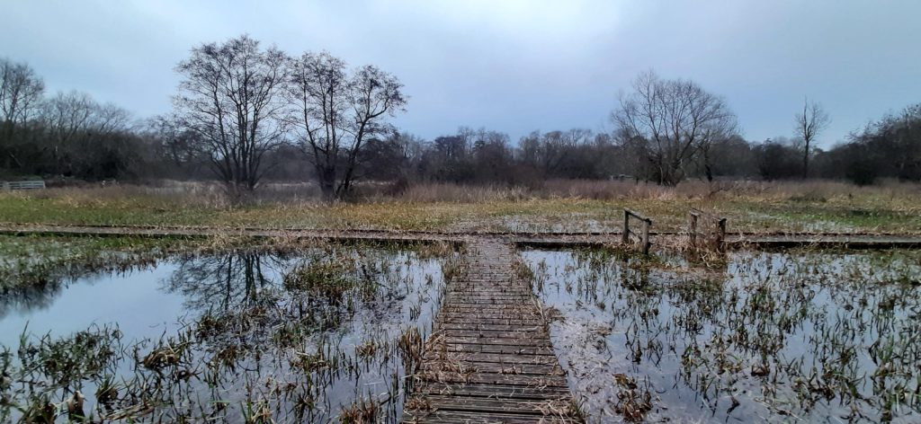
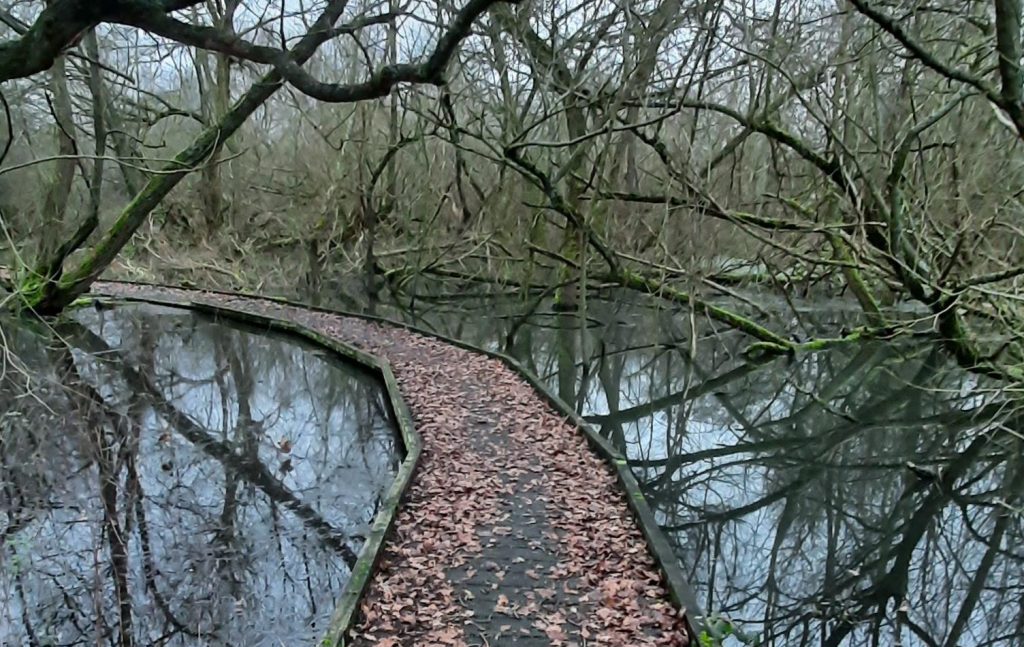
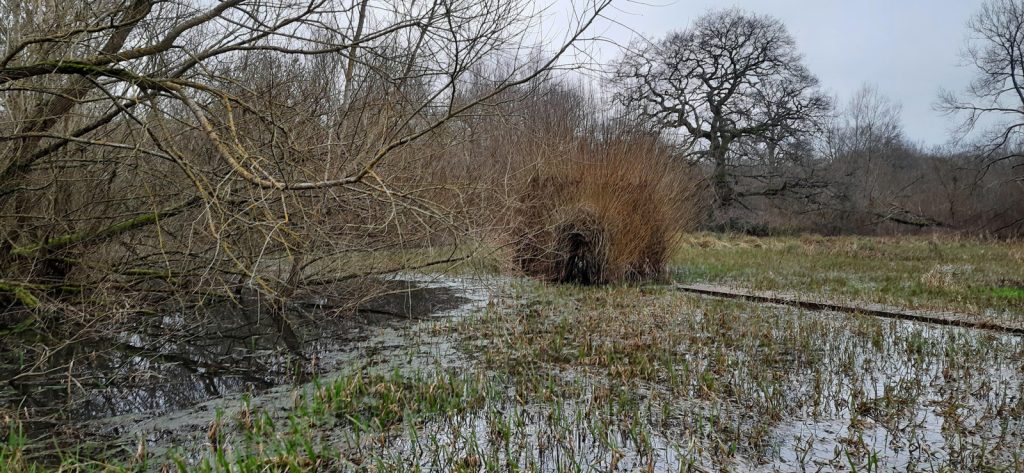
A short visit to a local nature reserve between Moor Park and Watford, just north-west of London, proved an unexpected atmospheric delight, as can be seen from these photos, taken just before sunset in mid-winter, after a number of days of rain. The Withey Beds (named after withys, which are willow stems) is a relatively undisturbed area of wetlands, and so the main field was partially underwater and inaccessible, but the ~300m boardwalk that runs through the south of the site was just below the waterline.

The boardwalk is extremely atmospheric, particularly with the spooky submerged forest all around, and is in good condition so is an easy walk.

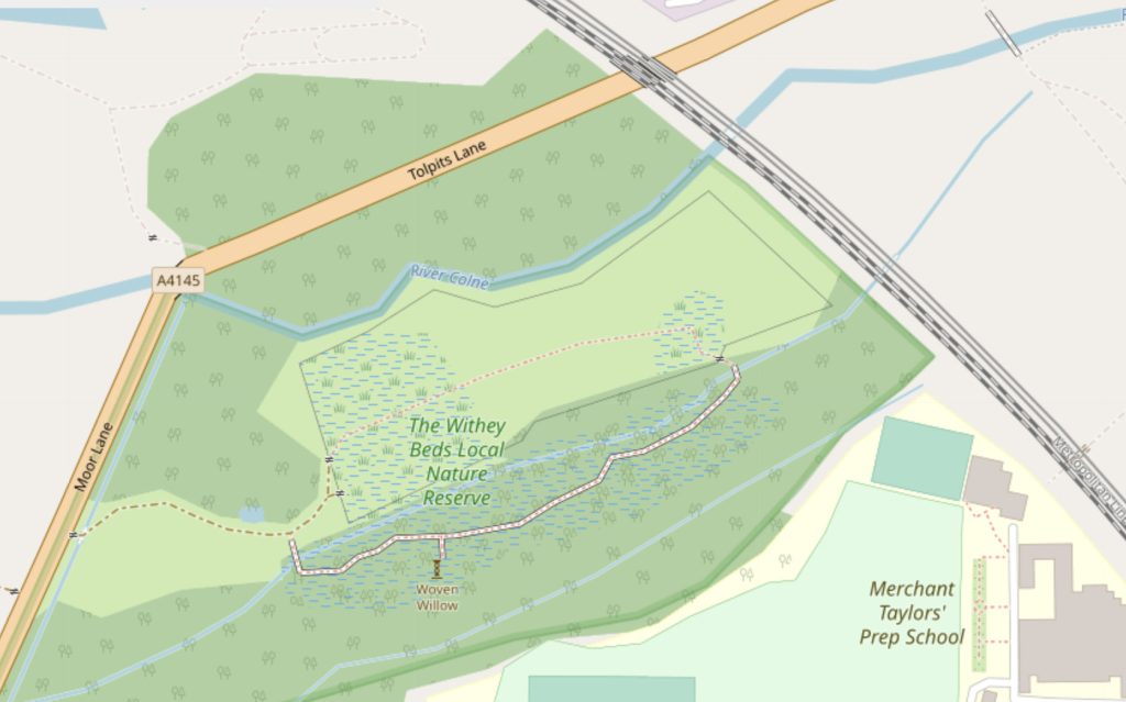
There is a curiosity early on the boardwalk – what looks like a simple clump of vegetation, is actually a woven willow feature, created by a local artist, which includes a tunnel – not accessible at all during the waterlogged season, but visible from a short dead-end section of boardwalk, just off the main route.

Fauna included a number of sheep in the main field, staring at me from a slightly raised (and so not submerged) section, a couple of ring necked parakeets that were enjoying unharvested apples from a wild apple tree, and most excitingly of all a Muntjac deer which lurked in the wooded section near the entrance to the reserve, before scampering off.

Access to The Withey Beds is very poor, there is only one entrance, and it is off a busy road (Moor Lane/Tolpits Lane) with no pavement. There is also no car park, although there is a tiny layby on the other side of the road a bit further down, for a couple of cars. The reserve is about a 15 minute walk north-west from Moor Park underground station, through the eponymous private estate and then around 200m on the busy road. Walking from the north, via Croxley station, Croxley Common Moor, the Ebury Way rail trail and Tolpits Lane, is not recommended, due to a long and unpleasant pavement-free section along Tolpits Lane.

It is difficult to see how this could be remedied without considerable expense – a pavement would be the obvious fix (and there is space on the far side of the road) plus an informal crossing near the entrance itself. An eastern entrance, making use of a bridge across the River Colne and an old tunnel underneath the railway, also looks feasible, but would require the blessing of Merchant Taylors School and Prep School, whose sites are on either side of the line.

The Withey Beds. © OpenStreetMap contributors.

There is however something to be said for the current, difficult access. You are very unlikely to bump into anyone else in the reserve, and so you can have all the flora and fauna to yourself.

Categories
London

Welcome to London

Do we get welcomed to Greater London at any of the capital’s boundary point crossings? The City of London has its dragons guarding most entrances, but the larger city area doesn’t really have such obvious symbols. Do we have any welcome signs? Do they welcome to you London or just to the borough you are entering (which may or may not mention London if you look carefully)? In most sections of the border, only the larger roads have signs, and they are almost always just for the borough. Here’s a few examples, using Google Streetview.

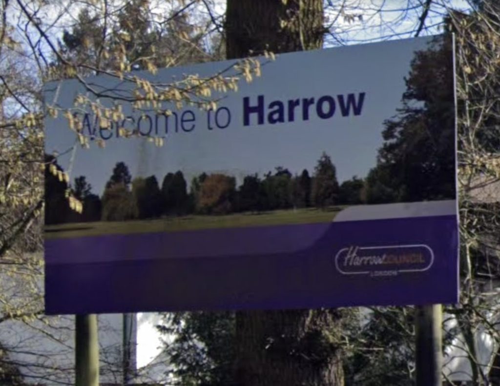
Harrow Borough has nice welcome signs on most larger roads, often 100m or so into the border. They do say London, but you have to look really carefully:

Sign on the A4140 in Stanmore.

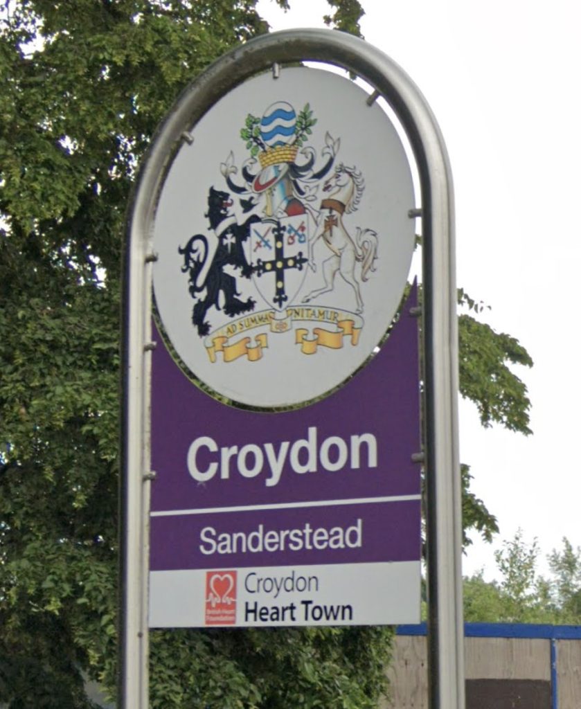
This sign makes no mention of London at all, it’s at Hamsey Green, as you enter the London Borough of Croydon. It doesn’t specifically welcome you either:

Welcome to Croydon.

Here’s one that mentions London in a readably large font, although the capital is very much not the focus of the welcome:

Sign on the A30 as you enter the London Borough of Hounslow.

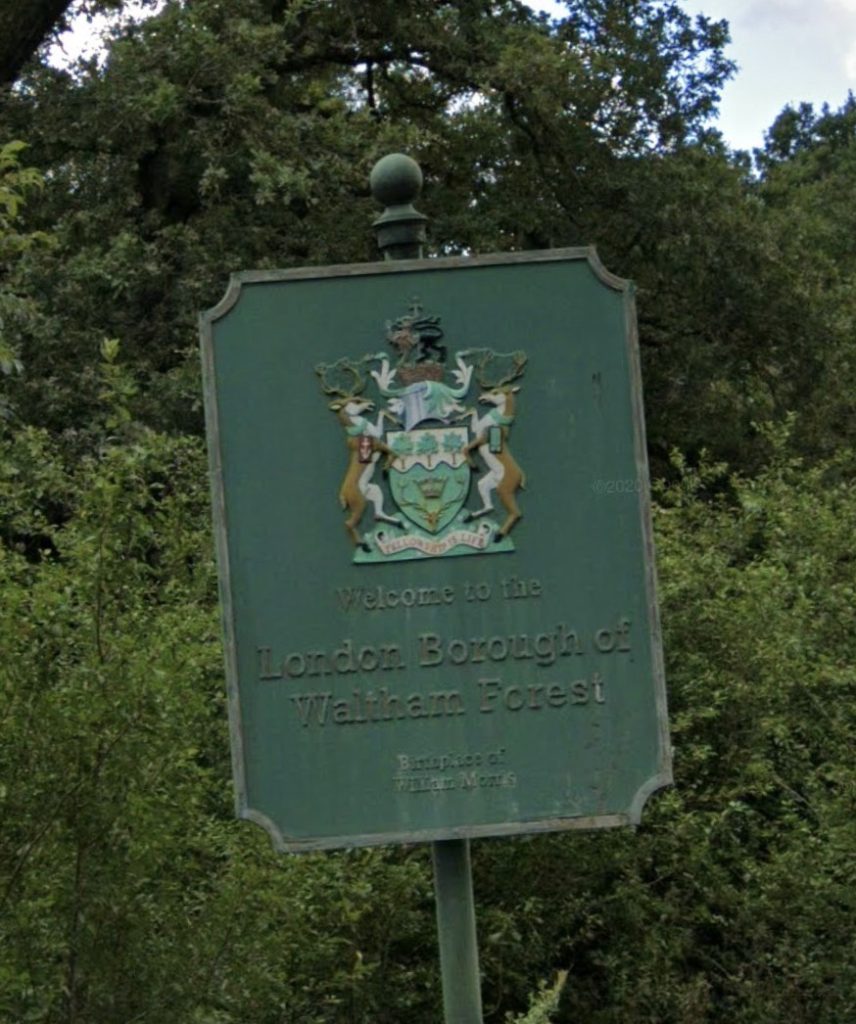
Waltham Forest’s are rather nice, if hard to read:

Welcome sign on Ranger’s Road in Epping Forest.

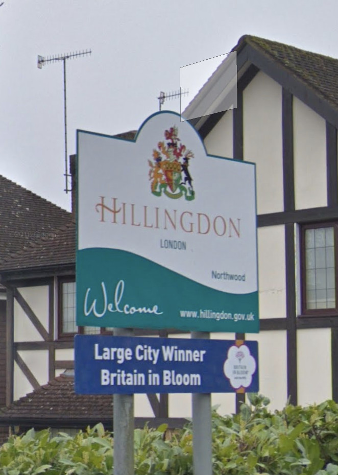
Hillingdon’s are also nice – there is a “London” therefore although it is very small. The Large City award message is in fact referring to Hillingdon Borough itself – it is large enough on its own to be a “Large City” in the awards, even though it is just one of London’s 32 boroughs.

Sign on Eastbury Road, as you enter London. There is continuous suburbia on both sides of the sign here, the border is also marked here in the north of the borough by a narrow footpath that runs along it for several miles.

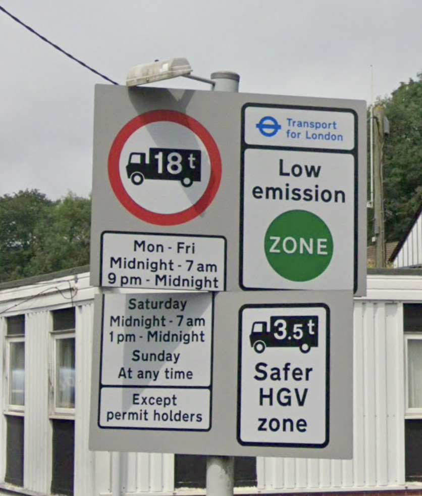
The one sign you will virtually always see just inside the London border, on roads big and small, is the Transport for London Low Emission Zone sign. I guess it mentions “London” but isn’t exactly a welcome. (Sometimes this sign is quite a way into London – generally, the zone is as close to the border as possible, but allows a “dirty truck” escape route so that vehicles have an opportunity to turn back between the border and the zone start. For example, it will typically be at the first roundabout or other junction encountered:

Low Emission zone just inside the London border at Polsteeple Hill, in Biggin Hill.

Perhaps it’s just the major railway stations and airports that will give you a London welcome? Even then, I am not sure they do…!

Categories
Escooters

Tier Launches eScooter Innovations in London

The Tier Four escooter, unveiled today in London and hopefully coming as part of an escootershare fleet nearby, soon.

Tier, the German micromobility company, launched their “Tier Four” scooter and their “Energy Network” initiative at an event today in London.

Tier is one of around 20 companies vying to run escootershares in parts of the UK as part of the DfT trials, and so are keen to demonstrate the unique aspects of their offering to the market. They already operate a fleet of around 45000 escooters in 70 cities across Europe, which gives them considerable depth of experience.

Tier’s indicator lights, at the end of each handlebar.

The Tier Four escooter contains a number of innovations including user-operated indicator lights, a user-swappable battery, a wireless phone charger, and a foldable helmet contained within a secure box in the scooter, for optional, free use by a user. The helmet includes hairnets for cleanliness between users. The scooter is also designed for safety and comfort with a wide footplate, good lights, dual brakes and 12 inch wheels which both have suspension.

The phone mount/wireless charger, speedometer and (below) the helmet container.

The Energy Network concept involves the operator installing a number of “Powerbox” charging units, containing four batteries, in local stores in a fleet area. Users can swap out their battery at these stores for a fully charged one, using their app to unlock the batteries. The challenge of course is finding a good network of stores willing to host the units and supply the power. If it works, it should cut down on regular operator journeys needed to retrieve scooters and change their batteries.

User swappable battery, mounted in a Tier scooter.

I took a good look at escooter at the launch and gave it a test ride around Potter’s Fields, by Tower Bridge. The scooter comes with a nice digital readout of the speed (topping at 20km/h in the demo area) and the phone mount means a map of exclusion zones and read-out of journey time should be straightfoward. The indicator buttons were a little hard to find but these are likely to be further refined before the Tier Four is rolled out into a publically accessible system.

Some technical notes:

  • 700Wh battery
  • 20km/h max speed (UK allows up to 25km/h)
  • 100kg max load
  • The formal model name is ES-400B

No word on a UK launch yet – talking to staff indicated that, despite the expedited trial process taking place, there are still many steps for local authorities and operators to complete before an operation launches here. But it’s a nice product and undoubtably a positive addition to potential options for urban travel. and I hope to see it in an appropriate UK setting soon.

Published in association with Zag.

Categories
Escooters

Spin Launches UK’s First Dockless Escootershare in Milton Keynes

The UK escootershare trials are gathering speed, with the launch this weekend of Spin in Milton Keynes – the UK’s first one where journeys can end almost anywhere in the operating zone, rather than in a limited number of hubs. Ginger and Lime are to follow soon – making this a three-way competitive trial of escootershare for the first time in the UK. Ginger already have a small escootershare in Middlesbrough, and Lime already operate a (recently reopened) electric bikeshare in Milton Keynes, so Spin very much are the new kids in the UK, although they have operated various other escootershares in the world, including over 1200 currently in Washington DC.

So far Spin have deployed around 100 escooters, across much of Milton Keynes. The town is large, with a unique (in the UK) structure of 1km square communities connected by a grid of fast (typically 60mph) roads, but with an extensive but little used “redway” parallel cycle network that also joins the communities together but on more wiggly routes. Escooters in the trial can use the same facilities that cyclists can. Hopefully this will lead to a better use of this part of the town’s infrastructure – although interestingly the scooters are allowed on the grid roads too. Only the motorways and trunk roads roads (A5 and M1) are explicitly banned for scooters to go on, in the app (although this also therefore blocks some cycle paths that cross these roads). Users also cannot go in the pedestrianised shopping precient in the town centre, and can ride in, but not end, journeys in the city parks:

No word yet on the Ginger and Lime launches although I would imagine they would be pretty soon in order to not allow Spint to get too entrenched. Ginger recently announced over 15000 miles traveled on their escooters in Middlesbrough which is excellent usage levels for their 50-scooter trial there which has been running for just over a month (4o days). Assuming an average journey of 2 miles (generous – 1-1.5 miles is more typical), that suggests getting on for 200 journeys a day, or 4 per scooter per day. Anything over 2 is a good social use of the asset, and if approaching 4, then that is a good economic use of it as well (i.e. potentially viable for a purely commercial operator). This is a rough calculation, of course, and may include retrievals of the scooters by operators where users didn’t leave them in the hubs. However, with Ginger having suffered numerous operational incidents, this must have been a bit of a relief for them and also demonstrate that escootershare in the UK might well be bigger than anyone has realised. It’s going to be an interesting autumn.
LocationOperatorNumberStatusType
London’s Olympic ParkBird15SuspendedHub-based (3 hubs)
MiddlesbroughGinger50Operating, restricted hoursHub-based (3 hubs)
Milton KeynesSpin110OperatingDockless
Currently escootershares in the UK, as of 23 August 2020.