High Speed 2 (HS2) will leave London by curving away from the Chiltern Main Line, across the Colne Valley on what will the the UK’s longest railway viaduct. It crosses the Greater London boundary before briefly coming back to ground level and then on into the Chiltern Hills in a long tunnel.
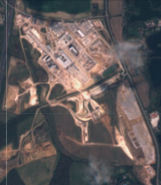
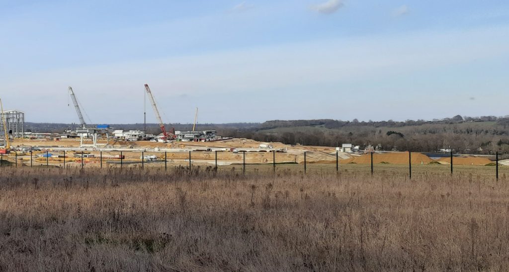
The place between the viaduct and the tunnels is called the Colne Valley Western Slopes. It is here that Align JV, who are building the viaduct in one direction towards London, and the Chiltern tunnels in the other direction towards Birmingham, have created a huge construction site to assist in building both. The site covers several square miles of what were arable fields, and is highly visible from Harefield, a village on the other side of the valley:
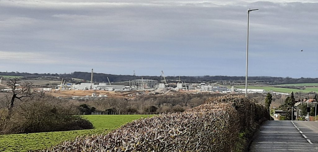
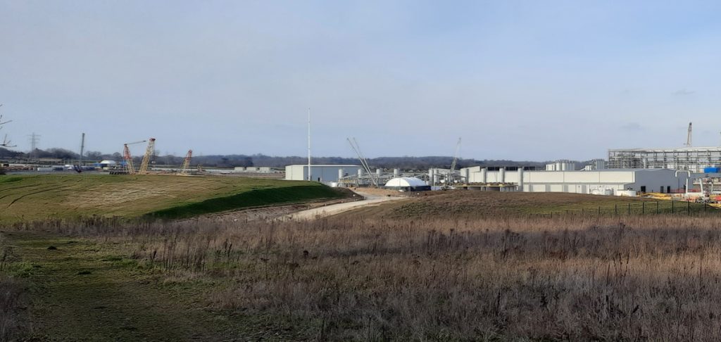
The Colne Valley Western Slopes site is very large for several reasons – it houses factories to construct the concrete segments both for the tunnels and the viaduct deck and also the launch podium for the tunnel boring machines (TBMs). It will also be able to comfortably accommodate the chalk spoil coming from the TBMs. Having the production and spoil deposition both on site will substantially cut down on lorryloads bring concrete in and chalk out of the site. A private “junction” has been created on the adjoining M25 motorway, to provide a suitable route for the lorries that do need to arrive.
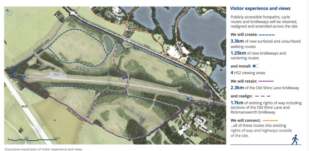
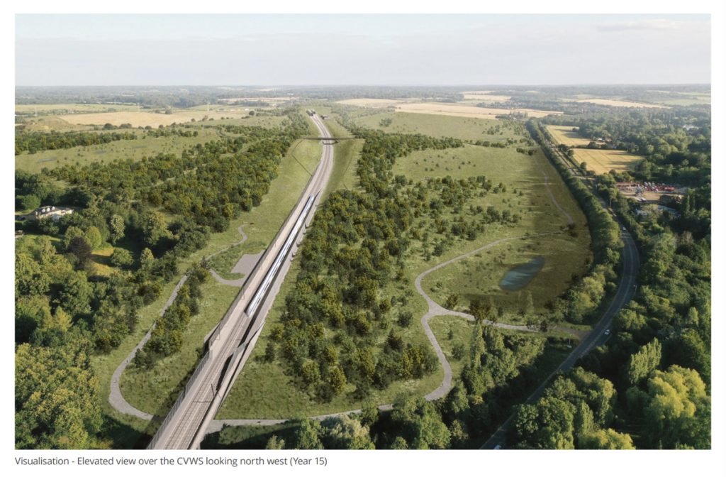
The opportunity is being taken, post construction, to not just restore the arable farmland beforehand, but instead create a large-scale nature habitat – to partially offset HS2’s undeniable impact on the natural environment. HS2 have recently unveiled their detailed plans for the site, which include reconnecting two public paths that have been severed, and plans for new forest to help screen noise and improve biodiversity. A number of set-piece views of the line are also being designed.
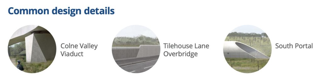
A common design style for the tunnel portals, the viaduct, and a new road bridge to accommodate a rerouted road, Tilehouse Lane, that sits in the centre of the site, has been adopted. The design is modern and sophisticated, without distracting from what should return to a natural, rural environment post-build.
One reply on “HS2: The Colne Valley Western Slopes”
[…] For the last piece in this mini-series, I focus on the huge worksite for both this viaduct and also the Chiltern Tunnels – the Colne Valley Western Slopes. […]