[Updated] I cycled from London to Oxford yesterday, initially taking quite a southerly route out of London, before heading north-west. This was to ensure that the Thames was followed for as long as possible, minimising climb, and because the more direct routes, via High Wycombe or Amersham, are in deep valleys with only major roads (e.g. the A40) – or very steep roads – going up them. As well as being beside the Thames at both the start and the finish, I crossed it three times – at Teddington, Chertsey and Henley.
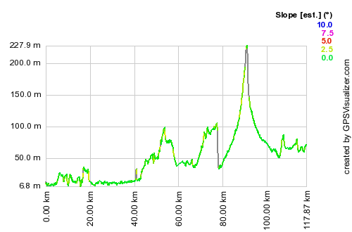
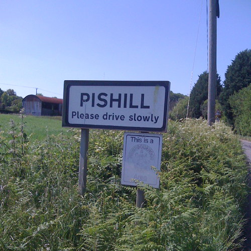
The route was 118km from London Bridge to the centre of Oxford, and had only one big hill – the 200m concave climb out of Henley up onto Christmas Common at the top of the Chilterns. Following the Thames here would mean taking a very long detour down to Reading and back up through Didcot. The Henley to Oxford road is a B-road but is actually very quiet, and was very pleasant to follow. It goes through the legendary hamlet of “Pishill”.
There were two large drops – one on the immediate approach to Henley which is a 10% gradient down around 80m – I hit around 50km/h here. This was however beaten by the 60km/h descent on another 10% gradient drop, at the top of the climb up into the Chilterns.
I was aiming to get to Oxford for around 4pm, to gatecrash the end of the Pembroke College Garden Party and then hopefully watch the end of the summer VIIIs regatta on the river. As I was on my own, I pushed the pace all the way, and only took brief stops. I completed the 118km route in 4h50, plus around 50 minutes of stops and breaks, an average of around 25km/h including hills, which is far above my planned pace for my Thurso to London trip later this summer.
I’m pleased to have completed this ride, in good time and without much effort, as my previous attempt, cycling from Oxford to London around five years ago, ended at Reading. I was on a very old hybrid bike and had optimistically started at 3pm in the afternoon, following National Cycle Route 5, which takes a very meandering route with lots of climb through the Chilterns, rather than following the river as I had hoped.
The route: This is the “idealised” route, routed using OpenStreetMap and Google Maps routing data, rather than my actual route, which included a couple of wrong turns and unplanned detours, largely due to quirks in the routing. I took no map, trusting completely in my Garmin Forerunner 305 turn-based directions, created using Bike Route Toaster, which also creates and loads onto the GPS a profile map – useful for counting down to the top of the climbs.
[osm_map lat=”51.58″ long=”-0.69″ zoom=”9″ width=”500″ height=”300″ gpx_file=”/files/2009/07/londontooxford.gpx”]

[Update – GPX file here]
