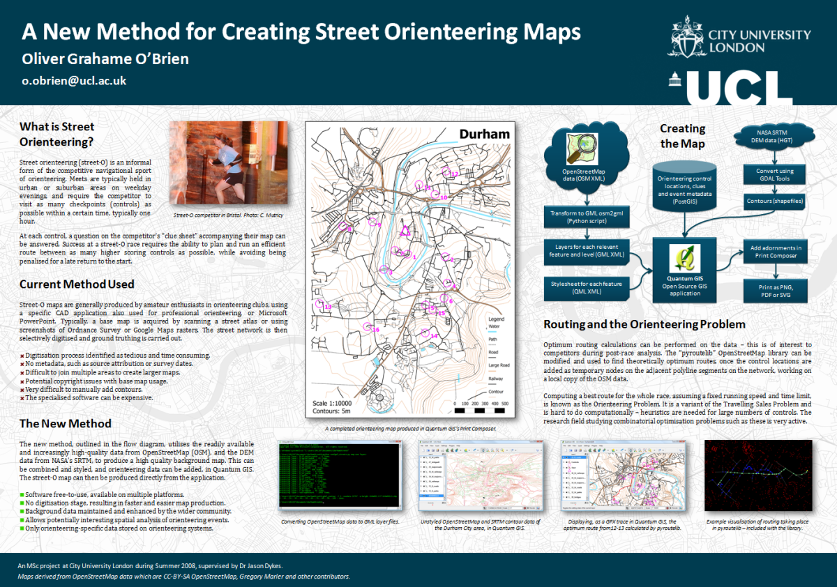
This is a poster that I will be presenting at next week’s GISRUK conference in Durham. It is a summary of my Masters dissertation that I wrote last summer. The dissertation itself focused on areas and data in London, however thanks to LivingWithDragons‘ (and others’) excellent data-gathering for OpenStreetMap, Durham is similarly well mapped, so I customised the example map to be Durham itself.
The background, by the way, is a faded greyscale version of the map for much of London, which came from a “Slippy” street orienteering map of the metropolis that I’ve created but never got around to releasing, however it does show the extent of OSM’s London coverage now – pretty impressive.

Click the graphic to see a larger version, but you’ll have to come to Durham yourself to see the original in its A1 glory.
2 replies on “A New Method for Creating Street Orienteering Maps”
I haven’t (yet) written a complete step-by-step guide, however the detail is described in my MSc dissertation which is downloadable from my brand new work blog at: http://ollie.blogs.splintdev.geog.ucl.ac.uk/2009/04/17/msc-dissertation/
You’ll need to use a couple of the scripts in the appendices, to get the data into Quantum GIS.
Hello,
Seems like a pretty neat way of creating orienteering maps. Do you have a more detailed description of the toolchain you are using to create this mapping? I would like to give it a try to create an o-map of the city I am living in.
Kind regards,
Frederik Loeckx