Categories
Leisure Orienteering Orienteering Events Log

E9: Gridded

So, I ran in the Nike Grid ARG (alternative reality game) on Saturday, concentrating mainly on the E9 postcode in Hackney, but also going jogging around the City of London (EC1, EC2, EC3 postcodes) doing an informal City of London Race. The aim of the game was to log runs between four specially designated phoneboxes in each postcode, dialing in at the start and end of each leg. The more legs done, the more points you got – bonus points were available for running early/late, doing a fast run, completing every possible leg, and the most number of legs.

My strategy was hampered by having a severe hangover from the night before, so I didn’t make it out of the house until 3pm (the game ran from 8pm-8pm) and was pretty dehydrated. It was also a very warm day – and, to make things worse, the phoneboxes themselves acted as heat reservoirs. One City leg went via a supermarket and its chiller cabinet…

In my first session I essentially ran all of the six possible legs between the four phoneboxes, and several extra legs between the two closest ones. In the later session (after my jog around the City) I again aimed to run all six possible legs, getting the fastest split bonus for each, but realised near the end I wasn’t going to make it to/from the far one, so repeated some of the smaller legs. The many people enjoying a cool drink in the garden outside the Royal Inn on the Park, immediately opposite the most southerly phonebox, must have wondered what was going on.

The map below shows the routes I took between the four phoneboxes, marked with green rectangles:
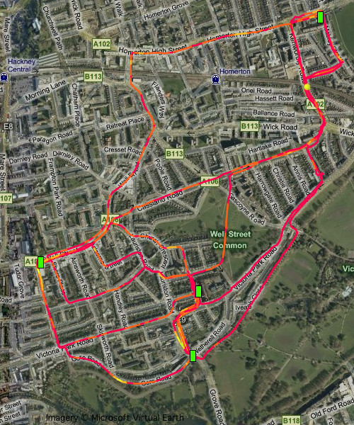
In total I ran around 16.5km (10 miles) in the E9 postcode. The phonebox dialing process meant I essentially had a two minute rest after every leg – the longest of which I did in just under 10 minutes. My shortest leg was 1m 26 – I tried this one again and again but my times kept getting worse with each attempt!

I ran into the last box about 10 seconds before the game closed – I had to push it for this final leg and got bonus points for running this leg in the fastest time. (In fact I think I picked up all six of the fastest leg bonuses during the day.) The Nike team were filming this last phonebox and interviewed me afterwards.

I was extremely unlucky not to win – notice how close I finished to the eventual winner in the leaderboard below. However I did get 110 of my points in the dying seconds of the race. The guy who finished third appeared at the same phonebox a minute later (i.e. too late) and, had our arrivals been reversed, he would have finished in front of me.
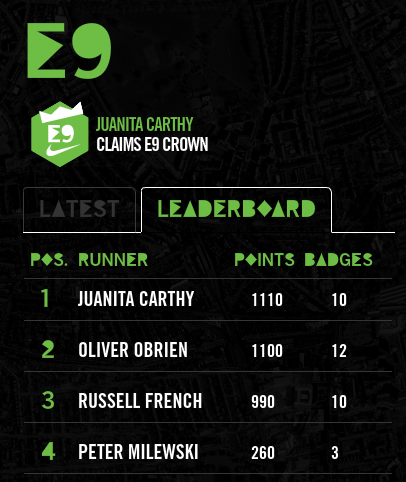
Although I didn’t win, a friend won not once but twice in a different postcode, so I’ll at least get to see what prizes I missed out on!

There were some “bugs” in the game – certain phoneboxes in the City had quite unresponsive keypads which made it difficult to clock in at the end of the leg. Quite often, the automated service appeared overloaded and stopped talking half-way through, leaving you wondering whether the run had been correctly logged or not. The game leaderboard was updated in real time, which was impressive, but it was written in Flash so I was unable to see how I was doing on my iPhone. (A dedicated iPhone app would have been cool.) There luckily weren’t many players in my postcode, but many more would have clogged up the system – it took 1-2 minutes in the phonebox to stop and start each leg. Some clarity on how many points were on offer would have helped me refine the strategy, although I suppose part of the challenge is figuring it out for yourself. A couple of “test” 3am short legs I tried on my way back from the pub didn’t count for “early” bonus points, although game messages suggested they would at that time. Finally the maps weren’t too great – some phoneboxes were in the wrong place. I had however done a bit of online research first though and used a marked orienteering map instead, so this didn’t affect me. A friend of mine greatly benefited from one phonebox not being themed – he was the only person in that postcode who realised it was still a game phonebox and so completely destroyed the opposition.

It must have been a nightmare to organise, with nearly 150 postboxes scattered across many miles that needed theming, maps distributed to them, checking and fixing them – not to mention answering the many and varied questions and complaints on the Facebook event page, and writing the software to handle the automatic logging, updating and cheat detection.

Overall I really enjoyed the style of the event. There was definitely something of “The Matrix” about sprinting through the grimy streets to a phonebox (themed in green and black, too!) and breathlessly grabbing the receiver in front of surprised bystanders. All things considering, it was a nice “Real Life 2.0” take on the street orienteering theme. Not sure we’ll see this repeated – Nike generally organise a “concept” event in London yearly but each year’s idea changes dramatically to keep things fresh – however I would certainly love to try it again.
Categories
Leisure OpenStreetMap

Nike Grid – Nice Idea, Shame about the Attribution

[Update – Nike Grid is back in late October! – and they sorted the map this time.]

Nike are running an event next Friday/Saturday in inner London called Nike Grid. It’s a great idea – basically players run between any two specially marked phoneboxes in a postcode area (e.g. E9). Typically there are 3 or 4 such phoneboxes in each area, each temporarily branded with the event logo. At the beginning and end of the leg, the player phones a special number from the phonebox, entering their player code. As the call comes from the phonebox, it’s proof that the player is there then. Players then earn badges by doing the most number of runs in a postcode, doing all the possible combinations, the fastest run, the hilliest run, etc.

Like I say, a great idea. It’s a technologically advanced version of street orienteering, similar to what my club has been running in similar locations in central London over the winter and it’s a shame that Nike doesn’t mention the “o” world anywhere in their publicity for the event – but maybe orienteering is a bit anoraky for their brand experts? (Nike don’t make orienteering shoes anyway, but their big rivals, Adidas, do – my current o-shoes are Swoop 2s.) It’s a missed opportunity to promote the (sub)-sport to a market that likes running, is happy to be holding a map as a different challenge, but has never heard of orienteering.

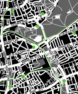
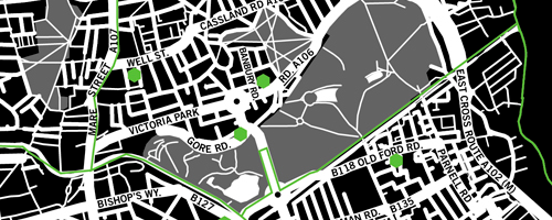
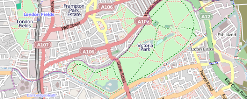
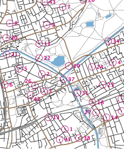
On the left is part of the map my club used for a street-o in Bow, below it is Nike’s version.

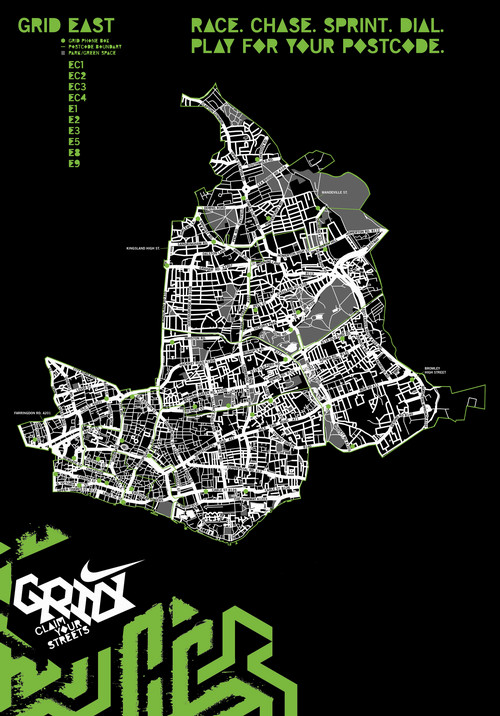
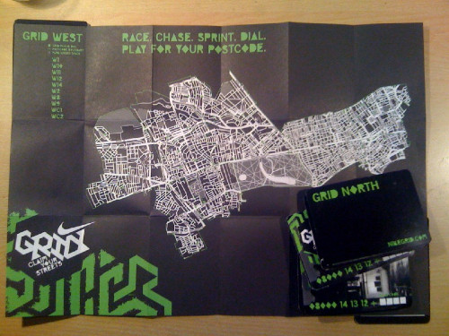
To pick your way between phoneboxes, you get a map – downloadable from the website, or collectable in paper form from the phoneboxes themselves or the Nike stores in London. There’s four maps, representing south, west, north and east London – the coverage generally extends out to the edge of zone 2. I visited a few of the phoneboxes this evening and picked up the north and the west maps (the south and east ones haven’t been put out yet, or have all been swiped already). On the maps, the phoneboxes are shown as green hexagons and the rest of the map is a rather pleasingly mimimalistic white-on-black design, rather like some of the other great cartography you can create out of the OpenStreetMap data for inner London that I and other project volunteers have collected.

In fact, wait a minute. Some of the detail on the maps around my home area looks rather familiar. Yes, they have actually used OpenStreetMap data for the map. I can see the characteristic kinks in the paths in my local park that I surveyed and that don’t appear on OS/Google/Teleatlas/Navteq et al map data. Nothing wrong with that – using OpenStreetMap data commercially such as promoting a brand of shoes is just fine. Except they haven’t attributed the project or stated the licence the maps fall under – both requirements of using OpenStreetMap data to create a derived work, especially in printed form. Oops.

Why am I bothered? Contributors of open data don’t do it for the money (mostly) but for the “kudos”. In the case of OSM, the project itself typically gets attributed rather than specific contributors, for practical and logistical reasons. The contributors are still acknowledged in the data itself. The project benefits from acknowledgement because publicity will help increase the number of contributors to the project and so increase the quality and completeness of the map data, making it in turn more viable for future uses. Everyone wins.

All they need to do is (a) add a line to attribute the project, such as “Map data (c) OpenStreetMap and contributors, CC-BY-SA”, to the maps concerned on their website and future printed copies, and (b) not be surprised if people make derivative works from the maps, which is allowed by the licence the data has been used under. I’m tempted to create an interactive map for the whole of London or indeed the world, in the same style – the cartography is very nice.

Incidentally the map is created using quite an old copy of the data, from before last September – some of the more recent roads I and others have added to the project don’t appear. The designers have also enhanced the widths of some of the major roads, and added in road names and numbers. Roundabouts have also been added in as proper circles. There are some mistakes in the process they’ve used – the main track (highway=bridleway if I recall correctly) around Victoria Park doesn’t appear, but the paths (highway=path) that lead to it do, resulting in a rather odd “gappy” looking bit of cartography around there, ironically a similar quirk of the Google maps of the same area.


Also, I’m not sure where the postcode boundary lines come from, but they mis-align somewhat with the OpenStreetMap data – in some places the lines wander near, but not exactly along, the centreline of a boundary road. You can see a particularly bad mismatch between the green line (postal boundary) and the white line (here a canal) on the left of the first map above. Just a cosmetic quirk.

It is a really great idea, and a really nice bit of marketing. I will, hopefully, have a go at getting a few of the badges during the 24 hours the game runs. Let’s hope they get the attribution sorted out.

(I notice it’s happening the same weekend as the London Marathon, who have Nike’s rivals Adidas as a key sponsor. The timing is not a coincidence, I’m sure!)

By the way, Nike have made it very hard to be contacted about this – there are no contact details on the game’s website and it is not possible to send private messages to the owner of the game’s page on Facebook, thanks to the way the social network sets up fan pages. Sigh. Of course, people in glass houses and all that, I should attribute the screenshots in this blog post – all the screenshots are of maps created using map data (c) OpenStreetMap and contributors, CC-BY-SA.

[Update – I have made minor edits to improve the clarity of the article and add the note about Google.]

Categories
Leisure

Parkrun – The Video

Here’s a brilliantly produced video showing what parkrun is all about.

It’s shot on location in (I think) Bushy Park in south-west London. Plenty of shots of the verdant park and the wildlife, as well as the runners.

Categories
Leisure Munros

A Day in the Mountains

One day last February, I stepped out of work and onto a sleeper train up to the Scottish Highlands with a friend, did a day’s hillwalking from Corrour, an outstandingly remote place, then got the evening train down and the sleeper back to London, rolling back into the office at an unusually early (for me) hour.

Last month I did the same thing again, this time with Dan and James. This time we got really lucky with the weather, so I decided on an ambitious (for winter) trek over two Munros to the south of Tulloch. We had just six hours between the morning train arriving and the evening train leaving, so we kept up a good pace. The snow depth wasn’t as bad as expected, with a 10-15cm layer of hoar frost sitting on top of some well-packed snow. Towards the end of the day we saw a front creeping towards us, that was to give a very heavy snowfall and avalanches in the area the following day.

Finding a good, straight path, we took a direct route up the ever-steepening slopes to the first summit (very boggy and nasty in summer apparently), then a pleasant and fast ridge-walk to the second Munro (again rough in summer) and finally a steep descent back down to the Narnia-like forest – the track being overgrown with trees bent double under the weight of the snow – and back to the station.

The area was a bit sparse on OpenStreetMap but I’ve gone back over the area and traced in the details, with the help of my GPS log, Landsat imagery and Scottish Popular Edition mapping that is now available in Potlatch (more on that soon).

A grand day out.

Route – for the full 3D experience you need the Google Earth browser plugin.

Categories
Leisure Notes Orienteering

Review of the Year 2009: Part 1

2009 was a year in which I started to do less orienteering (after 13 years in the sport), a bit more running, and a lot more cycling. It was also almost an injury-free year.

January

The year started with a training score exercise in Aird’s Park, near Oban, on New Year’s Day. “Park” is a highly misleading name for the area, it was extremely physical with tussocks and marshes everywhere. Managed to finish second, but only because most of the good people misjudged the time back to the start and got penalties. I was up in the Scottish Highlands on the annual JOK New Year hillwalking trip, so the following day it was back to the Munros – and what a day. The four eastern Mamores climbed in cold and crisp conditions, finishing well after dark.

The only other orienteering in January was two London street-Os – an LOK race in Hampstead and a SLOW race in Wimbledon. They were very hilly, and I got a late penalty at both. And also a weekend of city races – on the Saturday the second Edinburgh Street Race which I enjoyed even more than the first, especially as I didn’t get disqualified this time – and then on the Sunday, having travelled right back to London, it was up again to Lincoln for their own City Race, again the second time I have run it. Again, a great race, and even better than the one before. This time, we got to run right through Lincoln Castle – up the drawbridge, across the battlements and out through the gate. A race with a definite “wow” factor.

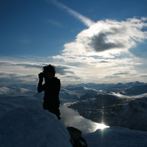
On the summit ridge of Binnein Mor (5290)

February

In February I was quite preoccupied with planning for the JOK Chasing Sprint, which was near Watford. A few chilly weekends were spent surveying the courses. There was also another SLOW street-O, at Kingston, where I again got a late penalty!

Also, I got back up in the Highlands, for one day only. Sleeper to Glasgow, early morning train up, six damp hours in the hills around Loch Ossian (some snow, but a big thaw was on) and then back on the train overnight to London. I’m doing it all again next month.

Finally, I got to use my mountain bike on “proper” terrain as opposed to the streets of London – a two hour lap of the “Red trail” singletrack at Bedgebury Forest in Kent – a warm-up for a weekend singletracking in Wales. My cheapo-MTB held up just fine, which was more than could be said for Chris’s hire bike.

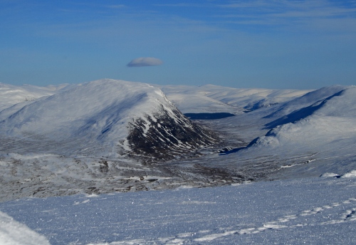
View down to Loch Ossian (5361)

March

The first terrain orienteering of the year – BUCS in SW London. Oxford was organising it on SLOW areas. I went very wrong indeed at the individual race – probably lack of practice. The relay was a bit better but I was still a bit clueless. At least I was a bit better at the next SLOW street-O two days later, in Surbiton. Didn’t get a late penalty for once.

The next weekend it was time for my first mega-cycle of the year – over 10 hours in the saddle, as I tried (and failed) to get to Eastbourne. My mistake, perhaps, was following the National Cycle Network route (21) strictly, even where it goes off the road to go up a bumpy, muddy track, only to rejoin the road a couple of km later. It did this many times. Some sections were very pleasant, such as the bit around Eridge. But, 140km after leaving Hackney, it had got properly dark, so I cut the trip short.

One week later I was off on the bike again, this time taking the “official” road-cycling route to Brighton. I completed the 100km route in just over 5 hours, + a couple of hours of stops – slightly disappointingly seven minutes longer than last year’s.

I also made a start on mapping the western extension to the City of London orienteering map, with a wander around the old alleys off Fleet Street.

The month finished with a weekend in Wales, on the various MTB singletrack trails in Coed y Brenin in North Wales. Great fun, a lot of trails were done, including the Tawr and most of the Dragon’s Back.

n779785520_6111535_5282780

April

The fourth trip in four months to Scotland – on Saturday I ran in the Scottish Sprint Orienteering Champs at Stirling University. Afterwards I went for a walk up to the Wallace Monument – I’d been meaning to have a look around this for years. The following day I ran the Edinburgh Half-Marathon – the sprints having been a less-than-ideal preparation. The second half of my race was a lot slower than the first. I’m doing the full-marathon version this year, and will be preparing better!

A couple of days later, and I had not recovered, but I ran anyway in the final SLOW street-O of the year, in Pimlico. I got around with two seconds to spare, and got my second best result of the series. Tim & CJ’s feast was excellent. Then it was back up to Scotland for Easter, but doing the JK Sprint in Newcastle on the way.

Back in London, I cycled 75km to Cuckfield with Anna, the first of our joint training trips for John O’Groats-London in the summer. It was a busy weekend – on the 19th I ran in the Newham Classic 10K – it was a very local race for me, and cheap to enter, and the route past the Olympic Stadium looked interesting. Then in the afternoon more City of London map surveying, around Lincoln’s Inn – and I had my bike nicked! It had lasted only 18 months, although as it happened I was going to be getting a road bike for the long summer cycles anyway.

Finally, there was the Varsity Match, which was just north of London and later in the year than normal – this year’s is in early March in Cornwall. The individual was in Epping Forest – always an enjoyable area to run on. The course was tough but pleasant, and my race was livened up when I spotted a snake slivering away from one of the controls near the end. It was warm enough to lie around at the finish and eat ice cream – summer was on its way!

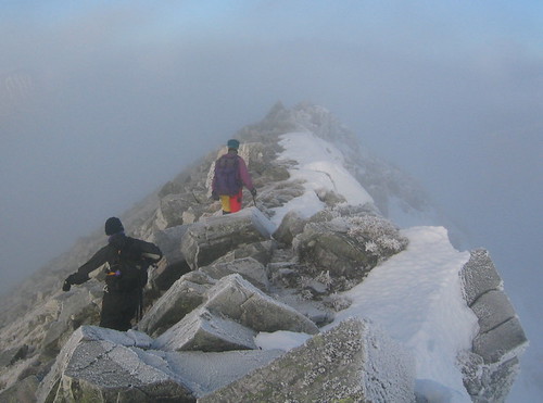
Dalkeith to Peniculk Railway Walk (5967)

Categories
Leisure

Finsbury Parkrun

[Updated] North London finally has its own parkrun – a free 5K timed race, starting at 9am every Saturday in Finsbury Park. The inaugural is on 31 October.

And unlike Bushy Park, this one has hills…

Update: It looks like a Victoria parkrun might be on its way too, permissions pending… and also a Greenwich parkrun, which could be just as hilly as Finsbury.

Categories
Leisure Orienteering Events Log

Dunwich Dynamo 2009

img_0389
This is an annual 180km self-supported ride from London Fields in Hackney, to the beach at Dunwich in Suffolk. As it’s a free turn-up-and-go event, it’s all quite informal – people just turn up at the Pub in the Park and then start to head off. The catch – it’s a night time event. I started at 8:50pm…

I was riding with Jenn and Michal, also trying out various new accessories I’d bought in the day – a fell-runners’ bag, saddle bag, frame bag, padded shorts, a proper cycling top, cleats and a couple of bike lights (which proved to be woefully underpowered.)

There most have been close to a thousand cyclists in this year’s Dynamo, taking advantage of the calm, dry and clear weather, although it got surprisingly chilly quite quickly.

The pace was far faster than I was expecting – once we had passed the highest point of the route (Epping Forest) the pace really went up and we pushed hard until the food stop at 100km, arriving at around 1:15am. The pace then on was also quite fast, at one point a wonderful 10km with the Dulwich cycling club peloton. Then, as dawn broke properly, we started to tire a lot.

img_0395

We finally made it to Dunwich at 6:10am (ride time 7h 23, + 2 hours of breaks) where the cooked breakfast in the cafe was very welcome – the rain shower, the first of the night, wasn’t. We took a risk, cycling 8km through the second rain shower to get the first local train of the day. 20 others had the same idea, but the guard let us on, and three hours later we were back in London. An extra 50km to cycle to Ipswich for the main-line trains was thanfully avoided.

img_0404The high point was tearing down the Suffolk Coastal District part in the back of a fast-moving (~35km/h) peloton. The low point was definitely waiting for the rain to clear at Dunwich and dreading the cycle to Ipswich. The most memorable sight was seeing a long stream of flashing red lights in front of me, sweeping around invisible corners.
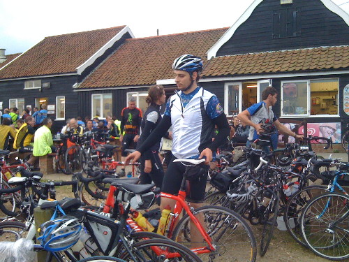
Despite the pain near the end, it was great fun and good training for when I set off to cycle the length of Britain (Thurso to London) in a couple of weeks time.

We spent a couple of hours taking breaks, including nearly an hour at the 100km feed station. The first 100km was virtually without stopping, but the latter section had more frequent stops, as Michal’s bike started to make strange mechanical sounds and so he limited his speed. We also took a couple of wrong turns later on, although we found straightforward shortcuts back onto the main route. At one point, Michal and I thought Jenn, who was generally the fastest of us three and was ahead most of the time, had missed a sharp turn and headed off to the coast 10km south of Dunwich. However, after a bit of worrying, it turned out she had made the turn after all.

On the back of a disturbed night the night before, and obviously no sleep at all last night, I don’t feel too bad right now. However I did nod off numerous times on the packed train back from Ipswich to London.

Drinks-wise I got through 1 litre of Lucozade and around 1 litre of water, + coffee at the feed station and at the cafe at the end. Food I ate included some chewy sweets, three Power-bars and few Clif Shot Bloks. At the half-way point a had a pasta salad plate and a couple of bananas. At the end I had an SIS sport bar and a Clif bar, as well as the cooked breakfast. As a consequence I didn’t bonk at all and feel fine now!

[osm_map lat=”51.886″ long=”0.779″ zoom=”8″ width=”500″ height=”350″ gpx_file=”/files/2009/07/04-jul-09-20_53.gpx”]

img_0407

Categories
Leisure

3D Course Flythroughs

This video of the 2009 Tour de France course has been going around.

With Google Earth 5.0’s new Tour functionality, particularly the GX extensions in the KML Touring spec, I reckon it should be possible to create a similar flythrough for my forthcoming Thurlon trip, based on GPX route data and adding appropriate features, zooms and swoops to show the interesting bits.

I’ve just noticed, incidentally, that the Thurlon trip is on at the same time as the latter part of the TdF and finishes on the same day. We aren’t, however, traveling further than the TdF riders, on any of the days, and we certainly aren’t doing any alpine-sized climbs! We are actually going further than the TdF riders on the final weekend.

Date Thurlon Our Terrain Destination Tour de
France
Their Terrain Destination
17 July 63km Time trial Thurso 200km Medium mountains Colmar
18 July 145km Medium mountains The Black Isle 199km Plain Besançon
19 July 140km Medium mountains The Great Glen 208km High mountains Verbier
20 July 141km Medium mountains Loch Lomond Rest day Rest day Verbier
21 July 138km Plain Edinburgh 159km High mountains Bourg-Saint-Maurice
22 July 152km Medium mountains Morpeth 170km High mountains Le Grand-Bornand
23 July 146km Plain Whitby 41km Time trial Annecy
24 July 144km Plain Lincolnshire 178km Plain Aubenas
25 July 164km Plain King’s Lynn 167km High mountains Mont Ventoux
26 July 173km Plain London 164km Plain Paris
Categories
Leisure

London to Rye

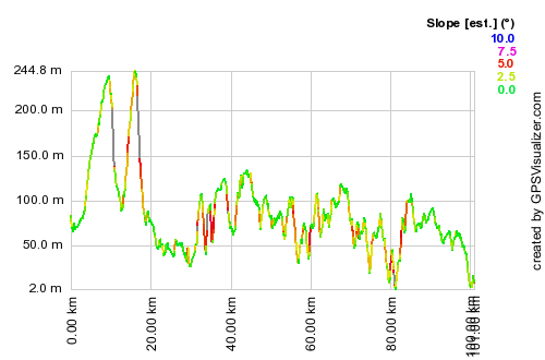
This was the first long bike ride I did on my new bike – a Giant Defy 2.5 road bike. Having recently cycled from London to Eastbourne, as part of training for my cross-Britain epic this summer, I was keen to do another ride across the hill Kent Weald, and to repeat the first hill, with its gentle climb followed by a dramatic 15% drop off the edge of the North Downs.

The route started at Orpington, in order to avoid a tedious two-hour section through London, and went via Tunbridge Wells and part of National Route 18. The section through Bedgebury Forest was on forest tracks, the rest was generally on quiet roads. I didn’t take a map, instead programming the route into my Garmin, which gave accurate turn-based directions all the way to Rye. The route was certainly hilly – with two large hills at the beginning and five small ones, including three in quick succession just west of Tunbridge Wells. The weather was warm with light clouds, but brooding thunderclouds were in the English Channel and they brought some rain for the final third of the route. I cycled it with Anna – who has been doing some serious training recently as she beat me up almost all the hills – and Iain, who accompanied us as far as Tunbridge Wells.

[osm_map lat=”51.18″ long=”0.352″ zoom=”9″ width=”500″ height=”400″ gpx_file=”/files/2009/06/course-1.gpx”]
lonryeprofile

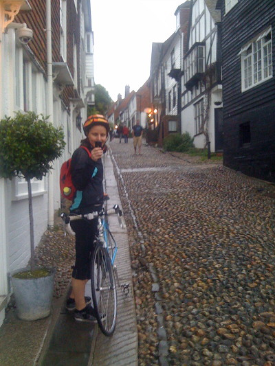
Rye was very nice, even in the pouring rain. Its cobbled streets were certainly not suitable for cycling around, so we pushed the bikes around and explored Mermaid Street and the other ancient, pretty streets in the village. Certainly if we had had more time, and the weather had been nicer, then a stop in one of the Ye Olde pubs with their beer gardens would have been nice. As it was, we had a train to catch and it was starting to get dark, so we headed back to London – it’s nearly two hours on the train to get back, so I was quite pleased we had cycled the 101km route in just over 5 hours, plus 2 hours of breaks.

img_0358

Categories
Leisure

London to Oxford

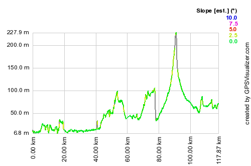
[Updated] I cycled from London to Oxford yesterday, initially taking quite a southerly route out of London, before heading north-west. This was to ensure that the Thames was followed for as long as possible, minimising climb, and because the more direct routes, via High Wycombe or Amersham, are in deep valleys with only major roads (e.g. the A40) – or very steep roads – going up them. As well as being beside the Thames at both the start and the finish, I crossed it three times – at Teddington, Chertsey and Henley.

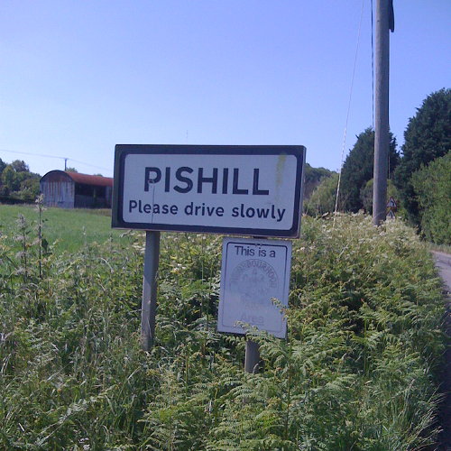
The route was 118km from London Bridge to the centre of Oxford, and had only one big hill – the 200m concave climb out of Henley up onto Christmas Common at the top of the Chilterns. Following the Thames here would mean taking a very long detour down to Reading and back up through Didcot. The Henley to Oxford road is a B-road but is actually very quiet, and was very pleasant to follow. It goes through the legendary hamlet of “Pishill”.

There were two large drops – one on the immediate approach to Henley which is a 10% gradient down around 80m – I hit around 50km/h here. This was however beaten by the 60km/h descent on another 10% gradient drop, at the top of the climb up into the Chilterns.

I was aiming to get to Oxford for around 4pm, to gatecrash the end of the Pembroke College Garden Party and then hopefully watch the end of the summer VIIIs regatta on the river. As I was on my own, I pushed the pace all the way, and only took brief stops. I completed the 118km route in 4h50, plus around 50 minutes of stops and breaks, an average of around 25km/h including hills, which is far above my planned pace for my Thurso to London trip later this summer.

I’m pleased to have completed this ride, in good time and without much effort, as my previous attempt, cycling from Oxford to London around five years ago, ended at Reading. I was on a very old hybrid bike and had optimistically started at 3pm in the afternoon, following National Cycle Route 5, which takes a very meandering route with lots of climb through the Chilterns, rather than following the river as I had hoped.

The route: This is the “idealised” route, routed using OpenStreetMap and Google Maps routing data, rather than my actual route, which included a couple of wrong turns and unplanned detours, largely due to quirks in the routing. I took no map, trusting completely in my Garmin Forerunner 305 turn-based directions, created using Bike Route Toaster, which also creates and loads onto the GPS a profile map – useful for counting down to the top of the climbs.

[osm_map lat=”51.58″ long=”-0.69″ zoom=”9″ width=”500″ height=”300″ gpx_file=”/files/2009/07/londontooxford.gpx”]
lonoxfordprofile

[Update – GPX file here]

img_0361