Categories
Olympic Park

Olympic Velodrome Test Event

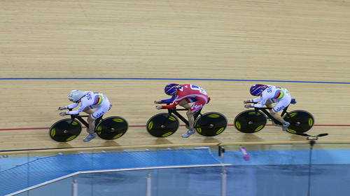
I was at the Velodrome in the Olympic Park yesterday, for the opening evening of the UCI Track World Cup London stage, which was also a London Prepares test event for the forthcoming Olympics. As such, it was the first opportunity to get into the Velodrome to watch an competitive event. The only races taking part were the Team Pursuit qualifications, but it was still exciting to see 33 teams go around the track (one at a time) at impressive speeds.

Tickets were not easy to get – I got through as a local resident, and even then had to apply on the dot as registrations opened, and the ticket site slowed down. So it was a little galling to see some seats (5-10%) remain empty all evening. As many of these were “prime” seats adjacent to the finish, I wonder if these were free seats give to sponsors, who then decided that the preliminary arounds weren’t that exciting to watch.

The logistics were also a little awkward – requiring a longish bus ride from right the other end of the park. With nearly 6,000 spectators to bus, there were inevitably long queues both to get to the velodrome, and (longer) coming back. Obviously for the Olympics itself, people will be walking around the park, rather than being bussed around it.

There were some technical issues on the night – the start gate failed to release one of the riders, at one point, and the overall time system got confused for a couple of teams and arbitrarily added over a minute to the affected team’s time, as they crossed the finish line. This was particularly odd as the erroneous time had not yet elapsed, so where this extra time came from I do not know. Of course, the whole point of test events like this is to test the equipment, in a competition environment, so that come August, the bugs will have been ironed out. One non-technical “incident” was that the Spanish men – who incidentally had the most striking tops of the night – managed to get themselves disqualified, for altering a bike into an illegal configuration after it had been measured. Oops!

But enough of the negatives, it is a super venue. We entered through the door where the roof shrinks right down so it is barely 10 foot above you – and then suddenly you are in a huge, brightly lit arena, with terraces of seats disappearing into the “Pringle” shape and masses of cyclists and bikes in the race team area within the track. Certainly the entrance had more of an impact than the previous test event I went to at the Copper Box (aka the Handball Arena). The seats are more comfortable too.

The best aspect of the night though was the two times that Team GB took to the track (the Women, and later the Men). Deafening clapping and cheering from start to finish of their cycle. If they can sort the other problems, the Olympic experience here is going to be amazing.
Categories
Olympic Park

February Circuit of the Olympic Park

I went for a cycle around the perimeter of the Olympic Park on Saturday. The route is around 11km, and although it’s outside the park itself, there’s still plenty to see – particularly as the Greenway (also to be known soon as Victoria Walk) crosses through the site, and the Stratford City retail complex protrudes someway into it. I’ve already done the circuit twice in 2011 and also been on two bus tours inside the park, in 2010 and 2011. You can see my complete collection of Olympic Park photos on Flickr.

My route was along the Greenway, then along Stratford High Street, around Stratford City, then through Leyton and along Ruckholt Road to Hackney Marshes, finishing by returning down the canal to Hackney Wick, Fish Island and Old Ford. The last first and last sections are the most scenic – mainly because they don’t involve cycling along roads, so the natural state of the park and surrounding area is more evident.

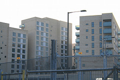
The main changes were the appearance of a tunnel across the Greenway, linking the warm-up tracks to the stadium, lighting towers on the former, and much wider Greenway (with the security fencing moved back) and the complete, and surprisingly ugly, Olympic Village – maybe I just got it in a bad light. Crossrail also makes an appearance – the Pudding Mill Lane tunnel portal work has started. The blue Olympic hoarding in the area has been replaced by a slightly darker blue, with the Crossrail logo on it. With ongoing Olympic works on the other side, the narrow passageway looks like it will be there for a while yet.

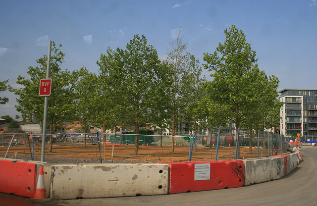
There was also a lot more security fencing than I remember before in the north and east of the zone, with 16-foot high fencing, topped with a 4-foot electric fence, CCTV cameras and microwave detectors, protecting empty coach parks and concrete podiums away from the main park. I can understand it for the central area but it seemed a bit over the top for these areas which are generally unconnected to the main park.

Most excitingly was the appearance of two new slender footbridges, both of identical design, spanning the canal. These will “open up” the park in legacy mode (i.e. from late 2013 onwards) to the residents of Hackney Wick. One links to the Copper Box (formerly known as the Handball Arena) and the other is beside the Omega Works housing development and links to the area north of the main stadium. I’ve added both bridges on to OpenStreetMap, where they are currently showing as dotted pink blobs, i.e. under construction.

My favourite find was this furry graffiti monster, below, on a warehouse in Hackney Wick, overlooking the canal and sticking its tongue out at the Olympic Park. I think it’s been there for a while (and has been since “adorned” with other graffiti) but I hadn’t spotted it before now.

You can see all the photos in my Flickr album.

Categories
Olympic Park

London Handball Cup

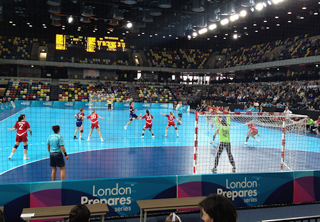
I was along on Saturday, along with James, Dan and Isla, for the semi-finals of the London Handball Cup. Handball is a sport I had never seen or even thought about before (along with the majority of the UK, I expect) but it’s an Olympic sport, and this event was a test event (part of the London Prepares series) for next year’s Games. Particularly exciting for me was that the event was taking place in the Handball Arena, a new permanent venue that is in the Olympic Park itself – so this was an excellent early chance to walk through and experience this huge newly transformed area of London, ahead of next year’s Games and the presumed general opening of the park to the non-ticketed public sometime in late 2013 or early 2014.

The tournament was over four days (Thursday to Sunday) with six women’s teams, and on Saturday the semi-finals and the 5th/6th place playoff was taking place. Unfortunately, the new Great Britain team was in the latter playoff – and lost to Slovakia 17-22. The other game we saw was the Angola vs Poland semi-finals, which was tied at 22-22 after normal time, resulting in 10 minutes of extra time being needed. Being such a close score, things got pretty exciting at the end.

Handball was a pretty easy game to pick up for spectating (the event guide helped) and the new arena is great. The seating is multicoloured, to provide the illusion of the arena always being full of spectators even if it is half empty. Everything’s brand new and – although the seating is rather uncomfortable, it was OK for the two matches (an hour each) that we stayed for. This being a test event, there were a few hitches – one notable one being the scoreboard, which displays an impressive number of stats, freezing up. The wrong team also got a point scored after a penalty, although this was presumably human error.

It was a bleak, windswept and chilly 1km walk from Westfield Stratford – the entry point – to the arena itself, but it did mean a walk right through the park (between temporary security fences) crossing numerous wide bridges and passing the Water Polo arena (temporary) and almost underneath the front of the Aquatic Centre. There is quite a lot of landscaping going on, and the odd tree here and there, but also large areas of hard paving, unfortunately reminiscent of the area around the O2 or Surrey Quays but I am sure necessary to cope with the huge volumes of people next summer. Hopefully the post-games conversion work will do a lot to break up the windswept plazas and soften the park area.
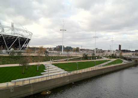
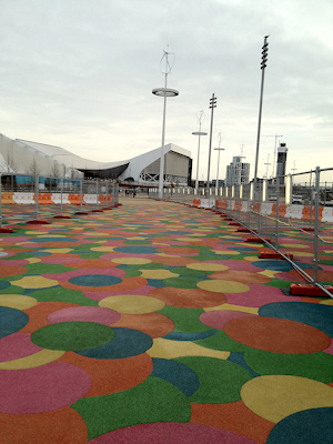
One particularly odd bridge had soft paving made up of multicoloured circles, rather lurid and jarring, and presumably soon to fade to murky brown with the weather over the winter. Surely some nice Portland granite would be better, or red brick – presumably much more expensive though. If the Barbican Estate can get large expanses of paving right, then why not the Olympic Park?

Still, it’s going to be a fascinating new part of London to explore – eventually.

Categories
Olympic Park OpenStreetMap Orienteering Events Log

Olympic Torch Relay – The Unofficial Map

Cross-posted from my research blog.

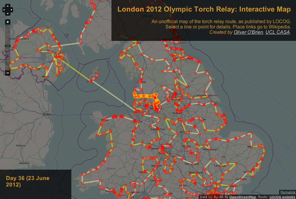
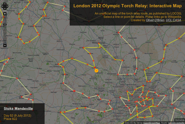
The organisers of next year’s Olympic Games in London, LOCOG, have unveiled their map of the 1000+ places that the Olympic Torch Relay will pass through. The data that the map is built from is readily accessible (as a JSON file that gets downloaded to your computer when you view the map) so I’ve taken the data and built my own (unofficial) map. It has a number of advantages over the official map:

  • The base map is OpenStreetMap, which is much more detailed.
  • The map takes up the whole browser page, allowing for easier panning around.
  • The line that connects each of the places is drawn as a vector, so it still appears as you to zoom right in to see individual villages. (The official map surprisingly uses tiles for the line.)
  • There are Wikipedia links for each of the places. Almost all of these resolve to proper Wikipedia entries, so you can easily find out about the places that have been picked, with the richness of detail that is characteristic of the Wikipedia project.

See it here.

Categories
Olympic Park OpenStreetMap

Olympic Torch Relay – The Unofficial Map

The organisers of next year’s Olympic Games in London, LOCOG, have unveiled their map of the 1000+ places that the Olympic Torch Relay will pass through. The data that the map is built from is readily accessible (as a JSON file that gets downloaded to your computer when you view the map) so I’ve taken the data and built my own (unofficial) map [no longer online due to dependency removals, as of ~2020]. It has a number of advantages over the official map:

  • The base map is OpenStreetMap, which is much more detailed.
  • The map takes up the whole browser page, allowing for easier panning around.
  • The line that connects each of the places is drawn as a vector, so it still appears as you to zoom right in to see individual villages. (The official map surprisingly uses tiles for the line.)
  • There are Wikipedia links for each of the places. Almost all of these resolve to proper Wikipedia entries, so you can easily find out about the places that have been picked, with the richness of detail that is characteristic of the Wikipedia project.

The route has been designed to “ensure the flame within a one-hour journey of 95% of people in the UK” (Source).

Although my map is no longer online, you can download the geospatial data I used, here.

Categories
Olympic Park

Olympic Volunteering Interview

I was invited along this morning to a “Games Maker” selection event, i.e. an interview session for volunteers for the Olympic Games in London next year. Should I be accepted, I’ll be in a Security team, which sounds like it means standing at Stratford Station pointing people through the shopping mall to the Olympic Park, or possibly telling people to stand in line for the park entrance screening – hmm.

Anyway, the interview process itself was quite unlike any I’ve had before – some of the quirks can be explained by the fact that LOCOG are apparently needing to interview over 100,000 people.

The interviews were on the 19th floor of a skyscraper in Canary Wharf – chosen presumably because of the stunning view north to the Olympic Park, which is looking encouragingly complete these days. I guess some interviewees have found the drop from the 19th floor a bit much, because we were asked if we wanted an interview “pod” away from the windows…
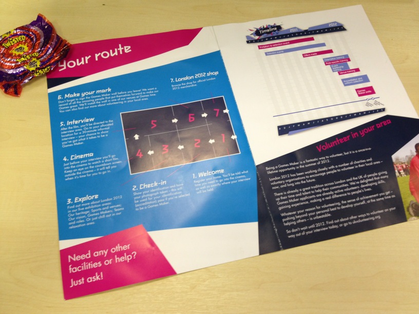
The process is timetabled to take 90 minutes, but I was in and out in just over 65 minutes – although I did arrive a little late. On arriving in the interview area, you are welcomed by a person at a desk, given a wristband (red, white or blue) indicating your interview time, and a programme. Then a second desk checks your passport and takes your photo. On both desks there was a large box of sweets, which at the time seemed a little odd – however Cadbury is one of the major sponsors of the volunteering program (along with McDonalds) and I really should have been a little more boldand nabbed the rather nice Creme Egg “Twisted” chocs that were in abundance.

Stage three is an exhibition – a map, some panels and screens – best of all is the aforementioned view to the park. Then there’s a short film to watch, where Seb, Tanni and Eddie Izzard, + a Cadburys guy, encourage you to be motivated for the interview itself. Despite the efficiency and formality of the whole process, Eddie’s section is actually quite funny – “We don’t want you to be just talking about cheese – now if this was an interview for a cheese competition, you’d be sorted.” Finally, the interview itself – the interviewer read strictly from a script – when I failed to understand the final question, he simply read it out several times! He also was glancing around quite a lot which was a bit disconcerting. To be fair to the interviewer, he was under quite strict time pressure, and also I think he himself was a Games Maker, i.e. volunteer. He was also an extremely polite and nice person, which is presumably why he had landed that role.

Finally you end up back with your fellow interviewees in a small room with a board on it where you are encouraged to write a “thought” on a whiteboard. Apparently the whiteboard fills up and is wiped each week – which considering there must have been a thousand comments on it, makes you realise just how many people are going through the process. There was also a small Olympic shop, although no one in my group went in it. I already have my British Team mug thanks to the John Lewis Olympic Shop in Stratford City.

…and that was it! Very organised, very slickly run, very slightly overbearing, but considering the numbers of people involved, about as good as it could be. My fellow interviewees probably represented the average demographic of London, with an average age probably mid/late 30s, mainly professionals and about half women.

I have no idea if I’ll be accepted. I wanted to phrase all my answers to the questions in relation to my volunteering and organising of various orienteering races, but the interviewer tended to steer me towards classic work-based scenarios. I guess I will find out in a few weeks. It sounds like I won’t be the one handing the towel to Usain Bolt, but you might see me with an Olympic map, pointing people in various, hopefully correct, directions.

Categories
Olympic Park OpenStreetMap

So Just How Exactly Do You Get to Stratford City?

So the huge Stratford City mega-mall opened up last week. But, thanks to a combination of the Olympic Park, security concerns, and existing geographical barriers, it’s actually rather hard to get to – particularly if you don’t have a car.

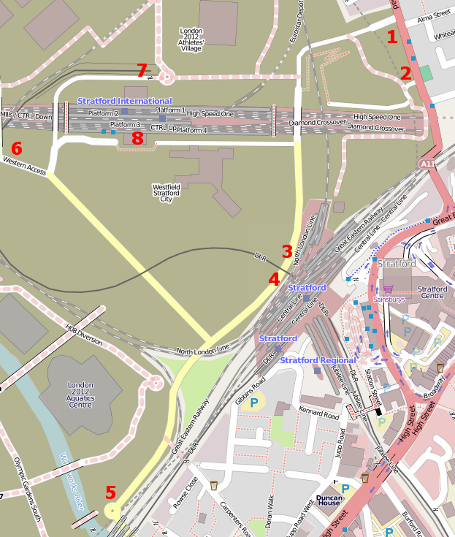
As things stand, here are the ways you can get to it. I’ve marked the entrances on in red, on an OpenStreetMap map. The map is currently rather bare, in that it doesn’t really show the mall buildings, or indeed much else. However never fear, the OpenStreetMap community is here, and I have it on good authority that the map will rapidly become more comprehensive and complete in the next few days.

1 – NE. Cars only.

2 – NE. Pedestrians and cyclists only. After walking along a dusty, unpleasant road through a building site, you then follow a narrow path, with a couple of switchbacks to climb up onto a bridge. Only after passing the main access road to the Athlete’s Village can you join the road. There are security people at three points – the entrance to No. 1, the bridge, and the point where the route joins the road, to ensure everyone goes the right way.

3 – SE. Pedestrians only – although you could walk your bike. This is over the huge “rusty” bridge from Stratford itself, and drops you straight onto the “ground” level of the mall.

4 – SE. Pedestrians and cyclists via train from Stratford station, or pedestrians from the bus station just to the north. This entrance is at “lower ground” level of the mall, i.e. below the “rusty” bridge. There are a few cycle parking stands here.

5 – SW. Cars, pedestrians and cycles, although it’s a long lonely road to walk along from here – but you do get a great close-up view of the Aquatic Centre and its curious turf wall. The cycle lane marking is a bit of a mess – initially you start on one pavement, then encounter a no-cycling sign and have to cross to the other – but breeze-blocks have hemmed in the route, meaning pedestrians and cyclists have to share less than a metre’s width of space.

6 – NW. Cars only. The most contentious route for me on a bike, as it’s the direct route from Hackney. Security here is polite but firm – only cars get to drive through the Olympic Park. I suspect the real reason cyclists and pedestrians can’t enter here is because there are no pavements, just fences and walls – so for safety these road-users would need to take up the whole lane – and that would slow the traffic flow on this critical link between the A/M11 and the mall.

7 – N. Pedestrians via train only. Entrance from the DLR station at Stratford International (bikes not allowed.) Note you have to exit through the main Stratford International station, i.e. entry-point 8. The road leading from 7 is barricaded off at this end (only) and I got a yelling from security when I approached from the other (unblocked) end of the road.

8 – N. Pedestrians and cyclists via train from the High-Speed train services from St Pancras International or from Kent.

So, the only route by bicycle that does not involve you needing to dismount is from entrance 5, i.e. to the far south of the site. And, as the Londonist has spotted, even from this direction, there are obstacles in the way!

One tip for Olympic Park spotters, there was (on Sunday) a temporary overflow car-park that had opened just NE of the Aquatic Centre, allowing people an even closer view of the facility, along with the rather attractive temporary Water Polo arena. The Olympic Stadium and the Orbit are not far away either. It’s all coming together!

Categories
Olympic Park OpenStreetMap

London Olympic Park Village Names

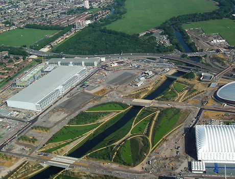
I was one of the winners of the competition run by the Olympic Park Legacy Company (OPLC) to name the five areas of the Olympic Park that will, one day, be new residential areas. I actually entered the competition once for each area, but my “East Wick” was the winning name – it, appropriately, will be the area just east of Hackney Wick, separated by the canal. In the photo above, it is the area in the middle-left, dominated currently by the huge International Press Centre building. The main channel visible is the River Lea, with the green part of the Olympic Park looking nice. On the far left is a bit of Hackney Wick. The canal that separates the Wicks is just visible but has gone green with algae growth.

It is somewhat a misuse of nomenclature, as “Wick” is often used as a post-name qualifier rather than as as a name itself. Research suggests it simply means “town” but, because of the curiously large distance from Hackney Wick to central Hackney, and Hampton Wick to Hampton Court, I’ve always thought it indicates “far end of”. So by “East Wick” I would mean, using my unofficial definition of “Wick”, the far end of the “East End” of London.

My final inspiration might have been that the “Witches of Eastwick” was in my mind, as our pub-quiz team at work is called the “Witches of Austwick” – so named as the team captain is Martin Zaltz Austwick.

There’s a video on the BBC News website which includes (near the end) a vox pop of various locals grumbling about the name. As one of my colleagues frequently says, “everyone’s a critic”.

On a related topic I found some CC-By (i.e. only requiring attribution) photos by EG Focus, on Flickr, of the Olympic Park. They are very oblique aerial photos – one is above – but usable to trace rough outlines of the park area, Olympic Village blocks, roads and paths, so I’ve added these features to OpenStreetMap. The park looks a little greener and a little more detailed now. Photo above is CC-By EG Focus on Flickr.

Categories
Olympic Park

Olympic Non-Update

I was hoping to go for another peek around the perimeter of the Olympic Park this morning, but a key section of the perimeter – the part along the canal near Old Ford Locks – is still blocked off for reworking after a water main burst last year. The notices at the wall blocking off the section assure me that works will be finished by “20 June 2011″…

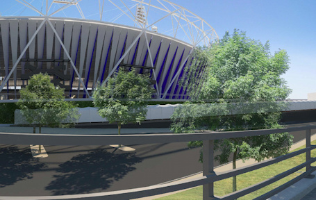
I did spot an interesting graphic (extract above, or download the full image from here on the ODA Planning Applications website though – an application for a covered bridge between the “WUT” (Warm-Up Track) and the Olympic Stadium, presumably covered to stop freeloaders on the Greenway from glimpsing the athletes, has some nice renderings of what it will look like. One also shows the stadium, covered in the vertical “pennants”, in blue and white, that look like they are the new thinking for the “wrap” around the facility. There’s been no announcement yet that the new-style wrap will be going on the stadium – an earlier design for the wrap was cancelled to save money – but with the Olympic Park currently under budget, hopefully it will happen. A small test section of white wrap remains on the north side of the stadium. That a completed wrap is appearing at least in the latest renderings is encouraging. Another virtual view, showing even more of the stadium is here.

Come September this year, Stratford City – and presumably the accompanying Stratford International DLR station – will be open, taking a huge bite out of the largely rectangular Olympic Park site. This should mean lots of closeup views of the Aquatic Centre and Olympic Village will become possible. I look forward to it!

Categories
Olympic Park

Inside the Olympic Park – Update

I’ve been on another bus tour of the Olympic Park – I last went on one in May last year.

Everything seems nearly complete now, and there’s a lot of landscaping going on. This year’s tour was much faster – under 40 minutes – and disappointingly we didn’t get to go up close to the Velodrome this year, but we did get close to the Aquatic Centre, which is currently getting its sides “filled in”.

New to the tour this year were a trip through the Athlete’s Village, with its many apartment blocks all designed slightly differently but yet looking the same, and to outside the new Stratford International DLR station which is due to open along with Westfield Stratford City in September. A newly tarmac-ed section of road at the north end of the park, with new security cameras, indicated a section of the Northern Retail Lifeline that will open along with Westfield, soon.

As to the stadium itself – well, you actually get a better view now from the elevated Greenway’s viewpoints, than from the bus. There also no sign of the stadium’s wrap being extended.

Here’s the photos: