Categories
Leisure

London to Brighton – Again

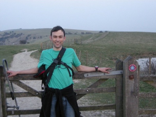
I’ve already cycled from London to Brighton, but my new housemate suggested it on Saturday morning as it was such a nice day, so off we went.

The route and profile were pretty much the same time, so I won’t repeat them again here. The only variations were starting a couple of miles further back (as I’ve moved house), taking a pleasant detour through Tooting Park as Clapham High Street was closed, and not doing the kilometre-lengthening bit along Madeira Drive in Brighton itself. We also started earlier (just before midday) so the sun set this time when I was on the top of Ditchling Beacon, not at the bottom of it.

The traffic was noticeably busier, both in London and along the country lanes, which was a shame really – but using smaller roads would probably result in an even longer and hillier route. The cars going up and down the narrow road that climbs up Ditchling Beacon were particularly unpleasant.

Moving time was 5h 10 – slightly disappointingly taking 7 minutes longer than last year. However I was in considerably less pain this time and felt a lot fresher at the end – and didn’t get lost on the way from the sea-front to the station. Was too tired to get up early the following day though, so yet another weekend without orienteering.

ditchlingme

Categories
Training

A New Method for Creating Street Orienteering Maps

This is a poster that I will be presenting at next week’s GISRUK conference in Durham. It is a summary of my Masters dissertation that I wrote last summer. The dissertation itself focused on areas and data in London, however thanks to LivingWithDragons‘ (and others’) excellent data-gathering for OpenStreetMap, Durham is similarly well mapped, so I customised the example map to be Durham itself.

The background, by the way, is a faded greyscale version of the map for much of London, which came from a “Slippy” street orienteering map of the metropolis that I’ve created but never got around to releasing, however it does show the extent of OSM’s London coverage now – pretty impressive.

durhama3

Click the graphic to see a larger version, but you’ll have to come to Durham yourself to see the original in its A1 glory.

Categories
Training

Google Street View London finally here

…and not just London. It covers 25 cities in the UK.

There are some omissions in the coverage of course – e.g. Chancery Lane is a notable missing street. But my home street in Hackney is there, and the imagery extends right out to the edge of the metropolis.

Here’s some fare-dodgers getting booked by the police, outside the main entrance to UCL.

Photo Copyright Google.

Categories
Training

Trees on OpenStreetMap

I noticed for the first time yesterday, that individual trees are being stored in OSM, and being rendered on the default OSM/Mapnik map:

osmtrees
The green dots are points tagged with natural=tree, here at City University London.
OSM documentation for the natural=tree tag

This got me thinking – might I be able to build a “proper” orienteering map using entirely OpenStreetMap? Street-O* maps can already be produced with OSM data – this was some work I did last summer, and also am working on – but being able to produce an ISOM** map directly from OSM data is quite appealing. (ISSOM*** might be harder, as this standard requires roads to be shown at their actual width, rather than being linear features with fixed-width cartography.)

Most of the orienteering-specific features, such as pits and earth walls, wouldn’t show on the “public” renders of OSM data – the ‘general maps’, but a customised rendering could show these and have specialised cartography for them. As well as adding these new features, some existing features (e.g. natural=woodland) which are rendered on the general maps could have tags added to indicate the runnability level – orienteering maps have four levels of “greenness” for woods, and sometimes tree canopies are shown in white – this could be inferred from a size tag associated with a natural=tree point, medium being shown as a circle with a 5m circumference, for instance.

Many other features are already on OSM – paths, tracks, minor and major roads, as used in the Street-O maps, and also vegetation types, gates, walls and fences, that would appear in an ISOM/ISSOM based map.

My local park, Victoria Park, could be having a lot more detail added to it soon.

* Street-O: An informal orienteering discipline, run in urban areas with simple maps showing the street and path networks, and little else. Typically A4 at 1:10000
** ISOM: International Specification for Orienteering Maps. “Normal” orienteering races use these maps, which are full colour and very detailed, typically A3-A5 at 1:10000.
*** ISSOM: International Specification for Sprint Orienteering Maps. A much newer specification designed for the increasingly popular urban and sprint races, the map is almost a plan view of the ground, with roads shown at their correct width, sometimes with pavements shown seperately. Typically A3-A4 at 1:4000 or 1:5000.

Categories
Training

A Couple of Wiki Pages…

Some things I have been doing recently:

London to Eastbourne

I cycled 130km along most of National Cycle Route 21 on Saturday, from London to nearly Eastbourne (nearly, because I set out late as usual and it got too dark to do the final 30km). As usual with NCN routes, it tends to take you up hill and down dale when a perfectly good quiet road nearby would have sufficed. However, this route is generally well signposted, and everything after Crawley is very pleasant indeed. Plus you don’t get to cycle underneath an airport terminal and between runway approach lights. I’ve written an article for the route on Wikipedia – it includes the “NCN” box which links to the other routes that have articles – currently 1/3rd of them do.

Hopefully, at some point, the Wikipedia route articles, and the OpenStreetMap/OpenCycleMap maps and data, will become the de-facto “official” information sources for the routes.

The National Byway

One thing I found when doing the cycle is that some sections are not suitable for road bikes. I’m on the point of purchasing a road bike myself, so it was with some interest that I discovered the National Byway – which aims to signpost quiet countryside road-routes particularly suited for cycling. It looks like a nice idea, even if the logo reminds me of a brand of bread, but it’s a shame this doesn’t come under the fold of Sustrans as a “road-bike routes” category – e.g. it would be nice to have consistency with the waymarking being blue (like Sustrans) rather than brown. There’s also no decent online mapping – I hope it’s not just about selling maps.

Map Milton Keynes in a Weekend

Finally I’m organising a mapping weekend in Milton Keynes. The town has been identified as one of the least mapped areas in the UK on OpenStreetMap, and it’s not far from London, so this is an opportunity to fix that. It also has some completely “blank canvas” areas, which is quite exciting for any London-based OpenStreetMapper living in a “near complete” city.

The event is on the 16th-17th May and you can sign up. No prior experience needed. Based on the rough-and-ready approximation that one mapper can survey the area that 1000 people live in every hour, and four two-hour sessions in the weekend, we probably need around 25 mappers to get the whole 180,000 population town completed in the weekend.

I’m bagging the area with the concrete cows in it.

Concrete Cows
Photo by diamondgeezer