Categories
Orienteering

OpenOrienteeringMap and MapRunF

OpenOrienteeringMap, a website for creating a PDF street orienteering map of anywhere in the world based on OpenStreetMap data, has seen a massive upsurge of use since various countries starting locking down their populations during the Covid-19 crisis. Suddenly, many people have found their exercise limited to around their home area, and, if they aren’t lucky enough to live on a “proper” orienteering map, OOM is a great way of getting a simple map quickly – with blue plaques and (for the UK) postboxes pulled in with a single click as potential control sites.

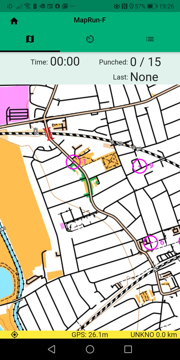
At the same time, there have been a number of initiatives to combine the basic orienteering concept of navigating with a map between points, with the use of GPS receivers on the smartphones most of us carry, and their increasingly high-resolution screens, to virtually “punch” a control by being in the correct location, and carrying the map on the phone.

MapRunF is one such project – with an Android and iPhone app. Courses can be created on the phone itself using Google Maps aerial imagery, or .ocd format maps and courses loaded in from OCAD or Mapper. But if you want the authentic orienteering experience without needing to do “proper” mapping, OpenOrienteeringMap now offers two buttons to easy the import into MapRunF.

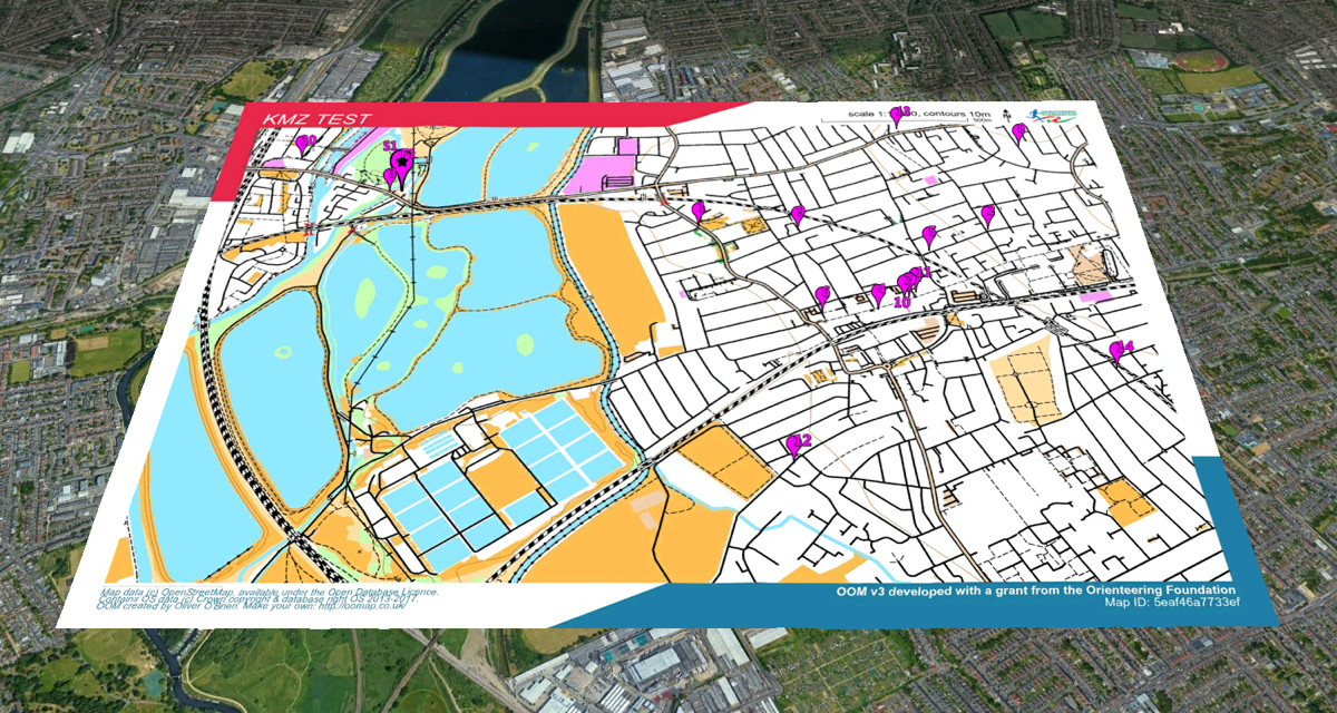
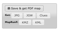
Once you’ve saved your map and course, you can click on the KMZ and KML buttons to download a map and courses file respectably. You can then upload these to Check Sites, note down the ID number, and load it into your phone running MapRun F. Straight away, you have your orienteering map and courses, ready to run!

The KMZ map file does not include the courses or start/finish marker, as these are contained within the KML course file. However, it does contain any crossing point “bridge” symbols or do-not-cross “X” markers that you added.

The KMZ and KML files also work in Google Earth:

Try OpenOrienteeringMap – the UK and Ireland editions update daily from OpenStreetMap, while the Global edition updates once or twice a year – but you can create a map at any time! Look out also for a daily updating Australia version soon.

Categories
OpenStreetMap Orienteering

OpenOrienteeringMap Version 3

OpenOrienteeringMap, the easy online tool for creating street orienteering maps from OpenStreetMap data, has been updated to version 3. Development for this version was kindly funded with a grant from the Orienteering Foundation.

New features for version 3 include:

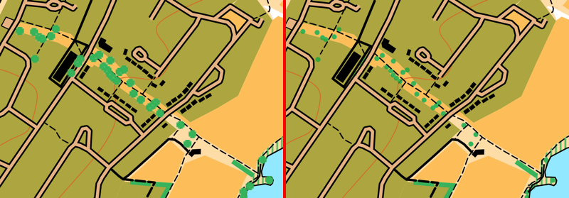
  • Better trees! We now use SVG graphics for lone trees (and monuments). This means they are scaled correctly when appearing on the map, both on the screen and on the high quality ready-to-print PDFs. The use of SVGs and better scaling means that the trees now don’t dominate the map at smaller scales. In addition, trees are drawn underneath line features, so that they don’t obscure, for example, path detail. The same treatment is applied to monuments, too. This fixes one of the most requested bugs on the OpenOrienteeringMap Github. See above for the difference – note the better scaling, lack of pixalation, and less obscured paths, on the right!
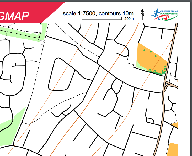
  • Similiar vectorisation improvements have taken place for fences, walls, power lines, cliffs and embankments. These linear features have regularly spaced markings to indicate their type. Previously, these markings used PNG images, which did not work well for the high quality vector PDFs. These have been replaced with SVGs, which scale correctly and print at high quality, through the use of a different kind of Mapnik symbolizer – a MarkerSymbolizer rather than a LinePatternSymbolizer. The only remaining raster graphics that appear on an OpenOrienteeringMap are the fill textures for polygon areas, such as vegetation undergrowth. These use PolygonPatternSymbolizer, which does not support SVGs and has no equivalent symbolizer which does.
  • We now include benches, picnic tables and litterbins on the maps. These are shown as small black crosses.
  • JPEGs can now be produced for OpenOrienteeringMap. This is very useful for adding OpenOrienteeringMap maps to platforms like Routegadget or OCAD (as background map) where JPEGs are required. PDFs should still be continued to use for printing, as they will result in a much higher quality map, but you no longer need to manually convert to JPEG using an image editor or other additional software.
  • In conjunction with the above, geolocation “Worldfiles” can now be produced for OpenOrienteeringMap. These are small config files that allow a JPEG (or PDF) OOM map to appear in the correct place on a location-aware service, such as Google Earth, Mapper from the OpenOrienteering project (not tested) or similar.
  • Some of the details from the “Pseud-O” map style on OOM have been ported across to the standard “Street-O” maps. This includes trees, monuments, powerlines, sports pitches and hedges.
  • Some layer reordering – contour lines now go across roads and above buildings. The shape of the land is important, and so this change makes it easier to see hills and slopes.
  • Buildings on the Pseud-O map style are now shown as grey with black borders, rather than all black as before, this stops them from overwhelming the Pseud-O map in city centres.
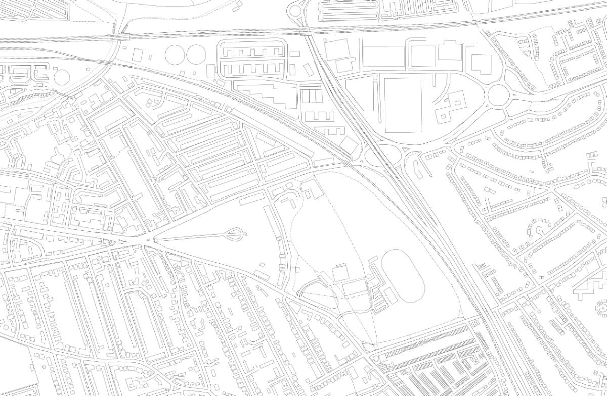
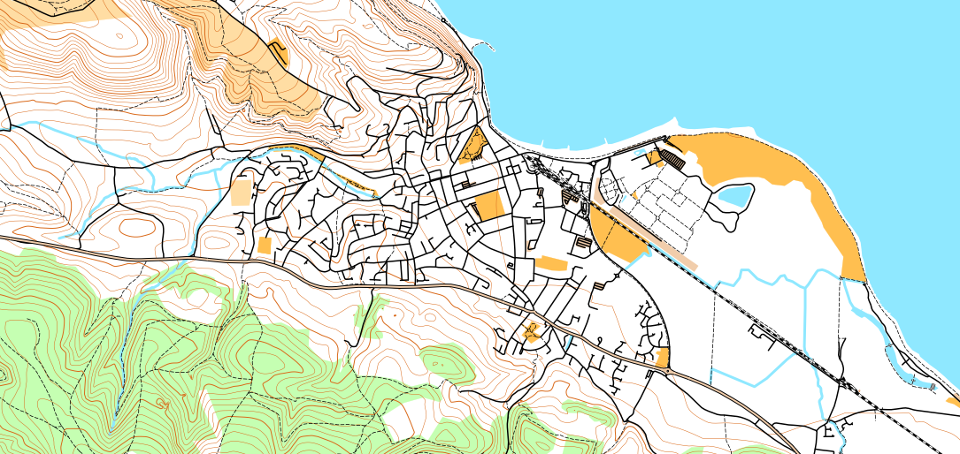
  • A new style, Blueprint, has been officially launched. This style (see example at top) which was in beta for a while, is different to orienteering maps, as it is designed for people who want to create a map of their local area to colour in! A simple set of very think black lines, with lots of white spaces, is produced, allowing a simple high-quality map of local areas to be produced, ideal for colouring in! Blueprint doesn’t include contour lines and doesn’t allow controls to be added. You can try it out here.
  • The global map database has received a bulk update, so now covers changes/additions made to OpenStreetMap up to around early August 2017. The UK database continues to enjoy daily updates (changes appear approximately 48 hours after the corresponding edits in OpenStreetMap).
  • Branding of the website and the PDF maps has been updated to recognise the support received from the Orienteering Foundation.
  • The grant also partially supports the hosting/bandwidth costs associated with OpenOrienteeringMap for the next twelve months.
Categories
Orienteering

OpenOrienteeringMap – Postcode Search Fixed

A minor update to the GB edition of OpenOrienteeringMap – the postcode search has been fixed. Typing in a valid GB postcode should now jump to the map to the centre of that postcode. Note that postcode search for Northern Ireland is not available.

Categories
London Orienteering

London City Race Mega-Map

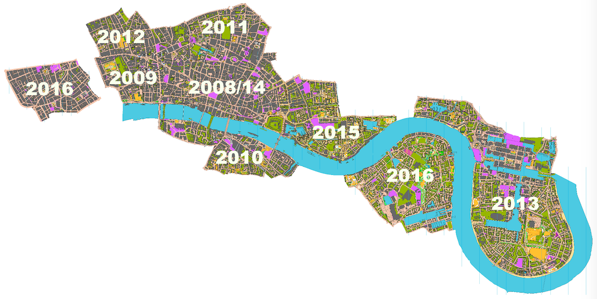
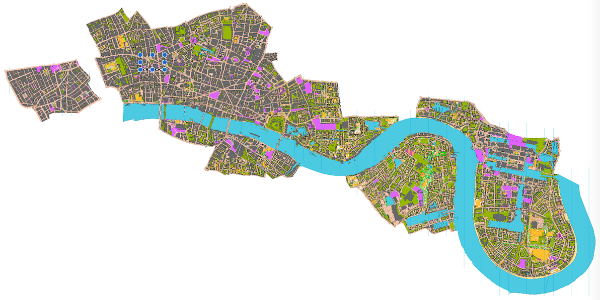
Below is a low-resolution view of the London City Race orienteering maps that have been used since the race was first held in 2008, arranged geographically to show their relative position. The maps were drawn by myself (initially) and Remo Madella (subsequently) who joined them together and assembled this image. Dark grey represents buildings, with olive green for private gardens and other off-limits land, and pink showing construction sites. The map is not entirely up-to-date, as only the relevant section is updated/extended, for each race.

There are only a couple of small gaps, between Covent Garden and Aldwych, and between Wapping and Limehouse. These aside, it would be possible to run on a proper urban (ISSOM) orienteering map, from Oxford Circus in the West End, right down to Island Gardens on the tip of the Isle of Dogs. Such a run would be well over 10km, and the accompanying map would be over two metres long at its 1:5000 native scale.

Here’s where each area was first used. 2014 was the only edition of the race, to date, that did not expand the map:

The maps contain OS data which is Crown Copyright and database right Ordnance Survey, 2007-16, with licence # 100015287 for non-OGL content.

Categories
OpenStreetMap Orienteering

MapOnShirt

COyiL04UAAQkgk3

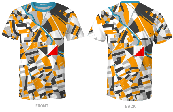
Here’s a great idea well executed – MapOnShirt uses OpenStreetMap data and some nice custom styling – and an easy-to-use website, to allow you to design your own T-shirt of anywhere in the world. It works best in large built-up places, particularly across new-world cities with their grid structures and other large-scale planned road topologies, but familiar shapes in older cities work too – such as the River Thames.

MapOnShirt was kind enough to create a mock-up of a shirt for the recent Street-O race in London that I organised. I reckon these kinds of shirts would make for great prizes for such events.

Categories
Orienteering

OOMap 2.4 – Add Plaques from Open Plaques

oomv24

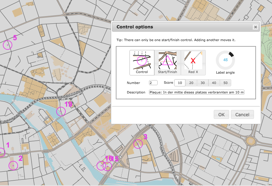
OpenOrienteeringMap can now automatically import the locations and details, of public plaques, as suggested controls, into the area where you are creating a map. The service uses the API from Open Plaques, which is a global open-source database of public plaques. In the London, the most commonly known plaques are the “Blue Plaques“, which are put up by English Heritage and typically mark the houses where the great and good of times past live. However, there are many other types and colours of plaques which are also recorded in the database and accessible now on OpenOrienteeringMap. Thanks to Jez and the team at Open Plaques for building a comprehensive open database, with a fast and flexible API to access it. Once you’ve placed your map, just click “Add Plaques” and a control will be created to represent each plaque. The locations are sometimes imprecise so ground-truthing is always recommended.

If you discover plaques that are not in Open Plaques, then please add them to the project so that OOM and other services can benefit from the extra data. Additionally, if you discover more accurate locations for plaques, you can update Open Plaque with this information. If you take photos, add them to Flickr or WikiCommons, tagging with their Open Plaques ID to link each photo to its corresponding record.

The functionality is similar to importing postboxes, another popular control type for informal Street-O events, which was added in v2.3, except that the plaques are available across the global and other editions of OpenOrienteeringMap, as well as the UK edition. However, please note that, at the time of writing, plaques have been most widely recorded in the UK, USA and Germany, each of which has over 5000 plaques. Other countries have (a lot) fewer, so you are likely to see a “no plaques available” message when you try and import them in to places in other countries, except perhaps in the centre of major cities.

Also for v2.4 I’m using newer versions of the JQuery and JQuery-UI libraries, and have slightly tweaked the user interface for the new Plaques button. The paper orientation toggle also now has some nice logos, and some bugs relating to tip display have been fixed.

Try it out now. As ever, OpenOrienteeringMap is completely free to use, if you find it useful for your event, and it saved a lot of time for you or your club mapper, then feel free to tip, see the links in the pink box.

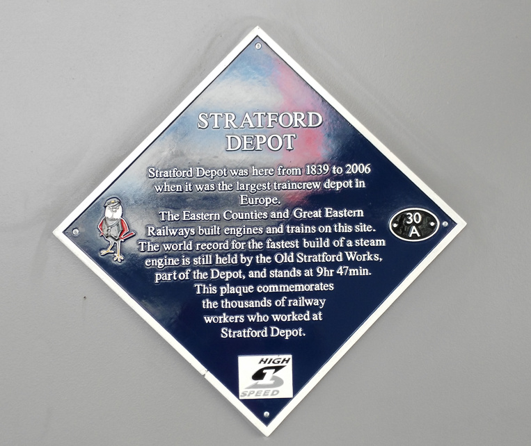
(N.B. The full plaque text is used as the control description, so this should be edited and partially removed, should you use the automated clue sheet option in OpenOrienteeringMap, so that the competitor has to prove they are there by writing an appropriate part of the text.)

stratford_plaque

Categories
OpenStreetMap Orienteering

OOM 2.3 – Automatic Postbox Additions

postboxes

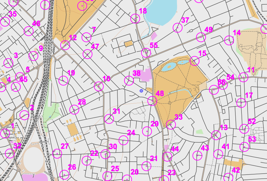
As a fun project for OpenOrienteeringMap (OOM) during the Christmas pause, I incorporated a feature requested on the forums of NopeSport that I had actually also been thinking about myself – the automated addition of controls. I’m using Nearest Postbox which is a tool written by the polycoder Matthew Somerville to show postboxes in OpenStreetMap augment with reference numbers and other data. If you zoom into an area on the UK edition of OOM and click to add a map “sheet”, you can then click on the “Add Postboxes” button. OOM will make use of Matthew’s API to his site, to pull in known postbox locations and create controls from them. You’ll only be able to do this if there are not any controls already added. You can then edit/delete the controls (e.g. change the score) in the normal way.

postboxes_button

Some Street-O events by SLOW and other clubs already use postboxes as useful controls. This will hopefully make it more easy for the planner, although they’ll still need to visit the postboxes concerned to verify the ref and make sure the postbox is still there…

The feature is experimental, so if you run into any bugs please tell me.

Categories
OpenStreetMap Orienteering

OOM on OpenCageData

I was interviewed by OpenCageData recently, the article appears on their blog and I have reproduced it here:

Continuing in our series of interviews with folks doing interesting things in the open geo world, today we enter the realm of domain specific OpenStreetMap variants by talking with Oliver O’Brien, maker of Open Orienteering Map.

1. Who are you and what do you do? What got you into OpenStreetMap?

I’m Oliver O’Brien (“Ollie” on OpenStreetMap). I’m a researcher and software developer at the Department of Geography at UCL in London, specialising in geovisualisation and demographic mapping.

I’ve been a contributor to the OpenStreetMap project since 2007. I first learnt about it when a friend was keen to try out lots of different routes around Edinburgh during the Hogmanay festival, recording them with a GPS receiver. He explained he was uploading them to a project – OpenStreetMap – a map that anyone can edit. At the time it was nearly blank in the Edinburgh area. When I got back to London I discovered that many of the roads in my local area were missing too, so got down to filling them in. At the time, the project did not have access to high-resolution aerial imagery, so GPS traces were very useful – as were annotating note by hand on various scraps of paper! I then discovered the thriving London OpenStreetMap community – we organise mapping parties, though now, as London is largely “done”, it’s generally pub meets. I’m lucky enough to regularly use OpenStreetMap data for my day job at UCL, sometimes including my own contributions.

2. What is Open Orienteering Map? What is the goal of the project?

My orienteering club (South London Orienteers, aka SLOW) has been running informal “Street-O” evening training events in various parts of London, for many years. The idea is that you have to visit as many points, marked on a printed map that you run with, as possible within one hour, and get back to the start. The route you take is up to you, so it’s vital that the map you use doesn’t get you lost. Many of the maps being used at the time I first joined the club were created in fiddly (and expensive) bespoke software used for professional maps, typically by hand, tracing in A-Z or Ordnance Survey paper maps. The process was prone to error and very slow.

Having seen OpenStreetMap data being used in various other projects, such as Andy Allan’s OpenCycleMap, I realised there was potential for it to be used for orienteering mapping too. While regular orienteering maps contain a lot of specialist features not on OpenStreetMap (such as forest thickness and crag detail), basic Street-O maps are simpler, and for many areas, OpenStreetMap likely has sufficient level of detail. Initially I set up a system which required GIS software to use, with appropriate orienteering styles and filters, but that was still hard to use for people outside the GIS world, so I then realised I could go one step further and build a website – http://oomap.co.uk– that performed the same function. So OpenOrienteeringMap was born.

The goal of the project is to make it as easy as possible for the volunteer Street-O organisers to create maps for their events. This has two main benefits – firstly, with less spent time on drawing the map, and no cartography skills needed – the website generates a PDF map to print, at the click of a button – more new people can get involved and organise their own event, taking time to plan great courses rather than draw a map. Additionally, it encourages new people into the OpenStreetMap community. By making the only easy way for organisers to update the roads, paths and other features on the Street-O map being via OpenStreetMap – with a regular refresh of the database back to OpenOrienteeringMap – the website has got a few people hooked on being “regular” OpenStreetMap editors, as well as orienteers. (N.B. if I rebuilt the service now from scratch I would probably use something the Overpass API and vector tiles directly in the browser, rather than have my own copy of the database and an image tiler and PDF generator.)

There are three versions of the website: British (with OS Open Data contours), Irish and worldwide, and two main mapping styles, “StreetO”, used for Street-O races, and “PseudO”, which is an attempt to create a “regular” orienteering map style in OpenOrienteeringMap, following the colour and symbol standards defined by the sport. It has a distinctive look but is of less use for orienteering events except in a few very well-mapped places. The styles are on GitHub.
rihcmondstreeto

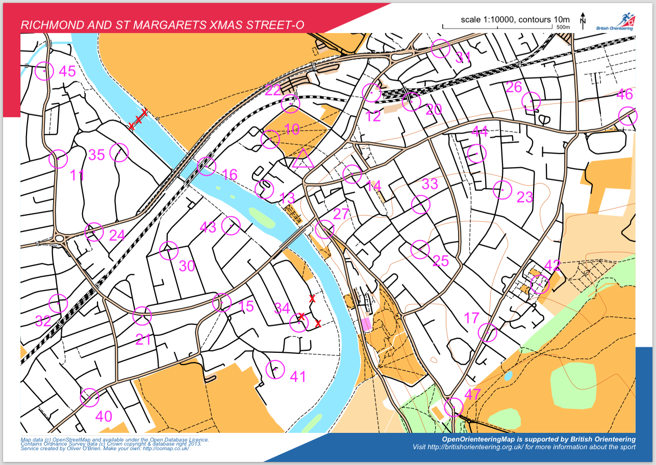
Above is the map that is being used for the next South London Orienteers’ Street-O event, in December 2014, with around 100 people taking part. Further details of the events can be found at http://slow.org.uk/about/streeto/. Map data Copyright OpenStreetMap contributors.

3. What are the unique needs of a map designed for orienteering? How has using OSM to meet those needs worked out?

Orienteering maps need to be highly detailed, clear and accurate, as competitors run through unfamiliar terrain at speed and the accuracy of navigation is as important as speed, when it comes to getting a good result. This general principle applies to Street-O events, where it is important that all navigable roads, tracks and paths are included and that the map is as uncluttered as possible. Other datasets can often neglect tracks and paths in particular, but OpenStreetMap has historically had a good record in this regard, being a grassroots community comprised of many enthusiastic walkers and cyclists, amongst others. The data isn’t perfect, but for areas in London that my local club users, it’s worked out pretty well. Sometimes missing detail is spotted by the organiser and they edit OpenStreetMap to fix it. Occasionally it isn’t spotted and competitors report back missing paths at the race finish – edits can then be made which will benefit future races there. Both these processes improve OpenStreetMap itself (for everyone) while also improving OpenOrienteeringMap (for racers), so everyone benefits.
6160108706_c4363f55bf_z
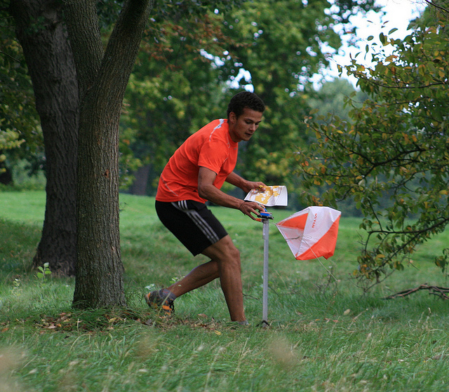
Competitor in a London park. Although he is using a custom drawn map for this particular race, the level of detail in some London parks on OpenStreetMap means that OpenOrienteeringMap is a possibility for more informal events here. Copyright Oliver O’Brien.

4. What steps could the global OpenStreetMap community take to help support the use of OSM in unique communities like this?

One feature which would be of great use, would be the ability to “sign off” certain areas has achieving a particular level of completeness, e.g. a local contributor confirming that, to their knowledge, an area in a particular bounding box has all the roads and paths on it. Such a mechanism was created by ITOWorld with their OSM Quality tool, for Great Britain, using complementary data from the national mapping agency, however a global version, using experienced OpenStreetMap editors as the authority, would very useful in encouraging Street-O event organisers to use OpenOrienteeringMap or other tools for using the data in orienteering events.

5. OSM recently celebrated its 10th birthday, where do you think the project will be in 10 years time?

It will be a map with virtually every building and road in the world on it. Improving and more accessible satellite and imagery will greatly help with this process. Detail will increase too, but I don’t think it will end up mapping every tree or lamppost – there will be spinoff projects which will cover things like that. The project’s licence does ensure that the data will always be as good as it is currently and so can only get better still. I think also, the project emphasis will shift away from the standard “openstreetmap.org” front page map and become more known as the definitive map data store for the world, with other websites becoming the primary way the data is viewed. The project is sometimes described as the “Wikipedia of mapping” and I think it will encounter the same problems, and come up with the same solutions, that Wikipedia did – such as dealing with vandalism of the dataset by having different levels of editors, area guardians and protected places. More generally, I see many more projects like OpenOrienteeringMap filling particular niches and the parent database continues to expand. Perhaps the database will form the start of a global postcode system?

Many thanks Ollie! A great example of a practical application of open geo data. Anyone who is interested in the project can learn more here. OpenOrienteeringMap is just one of many geo related projects Ollie is involve in, I highly recommend everyone follow him on twitter and read his blog.
Categories
Orienteering

Where in the World…

oom_world

…is OpenOrienteeringMap being used to create simple maps, for training and small “Street-O” events?

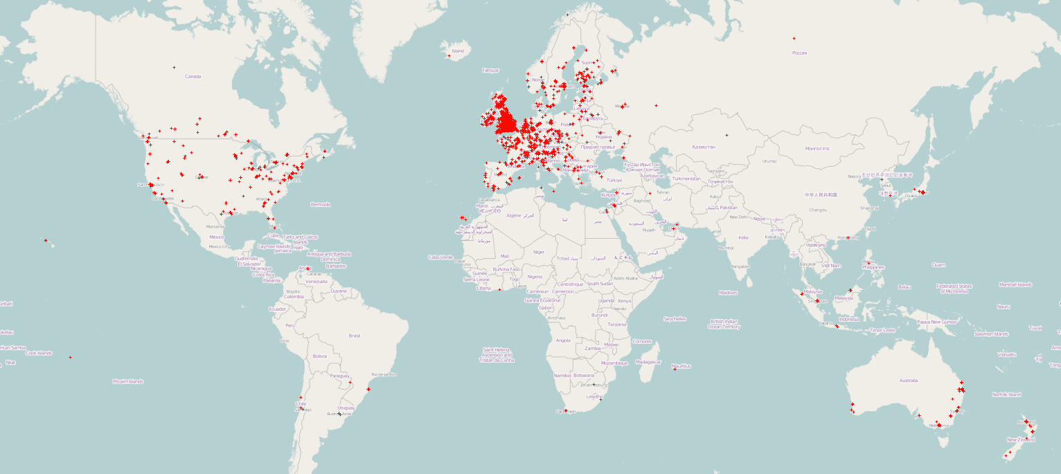
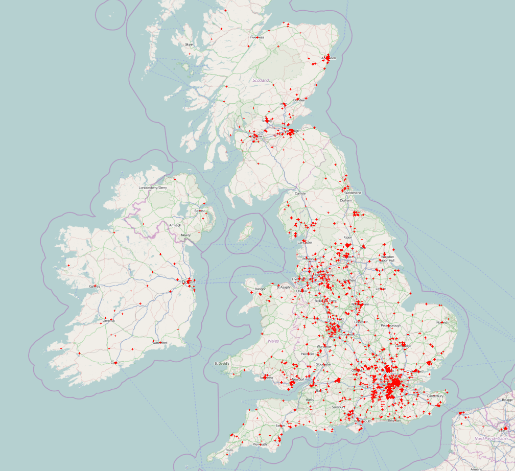
Since the all new (version 2) of OpenOrienteeringMap launched 19 months ago March 2013, almost 7000* maps have been created (4300* in the UK), with around 40000 control features added to them. Above (click for large version) is a map showing where in the world these maps have been created. Below is a zoomed in version for the UK. If your local club hasn’t put on a Street-O yet, then why not ask them to do one – with the map already drawn in OpenOrienteeringMap, putting on a Street-O event has never been easier.

oom_uk

Maps here use background data which is CC-By-SA OpenStreetMap contributors. The background data from the maps, and used in OpenOrienteeringMap, is Copyright OpenStreetMap contributors and licensed under the Open Database Licence (ODbL).

* Planners/organisers will may produce several maps for a single event, as they iterate towards their desired final race map. A new map is created every time they save. If we look at unique map centroids, then the number is 5000 for the world, of which 3000 are in the UK. Additionally, a proportion of maps will have been created without any controls added to them, likely for purposes other than Street-O.

Categories
Orienteering

OOMap 2.2 – Closed Route Crosses

crosses2

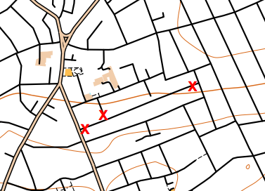
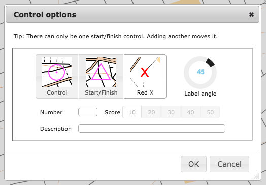
OpenOrienteeringMap 2.2 has been released, with a significant new feature addition – closed route crosses. These allow you to manually mark routes as out of bounds, for example along roads or paths which are private and locked at either end. The crosses are red “X”s, they are added singly, using the same dialog box for adding controls.

It is recommended that you places a little distance away from junctions, so that it is clear which road/path is being marked as closed,(and because the crosses will be sized slightly differently in the PDF that is created). You cannot edit or move existing red crosses, as they do not have an edit button in the control descriptions list, but you can delete all the red crosses you have added with the “Delete Xs” button at the top.

crosses1

I’ve also updated the styles slightly:

  • leisure=garden now included, shown as yellow (open ground). Previously it was shown as olive green (out of bounds) on Pseud-O or as white (not mapped) on Street-O.
  • Waterways in tunnels (such as canals or underground rivers) are no longer shown.
  • landuse=greenfield and landuse=brownfield no longer shown, as these are just legal designations.
  • landuse=construction and landuse=landfill now shown with light pink overlay rather than vertical black lines (Pseud-O) or white (Street-O).
  • On Pseud-O, fences (barrier=fence) are now shown with the fence symbol, rather than the wall symbol.
  • On Pseud-O, sports pitches no longer automatically have a fence shown around them.

The styles are open source, in Mapnik XML format, and can be found here on GitHub.

Why not try out the new feature now!

The OpenOrienteeringMap service is giftware. If it’s useful for you, it helps you run a successful event, or saves you time mapping, please buy me something on my gift-list or buy a print. Or buy yourself something through my Amazon store link. Gifts will encourage further development and offset the costs of hosting the site. The styles are open source (see link above) and you are encouraged to adapt them!