Ordnance Survey have this week released four new additions to their Open Data product suite. The four, which were announced earlier this month, are collectively branded as OS Open and include OS Open Map Local, which, like Vector Map District (VMD), is a vector dataset containing files for various feature types, such as building polygons and railway stations. The resolution of the buildings in particular is much greater than VMD – surprisingly good, in fact. I had expected the data to be similar in resolution to the (rasterised) OS StreetView but it turns out it’s even more detailed than that. The specimen resolution for OS Open Map Local is 1:10000, with suggested uses down to a scale of 1:3000, which is really quite zoomed in. Two new files in OS Open Map Local are “Important Buildings” (universities, hospitals etc) and “Functional Areas” which outline the land containing such important buildings.
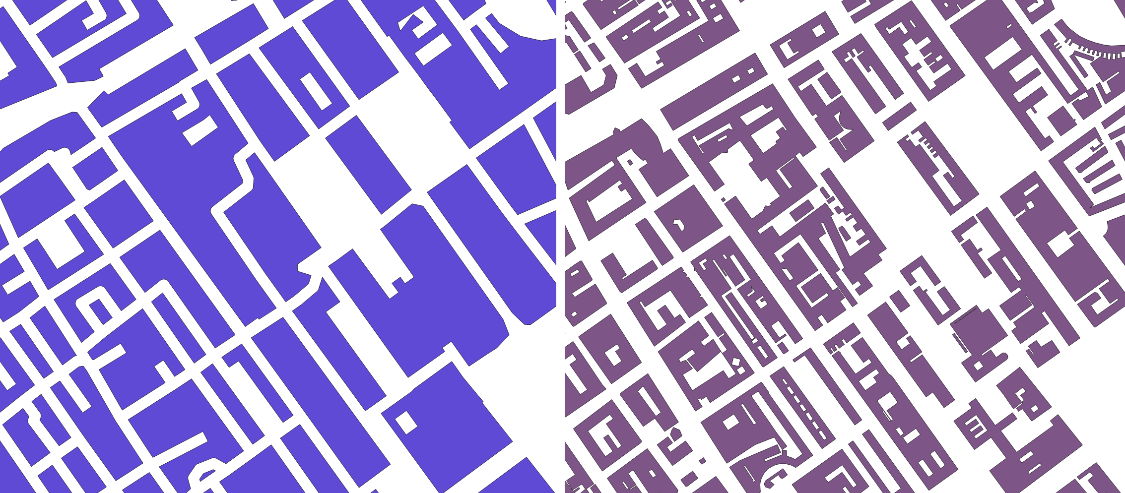
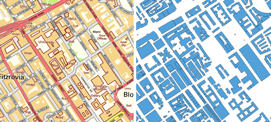
Above: Comparing the building polygon detail in the older Vector Map District (top left), previously the largest scale vector building open data from Ordnance Survey, and the brand new OS Open Map Local (top right). The new data is clearly much higher resolution, however one anomaly is that roads going under buildings no longer break the buildings – note the wiggly road in the centre of the top left sample, Malet Place, which runs through the university and under a building, doesn’t appear in full on the right. Two other sources of large-scale building polygons are OS StreetView (bottom left), which is only available as a raster, and OpenStreetMap (bottom right). The OS data is Crown Copyright and Database right OS, 2015. The OSM data is Copyright OSM contributors, 2015.
The other three new products, under the OS Open banner, are OS Open Names, OS Open Rivers and OS Open Roads. The latter two are topological datasets – that is, they are connected node networks, which allow routing to be calculated. OS Open Names is a detailed gazetteer. These latter three products are great as an “official”, “complete” specialised dataset, but they have good equivalents on the OpenStreetMap project. OS Open Map Local is different – it offers spatial data that is generally much higher in accuracy than most building shapes already on OpenStreetMap, including inward facing walls of buildings which are not visible from the street – and so difficult for the amateur mapper to spot. As such, it is a compelling addition to the open data landscape of Great Britain.
The OS also confirmed last week the location for its new Innovation Hub. It is indeed a mile from King’s Cross – specifically, it’s in Clerkenwell, and the hub will be sharing space with the Future Cities Catapult. Conveniently the new space has a presentation space and the May Geomob will be taking place there.
One reply on “OS Open”
[…] » Pour lire la suite, rendez-vous Suprageography […]