Categories
Bike Share Conferences

A Glimpse of the Future in Paris

Two Lime escootershare scooters being used on the former highway in Paris beside the River Seine that is now a peaceful, traffic-free route. The scooters are passing a rather well hidden New Velib bikeshare docking station.

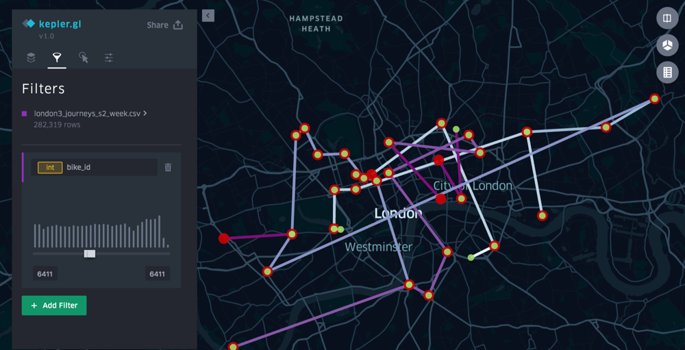
I was in Paris just before Christmas, taking part in a workshop at IFSSTAR (Université Paris-Est) on innovations in flow visualisation – GFlowiz. I talked/demonstrated some old and new ways that I and others have shown commute journeys in the UK on the web, looking both at The Great British Bike to Work and TubeCreature (developed with the HERE mapping platform), as well as some tests, with open bikeshare data, of the new React/WebGL/Deck.gl-based Kepler.gl recently developed by the Uber Engineering for interactively visualising large spatial datasets locally in a web browser. Kepler.gl works well with bikeshare flow datasets of up to around a million journeys, which, as CSVs with lat/lon pairs, can be simply downloaded, dragged and dropped into the web application:

Showing the journey of a single Santander Cycles bikeshare bike over a week in July, using Kepler.gl. Journey starts/finishes are green/red and the lines become more purple as the week progresses.

I enjoyed the other talks in the workshop too, especially the introduction to flowmap.gl by its creator, Ilya Boyandin of Teralytics.

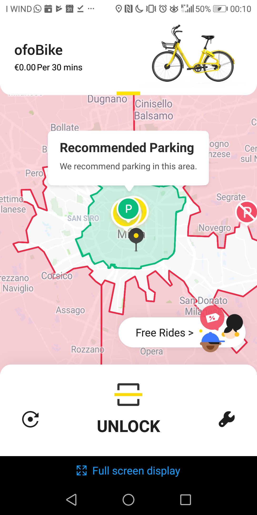
I had a few hours left after the conference to explore the centre of Paris, so I embarked on a long walk from Forum des Halles to Notre Dame, and then up to Gare du Nord. Paris has undergone a bit of a shared/smart mobility revolution on the quiet, since I last visited a couple of years back. Escootershare has taken advantage of the disastrous start to the relaunch of Velib at the beginning of 2018, and France’s more liberal traffic laws than in the UK, with numerous companies launching their operations there. Some dockless bikeshare systems have had a go, although Ofo at least has now disappeared from Paris, and the trend for the rest doesn’t look good either. 

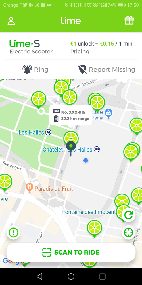
Lime escootershare bikes available (according to the app)

So, along my walk, I noted down all the escooter/bikeshare brands in use that I could see, along with the incumbent Velib service. There were also quite a few personally owned (or possibly white-label shares) that I spotted scooting past, which I didn’t note – for scooters at least, these were in total easily outnumbered by the brands.

Escootershares are, at the moment at least, all dockless, rather than being locked in physical stations, and I believe they tend to get taken in by casual workers overnight for recharging. My walk took place between around 6pm (i.e. end of rushhour) and 8:15pm, and I saw plenty being operated even at the end of the survey interval, so I would presume that the escooters are generally collected after this time. 

Overall, I was impressed both by the uptake of these devices, and the care in which they were left after use. I saw no sign of any vandalism (although I did mostly stay in the more touristy parts of central Paris) and very few were inappropriately parked. I can’t say for sure that all the ones I marked as parked upright were not blocking pavements or crossing (e.g. tactile strips, dropped kerbs) in such a way that someone in a large wheelchair might have an issue, but on the whole I got the sense that they were not the pavement intrusions or litter that many of the London dockless bikeshares have become.

I saw:

Brand Being
Used
Left
Upright
Knocked
Down
Stations or
Groups (3+)
Empty
Stations
Lime (escootershare)191820n/a
Bird (escootershare)71000n/a
Bolt (escootershare)3411 (with 5)n/a
Wind (escootershare)0500n/a
Tier (escootershare)0100n/a
New Velib
(bikeshare+ebikeshare)
360071
Donkey Republic
(dockless bikeshare)
0200n/a
Mobike
(dockless bikeshare)
0700n/a
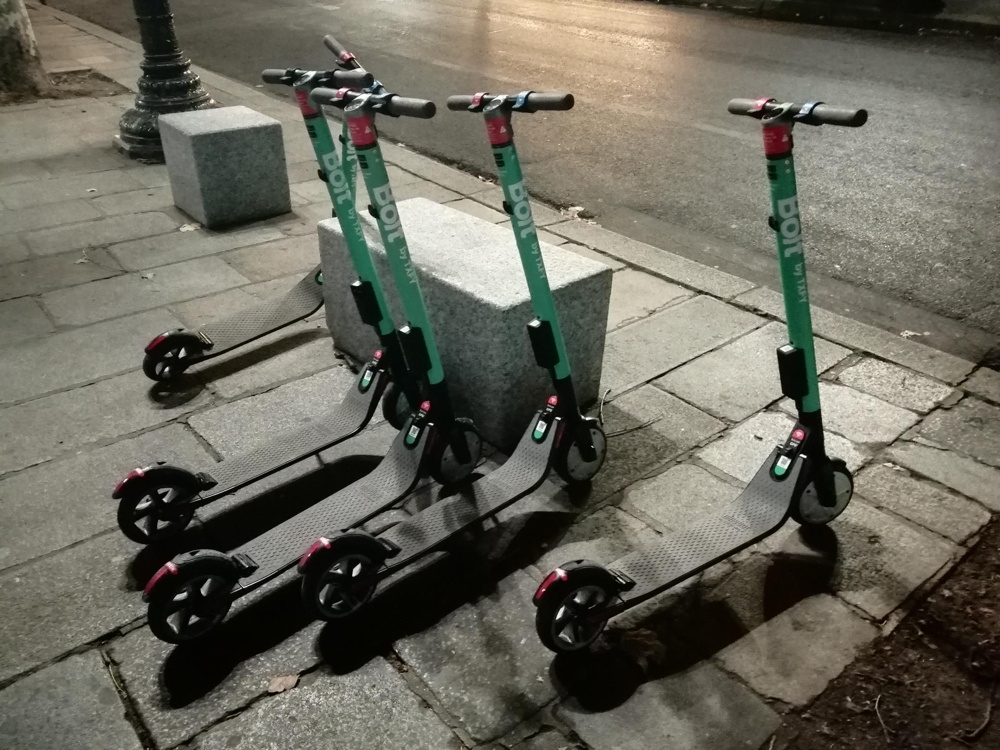
Five “Bolt” escootershare scooters – the only “group” of scooters I saw in Paris.

So in summary, from my unscientific survey, the dockless bikeshares are not really being used at all, the Limes and Birds are being well used, the new Velib is being used but not in the numbers I would have expected, and they are all generally being left tidily. I have no doubt that, in their current configuration/use level and street scene impact, the escootershares are a positive to the city. They are not cluttering the streets, and those that are there are being well used. There are too many operators, for sure, so some consolidation is needed – no one wants 6 share apps on their phone, but Lime and Bird at least have a good level of usage. It is very sad to see the Mobikes lying around unused, and with so few left, but they were a bike that was, initially at least, not properly designed for the European market. You can’t take shortcuts with new mobility solutions if you want them to actually be solutions. Maybe their lower profile approach will allow them to spot the markets where they can thrive, and give them the flexibility to adapt as necessary.

In London, we’ve moved on a bit from the autumn, where both Ofo and Mobike had retrenched considerably from June’s moment of “peak bikeshare”, even though we’re a long way behind Paris, thanks to escooters essentially being illegal both on pavements and public highways.

  • Mobike has expanded a little bit again, back to Ealing, although their two operating areas in London are very small. The bikes are generally now always in operator-placed groups, and while these are very visible, there are few bikes which are on their own, suggesting little use by actual genuine users. They’ve massively densified the number of bikes available in the areas, however they have attached “£20 fine for leaving bike out of zone” type stickers to all the bikes – and as these zones have changed several times since launch, I can’t blame users for not daring to use the bikes. I would not be surprised if they were seeing less than 1% of the journeys (or 10% of the j/b/d) of Santander Cycles. They also seem to struggle to monitor where their bikes actually are, or what state they are left in, as the few that are out of the operator-placed groups, are often left knocked down, for days at a time. It’s not a good look on London’s pavements, and it’s an effective way to lose the non-riding public’s sympathy unfortunately.
  • Ofo’s operating area didn’t shrink down as far, but unlike Mobike they haven’t restocked, so there are very few bikes to be seen anywhere in central London or the other parts of the operating area. It’s almost impossible to find one for a journey, now.
  • Both stolen Ofos and stolen Mobikes are appearing less often. This is probably because there are less available to steal, and the ones that were stolen are probably in very bad condition now. Occasionally you still see a youth on a stolen one, the bike sounding like it’s about to fall apart.
  • Lime has launched their ebikeshare in west London (Ealing, parts of which still have Mobike, and Brent, which was supposed to have had Mobike too but didn’t launch). You can’t officially therefore take Lime Bikes into central London. I don’t know if the motor cuts out if you do, but quite a few are appearing in central London anyway, and I think you may even be able to start from here (i.e. out-of-zone). Their starting price is very expensive though – £1 + 15p a minute. This means, after 3 minutes, it would have been cheaper taking the bus, tube or train. £1.50 flat rate for half an hour would have been better. But it’s a start, and though they are not escooters, unlike in Paris, the strength of the Paris operation suggests Lime knows something about how to run these.
  • There is also an escootershare in London! Bird have launched. However, it is only available on a single route in East London, on park land that is not covered by pavement/public road restrictions. You can scoot your “Bird” between Here East, the former London 2012 Olympic media centre which is now a start-up hub that is currently very poorly connected to tubes/trains, and Stratford station, which is incredibly well connected. Again, they are very expensive – £2.50 a ride. There is a free shuttle bus between the two points, too. So, really, it’s acting as a demonstrator. But, you have to start somewhere for escootershare in the UK and this is a start.
  • Santander Cycles are still not expanding, and unlikely to ever expand with TfL’s new financial woes and insistence on building very expensive permanent powered docking stations with card terminals, in a high density formation. But they did record five consecutive months this summer with over a million journeys each month. Their fleet seems to be in good working order and popular. I still think a redeployment of some docking stations further out, cheaper app-only stations, and an introduction of a Bike Angels style user rebalancing, would enhance things, but the system/contract is I suspect not set up to encourage radical innovations like this.

I look forward to 2019 as a year in which smart mobility technologies will continue to make cities better places. Look out on this blog for some exciting news, soon.

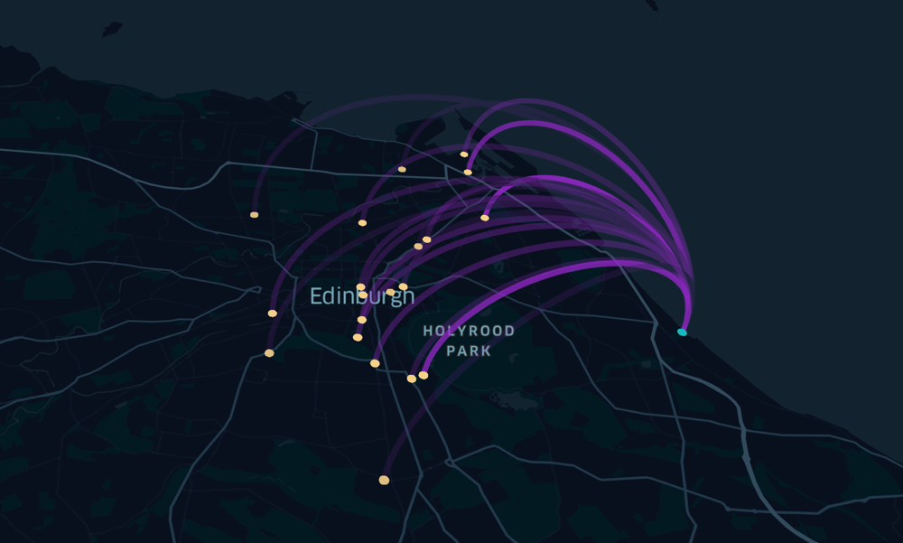
Journeys from/to a Just Eat Cycles docking station in early December, in the east of Edinburgh. Visualised in Kepler.gl. Translucency is being used to indicate multiple journeys between the same two stations.
Categories
London

London’s 9 Million Day – Delayed

I’ve been keeping an eye on London’s population projections, and indeed have featured them in a couple of presentations recently – at a TedX event and also a CRUK data visualisation conference at The Crick. By taking the most recent mid-year population estimates for London, and the annual population change, I can simply linearly extrapolate forward to see where it hits 9 million.

When I first put my presentations together, I was working off 2016 mid-year population and population change estimates. Since then, the 2017 estimates are out and have dramatically changed London’s “9 million day”.

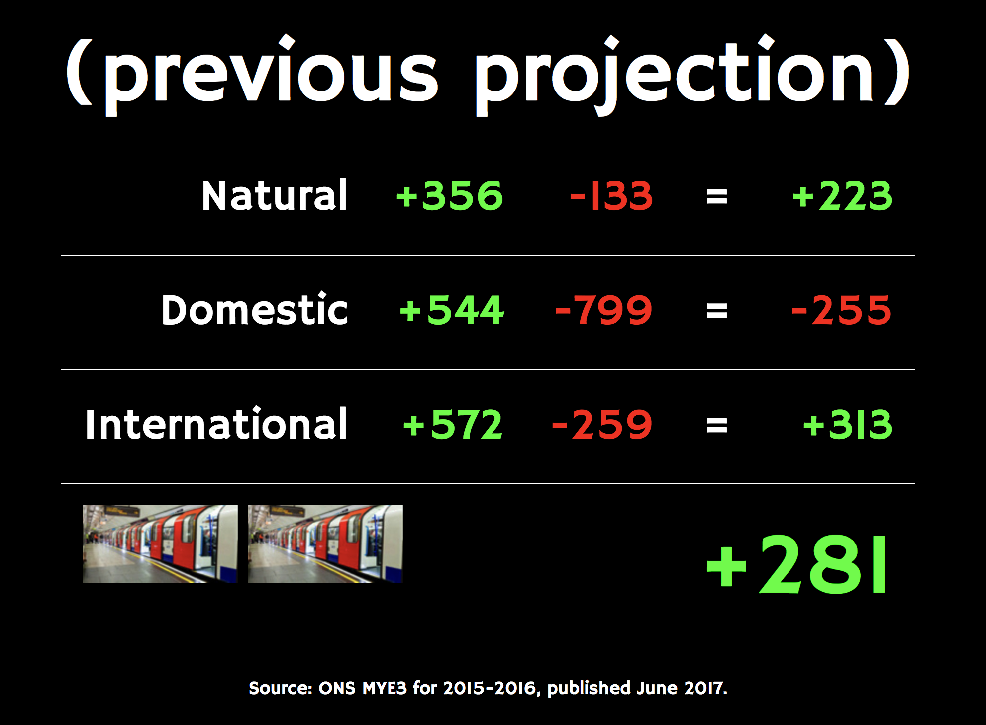
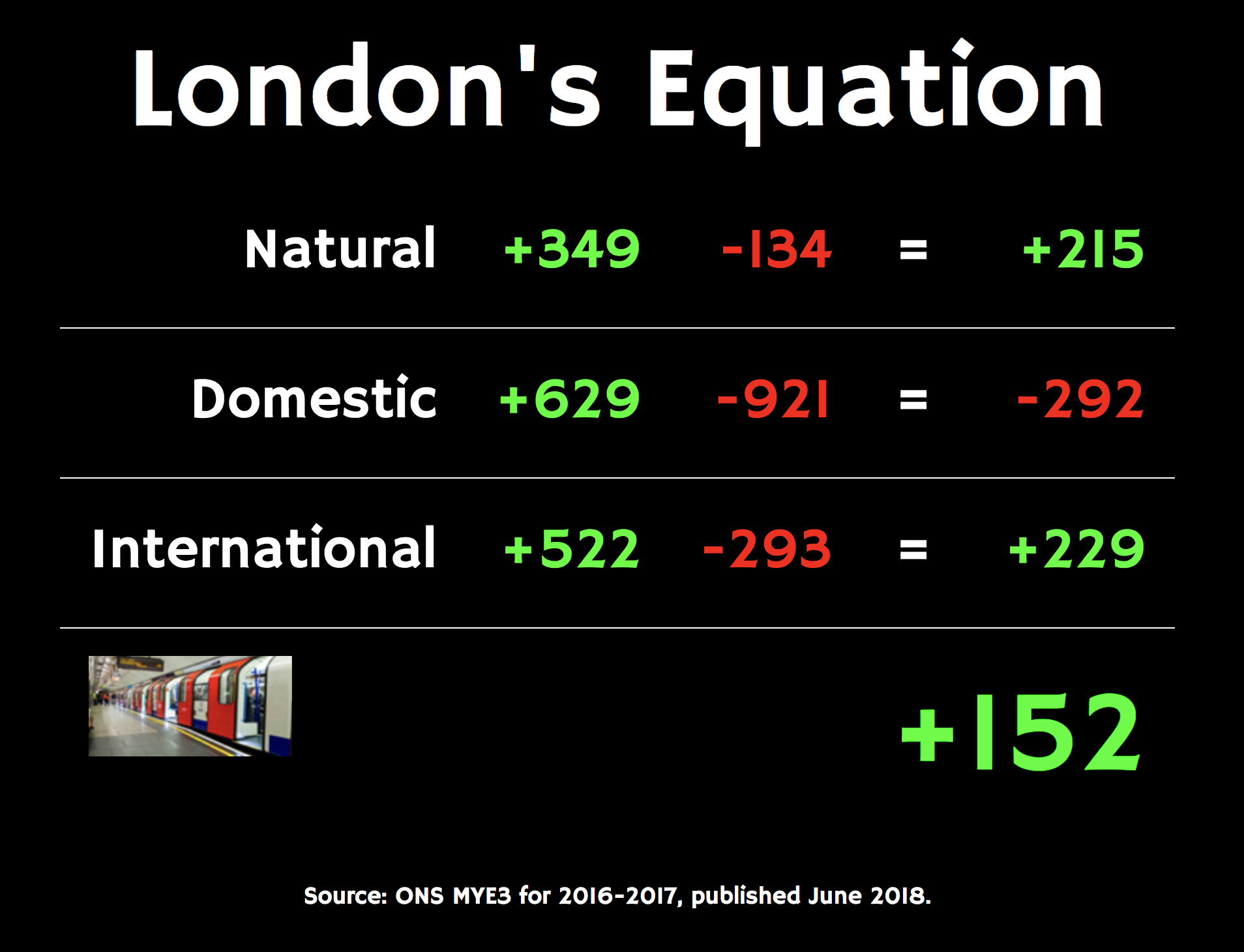
Here’s the daily population change in London, inflows and outflows based on natural factors (births/deaths), internal migration (from/to other parts of the UK) and international migration (to/from the rest of the world) –

Before:

Now:

Daily numbers are a simplification – through the year, the rates vary hugely, particularly at the start of the summer holidays and autumn term, where large numbers of interns and students, respectively, move into London. The numbers do however take care of short term migration, as they only reflect those who intend to stay (or leave) for at least a year.

The reasons for the change are not clear, I suspect it’s a combination of Brexit making London less attractive for international migrants, and increases in violent crime, house prices and home working, all three factors making it less attractive for internal migrants (i.e. from other parts of the UK). Or at least, after staying here for a while, people are more likely to move out than try and stick with London as a place to live and raise a family, even if it’s still a good place to commute in to work (or at least, the location of a head office to remotely dial into).

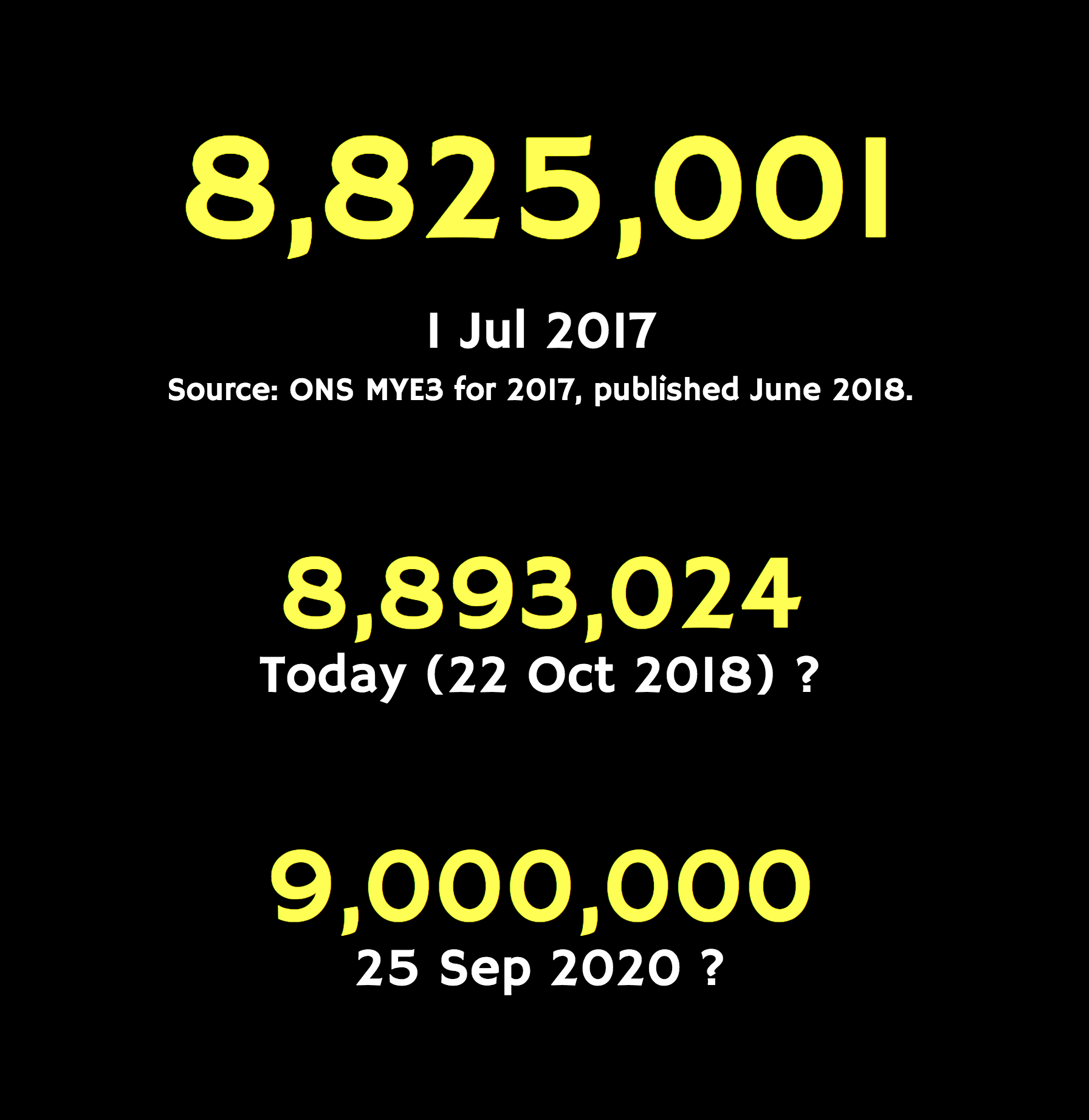
London’s 9 million day was to have been the 27 October 2018, i.e. this weekend, based on the 2016 numbers and a linear projection. Now, it’s moved right back to 25 September 2020. I am sure that a linear projection is an oversimplification, there is clearly a slowdown, and I am sure that the impact of Brexit (i.e. spring 2019 onwards) may further hasten the slowdown – so we will be well into 2021 I suspect before the number is finally hit.

ONS publish their mid-year estimates a year after the date of the estimate, so we can expect to see the mid-2018 estimates and changes, in the middle of next year, at which point I will recalculate the 9 million day again.

Categories
Bike Share London

Bikeshare in London – The Last 12 Months

I recently presented at the CoMoUK Good Mobility Conference in East London, looking at the story of bikeshare in London over the last 12 months ago, touching a little on other systems in the UK.

Here are my slides, slightly updated from the conference itself:

While the core of the presentation was a timeline, numbers and data from London’s bikeshare between last summer and this summer, I took the opportunity to also rate the various UK offerings on their open data provision, and offer some of my thoughts on round 2* of dockless bikeshare which took place this year.

It was great to hear a wide range of presentations at the conference. I particularly liked the Derby presentation. Thanks also to Tim, operator of Derby, for sorting out the GBFS feed. Thank you to CoMoUK for inviting me.

* Round 1 being oBike’s “forgiveness” model back in summer 2017, and round 3 being, I’m sure, American dockless providers “getting it right” next summer.

Categories
Bike Share

Bikeshare Snapshot – Milan and Singapore

Having travelled to both Milan and Singapore in the last few weeks, it’s worth a note on the bikeshare provisions there.

Milan – BikeMi, Mobike, Ofo

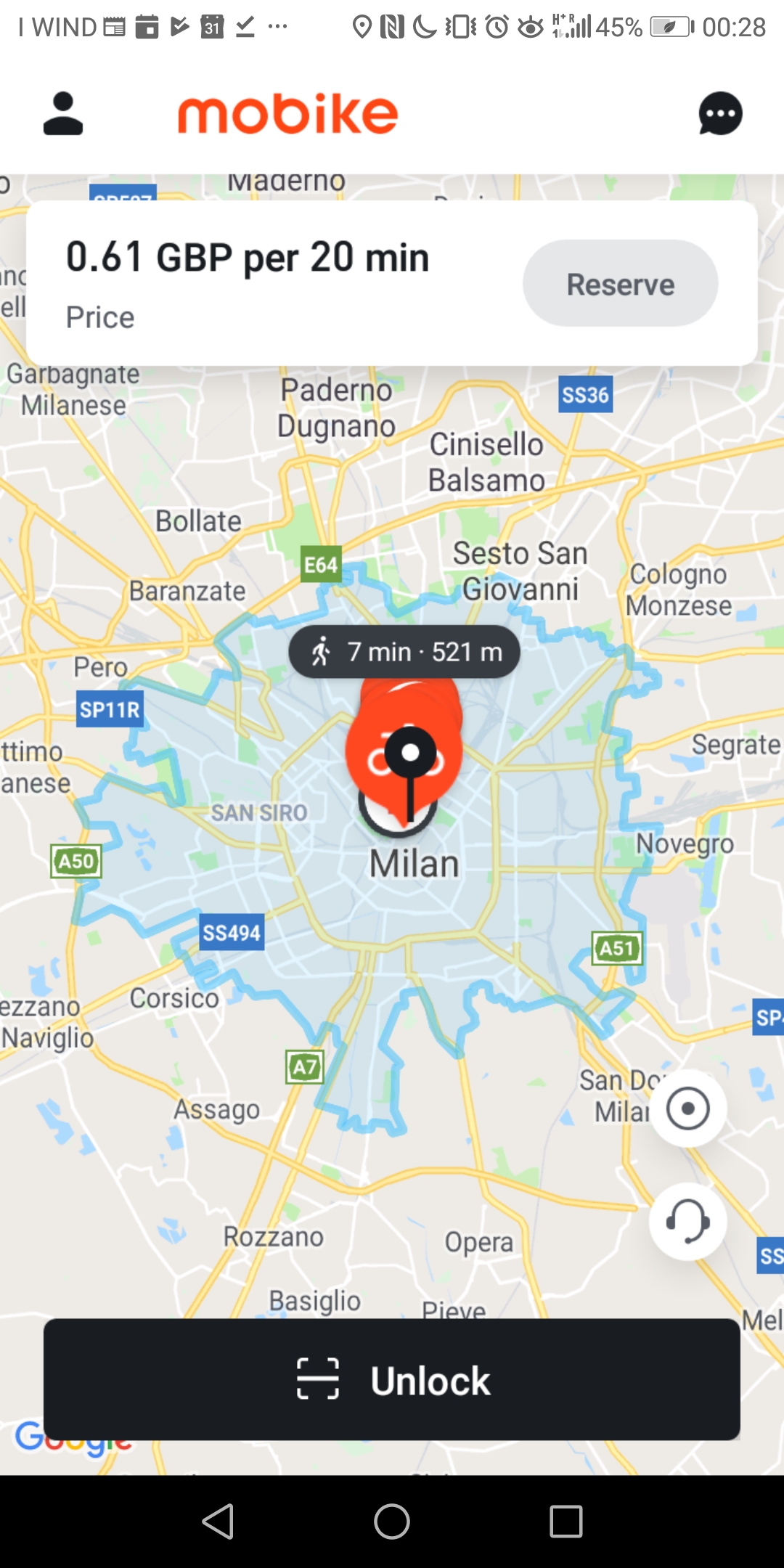
Milan has BikeMi, a long-serving dock-based bikeshare system, which is one of the nearly 400 city systems that I have mapped in Bike Share map. It covers a big part of the city. There was a docking station close to both my hotel and to the location of the the conference I was attending, however far more noticeable were the numbers of Mobikes around the streets. Ofo also operates in Milan, although their bikes are not as prevalent.

I ended up using Mobike – mainly because I already had the app installed on my smartphone, for my occasional usage in London – and Mobike, like Uber, works nearly seamlessly across the various cities it operates in. This simplicity, combined with the new EU free roaming laws meaning that I can use the app without incurring roaming data charges, and the fact there was one to hire just around the corner, means that Mobike for me won over BikeMi. It’s a problem that dock-based systems are going to struggle with, unless they can somehow collaborate with each other globally. Perhaps a start would be JCDecaux “Cyclocity” systems allowing use across their cities if you are already signed up for another one, and a similar approach for Motivate and Nextbike systems. Although, as each city typically has a monopoly dock-based operator, this approach still has a more limited approach.

(I say nearly seamlessly – both apps struggle a little initially when moving to a new city. In Mobike’s case, the system boundaries generally don’t appear until the app has been restarted a number of times, after moving to a new city. For Ofo, the pricing indication is initially wrong – I’m pretty sure it’s not free!

Mobike and Ofo have not suffered in Milan like their have in London. They both operate throughout the historic centre of the city, and much of the suburbs, rather than being artificially constrained on a borough-by-borough basis like in London, or only operating in small sections of the city by operator choice/resource limitations, like in Oxford and Cambridge.

Milan does not have as much in the way of dedicated cycling infrastructure as London, however I generally found a good level of respect from drivers and felt comfortable moving around the city. It was exceptionally hot when I was visiting (35°C) and although I noticed a few other cyclists and also bikeshare users, there weren’t huge nunbers in London. I noticed that most of the Mobikes were single ones which had been left by the previous user, rather than stacked by the operator, and also more than once they had been left in a position entirely blocking the pavement and meaning the pedestrians had to get onto the street to get past. This is a big problem in many cities where dockless operators run systems – how to get users to park responsibilty. The solution – a combination of user attitudes, rules and facilities, is one that does seem to have been solved for the next city I visited…

Singapore – Mobike, Ofo, oBike/GrabCycle, SGBike, GBikes

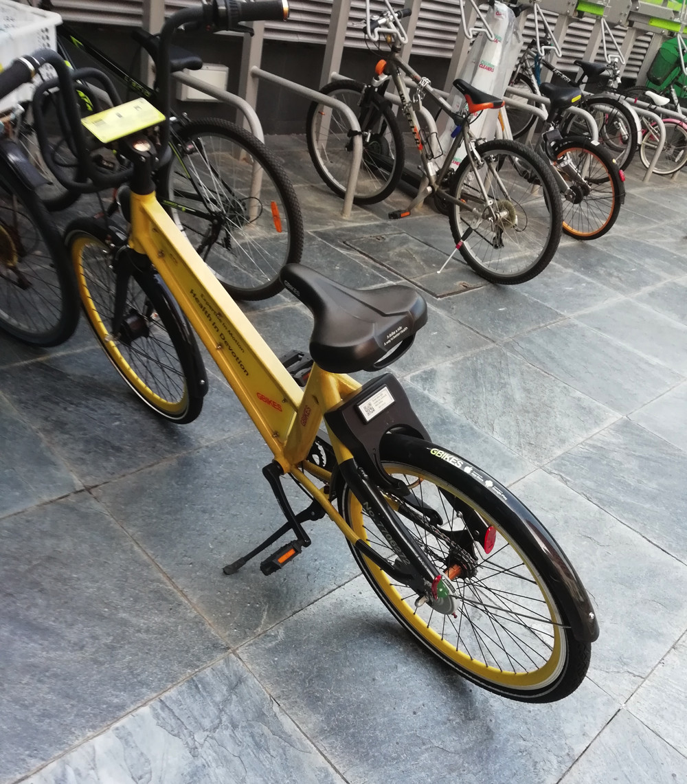
In Singapore, there is no dock-based system but a wide variety of dockless operators have bikes here – as well as Ofo and Mobike, there are the home-grown SGBike and GBikes (the latter based on the SharingOS system), and OBike (cobranded GrabCycle) – which started out in Singapore. Both GBikes and OBike have ceased in Singapore, presumably their apps no longer unlock their bikes – but they are both scattered everywhere – or rather, this being Singapore, they are neatly stacked up against trees and fences. Will anyone remove the bikes for companies that have ceased to be?

Singaporians being extremely considerate people, I didn’t notice any bikes blocking pavements, or indeed showing any sign of lock tampering or vandalism. A small number of bikes had damaged wheels. Again, I have both the Ofo and Mobike app on my smartphone, but with no free data, and no particular need to cycle, I didn’t hire any bikes this time.

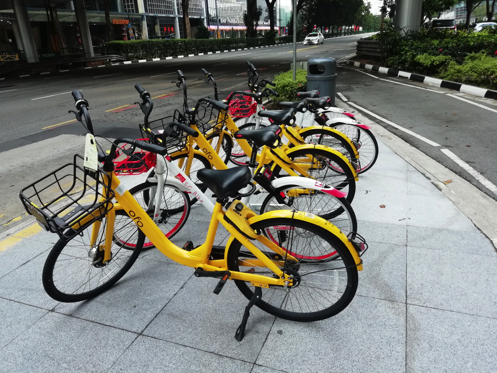
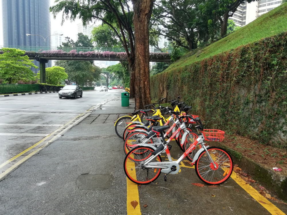
One thing I noticed over and over again is multiple operators bikes, being stacked neatly together. Sometimes, they were located within a painted rectangle indicating an “official” cross-operator permitted parking location:

Other times they were in “dead” pavement areas, such as traffic islands, where no one would otherwise need to be walking or driving:

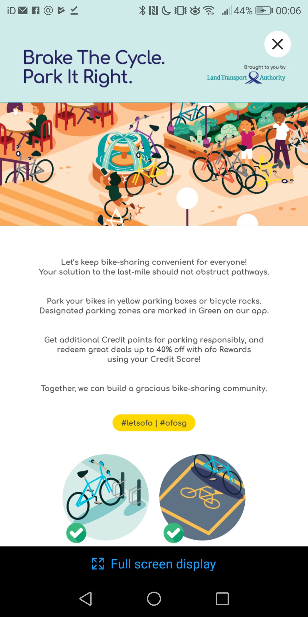
There is clearly some city council direct involvement with the operators – in Ofo’s app, there appears a message from the Land Transport Authority about parking neatly:

(Incidentally, GrabCycle is I believe a multi-operator marketplace/broker. I haven’t seen this before for bikeshare, and Ofo and Mobike are not currently part of it – they are presumably “too big” – but I think ultimately cities with multiple competitive bikeshare operators will likely have to eventually enforce/insist on allowing the bikes to be used through marketplaces. No one wants to have six bikeshare apps installed on their phone, and no city wants six incompatible bikeshare bikes sitting on every street corner, each only useable by a separate dedicated app.)

The central part of the city, at least, is not as bikeable (or walkable) as Milan – with large roads and the lack of much in the way of dedicated cycle lanes, the only cyclists generally seen were on riverside paths and in parks. Pedestrians also can come to junctions without any crossings – except perhaps by a nearby overpass. It’s all very well having a marked parking bay, but if it’s beside a huge road with no cycle lane, is anyone going to use it?

The high temperature (30°C) and humidity, characteristic of the city state throughout the year, doesn’t make it the greatest place for comfortable or leisure cycling. I saw almost no-one using the dockless bikeshare bikes, even through are are loads waiting to be used, but I did see plenty of people on eScooters – both for-hire ones and private ones. It is only a matter of time before these become huge in London.

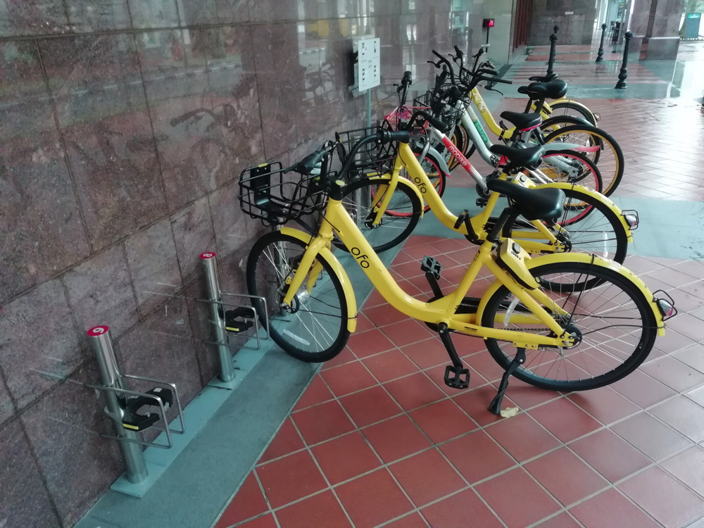
Intriguingly, there may note be a dock-based bikeshare system in Singapore – but I did notice these bike docks. They are “semi-smart” docks – they have an electronic lock that just locks the front wheel, but they are small and unobtrusive, presumably much easier and cheaper to put in than London’s hard-wired, “street furniture” type docks. They were, here, being used as spaces to keep Ofos, rather than by the bikes they were designed for:

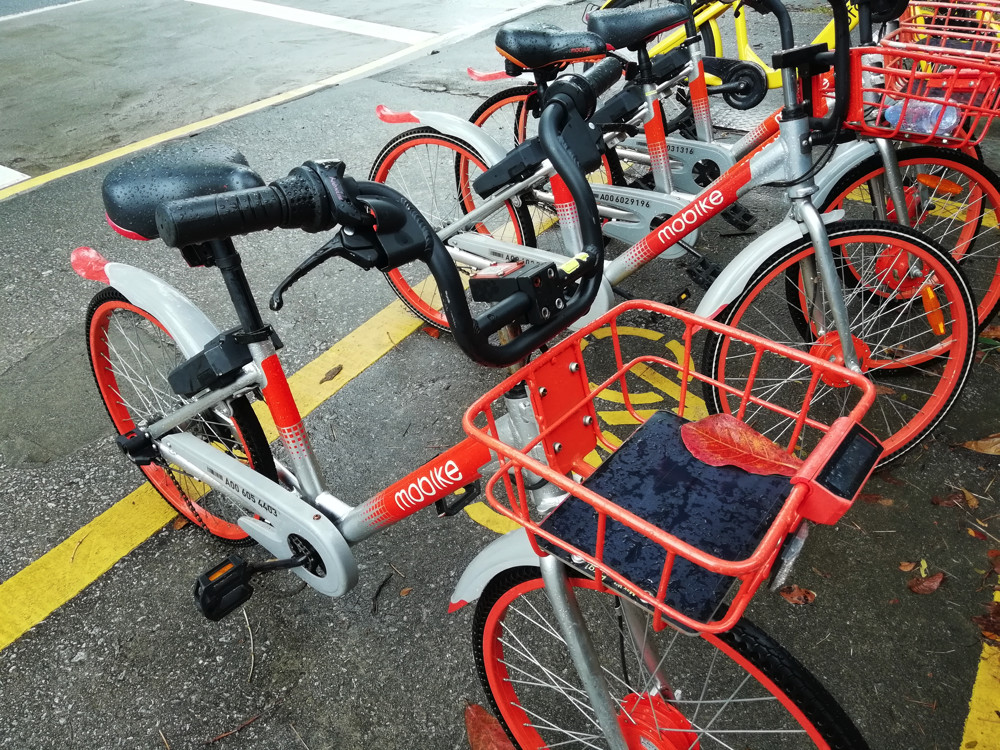
I did notice a number of interesting varients of both Mobikes and Ofos. They have been in the city longer than they have been in the UK, and so a greater number of models are on the streets – but as well as older versions, there are newer ones that have not made it yet to Europe. These newer ones generally look chunkier, with bigger locks.

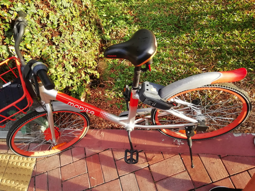
Here’s a Mobike with a rather nice frame painting detail, an unusually chunky looking lock, and solar panels in the front basket:

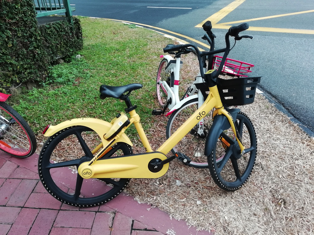
Here’s an Ofo with a very chunky appearance, particularly the tires, which look like they could withstand anything. They are solid, but with lots of holes drilled through the rubber to presumably reduce weight and possibly generate a warning whistle (not really):

Notice also the SGBike and Mobike parked neatly beside by other users. Off the pavement, off the road, not knocked down. London, you have a lot to learn.

I did get the feeling that bikeshare might be a spent force in at least the central part of Singapore (I did not visit the suburbs) and eScooters may already have taken their place here. Coupled with Singapore not being a particularly cycling friendly city – certainly compared to London – I wonder if the only thing remaining is for the city council to sweep up the unused bikes for the bust operators, and tell the others ones it’s time to move on? I understand that the council has recently tightened up the regulations for bikeshare in the city, making it harder for the companies to operate, but a necessity in a city with the layout and streetscape like Singapore’s.

Categories
London

Crossrail Preview – Whitechapel

Crossrail, who are building the Elizabeth line railway across London that is due to open this December, held “sneak preview” open days recently at two of their stations – Whitechapel in east London, and Tottenham Court Road in the centre of the city. The previews were self-guided tours of part of the new sections of the stations, including the Crossrail platforms and ticket halls.

Here’s some photos from the visit to Whitechapel. This already has Underground and Overground platforms (the former famously underneath the latter) but the Crossrail ones are far deeper down both.

The surface-level station reconstruction looks quite far from finished in places, however on the outside of one of the new buildings there is some nice concrete detailing:

Whitechapel has an additional six months before it comes into use in May 2019 as an Elizabeth line station, when the Shenfield services start to be threaded with the Abbey Wood services, into central London.

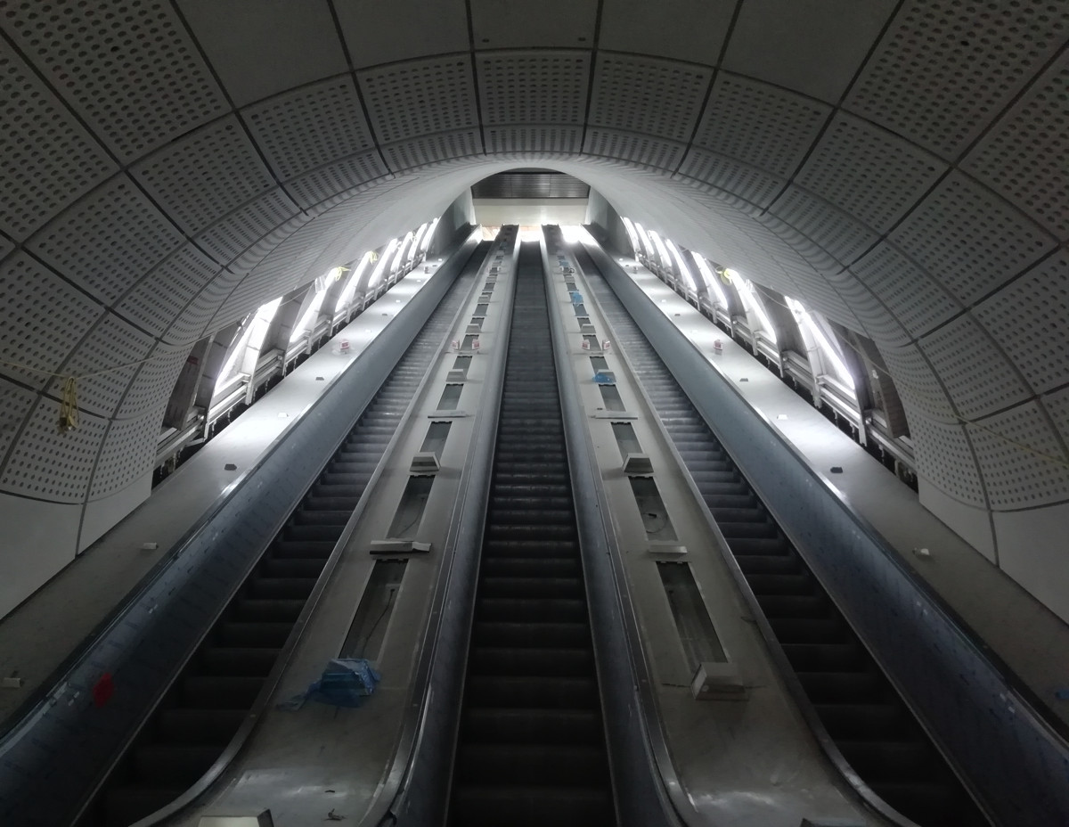
Descent was via over a hundred steps – these huge escalators are not yet for public use:

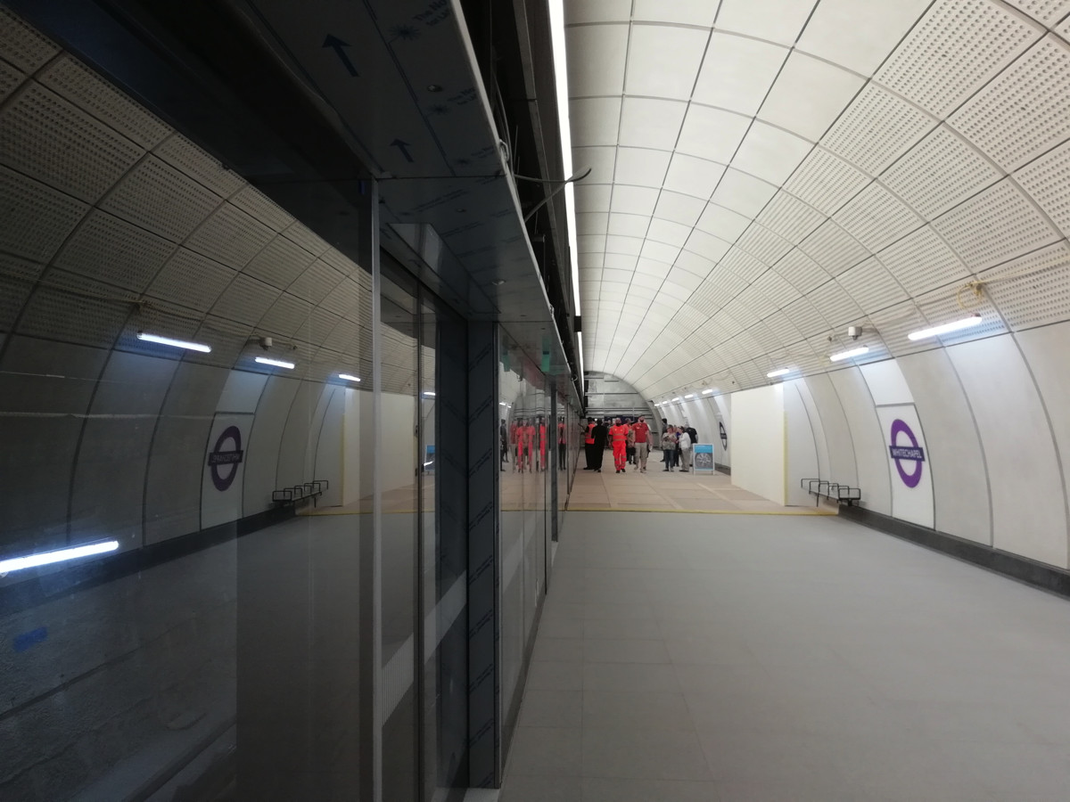
We were then able to walk around a section of the platform. Notice how the main lighting source is a continuous light panel that sits above the platform screen doors, between the two are the next train indicators – these screens for these are tilted down and covered in this picture, with some cabling sticking out:

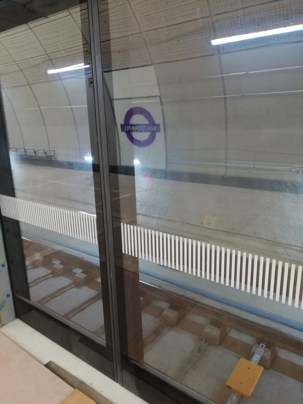
The glass platform screen doors were visible, along with the pristine looking running track:

A reminder that the project is close to completion:

Also, impressive in size was the huge connecting chamber – there is only one normal exit from each platform, unlike many other Crossrail stations which will have exits at either end. The connecting chambers don’t have regular corners onto the platforms and passages, instead they curve around rather sinuously. The effect is quite futuristic and rather fantastic:

It was great to get out of the oppressive heatwave, down into the cool (for now) platforms of the Crossrail project.

Categories
Bike Share London

Making Bikeshare Pay

Dockless bikeshare has been out in London for around 10 months now (not withstanding the brief but spectacular oBike launch and burnout in mid 2016). It looks like the operators are getting serious and trying to get dockless bikeshare to pay for itself – starting a transition from a “growth” to “profit” focus:

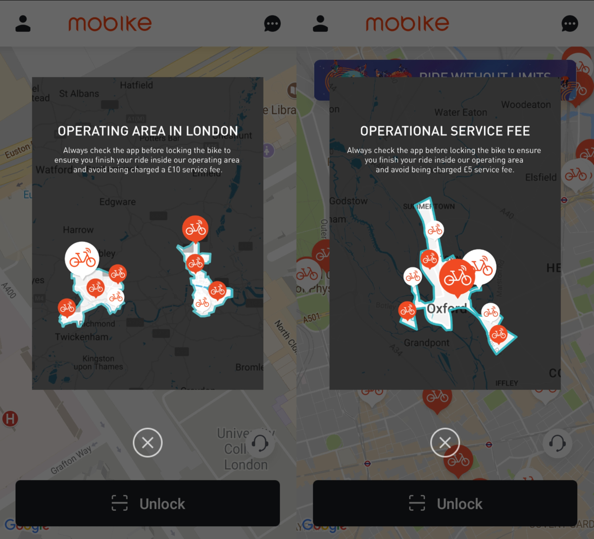
Mobike has introduced an out-of-operating-area fee of £10 for London (left). Interestingly, this is only £5 for Oxford (right), where arguably the competition is even more fierce:

It isn’t clear whether you can continue to start journeys from outwith the operating area, but you must finish within them to avoid the fee. However, you can also get the fee waived by taking any Mobike from outside the operating area, back inside it, within 12 hours. It could be the bike you took outside, or another one. This is interesting – let the user help the system work better. You either fix the problem (bikes outside areas the operator can manage effectively, or don’t have permission to be in) or pay the operator to do it for you.

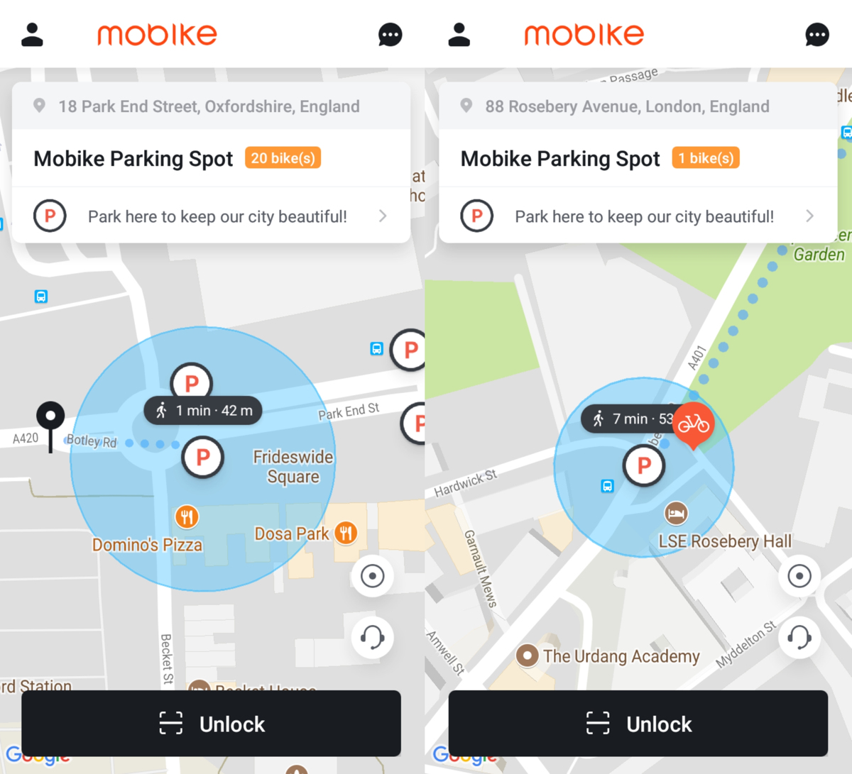
Mobike is making a bigger deal of its hubs now, showing the numbers of bikes currently available at them. Bikes in a circular buffer around each hub are reported as at the point in some cities (Oxford – left) but individually in others (London – right). This makes them a little more like a hybrid system, with certain locations generally having a reliable pool of bikes available, but with out-of-hub parking still available to keep the system flexible. At this point, there is no user incentive for hub-based journey finishes or starts.

Mobike have also shrunk their operating areas – in Islington, it now doesn’t extend north of Holloway. Presumably Mobike are tired of moving their bikes back up the hill to Archway and Highgate, only to have everyone cycle them back down. However they have extended into a small part of Hackney – the De Beauvoir Town area. They have also shrunk their Southwark footprint, so that the bikes can only be used north of the South Circular, and their western footprint has also shrunk – no service in west Hounslow, Feltham, Southall or Greenford now. They has also completely pulled out of Newham. Looking at their app, it never looked like there were many bikes available for use there anyway. You can see the area of operation here (orange border).

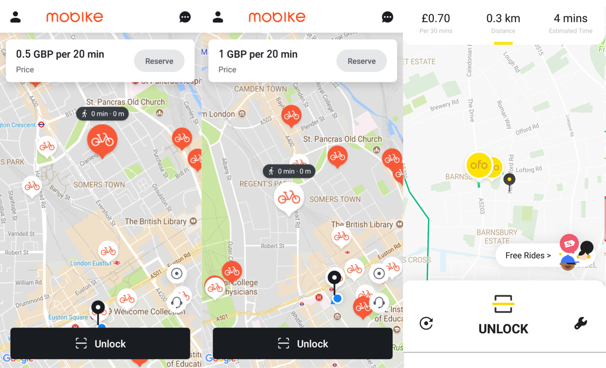
In addition they have significantly increased their usage fee. Initially it was 50p for 30 minutes. Now, it is 50p for 20 minutes on the smaller-frame bikes with black baskets (show as orange on their map), or £1 for 20 minutes on the larger-frame bikes with orange baskets (shown as white on their map). [Updated 12 July – now £1 for 20 minutes for all their bikes.] [Updated 1 August – now 99p/20 minutes.]

Ofo has also increased their usage fee, it is now 70p for 30 minutes. [Updated August – now £1 for 30 minutes.] So, in places where both systems operate, the small Mobikes are cheaper for journeys up to 20 minutes, the Ofos are cheaper for 20-30 minute journeys, the small Mobikes are cheaper for 30-40 minute journeys etc etc…

Single Journey

Ofo Mobike Small Mobike Big Santander Cycles
15 min 70p 50p £1 £2
25 min 70p £1 £2 £2
35 min £1.40 £1 £2 £4
45 min £1.40 £1.50 £3 £4
1h 15m £2.10 £2 £4 £6
1h 45m £2.80 £3 £6 £8

Subsequent Journeys in next 24h

Ofo Mobike Small Mobike Big Santander Cycles
15 min 70p 50p £1 Free
25 min 70p £1 £2 Free
35 min £1.40 £1 £2 £2
45 min £1.40 £1.50 £3 £2
1h 15m £2.10 £2 £4 £4
1h 45m £2.80 £3 £6 £6

Ofo and Mobike are also now showing specific forbidden areas on their app. This is interesting, because I assumed that all areas outside of their operating area were forbidden. Presumably these are extra-problematic areas for the operators. Ofo has marked various royal parks as forbidden areas, while Mobike has marked canal-sides, the London Bridge station complex, and large public parks, as forbidden. Mobike’s out-of-operating-area areas allow journeys to finish but the user (only) is then encouraged to move the bike back into an operating area within 12 hours, it is locked out of use for others.

This means that in effect there are five types of dockless system geofences, with four being shown on the maps in the Mobike and Ofo apps:

Ofo Mobike
Hub area Shown in app as points overlaid on green-bordered rectangles. Parking here encouraged, occasionally incentivised with free next ride coupons. Shown as points, but a blue circular buffer is shown on clicking it. Parking here encouraged but not incentivised.
Operating area Show as green-bordered areas Shown as blue shaded/bordered areas
Out of operating area Shown as regular map. Parking locks bike for user-only redistribution back. Shown as regular map. Parking results in fine, unless it (or another) is taken back in in 12 hours by the user, but still available for use.
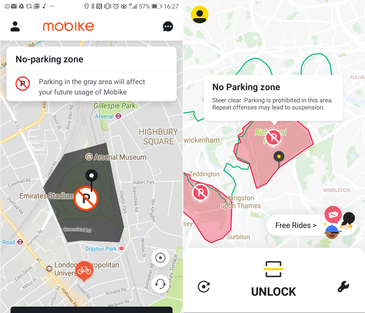
Forbidden area Shown as red shaded/bordered areas. Parking may result in credit drop or penalty. Shown as grey shaded/bordered areas. Parking may result in credit drop or penalty.
Out of region Not shown by either. But I assume there is a distance, out of the operating area, beyond which the operator would not seek to recover the bike into the operating area, but might sanction the user instead. For London, the GLA boundary might act as such an area

Meanwhile, the third dockless player in London, Urbo, has announced it is quitting the three London boroughs it is operating in – Enfield, Waltham Forest and Redbridge. Enfield will announce a replacement “soon”, Waltham Forest is getting Ofo in instead, and Redbridge already has Ofo. The numbers don’t sound great – only 6000 journeys in Waltham Forest in 5 months, on a fleet of 250 – so 20 journeys a day, or 0.16 journeys/bike/day, and 3000 miles clocked up in Enfield, again in 5 months, on a fleet of 100 – so (assuming average journey of 1 mile) 0.2 journeys/bike/day. This means these bikes are spending 99.8% of their time not being used (assuming an average journey of 15 minutes).

Barnet had just announced that Urbo was coming there, and Barking & Dagenham was due to sign-off Urbo coming there in July – I would speculate that these launches may be off. Urbo, an Irish company from the start, has just been bought by the operator of several bikeshare systems in towns in Ireland, and it has just launched Dublin, where it has access to the whole of the city. Just like in London, Dubliners likely want to cycle throughout the urban area and not within arbitrary political boundaries. So that would likely be where the London Urbo bikes are going.

Numbers of bikes and journeys are generally hard to come by for dockless bikeshare – the companies themselves have good commercial reasons for being coy with the numbers. In some cases, the operator will have fewer bikes out on the streets than they say – as they just don’t have that many (working) bikes – Santander Cycles have consistently overstated the numbers of bikes out there . The opposite can also be true – where dockless operators have agreed maximum numbers of bikes with boroughs, and then see these numbers be exceeded as users cycle over from neighbouring boroughs, or operations necessitate. There is little data, so we generally have to go on press releases:

Number of Ofos, Mobikes and Urbos in London

I am adjusting the following table as I get better information:

Ofo Mobike Urbo Santander Cycles
September 2017 200 750 250 9514
November 2017 400 (a + b) 1150 250 10038
December 2017 1000 1150 250 10211
February 2018 1000 (38km2) 2000 (130km2) 350 10513
March 2018 1350 Ann: 2200
Obs: 2616
475 10651
April 2018 1400 (a + b) Ann: 2200
Obs: 3315
475 10441
May 2018 2800 Ann: 3000
Obs: 3072
475 10279
June 2018 3000 (253km2) Ann: 4000 (68km2)
Obs: 1980
475 (177km2) 9716 (112km2)
July 2018
(provisional –
will be updated)
Obs (I): 1783 Obs: 1069 (68km2)
Obs (I): 889
CLOSED 9151 (112km2)

In better news, both Ofo and Mobike are both continuing to expand in London this summer, in areas where they do think dockless bikeshare will work. Mobike should be coming to Haringey soon, while Ofo have today announced their forthcoming expansions – Camden launches this week, with Waltham Forest following shortly (this week, says the borough at least), followed by Wandsworth and Hammersmith & Fulham. This means yellow bikes will soon be appearing in Bloomsbury, Fizrovia, Camden Town, Kentish Town, Highgate, Belsize Park, West Hampstead, Walthamstow, Chingford, Leyton, White City, Hammersmith, Fulham, Putney, Wandsworth, Battersea, Balham, west Clapham and Earlsfield.

Categories
London

London Borough Challenge

[See also this update.]

Is it possible to visit all 32 London boroughs (& the City of London) in a day? How quickly can you do it?

The “London Borough Challenge” has been on my to-do list for a while, and I finally got around to tackling the challenge on Saturday.

For my first attempt, and so possibly the World Record (if no one else has done/beaten it) the time was: 9 hours, 25 minutes, 23 seconds. It was 92km of cycling in 10 stages + 103km on 9 train journeys.

My initial thoughts were to do a route involving tube/trains, stopping at a station in each borough. Kind of a borough version of Geoff Marshall’s famous Tube Challenge. However I thought that would be a bit underwhelming for a “tour of London” – just railway platforms rather than the public realm. Also, it was a lovely, warm day, and spending the whole day cooped up in various trains and tunnels didn’t appeal. So, I decided to do a bicycle + train combo. If you don’t have a bike, you can probably substitute the cycling sections with a combination of walking, jogging and buses/trams. I’d not recommend a bikeshare bike, as if you are cycling nearly 100km, you want something that is comfortable for you for those kinds of distances.

Challenge rules

  1. Visit all 32 boroughs + the City of London, take a photo in each one to prove the visit.
  2. Each photo must be taken from within the borough and must be of a street name sign with the borough name and/or borough crest/logo on it.
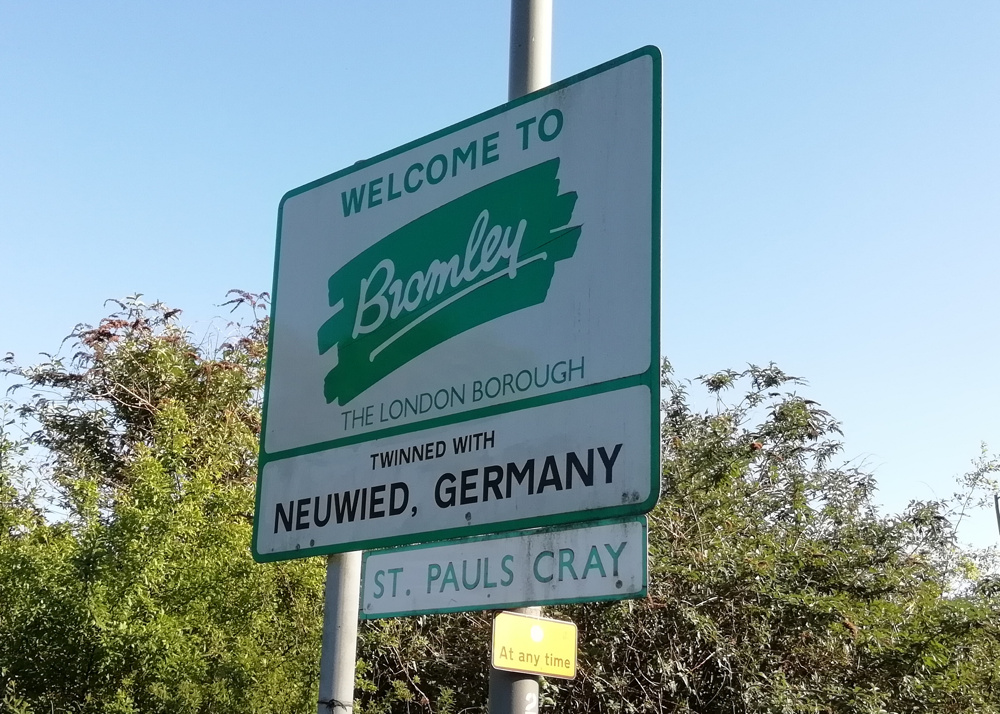
  3. Where a borough does not have street name signs with the borough on it, then a photo of a borough-owned street name sign with an immoveable object beside it (e.g. anchored waste bin, grit bin) with the borough name/logo on it is OK. (e.g. Bromley, Sutton)
  4. Truncated borough names (e.g. “Barking” for Barking & Dagenham) are OK.
  5. You can also have local neighbourhood welcome signs if they also contain the borough name/crest/logo (e.g. Corbets Tey in Havering, and Pinner in Harrow) as long as it’s not a “welcome to the borough” sign (as you are not standing in the borough when you see the sign!) and as long as it’s not on the edge of the borough (same reason).

Note that none of the 9 photos in this blogpost qualify – click on the blue pins in the map above to see the actual qualifying photos.

My route was constrained by the inevitable weekend railway engineering works. The main effect this had, on the day, was very limited services out of London Bridge station. The line through Forest Hill was closed, as were the lines through/near Lewisham. This would make the south-east London section difficult, with a long cycle needed from the Greenwich line down to Bromley, rather than a train dropping me near the Greenwich/Bexley/Bromley intersection; and then another long cycle down to Croydon rather than the London Overground dropping me there. I decided to cycle from Abbey Wood, on the Greenwich line, as I wanted to have a look at the brand new station there (it is a very nice new structure!) and thought this would avoid Shooters Hill – it did, but I forgot about Knee Hill – not quite as big, but very definitely a hill.

The main issue of the day was that I ran low on my GPS battery and phone battery. The former died completely about 20 minutes before the end of the challenge, so I missed tracing my final route into Barnet. The phone looked like it was on its way out before the end too, but by using airplane mode I was able to eek out the last bit of charge. This however meant I couldn’t risk using it for navigation in the latter part of the day. The location of the sun was useful as a rough compass indicator, but as I only started my challenge at around 2pm, it got dark during the latter part of the challenge and so I suffered some navigational problems thereon. In particular, my route out of Wimbledon station was very poor – I thought I was heading northwards alongside Wimbledon Park whereas I was heading southwestwards. You can see a dramatic and accidental curve in the map above. I similarly took a poor route from Richmond Park to Richmond proper, and wasn’t sure of the boundary lines around Turnham Green station, hence some double-backing around here while reading street signs for borough information! (it was nice to see this artwork there though.
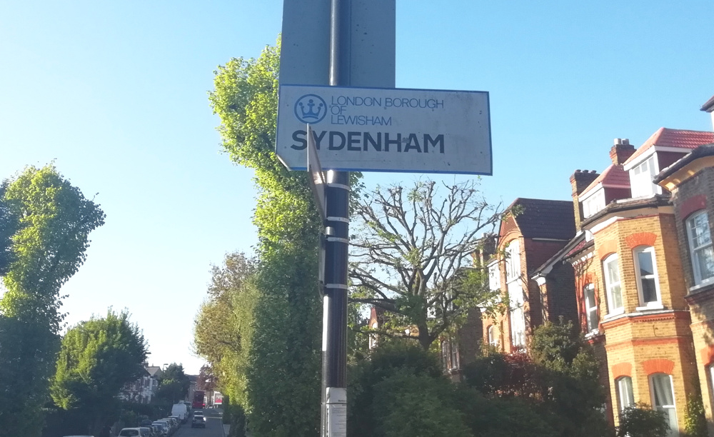
So, I am sure 9 hours, 25 minutes and 23 seconds is easily beatable. Maybe it will be much faster if done by car, at night? A route much shorter than 195km should be possible, a squint at the map suggests the shortest route would not be much less than 138km. Maybe going via Crystal Palace (five boroughs within a few hundred metres), if you can make it up that hill? 33 stops works out at less than 20 minutes per borough though, and actually finding a “qualifying” sign took quite a while in places. I think I got lucky for some boroughs. Waltham Forest appeared to have no labelled signs, but literally as I was exiting the borough, having cycled right through it, I found a very old street sign with the borough name on it. I also think I was very lucky to find a Wandsworth labelled sign. For four boroughs (Bromley, Sutton, Havering and Harrow) I never did find a street name sign with the borough name on it.

Challenge miscellany

  • I only spent a couple of hours planning the route and checking to see what trains were running.
  • I did not do any research into which boroughs would typically have borough names on their street name signs. This proved to be a problem right at the start – which was going to be around the IKEA at Tottenham. A fruitless search for names in this pretty bleak part of London, until I headed westwards into more residential areas.
  • I scribbled down rough timings, planned route (town-to-town) and boroughs. The rough rule that any journey in London on public transport takes half an hour seemed to hold true. My timings suggested a start at 14:00 and finish at 23:45. I started a little earlier and quite quickly made up half an hour by doing the central London leg at speed. I spent the rest of the day consistently 20-30 minutes ahead. I was keen to maintain this so that I could get through Richmond Park before the gates were locked – I forgot that it’s actually open 24 hours for pedestrians/bikes.
  • I used a Google MyMaps map (not the one above) loaded with a KML of the boroughs, to check where I was and where a nearby borough boundary was.
  • I used OSMAnd loaded with an offline OpenStreetMap map of London for detailed navigation when I needed it.
  • Total cost was just £9.75 for the day – £8.30 on an Zone 1-6 paper travelcard with railcard, and £1.45 on a fizzy drink in Sutton (it was a hot day!)
  • Trains generally ran to time, except for (guess who) Southern from West Croydon to Sutton which was around 10 minutes late.
  • OMG the Thameslink loop around Sutton is really very slow – although quite scenic.
  • I don’t know what on earth is going on with the road layout around Barking but it is a complete mess.
  • The only place I suffered from impatient (but not rude) drivers was, quite reasonably, as I was going up Knee Hill. Very steep, busy, no pavement…
  • I probably wouldn’t recommend cycling around Crittal’s Corner on the Bexley/Bromley border – and especially stopping on the slip to take a photo of the sign (above).

The challenge was a nice way to see a cross-section of London. However I did only spend a few seconds in some boroughs (Camden, Ealing) so it perhaps wasn’t a representative tour of the whole metropolis. The most intense full-on London experience was at/around Barking station, particularly as the street market was on. The nicest bit was, for sure, cycling through Richmond Park at sunset, with its lovely views and herds of deer. Uxbridge Road in Harrow, less so (although it was dark and I was rushing at that point). It was good to find some new cycle infrastructure – the new tracks along Forest Road in Waltham Forest and from Aldersbrook to Manor Park, for example. 0 I only got to cycle right across a few boroughs – Waltham Forest, Bexley, Hammersmith & Fulham and Harrow. A few – Havering, Sutton and Brent, were just jump out of the train, cycle around a bit, jump back on the next train. I was happy not to have to spend too long in Harlesden. But London is a city of villages and several that I visited were pleasant – Wimbledon village, Wood Street, Sydenham, Alderbrook. Upminster seemed nice enough. Spitalfields was buzzy as ever. Even Abbey Wood appears to be having an embryonic rebrand as Abbey Wood Village – hello there Crossrail.

Route narrative/timings

TimeBoroughNotes
13:50:05EnfieldStart right by the Haringey border, having found a suitable sign.
13:54:20HaringeyFollowed by a nice cycle through Tottenham Marshes and then along Forest Road and Wood Street.
14:25:57Waltham ForestHaving cycled right through the borough, found a named sign a few metres pretty much on the boundary.
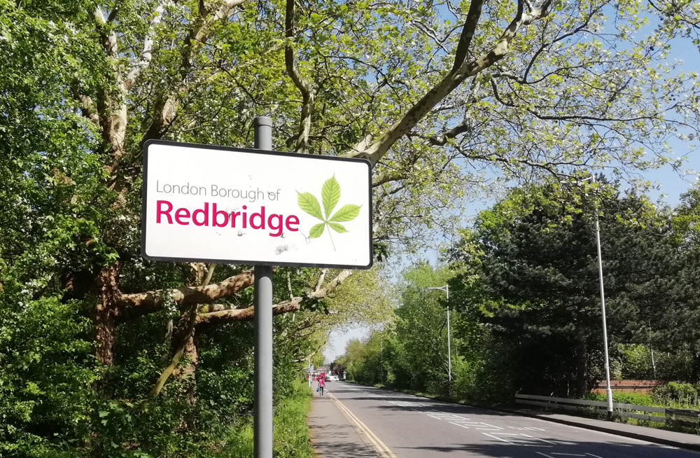
14:27:30RedbridgeA very old sign, for the same road as above, and didn’t find any more.
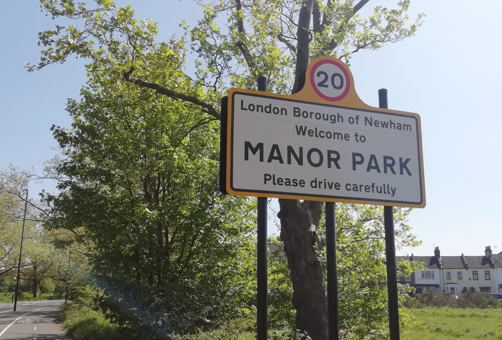
14:37:07NewhamBy Manor Park station, with the borough crest on the sign.
14:55:06Barking & DagenhamA sign for “Borough of Barking” which counts as it’s part of the borough name, even though the sign is for the pre-1965 Barking borough.
15:02c2c trainAir conditioned 🙂 from Barking fast to Upminster. 9 minutes for 12km.
15:19:30HaveringA borough without its name on its street name signs, but found a Welcome to Corbets Tay sign with the borough name/logo on it.
15:35c2c trainFrom Upminster to Liverpool Street, via Barking and Stratford. 27 minutes for 25km.
16:04:25City of LondonLike all inner London boroughs, the City of London name appears on all street name signs.
16:06:58Tower Hamlets 
16:10:15Hackney 
16:11:39Islington 
16:17:44CamdenOnly in borough for a few seconds.
16:22:17Westminster 
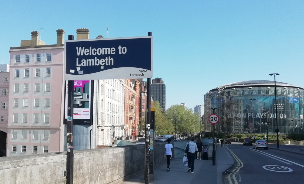
16:27:46LambethThe Welcome to Lambeth sign appears at the other end of Waterloo Bridge from the Thanks for Visiting Westminster sign.
16:29:16Southwark 
16:41Southeastern trainFrom London Bridge to Abbey Wood. 27 minutes for 16km. A slow train. It was the part of a special route to Orpington via Erith and Lee (!). I could have gone from Waterloo East and got off at Woolwich, but I fancied visiting the rebuilt London Bridge and Abbey Wood stations which are both impressive soaring lit-wooden-ceiling structures. Plus there was a train at Abbey Wood with the “Elizabeth Line” roundel (not “TfL Rail”) on it 🙂
17:13:35GreenwichA long way from Greenwich itself, but not too hard to find a sign.
17:20:57BexleyWeirdly, Bexley borough street name signs seem to have a “no dog mess” symbol as the “logo”, rather than a council symbol or crest.
17:49:49Bromley 
17:52Thameslink + Southeastern trainsSt Mary Cray to Bickley, and then Bickley to Penge East. 18 minutes for 12km + 6 minute change. In Bromley borough for the entirety of this leg.
18:26:21LewishamMost street name signs without the borough name, but found this one near a roundabout in Sydenham.
18:54:36CroydonAlmost no street signs with the borough name on them, so continued cycling past Selhurst, until finally found one outside West Croydon station.
18:59Southern trainWest Croydon to Sutton. A bit delayed. 12 minutes for 7km.
19:25:27SuttonAnother borough which hides its identity on its street name signs. So found a fixed bin. Had a nice looking shopping parade though with the borough logo on its gates, and a lovely clock outside the station.
19:37Thameslink trainSutton to Wimbledon. On the Thameslink loop – very slow. 21 minutes for 9km.
20:03:30MertonPretty every sign has the council name/logo on it.
20:22:11WandsworthWith phone battery running low and it getting dark, I didn’t realise I that I did a huge accidental 180-degree loop from Wimbledon Park into Wimbledon village instead of Southfields. Crossed into Wandsworth eventually and found this very old sign, almost entirely hidden by branches – so did some gardening.
20:36:26KingstonFollowed by a twilight cycle through Richmond Park.
20:51:39RichmondAll street name signs mention the borough.
21:04London Underground tubeRichmond to Turnham Green. 9 minutes for 5.5km.
21:17:57HounslowAll signs have the borough name on them.
21:19:00EalingAnother “easy” one. Only in Ealing borough for a few seconds.
21:23:16Hammersmith & FulhamThe borough finishes just beyond this sign.
21:31:21Kensington & ChelseaAs you might expect, this Royal borough loves to put its name on all the signs.
21:43London Overground trainShepherd’s Bush to Willesden Junction. 9 minutes for 4km. With a 10 minute wait for this one too, I probably should have cycled it.
21:59:02BrentBizarre spiral route out of Willesden Junction, walking at track level, with the platform (and train) beside/above you, along a very long walkway. Quick loop through, as all street signs have “Brent” on them, to find the other entrance to the station.
22:11London Overground trainWillesden Junction to Hatch End. 20 minutes for 13km.
22:39:20HarrowNo street name signs mention Harrow, but it does have neighbourhood welcome signs.
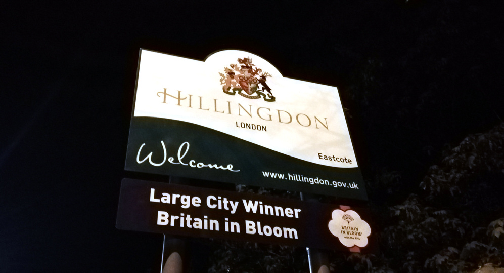
22:47:30HillingdonDidn’t realise this at the time (no map), but I’d followed the edge of the borough around.
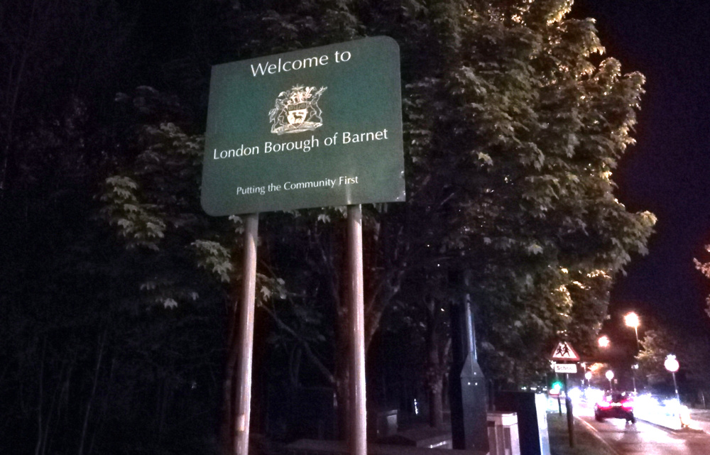
23:15:28BarnetTedious and unpleasant cycle along a surprisingly busy Uxbridge Road. They don’t expect cyclists this far out.

Epilogue

To get back to the start, I took advantage of the travelcard and the limited carriage of bikes on the Northern Line to go two stops from Edgware to Colindale and then one stop from Finchley Central to East Finchley (a suprisingly long way) thus managing a rare single journey involving both branches of the northern line in the same direction. It only makes sense if you look at the line geographically. Which left for an exciting finish for a weary cyclist down Muswell Hill. 🙂

Categories
Bike Share

Where Might Bikeshare Succeed in Great Britain?

There’s lots of bikeshare systems in the UK now. As well as the third generation dock-based bikeshare systems, fourth generation dockless (and hybrid) systems are starting to appear on various streets around the country, led by Mobike, Ofo and Urbo, three dockless providers and operators.

I’ve put together this simple model to try and understand where systems are most likely to be successful, for which I’m defining as a lot of (legal) journeys made with each bike placed by the operator. To do this, I split the country into its local authorities, apply three scores, and then multiply them together to produce an overall “propensity for bikeshare”, or PFB score (the name is a nod to PCT.bike from Lovelace et al) which can then be ranked.

Many mid-sized cities in the UK have their own local authority, approximately covering the urban area, while Manchester and London are split into multiple LAs. Conversely, some LAs individually cover multiple smaller towns/cities and large rural areas too. Hence, this is a very simply model which is not going to be completely fair to every urban area (Stirling, in particular, gets pushed well down the rankings as its LA includes a huge rural area). Still, for most of Great Britain, it produces results I would anticipate and is a good start towards potentially developing a more sophisticated model. The local authority geography is also appropriate, as local authorities act as the gatekeepers for which access is negotiated (for systems which pay themselves) or as authors of bids for subsidised systems.

Model Inputs

For this first, simple model, my three compounding factors are:

  1. Residential and workplace population density – on the assumption that bikeshare systems need a critical mass of people passing by their bikes/hubs/docks, in order to be seen and used sufficiently frequently to justify the costs of equipment/maintenance, on the basis that a major source of income is per-use fees. Both residential and workplaces populations are used, as people have journey opportunities that can be facilited with bikeshare, both from their office (e.g. lunchtime errands, commute to evening socialising or back home) as well as their home location.
  2. Proportion of people who already commute by bicycle, again looking at both workplace location and residential location (bearing in mind that many commute journeys, particularly in London, cross local authority boundaries). While such people are less likely to convert to bikeshare, as they already have a means of cycling, their presence on the streets and associated culture and facilities (e.g. bike coffee shops, marked cycle routes or existing cycle-friendly infrastructure) help normalise the idea that cycling is a possible option for a journey need.
  3. Vandalism rate – theft and criminal damage to bikeshare bikes happens and it is an expensive one for the operators. It can be what causes systems to fail – particularly if they run out of bikes, or broken bikes litter the landscape and turn public opinion against the concept. While the dock-based systems are less vulnerable to this, as the bike is either securely locked to a clamp or in the hands of a paying user, dockless bikes are particularly vulnerable to vandalism, as they are not secured to immoveable objects, and their locks are, unfortunately, relatively easy to break by a determined offender looking for a free bike. The tendencies for vandalism of property that is not yours does vary significantly around Great Britain, while stereotypically it is likely to be more urban areas and areas with a younger and less educated population that is more likely to vandalise, using actual crime data on vandalism allows a more nuanced approach to be taken. Other crime classes (e.g. theft) were also considered for this model, but I think that vandalism rates act as a good proxy for how the local population around a bikeshare system will “care” for it or abuse it.

I have not included the absolute populations of local authorities in the calculation, as in general, with one exception (Isle of Scilly), LAs all have a significant night and/or day population, so they are all large enough to have a self-contained system. Another obvious factor, hilliness, is likely already correlated with proportion of cycling commuters and so is not included. N.I. is excluded from the model for now. Data sources include the latest police crime statistics (with populated-weighted averaging when across multiple LAs), and census data.

Results: Propensity for Bikeshare by Local Authority

Here are the results of the model run. Clicking an underlined title takes you to the main bikeshare for that area – forthcoming systems in brackets.

Some notes:

  • London boroughs score consistently highly, and even London as a whole, which is interesting as outer London is anecdotally not known as a particularly cycling-friendly place. Considering the size of the city, and the intimidating conditions cyclists often have to put up with in much of the capital, it is great to see it scoring so highly here.
  • Bikeshare operators are doing their homework and generally, the top end of the list is already well populated with bikeshare systems, in some cases multiple systems are competing.
  • The top local authorities without a bikeshare system (operating, announced or consulting) are Haringey, a north-London inner-city borough which has been surprisingly quiet until now, and Merton, an affluent outer London borough to the south. Oustide of London, the highest ranking areas without a bikeshare are Portsmouth (small system launching this summer), Gosport (neighbouring), Gloucester, Poole, Worcester and Hull. With the exception of Hull, these are all southern English urban areas, with generally affluent populations and some established cycling culture.

See also my London borough bikeshare scorecard.

Categories
Reviews

Huawei P Smart Review

Through The Insiders I recently received a Huawei P Smart smartphone at a special rate. Here’s a review of it and some notes, a couple of weeks in:

The Huawei P Smart is a new “budget” phone launched by Huawei in the UK in early 2018, around the same time as its premium featured/priced P20 range, but an attractive price-point (£230 list price, in practice around £200) compared with £600+ for the P20 series.

The transfer process was straightforward. First I made sure my Whatsapp history was auto-backed up to Google Drive, then I simply removed my current SIM, snapped out the Nano shape and put it in the new phone, transferring my SD memory card at the same time. I then installed Phone Clone on both phones, the app creating a phone-to-phone network and then copying all applications

The Good

  • Comes in a nice compact Apple-style white box.
  • The fingerprint unlock mechanism is simple to set up and works very well.
  • The phone is a really nice physical design, with a curved edge and nice, black back with thin two metal bars to add a nice bit of styling. The logo is the bottom rather than the top, which is a bit weird but I’m getting used to it there.
  • Comes with USB Micro socket for charging, and a nice compact charger with a pop-up third pin. USB Micro cables/chargers are widely available so it’s good to have this as the charging solution rather than the still rare USB C.
  • Quite quick to charge – around 3 hours from empty to 100%.
  • Comes part charged (~60%) out of the box.
  • Comes with a decent looking pair of headphones, and a regular headphone socket.
  • Takes nano SIMs and Micro SD card on the same slideout tray
  • The screen is lovely and sharp.
  • Both front and rear cameras take excellent, sharp photos (see the examples above and below).
  • The “Bokeh” effect, while not being perfect (see grumble below) produces really nice “portrait” photos, as long as you have the distance right and good lighting conditions. A great example is a photo I took of a colleague above.
  • Comes with Android v8 which is a great UI and well designed, with an improved permissions request mechanism and more UI consistency.
  • Definitely a lot snappier than my Ascend G7 was, with the same number of apps loaded/open.
  • Not too many “junk” apps installed on it.
  • Nice auto-switch between mobile network data and Wifi data. One of my perenial annoyances was where I would auto-connect to a Wifi network and then not get data as I was not logged into it. Now, it will just switch back to the mobile data without me needing to disconnect the Wifi manually. Conversely, it will also auto-connect to new open Wifi networks it finds, seamlessly, for saving on mobile data usage limits.
  • Only a single speaker – but this a good thing, phones are juke-boxes to irritate near people with, the speaker should just be for ringing, or use the nice stereo headphones.

The Bad

  • It only lasted about 30 hours between its first charge to 100%, and being empty, with “normal use” (no videos). I was hoping it would manage to go 2 days and 1 night without a charge, at least for its first year, like the Huawei Ascend G7 it is replacing. Since then, it’s done a little better. With light use it will manage a couple of days. But if you spend a day at an event (e.g. wedding reception), taking lots of photos and maybe using the map a few times, it will be out of power before the end of the day.

  • This is the first Huawei “budget” phone to have dual back cameras for simulating low F Number effects (allowing for blurring of background detail while bringing the only subject into sharp focus). This works quite well but is not perfect – perhaps because the second camera, which is calculating the depth of field, is low-resolution (2MP). So, it doesn’t quite get the blur/not blur boundary quite right.
  • It is also not obvious how to start using this feature. Basically, it is activated by using the Portrait mode.
  • Photo processing tends to aggressively sharpen images, causing a halo effect for certain shots.
  • The system occasionally pauses/hangs for a few seconds, e.g. when reopening Google Maps, or going from standby to taking a photo with the camera. It’s something that my older phone did all the time, but I was hoping that this newer one would never suffer these pauses.
  • In the default keyboard, the space bar has been shifted slightly to the right. This means I keep hitting the new Emoji button which is in the middle-left, where the space bar used to extend to, and so keep putting in Emojis when I was just hoping to have a space…
  • Out of the box, the system uses 7GB of space, so you have 7GB less to play with, than is written on the box (so 25GB rather than 32GB in my case). Slightly confusingly, the space is called “ROM” on the box, which I always thought was Read Only Memory. These days its referring to the solid-state internal memory space for storing files/photos.
Conclusion: It’s not perfect, but for £200 SIM-free this is an excellent smartphone, well built, powerful and with some good premium features. Just be prepared to watch that battery, and be patient when waking it.

Categories
Bike Share

Bikeshare Docking Station Data Release

My research lab, the Consumer Data Research Centre, is making available much of the docking station empty/full observation data that I have been collecting, at frequent intervals (up to every 2 minutes) for generally the last 5 to 8 years, for over 50 cities around the world, to facilitate and encourage further quantitative research in the field. I already get numerous requests for this data – it is very interesting for all kinds of research projects, particularly because of it spans multiple years, so introducing this new mechanism is a good way to manage these requests. You can see the cities listed at the CDRC Data product page.

For three cities (Cork, Limerick and Galway in Ireland) we have directly attached the data to the record page. It is the data that has been collected up to the point that the record was published a few days ago, and on request we will reload the data, capturing more recent observations.

For the other cities, the data record is “Safeguarded”. This is because the logistics and technical limitations of attaching the very large amount of data to the records. Namely, it takes quite a lot of time to prepare each dataset for download, and the platform we are using is not designed for hosting extremely large files – plus, it is likely that researchers would want the most up-to-date data, meaning that we would need to build a mechanism to update the record regularly. Using an application process also minimises spurious requests – we have invested time both in collecting the data and processing it, so we need to be confident that it will be used. Additionally, some systems (particularly those in the USA) come with their own data licence restrictions from the operating companies meaning that we cannot freely distribute the “raw” data. In Europe, most of the datasets are explicitly open, meaning use of the data is unrestricted (although normally requiring attribution). the Irish cities listed above have a slightly more restrictive licence, requiring us to distribute it on the same terms, which we have done.

The data is available on application to interested institutional researchers. In practice, this means academic, public sector and non-profit organisations who which to carry out public/publishable research with the data. Application details are attached to each record.

Above and below are simple graphs produced from the data for various cities. I have looked at the number of bikes available every day at around midnight and plotted it on a simple graph against time.

Access the data here.

Stay tuned because I am planning on releasing two further “data portals” of bikeshare data, soon. These are slightly more manageable in terms of file size and administration, so I am aiming for these to be directly downloadable.