Categories
Cycling London

All the Boroughs?

Back in 2018, I did a London Borough Challenge – visit all 32 London Boroughs, plus the City of London, in as short a time as possible.

I made things hard for myself. I decided that my proof was taking a photograph, within each borough and of the name of the borough (e.g. street signs, salt-bins, libraries etc) – this involved some length treks around some boroughs to find such a name. I didn’t particularly plan the challenge, but just started near where I lived. I also did it at the weekend, where public transport options can be reduced, and started quite late in the day, with no food taken and only one drink bought.

I managed to visit all the boroughs in 9:25:23. My route was 121 miles, split roughly half in cycling and various train/tube legs. I quite like it, it looks reasonably efficient on the map (see blogpost above) although it did include an out-and-back leg out to Havering borough – I really should have started here (or in Bexley/Bromley).
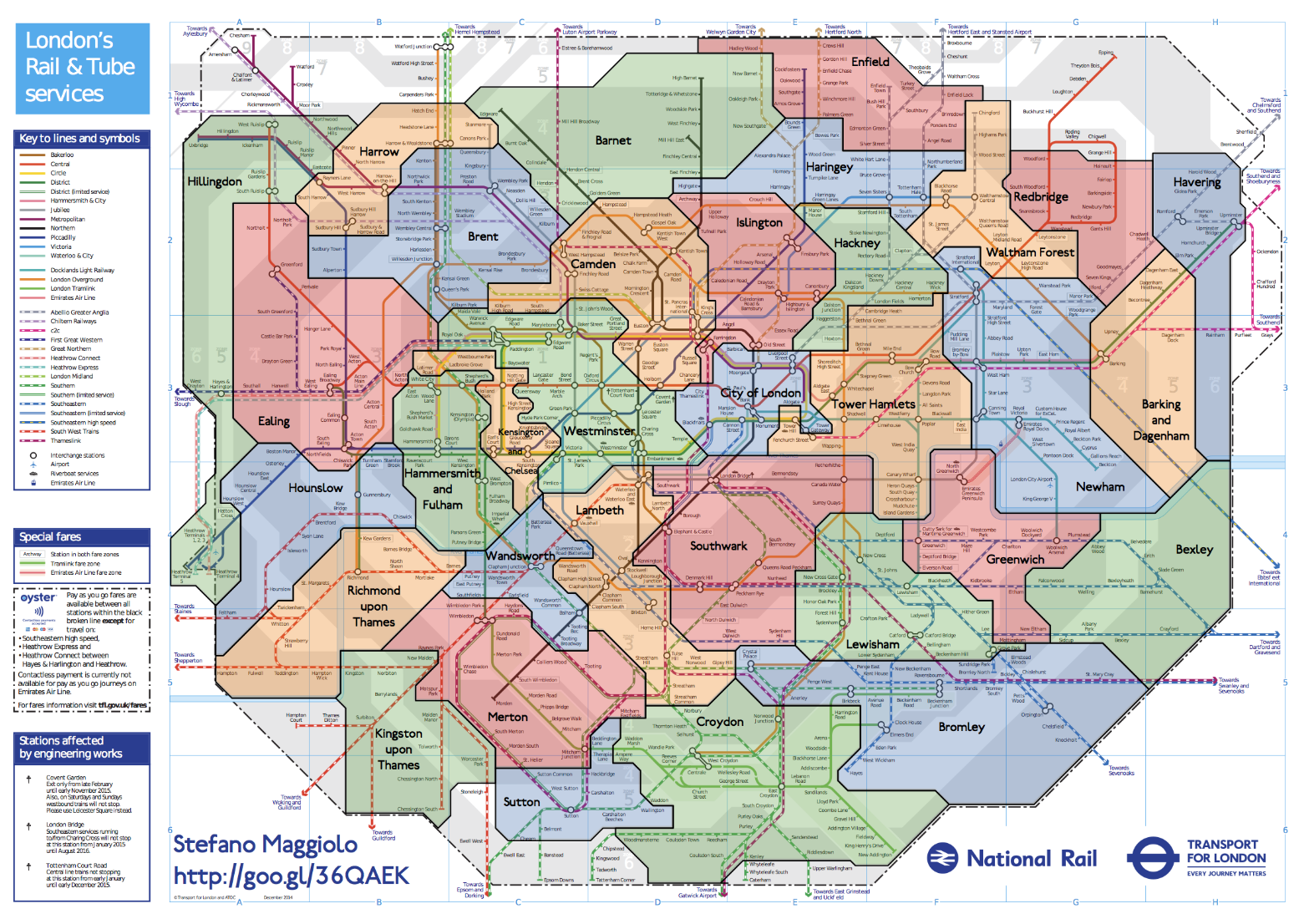
Above: The Borough boundaries superimposed on an (old) tube/rail map of London created by Stefano Maggiolo.

I loved the idea of visiting places in London that I would never normally go to, and it included a brief sojourn into the north half of Hillingdon borough – far from (at the time) a part of London I had ever been too. I now live there.

Thanks to a mention of the challenge on the Diamond Geezer blog, and some other posts I was able to tease out a few more “times” for such a challenge:

  • 10:39:50 – Richard, 27 January 2007 – Tube Challenge GWR rules, included a ~3 hour pause to watch a football game! Welling to London Bridge.
  • 9:25:23 – My effort, 5 May 2018, bike + tube/train, photos of borough names – Meridian Water to Edgware.
  • 8:16:27 (video) – FMP346, early July 2023 – Tube Challenge GWR rules – Oakleigh Park to Falconwood.
  • 7:41:39 – JBom1, 20 August 2007, Tube Challenge GWR rules – Hadley Wood to Welling.
  • 7:13:00 – Diamond Geezer, 11 October 2018, mainly trains/tubes and some walking, underground tube/train sections and non-stop visits were allowed – Romford to Abbey Wood.
  • 6:29:19 – Phil Brown and Hassan on 25 June 2009, stopping at a station in every borough – “a sub-6 hour time is possible”, Tube Challenge GWR rules – Eastcote to Belvedere.

Three of the five are “Tube Challenge GWR rules” runs. This is an adaptation of the classic London Tube Challenge. Each “visit” must be an arrival and/or departure at a stop/station by public transport. Walking/running sections are OK to link between public transport, But don’t count themselves as a “visit”. Being underground and/or staying in station/train/bus for a visit is OK.

I’m not wedded to the idea of theses rules because it makes the challenge mainly about trains/tubes/buses, rather than boroughs. Nothing wrong with that, but I feel that walking/cycling into a borough is “visiting” it. Even driving would be OK, I think. This might well be the fastest way to visit all the boroughs, if you did it late at night. But certainly, during the day, I don’t think you could even drive to a different borough every 15 minutes or so.

There’s a few, similar kind of London-themed challenges, which I would like to do one day or have done – Coast to Coast, All the Docks, All the (Thames) Bridges, the London LOOP, the London LOOP by bike, All the Boundary Dragons (&c), Walking the Tube (or Running it)… I think this “completionism” desire stems from the Tube Challenge (popularised by the legend that is Geoff Marshall) and also from All the Munros which is is proving more and more tricky for me to do (but I will get them done some day!)

(There was also a recent, similar challenge on the Tom the Taxi Driver Youtube channel – it wasn’t a time-based challenge but it did include the basic premise of visiting a large number of boroughs sequentially. Here Tom attempted to visit all the “Knowledge” boroughs, in his taxi of course, passing just one set of junction-based traffic lights in each borough.)

Anyway I would like to try visiting all the London boroughs in a day again, this time simplifying the rules and also planning things in adcance. A GPS track with timings would be proof enough (for me) of each visit.

I think the combination of cycling and train is still the best way to go. I would even say you don’t need to “stop” in each borough (at a train/tube station or bus stop) but that you need to be on the ground (albeit in a vehicle) to record a visit.

It should take well under 9 hours to do. Although maybe not under 6 – that’s 1 borough every 11 minutes! The only question is what route to take?

Some optimisations could be focusing on borough tripoints – possibly starting/ending at one. These are locations where three boroughs come together. Sometimes, a fourth borough is also very near, or even a fifth (at Crystal Palace). They tend not to have great public transport connections, because boroughs tend to not be so focused on connectivity at their edges – they would no doubt rather people spend their money nicely inside the borough, well away from their rivals.

Some route miscellany:

  • The Crystal Palace tripoint (Bromley, Lambeth and Croydon) at the A212/A214 road junction is only 100m from Southwark, and less than 1km along the same road to Lewisham. It’s 8 miles (45 minutes on a bike) from the New Eltham area which is the Greenwich/Bexley board. That’s the 7 boroughs of South-East London down in under an hour.
  • A cycle around the edge of the City of London (both sides of the Thames) can similarly get 7 more boroughs (Lambeth, Southwark, Tower Hamlets, Hackney, Islington, Camden, Westminster) plus the City itself, in little more than half an hour.
  • You can’t take your bike on deep-level sections of the tube at any time – or the tube/train at all during rush hour. You also can’t take your bike on buses. But I think despite these, bike+train is the right combination.
  • Bikeshare is possible this time – there’s so many Lime e-bikes in London now – possibly 10,000. But they aren’t in all of (outer) London and there is still “faff” time of finding one at your start, starting your journey with the app, and making sure the journey finishes correctly.
  • I think probably, the cycling to train/tube ratio will need to be higher this time.

All the Boroughs By Bus?
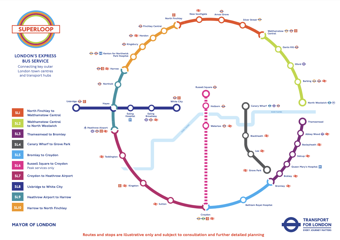
There is also the possibility of a “bus edition” of All the Boroughs. I did a desk-based calculation of a possible route which worked out at around 14 hours (!) but that was before the recent announcement, and ongoing introduction of, the Superloop. This is a near-orbital set of 8 limited-stop buses, circumnavigating outer London (plus 3 radial express routes). The orbital part of the Superloop should be fully launched later this Spring – by 2 March, is the plan – and then offer the ability to visit 18 of London’s boroughs by just staying on the orbital Superloop route itself. Add in the 7 boroughs surrounding the City of London, and City itself, which could potentially all be walked, and you are just left with an inner-West London trek from Merton through Wandsworth to Hammersmith & Fulham and Kensington & Chelsea. Then you just have Havering, Haringey and Greenwich to visit. Easy!?

Some more miscellany:

  • There is also one especially useful regular bus as it passes through 8 boroughs – the 341. Its northern end is close to a likely stop on the Superloop on the North Circular. Its southern end is very close to the SL6 radial Superloop down to Croydon – however this only runs on weekday peaks.
  • SL7 passes through Hounslow borough, but doesn’t stop in it. Does that count as a visit to Hounslow? (Probably yes. We are visiting boroughs not bus stops).

But London buses are often very, very slow. Is it possible to do it in a day (and ideally daylight)? Can I visit all the London Boroughs for £5.25?

Watch this space!
Categories
Cycling Notes Training

Solved: Bluetooth Connectivity Problems with Recent Huawei Smartphones

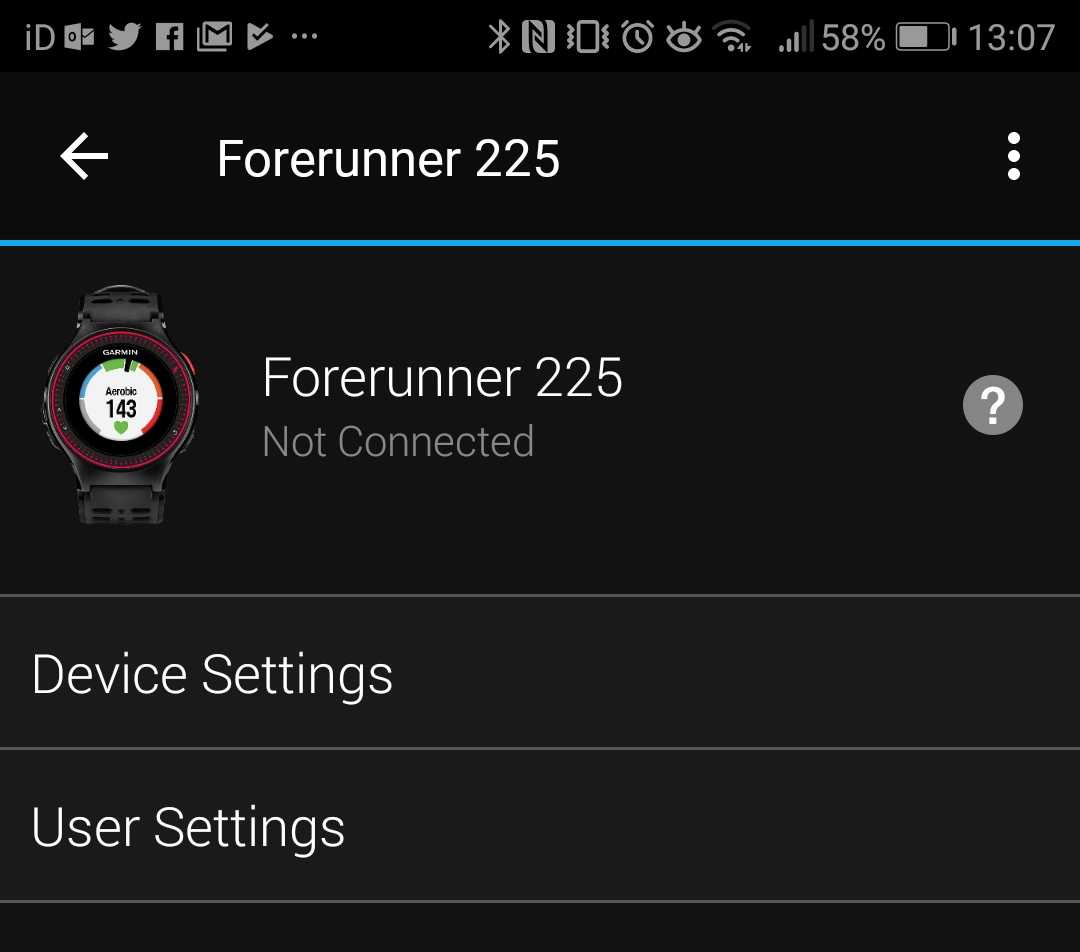
Since getting my most recent Huawei phone (using Android 6.0 “Marshmallow”), I’ve noticed that automatic syncing of my Garmin Forerunner GPS watch often didn’t happen automatically – even if the Garmin Connect app was open. Typically, restarting the phone would solve the issue, and allow a sync to happen – however next time, it would fail, meaning another restart was necessary. Very annoying! There was not a problem with my older Huawei phone, which was on an older (v4.0) version of Android.

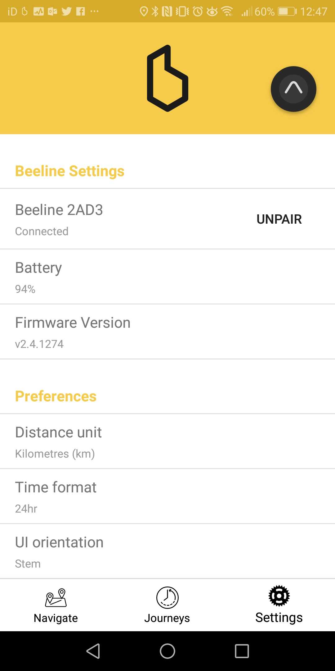
I recently acquired a Beeline smart compass for my bike, and immediately had the same issue. The initial setup was fraught, as it requires a Bluetooth connection, and I was only able to gain one, and pair it through the app, upon restarting my phone. After a few minutes, the connection would drop and, even though it was paired, the Beeline and phone would be unable to find each other.

The problem is due to a bug in the way Huawei’s battery management of its Bluetooth connection to apps, works. A simple configuration change was all that was needed, in order to fix both the Bluetooth connectivity between the Garmin Connect app and my Garmin Forerunner, and between the Beeline app and my Beeline device itself. Once I made the change, I was able to set up Garmin Connect so that it runs in the background, and now I don’t even have to manually open the app in order to sync, after a cycle ride.

The change is surprisingly poorly documented, and also quite hard to find. Indeed it seems to have been specifically hidden away. Essentially, you need to disable Huawei battery management for the app.

The steps you need to do are:

  1. Go to the Settings app.
  2. Choose “Apps & notifications”
  3. Choose “Apps”
  4. Press “Setting” at the bottom.
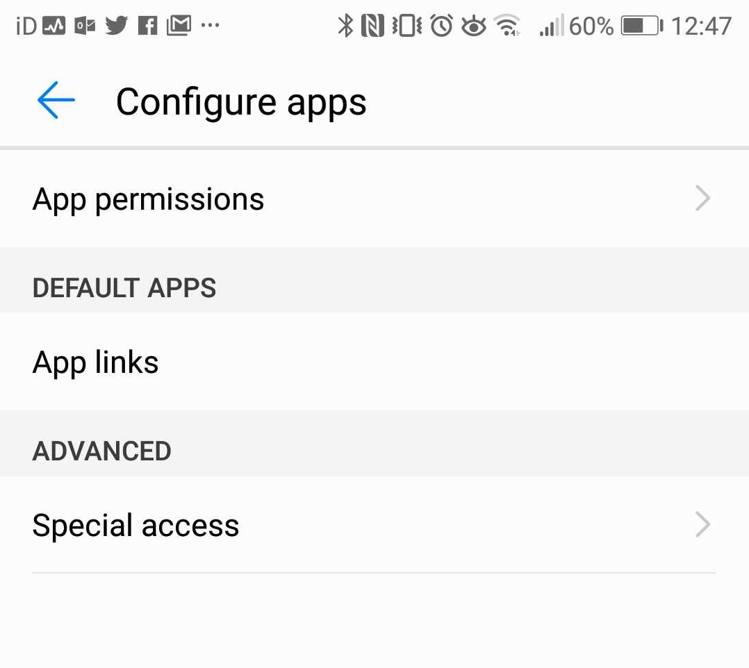
  5. Press “Special access” under the Advanced section.
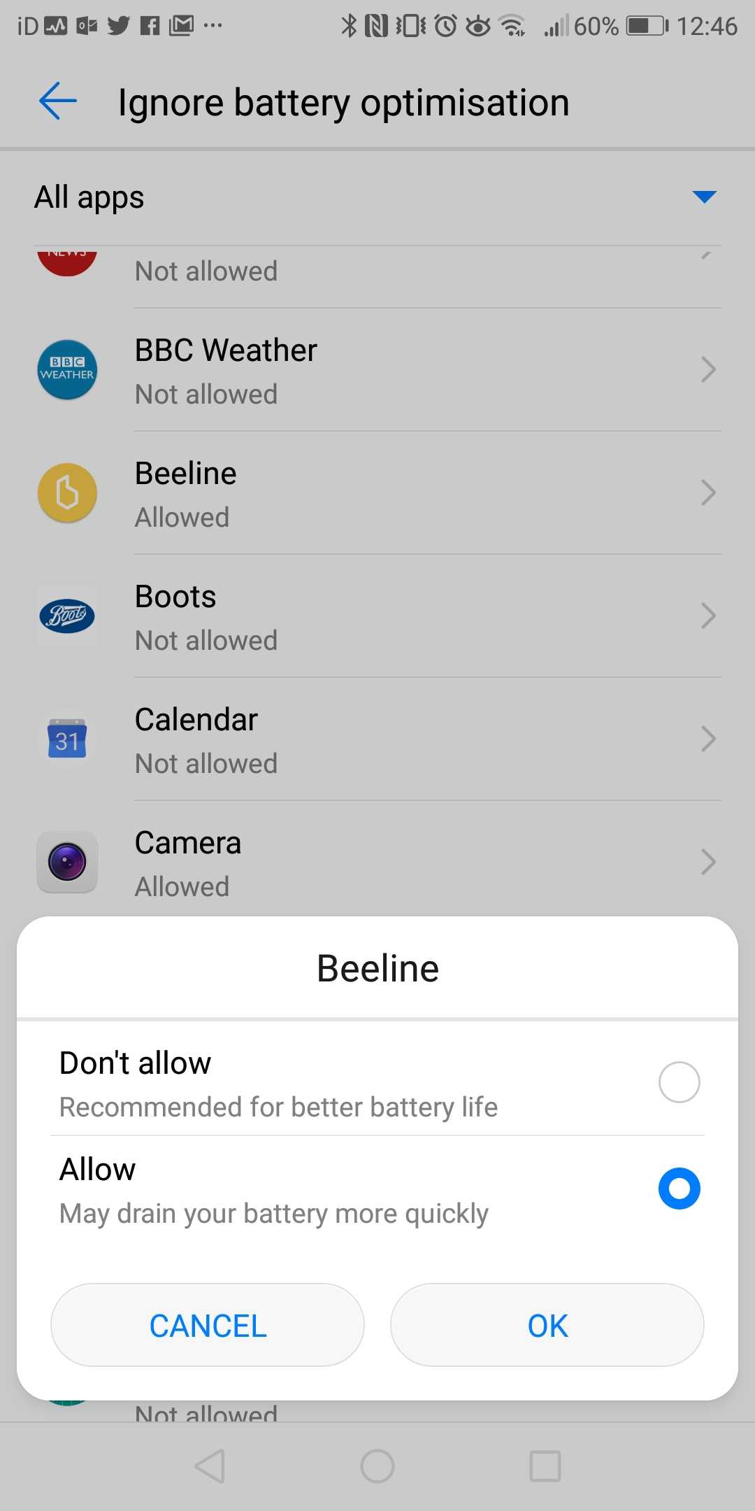
  6. Press “Ignore battery optimisation”
  7. Press the “Allowed” dropdown at the top.
  8. Choose “All apps”
  9. Scroll to the app which is experiencing the Bluetooth connection issues. It will probably have “Not allowed” displayed below it.
  10. Select the app concerned.
  11. Choose the “Allow” option and press OK.

That’s it!

Your Beeline, or Garmin Forerunner, should now generally connect without issues. You have to wait a few seconds, and you may sometimes need to toggle off and on the Bluetooth function from your shortcut panel. But you shouldn’t have to restart your phone just to be able to connect your devices.

Categories
Cycling London

Modal Choices for the London Commute

..and why I’m excited about the rollout of dockless bicycle sharing systems in London.

My commute is around 11km long, it is Zone 3 to Zone 1. Generally I avoid peak times.

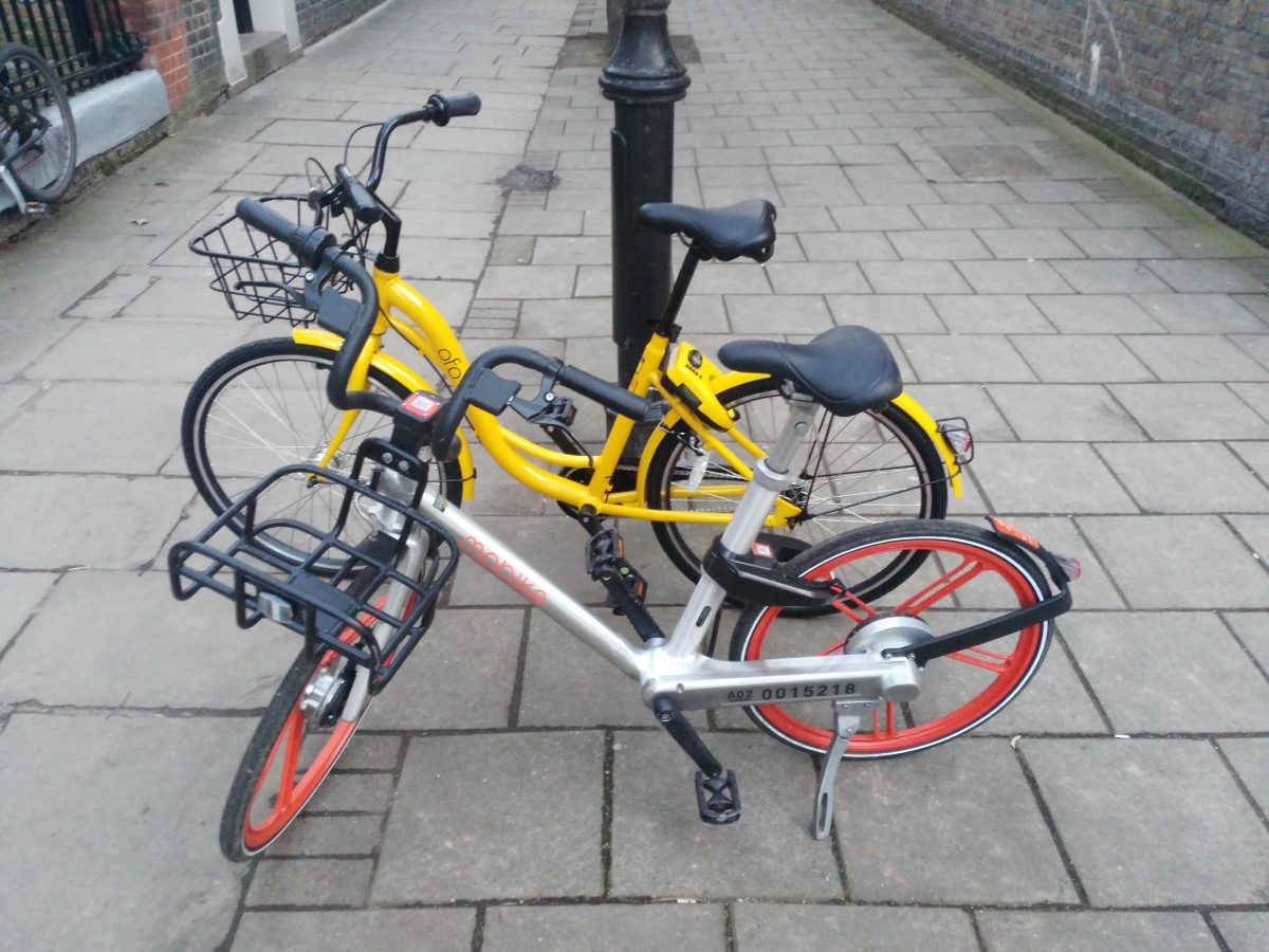
Ofo and Urbo are the dockless systems listed here. (Mobike doesn’t yet work for me, in terms of their borough rollout). Their current footprints don’t include either my start or finish location, so a walk is required at each end (and between them, when changing).

ModeTime      CostNotes/section times
Walk130 min£0.0045 mins to jog (or 60 mins via the scenic route) – can’t do that every day though!
Santander Cycles membership + walk100 min£0.2320+80. £90/year, 200 jnys
Dockless membership (future?)35 min£0.27Door to door. Based on £10/month for 11 months (Mobike). However is high risk as requires high bike availability.
Dockless (future?) + walk45 min£0.5030+15
Ofo (current) + day walk60 min£0.5015+30+15
Ofo (current) + night walk75 min£0.5015+30+30
My bicycle30 min£0.75Get through a £300 bike (or parts)/year
Dockless (future?)35 min£1.00Door to door
Ofo + Urbo (current) + walk70 min£1.0015+30+5+15+5
Santander Cycles + walk100 min£1.0020+80
Tube Z3-2 + walk55 min£1.5030+25. 20p more for peak.
Bus65 min£1.502 buses – hopper fare
Tube Z3-2 + Santander Cycles membership40 min£1.7330+10. 20p more for peak.
Tube Z3-2 + a bike for commute40 min£2.2530+10. 20p more for peak.
Tube Z3-2 + Santander Cycles40 min£2.5030+10. 20p more for peak. SC £2/day = £1/jny
Tube Z3-2 + bus season45 min£2.5530+15
Tube Z3-1 + walk25 min£2.8015+10. 50p more for peak.
Tube Z3-2 + bus45 min£3.0030+15. 20p more for peak.

Some notes:

  • Annual membership of Santander Cycles is scandalously cheap. If you are lucky enough to live in the Santander Cycle zone, then you really are getting a very good deal.
  • Sure I could save a lot of money (or time) by jogging twice a day, but my legs would probably give out after a few days of that!
  • Tube travel, avoiding Zone 1, remains a great bargain London. It’s a pity my work is just a bit too far inside the Zone 1 boundary – but then, that’s why the boundary is where it is.
  • I’m not including commute options that cost more than £10 (taxis, Uber etc). This includes driving, as the London Congestion Charge is £12/day and it is hard to park cheaply (or for free) just outside it!
  • It suprised me that it costs nearly £1 to cycle on my own bike each time, until I realised I spend around £300 a year, either on a new bike, or on repairs/components/tools for the existing one.

Categories
Cycling London

Traffic Calming Bank Junction

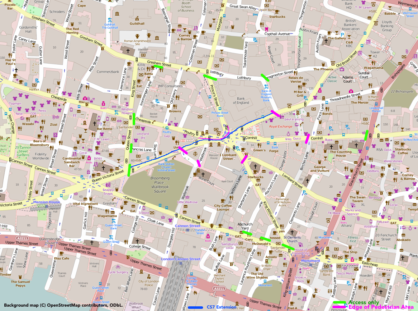
An idea from the City of London – to ban through traffic (except buses) from the seven-way junction at the very heart of the City, modelled on the part-pedestrianisation of Times Square in New York It’s a no-brainer, surely.

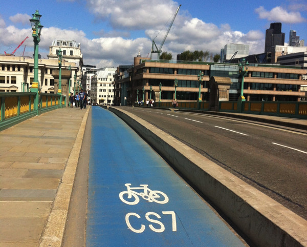
Here’s how I would do it – opening up the attractive space around the Royal Exchange for pedestrians only, adding a SW-NE cycleway through the junction as an extension/diversion of CS7 (which currently ends up at the less-well-located Guildhall), and allowing traffic (taxis) very near to the junction from four of the seven radial streets, while cutting out all through-journeys. Lothbury/Gresham Street is a quiet street and certainly able to take the east-west traffic, along with Cannon Street.

bankjunction

Categories
Cycling London

An East-West and North-South Cycle Superhighway for London?

eastwest

TfL is currently consulting on a couple of proposed “Cycle Superhighways” – an East-West route from Paddington to Tower Hill and a North-South route from St Pancras to Elephant & Castle. The consultations close on 12 October.

The Cycle Superhighways punch right through the centre of London, they are generally wide and properly segregated from traffic. The space is often being made available by reclaiming a traffic lane. The Mayor has referred to them as a “Crossrail for Bikes”, which is a fair description. The two routes meet at the Blackfriars junction.

The east-west route has some curious quirks – it takes a circuitous route around Hyde Park, whereas a new lane going right through the park, or the existing cycle track in the north-east, would surely work better. I expect this is thanks to a lack of cooperation from the Royal Parks authorities – they really should travel to Central Park in New York City to see how world city parks are done properly. It also has a strange section where it takes another tunnel alongside the Blackfriars Tunnel, even though the latter is having one lane closed anyway to keep the traffic lane count consistent. But overall it is a well planned route. Cyclists retain right-of-way over most of the side streets, they don’t have annoying chicanes around the “floating” bus stops, and the “early start” lights (which actually simply act to ensure a cyclist will never get a green light right through) are few and far between.

The north-south route is less completely planned – the core section from Farringdon to Elephant & Castle however is ready for the detailed consultation. A strange dogleg on the approach to Elephant & Castle is unfortunate – “Superhighway” cyclists are always going to be looking for the fastest route, which the route does not take here – but apart from that it is a good, and straight, route.

I very much hope these two routes get built in their planned form and the proposals don’t get watered down. But also I would like Transport for London to focus on improving the busiest existing infrastructure too. Today on my research blog I publish a map showing estimated routes for 12 million bikeshare trips earlier this year. It shows the “Route 0” cyclepath, south of and parallel to Euston Road, as being the busiest of all. There is a good section of segregated two-way cycleway, but it’s horribly cramped, with queues of cyclists at rush-hour often so long that they back onto the next junction. The roadway alongside is normally less busy and therefore often makes for a quicker cycle route. I would also like many more one-way streets to be made two-way for cycles only – the “Sauf Vélo” popular in France, but for London. This can be done on a “lightweight” basis with minimal signage change, so there should be many, many more streets allowing such flows. After all, we don’t make pedestrians walk in a single direction!

Categories
Cycling Training

Strava – Gamifying the Commute

Screen Shot 2014-08-07 at 14.01.32

I first tried Strava last year, comparing it to Endomondo, RunKeeper and some others, as a way of quickly pushing maps of long bike rides onto Facebook, rather than just keeping them to myself on Ascent (a standalone Mac application which has ceased development) or Garmin Connect (which wasn’t particularly sociable).

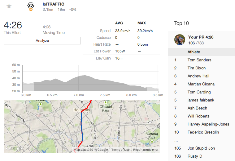
I didn’t use Strava in the end, but I’m a big convert now, because I’ve realised that Strava is not just a running/cycling route recording site, but it’s a fully fledged social network – crucially, one which is large enough to actually function as a proper social network – and best of all, they’ve basically turned London’s street network into a giant game, with “segments”. I first heard of this when a friend, who’s an active Strava user, lamenting that the Tour de France riders had wiped out various segment leaders, en masse, as they zoomed through the streets of London during the third stage of this year’s race, as some were GPS’ing their route as they went.

Segments are sections of a street – typically a long, straight section, or between two sets of slow traffic lights, or from the bottom to the top of a hill – which someone has named and designated as a segment. You then have a public leaderboard of who’s cycled/run the segment, plus your own personal statistics for the segments as well.

Despite recording my recent commutes, and back-loading various GPS’d runs and cycles into Strava, I don’t have many “CRs” (course records) for segments. But I’m pleased to hold on to two – both runs. One is along a windy road near Seven Sisters. The route/segment matching algorithm doesn’t seem to have minded that I cut a big corner near the end, even though it is obvious on the GPS trace, so has given me a comfortable 40 second cushion. The other was a short uphill section of the North Downs Way, part of a leg I ran during the NDW Relay race that my club takes part in every July. Oddly, it was a section where I made a mistake (due to OpenStreetMap inaccuracies), and veered off the route, only to have the others in the relay go past. I corrected quickly and ran hard to regain the lead, and as a useful bonus it’s given me a CR here too.

Anyway, for cycling, I may struggle to get any CRs soon, as most of these on the commute require cycling over 40km/hour, or more for sprints and descents. I’ll need to get lucky with traffic light timings, and late night empty roads. It might also encourage me to run more (which is good) and cycle faster (probably not so good). in any case, it’s made the commute a lot more fun. Thanks Strava!

Screen Shot 2014-08-07 at 14.00.01

Categories
Cycling Leisure

Zone 3 Orbital

14105958511_e24c3dfc40_z

London’s travel zones dictate how much your journey will cost, but their radial nature forms an interesting geography for London in general. While zones actually only apply to stations and not the space between them (the official tube map distorts distance, and you won’t see an official geographical map with zones on it), you can squint at a map and approximate where each zone lies.

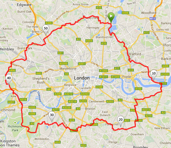
Zone 3 is the “hinterland” between inner London (Zones 1 & 2, or thereabouts) and outer London (roughly Zones 4-6). Zone 1 has an orbital tube line (the Circle Line) and Zone 2 has the circular part of the London Overground. I reckon there’s another circuit to be made – this time by bicycle. So, last weekend, I decided to do a complete circuit of London, staying entirely in Zone 3.

zone3map

Route as zoomable, downloadable map.

It’s a 59 mile circuit, I chose to start and end it in the Lea Valley by Tottenham Hale, but there’s several other obvious points to start it from, including Kew Bridge which is where I broke the route over two days – the distance is certainly doable in a day, but cycling in London traffic for a sustained period is quite exhausting. It took around seven hours in total – I was going very slowly.

Starting from Tottenham Hale, I headed down the canal towpath beside the River Lea, passing many moored canal boats (noticeably more than just a few years ago), the Lea Rowing Club and Springfield Marina. Crossing to the eastern side of the Lea Valley, is this extremely low bridge. The cycle path is good all the way down to Hackney Marshes, where the taller buildings in the newly opened Queen Elizabeth Olympic Park appear on the horizon. Not all the entrances to the park are quite open yet, including my intended entry by the Velodrome, but a short road section leads to the “lower” routes through the park, via new paths down at the riverside. The park is also a bit tricky to exit out of at the other end, with both the long-standing closure of a section of the Greenway, still in place. Then onto the Greenway proper, passing the impressively Victorian Abbey Mills Pumping Station. Then down to ExCeL, dodging the obstruction of the Crossrail building works, and onto the Connaught Bridge, squeezing past London City Airport.

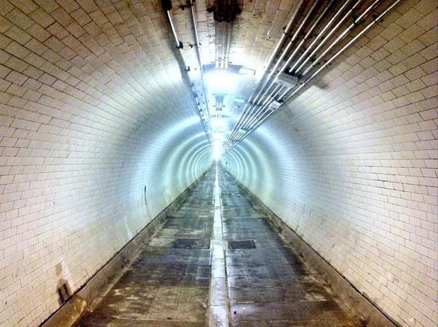
The first crossing of the Thames is via the Woolwich Foot Tunnel which is quite atmospheric – definitely the quieter, edgier version of its Greenwich cousin. I then followed (in reverse) the route of the first three miles of the London Marathon, via Charlton House, which I failed to notice during the run itself! The view from Greenwich Park is one of the most famous in London, but looking the other way is also striking, with a glimpse of the church at Blackheath. I was heading into south London sururbia now, trying to avoid the South Circular as much as possible, but this section was unexpectedly pleasant and interesting, despite being largely residential. A Zone 3 highlight is the Horniman Museum, its lovely Victorian conservatory currently closed but with another great view to London’s skyscrapers. South London’s Zone 3 has much green space including Dulwich Park, Tooting Common, Wimbledon Common with its windmill, and the eastern part of Richmond Park (which is huge), complete with deer, but also this rebuilt church and a rather old railway bridge, as well as this distinctive looking tube station. Then I was back to the bank of the River Thames at Mortlake.

14118494704_5faefcd3db_z

For the second day I started by redoing the Thames path section, it was more enjoyable this time as there were fewer swarms of flies! Crossing at Kew Bridge, my route through north London was, on the whole, less interesting, although I did pass this attractive pub (spot the animal on the roof) at Ealing, and it was good to see the odd bit of decent cycle infrastructure. The parks here are smaller but Hanger Hill Park was a pleasant diversion – Hanger Lane Gyratory less so. Park Royal is a fading and grim part of town – note the poster on the right urging people to fill in the census (three years ago!) and the canal is unattractive here – and the towpath cramped. However, within the north-west London dullness (thanks for nothing, North Circular Road!) there is this dramatic building which I’d been meaning to visit for years. Gladstone Park in Dollis Hill (above) is very hilly, and lovely, but Hampstead Garden Surburb was an odd place, clogged with cars and not living up to its billing of being the most expensive and desirable place in the whole of Zone 3 (I would rather live in Lee or Hither Green if I had a choice!). Ally Pally is dramatic, as are the views, but it’s a shame that it is still little used, given its illustrious history. Broadwater Farm is also dramatic looking, in a very different way. The whole estate is built on stilts, because of the nearby brook. Finally, back to Tottenham and bit of history – here’s the town’s High Cross.

38 Photos of the most interesting things I saw
Map of the photos – scroll right for the last few.

Squinting at this map on Londonist, and this one, I deduced that I had managed to stay in Zone 3 all the way around. The Woolwich Foot Tunnel is nearly (but not quite) in Zone 4, Bellingham is also close, and the southern part of Wimbledon Common is definitely on the outer edge. Richmond Park is an interesting one, going all the way from Zone 3 in the north and east, to Zone 4 in the west and Zone 6 in the south. So I stayed in the eastern part of the park.

My highly unscientific and overly sweeping observations from the route (remember, based on Zone 3 only!) can be summed up as:

  • I found East London more interesting than West London
  • I found South London was prettier than North London

This is based on the Olympic Park canals, and parks of the Lea Valley – and Greenwich Park – being a lot more interesting places than the various tired looking parks in west London (Gunnersbury Park in particular) and the Grand Union Canal is pretty industrial in north-west London. South London is prettier as it isn’t spoilt by the nightmare that is the North Circular road, which acts to cut off outer North London from the inner part, in a way that the South Circular road doesn’t.

13922510417_60f3d3228a_z

Categories
Cycling

London’s Cycling Revolution

cyclerevmap

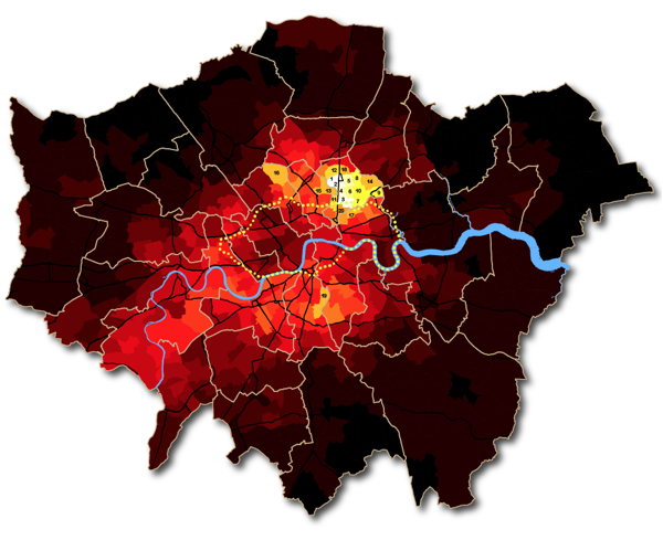
Above is part of a graphic created to highlight the dramatic changes in London’s non-casual cycling population. It is a map showing the proportion of people that travel to work by bicycle (compared to the overall population that travels to work) – each of London’s 620-odd wards being coloured by the resulting value, that comes from the 2011 census. QGIS was used to produce the map, the colour ramp used is a “fire” one, with the highest values corresponding to “white hot” colours, then cooling through orange and red for lower values. Yellow dots show the current (pre-December 2013) extent of the Barclays Cycle Hire system, which is revealingly at odds with where the cyclists actually are.

As a keen cyclist myself, it’s fascinating seeing how Hackney is “lit up” in the map, and also how barriers such as the North Circular Road and the Lea Valley act, apparently both physically and psychologically, to stop cyclists commuting across them. Outwith these constraints, traditionally affluent south-west London boroughs have combined with “hipster central” new-wealth north-east boroughs of Hackney and Islington to create an “axis of cycle commuting” across the capital city. The northern parts of Tower Hamlets, and the eastern parts of Camden, are also starting to turn red, as the Hackney cycling cultural influence slowly spreads. Herne Hill stands out in south London as being a popular cycling location, perhaps inspired by the legacy of the Herne Hill Velodrome (from the 1948 Olympics) living on. Highgate is also another hotspot. Perhaps people commute down its famous steep hills to work in central London, and then take the bike back home on the train?

The full graphic also includes a table listing the top 100 areas (wards) for the main measure. The numbers on the map correspond to the top 20 wards in this table – striking to see how many of them are in Hackney borough. The data came from the UK Census 2011 ward-aggregated data releases made earlier this year by the Official of National Statistics.

You can see the full graphic here which includes a number of “headline numbers” I haven’t mentioned here. I’ve listed the 100 wards from the graphic’s table below for convenience.

The “Total Num” is the population (aged 16-74) that travels to work, so not including those that work from home, are students, or don’t work. “Num by bicycle” is the subset of this population that use a bicycle as their primary means of commuting to work.

Rank Ward Borough Total Num Num by bicycle % by bicycle
1 Clissold Hackney 5988 1226 20.5%
2 Stoke Newington Central Hackney 6269 1274 20.3%
3 Queensbridge Hackney 6154 1235 20.1%
4 Dalston Hackney 7199 1395 19.4%
5 Hackney Downs Hackney 5636 1040 18.5%
6 Hackney Central Hackney 5663 993 17.5%
7 Victoria Hackney 5702 955 16.8%
8 Leabridge Hackney 5946 991 16.7%
9 Wick Hackney 4540 695 15.3%
10 Chatham Hackney 5445 829 15.2%
11 De Beauvoir Hackney 6765 1009 14.9%
12 Lordship Hackney 4620 675 14.6%
13 Mildmay Islington 5968 830 13.9%
14 King’s Park Hackney 3910 542 13.9%
15 Highbury East Islington 5765 795 13.8%
16 Highgate Camden 4538 607 13.4%
17 Bethnal Green North Tower Hamlets 6027 805 13.4%
18 Cazenove Hackney 5221 689 13.2%
19 Herne Hill Lambeth 7751 1017 13.1%
20 Haggerston Hackney 6564 837 12.8%
21 Weavers Tower Hamlets 6087 776 12.8%
22 St George’s Islington 5751 703 12.2%
23 Cantelowes Camden 5127 615 12.0%
24 Kentish Town Camden 6385 744 11.7%
25 Bow West Tower Hamlets 5863 671 11.4%
26 Village Southwark 5608 635 11.3%
27 Brownswood Hackney 5889 660 11.2%
28 Palace Riverside Hammersmith and Fulham 3285 357 10.9%
29 Hoxton Hackney 6844 737 10.8%
30 Highbury West Islington 8127 871 10.7%
31 Brunswick Park Southwark 5977 637 10.7%
32 Brixton Hill Lambeth 8544 910 10.7%
33 The Lane Southwark 7025 740 10.5%
34 Barnsbury Islington 5771 600 10.4%
35 St Peter’s Islington 5799 601 10.4%
36 St Mary’s Park Wandsworth 8833 913 10.3%
37 Wandsworth Common Wandsworth 7133 726 10.2%
38 Tollington Islington 6239 628 10.1%
39 Tulse Hill Lambeth 7544 757 10.0%
40 Junction Islington 5567 558 10.0%
41 Vassall Lambeth 6700 660 9.9%
42 Camden Town with Primrose Hill Camden 5546 543 9.8%
43 Bow East Tower Hamlets 7244 707 9.8%
44 Stroud Green Haringey 6252 609 9.7%
45 Gospel Oak Camden 4540 442 9.7%
46 Peckham Rye Southwark 6669 642 9.6%
47 Shaftesbury Wandsworth 8703 837 9.6%
48 Mortlake and Barnes Common Richmond upon Thames 5159 495 9.6%
49 East Dulwich Southwark 6536 624 9.6%
50 Oval Lambeth 8270 789 9.5%
51 Northcote Wandsworth 8532 811 9.5%
52 Canonbury Islington 5704 541 9.5%
53 St Mary’s Islington 5967 563 9.4%
54 Clapham Common Lambeth 7380 695 9.4%
55 Prince’s Lambeth 6938 650 9.4%
56 Askew Hammersmith and Fulham 7020 656 9.3%
57 Thamesfield Wandsworth 8505 791 9.3%
58 South Camberwell Southwark 5982 553 9.2%
59 Holloway Islington 6869 633 9.2%
60 Munster Hammersmith and Fulham 5953 548 9.2%
61 Mile End and Globe Town Tower Hamlets 5856 537 9.2%
62 East Sheen Richmond upon Thames 4425 404 9.1%
63 Ravenscourt Park Hammersmith and Fulham 4917 448 9.1%
64 Clapham Town Lambeth 7986 724 9.1%
65 Queenstown Wandsworth 8944 810 9.1%
66 Newington Southwark 6546 589 9.0%
67 Nightingale Wandsworth 8062 721 8.9%
68 Stockwell Lambeth 7367 658 8.9%
69 Barnes Richmond upon Thames 4146 370 8.9%
70 Ham, Petersham and Richmond Riverside Richmond upon Thames 4195 373 8.9%
71 Thurlow Park Lambeth 6497 574 8.8%
72 Clerkenwell Islington 5188 455 8.8%
73 Caledonian Islington 5935 518 8.7%
74 Finsbury Park Islington 6373 548 8.6%
75 Crouch End Haringey 6647 567 8.5%
76 Fulham Reach Hammersmith and Fulham 5892 497 8.4%
77 Thornton Lambeth 6235 525 8.4%
78 Balham Wandsworth 8660 729 8.4%
79 Fulham Broadway Hammersmith and Fulham 5583 469 8.4%
80 Hillrise Islington 5077 426 8.4%
81 Ferndale Lambeth 8868 744 8.4%
82 Larkhall Lambeth 9197 771 8.4%
83 Shepherd’s Bush Green Hammersmith and Fulham 6244 521 8.3%
84 Sands End Hammersmith and Fulham 5947 489 8.2%
85 Coldharbour Lambeth 7267 597 8.2%
86 Colville Kensington and Chelsea 3896 318 8.2%
87 Addison Hammersmith and Fulham 6154 500 8.1%
88 Fairfield Wandsworth 9123 741 8.1%
89 Bethnal Green South Tower Hamlets 5471 443 8.1%
90 Notting Barns Kensington and Chelsea 3657 294 8.0%
91 Streatham Hill Lambeth 7180 577 8.0%
92 Chiswick Riverside Hounslow 5428 433 8.0%
93 Tudor Kingston upon Thames 4128 329 8.0%
94 Hammersmith Broadway Hammersmith and Fulham 5574 444 8.0%
95 Camberwell Green Southwark 6471 513 7.9%
96 Queens Park Brent 7598 600 7.9%
97 Haverstock Camden 4900 386 7.9%
98 Spitalfields and Banglatown Tower Hamlets 4619 362 7.8%
99 West Putney Wandsworth 6772 527 7.8%
100 Fulwell and Hampton Hill Richmond upon Thames 4747 369 7.8%

The graphic was produced in association with Mediarun and Bolt Burdon Kemp.

Categories
Cycling Olympic Park

Five Not-so-great Pieces of Cycling Infrastructure in London

Following on from my previous article on five great pieces of cycling infrastructure, here’s five things that didn’t make the list, and why:

Cycle Superhighways

cyclefac_cshgoogle

These were never intended to be “Dutch” fully segregated, high-capacity cycle routes. They are there to assist confident cyclists getting to work and back along the major roads. The project included reconfiguring many junctions to make them safer for cyclists too. However, too often, the “Superhighways” are just specially surfaced sections of roads, with no physical or optical barrier stopping trucks and cars driving along them. Worse, some sections are badly breaking up, with the surface disintegrating – most likely due to motorised traffic rather than the bicycles themselves. I understand that the project included funds to keep these maintained but that’s clearly not happening.

A real Cycle Superhighway would have been a lane in each road closing to motor traffic, which is happening in other cities (Vancouver, Washington DC to name but two). But with one measure of the transport authority’s performance being the average speed of traffic across its network, this was never likely to happen on the trunk roads.

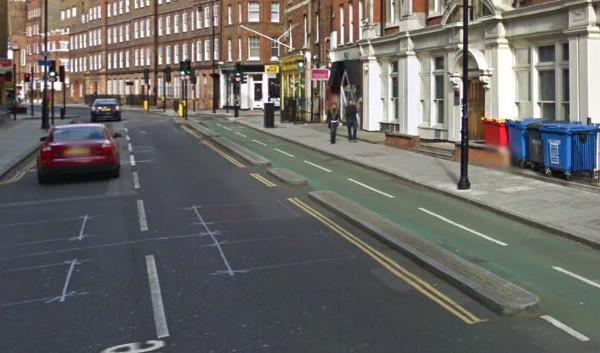
Tavistock Place / Torrington Place Cycleway

cyclefac_tavistock

A very well used two-way cycle facility on a key east-west cycle route in London, the cyclists’ parallel to the heavily trafficked Euston Road. Sadly it is so busy with cyclists now that, at rush hour, with the lane only wide enough for one bicycle, the queues can stretch back beyond the previous junction. It’s therefore faster to cycle along the road during the rush hour – except you get hassled by taxis and other traffic when you do, because apparently the rest of the road is out of bounds to cyclists if there’s a cycleway.

The cycleway also includes an odd section where the two cycle lanes pass each other on their left – minor cycle-cycle collisions are frequent. Pedestrians often also cross the lanes without looking, with poor sight-lines, resulting in frequent frustrated yells from oncoming cyclists. The route needs the Royal College Street armadillo treatment, and the Camden Cycle Campaign has recently launched a project to encourage this to happen.

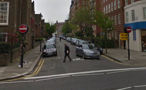
One-way Streets, even for Cyclists

cyclefac_oneway

Encouragingly, two-way cycling on one-way streets is happening in quite a few places now – Hackney borough and the City of London Corporation, in particularly, have been taking the simple steps to allow quiet roads to be one-way for traffic, but two way for cyclists, without building complicated and often unnecessary dedicated cycle routes. Most European cities – Paris, Brussels and Vienna to name but three, are full of these kinds of streets. However, in London a great many side streets remain as impermeable for narrow bicycles as they do for big cars and trucks. There is often no reason why other than historical convention.

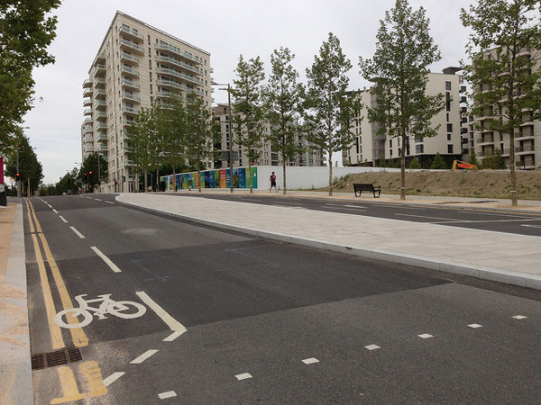
Cycle Routes in the Olympic Park / East Village

cyclefac_olympic

A whole brand-new neighbourhood being created, and a great chance to create a sustainable transport utopia, along with direct, spacious cycleways between east and central London, avoiding the traditional big roads? It’s still early days, but it doesn’t look like it’s going to happen. There’s just the “usual” cycle lanes which cars can drive in. There are a few dedicated sections, which are wide and straight, but it’s not all joined up. A real missed opportunity.

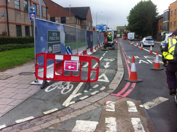
Removal of Cycle Paths

broadlane

For streets managed by the central transport authority, rather than the individual boroughs, it seems that dedicated bicycle paths are out of fashion. The photo shows a cycle path on a wide pavement, about to be bulldozed away. It was never a great path, and not particularly popularly used (and often walked upon by pedestrians, hence the sign here), but it was still better than being on the road with the traffic. Original plans for the road rebuild here showed the cycle path being retained (Map D) but the plans were quietly updated and now show it gone. It will be replaced by a wide pavement with trees, the three-lane one-way road beside going to a two-lane two-way road. You can tell its a centrally managed street, by the way, because of the lines on the edge of the street being pink rather than yellow.

There are other examples of junction rebuilds happening where dedicated infrastructure for cyclists appears to be being designed out.

First three photos: Google Streetview. Fourth photograph: Diamond Geezer.

Categories
Cycling

Five Pieces of Great Cycling Infrastructure in London

As part of some recent work visualising and mapping London cycling, I identified five pieces of bike infrastructure in the city that I feel are worthy of highlighting. As is the way with most things related to London cycling, most of these have some controversy attached and here I try and justify why I think they deserved inclusion in my list.

Armadillos, Royal College Street

cyclefac_armadillos

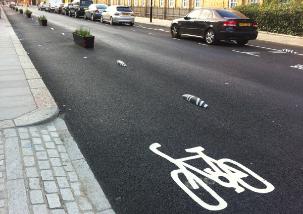
Royal College Street has long been a flagship cycle facility for Camden Borough, with a wide pavement-based two-way cycle lane being at least 10 years old. However, with some incidents occurring at side-junctions due to motorists not expecting cyclists in both directions, the road has now been reconfigured so that both sides of the street have a cycle lane, and the lane is placed in the road. To stop cars parking in the lane, a mixture of flower planters and “armadillos” are used. Armadillos are compact plastic “bollards” which are small and unobtrusive – so easy to install – which is potentially very significant as a way to quickly increase the number and effectiveness of London’s cycle lanes. The configuration of Royal College Streets ensures the best of both worlds for cyclists – the lane is at road level so pedestrians don’t walk in it, but is separated from the road so motorists don’t park in it. Bus stops don’t interrupt the lane or cause it to swerve behind. The scheme is not perfect – the lanes are not quite wide enough and the route itself stops short of its main junction, and it remains to be seen if cyclists and disembarking passengers can share the same space safely – but still represents an innovative experiment and I hope that armadillos will be marching throughout London soon.

Cycle counter, Goldsmiths’ Row

cyclefac_counter

The south-west to north-east route between Hackney Road and Hackney Central, via Broadway Market and London Fields, has long been popular with cycle commuters. Recently, a further part of the route was closed to vehicles and cyclists instead get the width of the road, rather than the pavement route which was a hazard to people entering the nearby city farm. This counter detects each passing cyclists with metal detectors under the road, and displays the stats on a board for all to see. It’s not perfect (the sensor can double-count or miss from time to time) but generally it shows 1000+ cycles a day, and hit the 100000 mark on 31 August – less than a month after being switched on on 5 August.

Floating towpath, Bow flyover

cyclefac_towpath

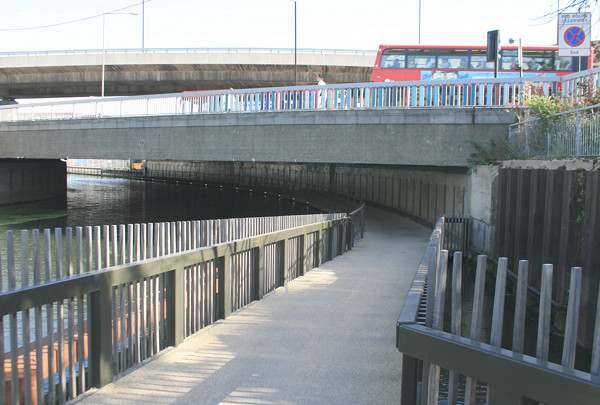
The Bow flyover junction has long been a physical barrier for cyclists heading up and down the Lea River – and an accident blackspot with two cyclist deaths on the roundabout level recently. This floating towpath was added underneath the roundabout recently, allowing a hassle-free route from Hackney Wick to Poplar and Limehouse. It joins two other “floating towpaths”, one upstream at Lea Bridge/Clapton, and one downstream near Bow Locks/Poplar. The sections are technically floating in that there is water under them, but they are perfectly solid to cycle over, and are subtly lit to allow safe usage at night.

Cycle repair stand, Great Guildford Street

cyclefac_stand

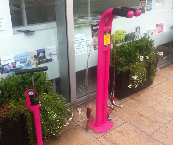
Every had a mechanical while out and about? I have had one many times, and if it’s the evening and the bike shops are not open, then a convoluted tube journey (or worse after 1am) often follows to get home and repatriate the bike or retrieve tools. However if you break down near Bankside, then this handy utility has all the tools you need, attached to wire. The stand itself will also support a bike’s weight while you work on it, and a pump beside (sadly broken at the moment) will help with flat tires. There is another stand in Paddington Station. Both are supplied by Cyclehoop – see also this map of all their public bicycle pumps.

Cycle lanes, Southwark Bridge

cyclefac_bridge

These layers are wide, allowing overtaking, and are segregated from both the road and from the pavement. Although they were built because Southwark Bridge was too weak to allow four-lane traffic, the space created represents the safest way to cross a London bridge by bicycle – and with the majority of morning commuter traffic on central London’s bridges being bicycles, it is a much-needed facility. The lane is prominently marked, being one of the better parts of the controversial Barclays Cycle Superhighway network.

To follow in my next post – five that were not in my list, and the reasons why.