Categories
Data Graphics London

Tube Heartbeat

tubeheartbeat

Tube Heartbeat is a interactive map that I recently built as part of a commission by HERE, using the HERE JavaScript API. It visualises a fascinating dataset that TfL makes available sporadically – the RODS (Rolling Origin Destination Survey) – which reveals the movements of people on the London Underground network in amazing detail.

The data includes, in fifteen-minute intervals throughout a weekday, the volume of tube passengers moving between every adjacent pair of stations on the entire tube network – 762 links across the 11 lines. It also includes numbers entering, exiting and transferring within each of the 268* tube stations, again at a 15 minute interval from 5am in the morning, right through to 2am. It has an origin/destination matrix too, again at fine-grained time intervals. The data is modelled, based on samples of how and where passengers are travelling, during a specimen week in the autumn – a period not affected either by summer holidays or Christmas shopping. The size of the sample, and the careful processing applied, means that we can be confident that the data is an accurate representation of how the system is used. The data is published every few years – as well as the most recent dataset, I have included an older one from 2012, to allow for an easy comparison.

As well as the animation of the data, showing the heartbeat of London as the the lines pulse with passengers squeezing along them, I’ve including graphs for each station and each link. These show all sorts of interesting stats. For example, Leicester Square has a huge evening peak, when the theatre-goers head for home:

leicestersquare

Or Croxley, in suburban north-west London, with a very curious set of peaks, possibly relating to the condensed school day:

croxley

Walthamstow (along with some other east London stations) has two morning rush-hours with a slight lull between them:

walthamstow

Check the later panels in the Story Map, the intro which appears when first viewing Tube Heartbeat, for more examples of local quirks.

This is my first interactive web map produced using the HERE JavaScript API – in the past, I have extensively used the OpenLayers, as well as, a long while back, Google Maps API. The API was quick to pick up, thanks to good examples and documentation, and while it isn’t quite as full-featured as OpenLayers in terms of the cartography, it does include a number of extra features, such as being quickly able to implement direction arrows along lines, and access to a wide variety of HERE map image tiles. I’m using two of these – a subdued gray/green background map for the daytime, and an equivalent darker one for the evening data. You’ll see the map transition between the two in the early evening, when you “play” the animation or scrub the slider forwards.

Additionally, I’ve overlayed a translucent light grey rectangle across the map, which acts to further diffuse the background map and highlight the tube data on top. The “killer” feature of HERE JavaScript API, for me, is that it’s super fast – much faster than OpenLayers for displaying complex vector-based data on a map, on both computer and smartphone. Being part of the HERE infrastructure makes access to the wide range of HERE map tiles, with their distinctive design, easy, and gives the maps a distinctive look. I have previously used HERE mapping for some cities in the Bike Share Map (& another example), initially where the OpenStreetMap base data was low in detail for certain cities, but now for all new cities I “onboard” to the map. The attractive cartography works well at providing context for the bikeshare station data there, and the tube flow data here.

There is some further information about the project on the HERE 360 blog, and I am looking to publish a more deatiled blogpost soon about some of the technical aspects of putting together Tube Heartbeat.

Stats

Number of stations Number of lines Number of line links between stations
268* 11 762

Highest flows of people in 15 minutes, for the four peaks:

Between stations (all are on Central line)
Morning 8208 0830-0845 Bethnal Green to Liverpool Street
Lunchtime 2570 1230-1245 Chancery Lane to Holborn
Afternoon 7166 1745-1800 Bank/Monument to Liverpool Street
Evening 2365 2230-2245 St Paul’s to Bank/Monument
Station entries
Morning 7715 0830-0845 Waterloo
Lunchtime 1798 1130-1145 Victoria
Afternoon 5825 1730-1745 Bank/Monument
Evening 2095 1015-1030 Leicester Square
Station interchanges
Morning 5881 0830-0845 Oxford Circus
Lunchtime 2060 1330-1345 Oxford Circus
Afternoon 5043 1745-1800 Oxford Circus
Evening 1109** 2215-2230 Green Park
Station exits
Morning 6923 0845-0900 Bank/Monument
Lunchtime 2357 1145-1200 Oxford Circus
Afternoon 7013 1745-1800 Waterloo
Evening 1203 1015-1030 Waterloo

* Bank/Monument treated as one station, as are the two Paddington stations.
** Other stations have higher flows at this time but as a decline from previous peak.

I’m hoping to also, as time permits, extend Tube Heartbeat to other cities which make similar datasets available. At the time of writing, I have found no other city urban transport authority that publishes data quite as detailed as London does, but San Francisco’s BART system is publishes origin/destination data on an hourly basis, there is turnstyle entry/exit data from New York’s MET subway, although only at a four-hour granularity, and Washington DC’s metro also publishes a range of usage data. I’ve not found an equivalent dataset elsewhere in Europe, or in Asia, if you know of one please do let me know below.

tubeheartbeat2

The data represented in Tube Heartbeat is Crown copyright & database right, Transport for London 2016. Background mapping imagery is copyright HERE.

Categories
London

Open Doors: Battersea Power Station

batt5
I’ve been slow to write about all my Open Doors week construction-site visits back in June, but as well as seeing a soon-to-be-skyscraper, I also made it to two other sites, the largest of which far-and-away was Battersea Power Station – more specifically, the “Phase 1” work beside it, which is the construction of two huge 20-story-high blocks that will surround the venerable power station – itself also a building site right now as part of the “Phase 2” work.

batt3

The blocks were all sold off-plan long ago, and construction is taking place at a frenetic pace, as the developer aims to deliver the accommodation as soon as they can. The sheer amount of activity is breathtaking, with over 2000 workers on site.

batt2

The tour included a visit to the basement infrastructure of the new blocks, as well as looking inside a couple of the flats (which include pre-fabricated bathrooms that have been just dropped in), and – the definite highlight – a journey up a hoist to the roof, from which you looked down to the roof of the old power station, or across the Thames to central London, and to the garden of the £4m+ penthouse that will be there soon.

batt6

There were a few additional surprises, such as a spiral staircase being constructed, and a close-up view of the power station in transformation (the route to the Phase 1 work is along a narrow pathway between the station and the river).

batt7

batt1

It was great to see too the chimneys of Battersea Power Station being restored – having disappeared from the skyline at the beginning of the project (sulphur damage had made them structurally unstable), the first of the four replacements, constructed with the same techniques and materials, has now reappeared.

batt4a

Categories
London

Open Doors: 22 Bishopsgate

22bishopsgate_1

It’s Open Doors week this week, where the public get a glimpse into many construction sites, and this morning I visited the site of 22 Bishopsgate, in the City of London. The site itself has an interesting recent history – it was going to be the Pinnacle, an elaborate, spiraling skyscraper. But construction stopped as the downturn hit hard in 2011, and for the last few years, it’s been nicknamed “The Stump” – an abandoned nine-storey concrete core. It’s taken Brookfield Multiplex, the chief contractors for the new skyscraper, around a year to dismantle the old core, by slicing up the concrete into 8-14 tonne sections, lifting them out, digging back down into and rebuilding the basement to the new design. Finally, pretty much in the last few weeks, they’ve been able to stop digging down and start building up again.

The building will start to rise quite quickly in the next few weeks. The new design consists of two cores – a square-ish one, which will lead a rectangular one alongside. This reflects the non-square shape of the site – it being narrow to the north than to the south, and squeezed to the east by the Cheesegrater and the long-suffering Hiscox building. Both will rise by around a storey a week, with the square one leading the rectangular one by around five storeys, and the metal structure of the floors surrounding the cores another five or so storeys below. Currently, the main core is 2-3 storeys up already and is about to start its long continuous rising phase. The rectangular core, which we looked down on from the elevated viewing platform, is a storey below ground level at the moment, and today is having a temporary wall added to the top of it, creating a platform and work area “raft” that will rise up with it. The square core already has its temporary wall erected, coloured black and made of perforated steel, and can be seen as the main feature in both the photos above and at the bottom, surrounding a small yellow crane and other yellow machinery that will sit on the raft.

Even with a storey-per-week rise, this process will take more than a year, for 22 Bishopsgate will be a huge “slab” type skyscraper, with vertical walls, stretching an impressive 64 storeys high. It will be only marginally lower than the nearby Shard skyscraper, at 278m. It will fit snuggly in to the skyscraper cluster of the Cheesegrater, Gherkin, Natwest Tower and various others. The design is not “exciting” – it is a straight up-and-down building which is using up its full footprint, but his means it will provide a good balance to the nearby flamboyant Gherkin and Walkie Talkie building. In this artist’s impression, in which it is the obvious tallest building in the cluster here, it looks like an updated, taller/wider and glassier version of the classic Natwest Tower nearby which is just to the right hiding behind another under-construction skyscraper, 100 Bishopsgate:

22_bishopsgate_impression

From the viewing platform, we could also see active work going on for 100 Bishopsgate, just up the road as the name suggests, as well as the recladding and height extension of One Angel Court, and finally a very small tower going up in the small space between Bishopsgate and the Natwest Tower. As part of this latter project and 22 Bishopsgate itself, the Highwalk around the Natwest Tower has now been completely removed. This is a shame – it was a largely unknown but nice elevated walking space. However, I understand that the Highwalk will be rebuilt once both projects are complete, so we will once again be able to walk above the roads and amongst the towers.

Unfortunately we weren’t allowed to take photographers on the tour, but you can see the square core clearly from Bishopsgate now – see the photos here. Our wooden-clad viewing platform can be see in the background of the first photo, on the left.

22bishopsgate_2

Middle image is an artists impression of the completed cluster, from Lipton Rogers.

Categories
Leisure London

A Glimpse into Walthamstow Wetlands

I was on a guided tour of the Walthamstow Wetlands today, a huge area of 10 historic reservoirs that has long been the preserve of fishermen, birdwatchers and water company workers, that is about to be turned into a large, publicly accessible nature reserve. The area is near to the Woodbury Wetlands, which similarly was a largely unknown area of water and reeds that has now been opened up, the guest of honour at the opening ceremony last month being none other than Sir David Attenborough. However, Walthamstow Wetlands is ten times larger, and the London Wildlife Trust, who are delivering the tranformations in both areas and led today’s tour, describe Woodbury Wetlands as just a “dress rehearsal” for the Walthamstow Wetlands area, which is 6 times the size and is due to open in 2017. It will be far and away the largest area of wetland habitat in London and one of the most important in Europe.

ww_reeds2

The area is already teaming with birds, other animals, and wildflowers, and some early signs of the conversion are already in progress, compared with my previous visit a few years back. The surface has been laid on a new walking/cycling route that will run the length of the reserve, with two new entrances being created at either end to complement the only current access which is from Ferry Lane in the middle of the reserve. Several areas have been fenced off in the Reservoirs 1, 2 and 3 – the earliest, hand-dug and shallow ones, the aim being to turn these into areas of reed beds to encourage bitterns back into the area. The two main islands, Heron Island and Cormorant Island, are full of their respective birds – the latter island being largely bare of vegetation and full of the squarking animals. Other wildlife spotted included a variety of geese and ducks (some as families), some large fish (the area is a major spot for angling) and many dragonflies. Also, somewhat less fortunately, there was a grass snake near the entrance – run over and squashed presumably by estate traffic.

Plans include complete renovation of the historic engine house in the middle of the site, to act as the main visitor centre, cafe, exhibition and an education facility. The house will have part of its tower rebuilt with hollow bricks, to encourage skylarks to nest. The renovation is well underway with the building gutted and in scaffolding. Various bits of machinery from its days as a pumping house will be retained, although the main pump itself was removed many years ago. At the southern end of the reserve, the central part of the Coppermill building will have a lift added, allowing access into the tower for a great view over the reserve. The look of the building will be carefully preserved, this means the lift will not make it to quite the top of the tower. Access to the reserve, centre and viewpoint will all be free. Possible future plans, subject to the success of the reserve and its ability to be self-funding following opening, will be a second small visitor facility being built in the rest of the Coppermill building, which, for now, remains a storage site for Thames Water.

ww_wildflowers

Top and second: Preparation of the new reed beds. Above: One of the tracks through the reserve, which has had bracken removed and has been planted with wildflowers to encourage different kinds of birds. Below: Geese and a swan on another of the reservoirs. Bottom: Looking from Ferry Lane into the north part of the wetlands, which was not part of today’s tour.

ww_water

There is more information about the project on the official website.

ww_north

Categories
London

TubeHacker: 10 Ways to Optimise Travel in London

wtt

1. Tube trains do run to a strict timetable, rather than just “saturating” the tunnels with trains, as can appear to be the case on many lines during the rush hour.

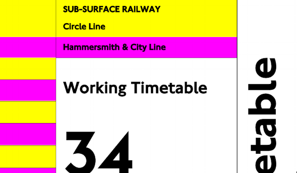
This is not normally useful because the gap between trains is so small, so TfL doesn’t publish the timetables, except for first/last trains and, for train geeks, the Working Timetables are hidden away on their website. However, the timetables (which are accurate to quarter-minutes) are useful near the start or end of the day – particularly around midnight, where the frequencies drop right down. Journey Planners, such as Google Maps, make use of the hidden timetables. Case in point – a recent journey suggested a Circle Line train arriving at 0002 at Paddington, going eastwards. Sure enough, as I ran down the stairs a hundred seconds after midnight, it was just pulling in. For less frequent services, such as Metropolitan Line trains to Amersham, the timetables become event more important. Crossrail will also likely be relatively infrequent, especially for services to the far ends.

tube_osi

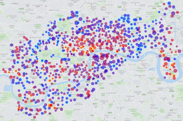
2. Out of Station Interchanges (OSIs) can be useful for saving money (i.e. avoiding Zone 1) or time (as distances can be much smaller between other lines than the tube map can suggest). They are “free” transfers which are not shown on the tube map, but which count as only one journey, even if you go out through ticket barriers and back in at the other station. The system does the maths so you don’t end up paying for too. Each OSI has a time limit between the two sets of barriers, so don’t go shopping in between the stations! You can see the current OSIs between tube/DLR/Overground stations on this map, or see this page for the complete list.

3. You don’t have to flag down, hail or otherwise signal TfL buses. This has been the case for a few years. Bus drivers will always stop if they see you at the stop and you show a vague interest towards the bus – such as facing it and looking at it. Save your weary arms and don’t give passing cyclists frights!

london_bikeshare

4. The Santander Cycles (a.k.a Boris Bikes, or generically, the London Bicycle Sharing System bikes) stretch across a wide area of central London. They charge £2 for every 30 minutes after the first half hour. You can save money on a long journey by docking just before the 30 minutes is up, waiting at least 5 minutes, and then starting the next leg of the journey, either from the same docking station or a nearby one. (N.B. Santander Bikes are not included in the Oyster/Contactless/travelcard system – yet. They may be included from summer 2017 onwards.)

5. Oyster/Contactless is always cheaper than paper tickets when travelling in Zone 1-6, or on any TfL services outside of these zones, but not necessarily when on non-TfL services travelling outside of Zone 1-6. For example, paper tickets from Gatwick Airport to London Bridge/Blackfriars or to London Victoria can sometimes be cheaper than Oyster/Contactless – particularly at weekends with “Super Off-Peak” paper tickets and especially if you have a railcard that you can’t use with Oyster/Contactless. I can travel from Gatwick to Blackfriars for £5 on Sundays with a buy-on-the-day paper ticket and a Network Railcard, but it’s £8+ with Oyster. N.B. In rare cases, the end-of-day batch calculation that Contactless uses, compared to Oyster with its immediate charging, means that Contactless can work out cheaper than Oyster. Geoff Marshall (Londonist) investigated this.

6. 2-for-1 to top London Attractions: If you have a paper train ticket (i.e. for National Rail and London Overground, not the tube) to the stations nearest the attraction then you can get a 2-for-1 on entry (e.g. Richmond to Kew Gardens for visiting the aforementioned gardens is £3 for 2 people – save £16+ on getting in). You don’t actually have to do the journey though, and you don’t need to buy the tickets from the start of your theoretical journey – buy it at the station nearest the attraction if there’s a ticket office there. Buy a journey which is very short, as then it will be cheap!

tube_shortcuts

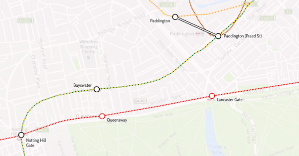
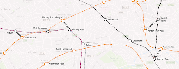
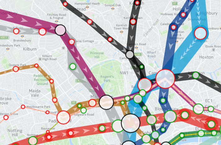
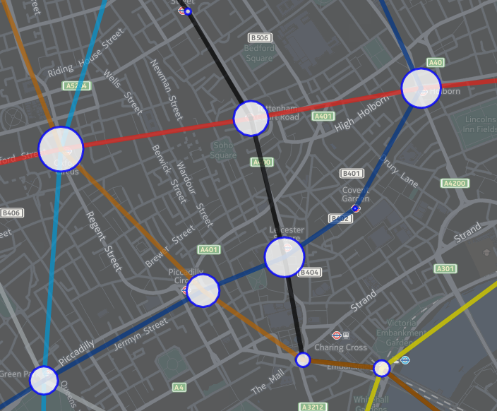
7. The tube map is far from geographical. Here are some journeys that are shorter by walking, than by taking the tube:

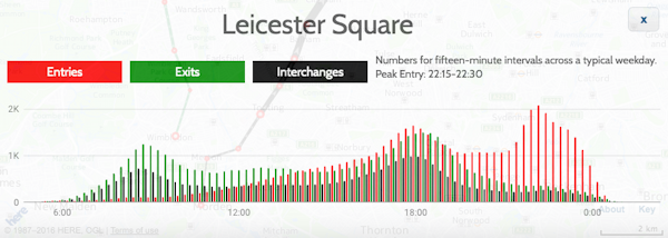
  • Leicester Square to Covent Garden (450 people a day do this journey by tube! Don’t!)
  • Bayswater to Queensway
  • Paddington to Lancaster Gate (i.e. Hyde Park)
  • Farringdon to St Paul’s

8. Sometimes, you don’t need to get the tube. A day bus pass is £4.50, but you get a free one automatically put on your Oyster/Contactless after 3 bus journeys that day, and then you can go on unlimited other TfL buses for free until 0430 the following morning. A “Hopper” ticket giving you two journeys in an hour for £1.50, is coming in September. In both cases, you pay for the electronic ticket through Oyster or a contactless credit/debit card – buses don’t take paper tickets.

9. Buses don’t have zones, but are included in any travelcard. So you can have a Zone 1-2 travelcard and then travel out from Zone 2 on a bus, to Zone 3 or right to the edge of London etc, then back into Zone 2 from Zone 3 on a bus, all on the travelcard.

singlefarefinder

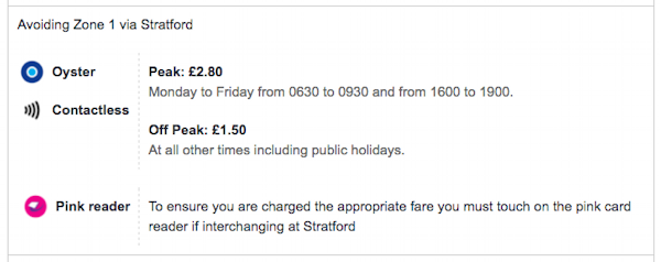
10. If you avoid Zone 1, long journeys can be extremely cheap. For example, stay on TfL rail services (Underground, Overground, TfL Rail, Tramlink) and it’s just £1.50 off-peak, no matter how far you go – you’ll need to touch on pink Oyster card readers when changing trains, to prove you went that way. Uxbridge to Upminster is just £1.50 off-peak with Oyster/contactless, despite being over 31 miles as the crow flies. Just touch the pink reader at Stratford’s Overground platforms. This doesn’t always work – if you have to travel back on yourself then you may not get the discount. For example, Earl’s Court to Highbury and Islington doesn’t work (despite both being in Zone 2), but very close by West Brompton to Highbury and Islington does, because you leave the same direction as you arrive, when changing at West Brompton. The single fare finder is extremely useful as it will always tell you if there’s an avoid Zone 1 option for your journey, and where you may need to touch a pink reader to prove it.

To complicate things even more, there’s certain journeys where touching a pink reader, will *increase* the fare you made – even if you didn’t go into Zone 1. A pink reader acts as proof you were at that place, and TfL will apply rules about logical/sensible journeys, based on this information. For example: Canada Water to Tottenham Hale: Single Fare finder says it’s £1.50 if you end at the National Rail gates there, and £2.80 if you end at the Underground gates.

pinkvalidators

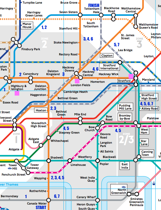
There are, I think, seven sensible off-peak routes, based on Zone 1/not Zone 1 choice, whether you have a bike and that the Stratford-to-Tottenham line being very infrequent – below, I’ve assumed leaving Canada Water as soon as possible after 8pm on a normal Friday and got the times from TfL’s Journey Planner or Google Maps:

Route Change At Zone 1? Bikes allowed? Pink Readers How Long (mins)? Fare
1 Green Park Yes No 33 £2.80
2 Highbury & Islington Yes No 33 £2.80
3 Canonbury, Hackney Central Yes Yes 45 £1.50
3 Canonbury, Hackney Central Yes Yes Hackney Central 45 £2.80
4 Whitechapel, West Ham, Stratford, Hackney Central No Yes £1.50
4 Whitechapel, West Ham, Stratford, Hackney Central No Yes Hackney Central £2.80
4 Whitechapel, West Ham, Stratford, Hackney Central No Yes Stratford £1.50
4 Whitechapel, West Ham, Stratford, Hackney Central No Yes Stratford, Hackney Central £1.50
5 Whitechapel, West Ham, Stratford No Yes £1.50
6 Stratford, Hackney Central No No £1.50
7 Stratford No No 34 £1.50

Cheaper than it should be, Pink validator increases your fare, more expensive than it should be, Pink validator increases your fare, correctly

There are other possible routes, but they are less sensible (i.e. not as fast), such as taking the Overground circle the long way around (via Clapham Junction).

If you go via Canonbury and Hackney Central/Downs (route 3), you pass through Zone 1 (Shoreditch High Street station), however the default off-peak fare is £1.50 as you finish at the National Rail gates. Touching at the interchange between Hackney Central and Hackney Downs will increase the fare to £2.80, because you proved you’ve gone that way, not via another route changing at Stratford only, which does avoid Zone 1. You could go in fact still change at Stratford and Hackney Downs/Central, which avoids Zone 1, but touching at Hackney Downs/Central will charge you the Zone 1 fare. This route is sensible, because the direct Stratford trains are only once every 30 minutes (and often not running at all). An even more convoluted route, changing at Whitechapel, West Ham, Stratford and Hackney Downs/Central, is still viable for me, as if I’m taking a bike on the train, I can’t do the Mile End to Stratford or Canada Water to Canning Town sections…

Categories
London

London Panopticon

Panopticon Animation

The London Panopticon utilises the traffic camera feed from the TfL API, which recently (announcement here) added ~6-second-long video clips from the traffic cameras on TfL “red route” main roads, to show the current state of traffic near you. The site loads the latest videos from the nearest camera in each compass direction to you. The images are nearly-live – generally they are up-to-date to within 10-15 minutes. If the camera is “in use” (e.g. being panned/zoomed or otherwise operated by an official to temporarily reprogramme the traffic lights, see an incident etc) then it will blank out. The site is basically just JavaScript, when you view it, your browser is loading the videos directly from TfL’s Amazon cloud-based repository.

The Panopticon continuously loops the video clips, and updates with the latest feed from the cameras every two minutes, the same frequency as the underlying source. If you are not in London or not sharing your location, it will default to Trafalgar Square. I’ve added a special “Blackfriars” one which is where the under-construction Cycle Superhighway North/South and East/West routes converge – during rush hour you can already see bursts of cyclists using the new lanes.

Try it at vis.oobrien.com/panopticon and note that it only works on desktop web browsers (I’ve tested it on Chrome, Firefox and Safari). It didn’t work on Internet Explorer “Edge” when I tested it on a PC. It also does not work on Chrome on Android and by extension probably mobile in general. It possibly uses a lot of bandwidth, so this is perhaps just as well.

I’ve named it after the Panopticon, a concept postulated by Jeremy Bentham, co-founder of University College London, where I work, in the 1800s for easy management of prisons. The Panopticon encourages good behavior, because you can’t see the watcher, so you never know if you are being watched. Kind of like the traffic cameras.

The concept evolved from a special “cameras” version (no longer working) of the London Periodic Table, which was itself a follow-on from CityDashboard, both of which I created at CASA. The source is on GitHub.

p.s. If you made it this far, you might be interested in a hidden feature, where you can specify a custom location. Just add ?lat=X&lon=Y to the URL, where the X/Y is your desired latitude/longitude respectively, in decimal coordinates. Example: http://vis.oobrien.com/panopticon/?lat=51.5&lon=0.

Categories
London

The View from the Shard for Londoners

There’s currently a great deal for Londoners who are keen to see the city from the highest viewpoint possible. The View from the Shard currently has a “Love London” pass for sale for just £20.16. This gives you unlimited visits between now and the end of the year – not bad if you consider that, for on-the-day visitors, the regular tourist price, for ONE visit, is £31 (or £26 if you book in advance). Even if you only visit every couple of months between now and December, that still works at £4 per visit. Go half an hour before sunset, go at night, go in the morning on a sunny day, go when the garden opens in mid-June, and go during heavy rain or a lightning storm! On my second visit I missed a big one by just a few minutes.

The Pass

To get it just turn up, buy the pass and then get a ticket for a visit, there and then. The pass is credit-card sized, and digitally stores a photo of you to check against swapping of the card. There’s only a limited number of the cards left, you can only get them from the ticket office in the Shard (open until 9pm every day). You’ll need both photo ID and proof of (London) address to get the pass. For subsequent visits you just flash the pass at the ticket desk and get a ticket. At the time of writing, there are currently “a few” left, the staff are cagey about how many, but a few thousand (2016 + 500 + X?) have been sold so far.

The Journey Up

Getting to the top of the Shard is reasonably involved, although in both visits I’ve made so far (7pm on a weekday and 6pm on a Sunday), there were no queues, either to get the ticket or for the lifts, and the two viewing platforms were both not too crowded – no waiting needed to see the view once you are up. To get there once you have your pass and ticket:

  1. Give your ticket to an attendant who swipes it to open a gate.
  2. You then have an metal-detector gate to go through, with your bags/pocket contents X-ray scanned.
  3. You then get a couple of green-screen photos of you taken (so don’t wear green!), one looking forwards and the other looking up. You get handed a card (to later retrieve the photos to view and/or purchase).
  4. You get given a small PDA containing a guide to the view you are about to see, with optional audio narration.
  5. Down a corridor into a lift to Floor 33, the 30 second journey augmented by a vivid animated display in the ceiling.
  6. Then, an usher shows you around he corner to the second lift, another ceiling visual and 30 seconds later you are on Level 68. Just about there!
  7. There’s a little shop at Level 68, but go straight up the stairs to Level 69, the indoor, and largest, of the two viewing platforms.

The View

shardtop_1
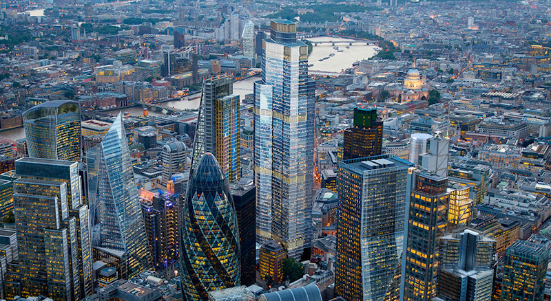
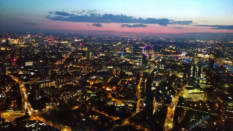
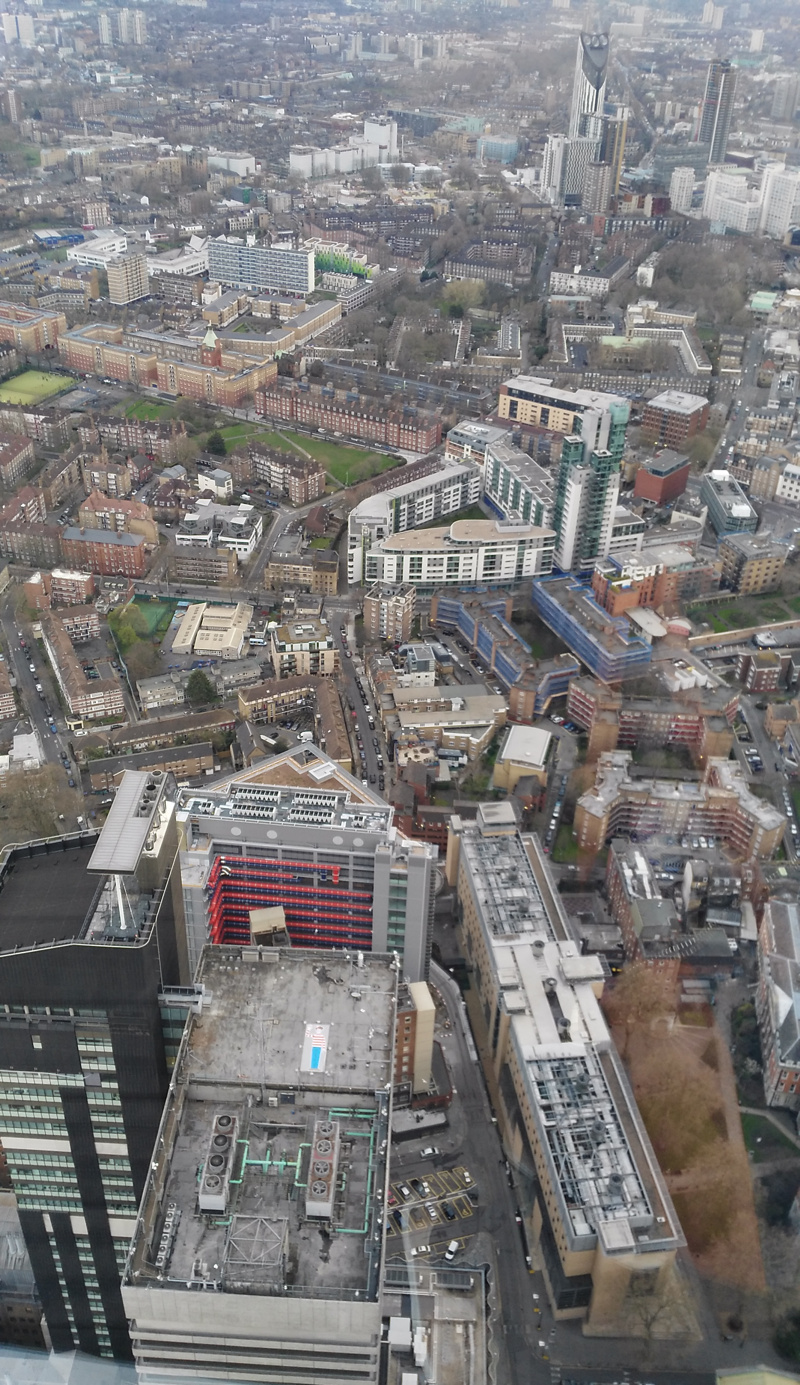
You made it! The building beams cast a reflection on the glass panels which is surprisingly strong but an hour before sunset they turn off the inside lighting, which helps, and after dark it is not a problem. There are also free (yay!) digital telescopes arranged around the edge (press the button on the left to get the live view, which unfortunately does not zoom in as far as the historic image views – take your own binoculars or telephoto lens, if you are trying to spot your suburban home!) The photo at the bottom of this post is the first view you see – looking to the south. It’s the least exciting direction, but is still visually striking. N.B. In this photo, on the top of the building at the bottom, which is itself a 25-floor skyscraper (Guys Hospital), you can spot Wally on the roof. He is there for a few more days, as part of an aerial I-spy.

Up three more flights of stairs to get to Level 72, the outdoor platform (though it still feels enclosed as there is glass above head-height, and the core behind you) which also hosts a Champagne bar. The floor is wooden decking, and partially under cover. Don’t forget to look up from this level, in the corners. Here, the view is more open, and you can see the rest of the Shard heading up for a further 17 floors, as it tapers to a point – see the photo above. There is also a further set of stairs up, tantalisingly off-limits to visitors.

The View from the Shard is definitely worth the trip, if you live in London and plan a few visits this year. It’s high enough up (the platforms are nearly 300m) up to give London a “Sim City” (or, at night, “Blade Runner”) feel, and a view which appears to cover the whole of London and – thanks to the continuous urban extent right to the horizon – makes the city look truly huge, in a way that maps, lower viewpoints and aircraft views (too high) don’t achieve.

…oh, and if you need another reason to go, there’s a nice floor map in the sky lobby, half-way up to the top.

Thanks to Diamond Geezer for tipping me off about the Love London cards.

shardtop_2

Categories
London

Locations of the 12 London “High Lines”

To aid virtual exploration of the twelve possible “High Line” elevated walking routes in inner-city London, that I’ve highlighted in my series over the last couple of weeks, I’ve created this map on Google Maps, showing the extent of each of the twelve routes.

See a larger version of the map here, which you can explore using aerial imagery and “Street View”.

To recap, the 12 are:

  1. The East London Line Extension
  2. The Greenway
  3. Millwall Viaduct
  4. Peckham Coal Line
  5. Parkland Walk
  6. Bishopsgate Goods Yard
  7. Limehouse Curve
  8. Barbican Highwalks
  9. Pedways of the City
  10. Borough Market Bridge
  11. Garden Bridge
  12. The Camden High Line
Categories
Bike Share London

London’s Bikeshare Needs A Redistribution of Stations

bikes_journey_day

Here’s an interesting graph, which combines data on total journeys per day on London’s bicycle sharing system (currently called “Santander Cycles”) from the London Data Store, with counts of available bicycles per day to hire, from my own research database. The system launched in summer 2010 and I started tracking the numbers almost from the start.

You can see the two big expansions of the system as jumps in the numbers of available bikes – to all of Tower Hamlets in early 2012, and to Putney and Fulham in late 2013. Since then, the system has somewhat stagnated in terms of its area of availability, although encouragingly at least the numbers of available bikes has remained constant at around 9500, suggesting that at least the operator is on top of being able to maintain and repair the bikes (or regularly source new ones). Some of the individual bikes have had 4000 trips on them. There is a small expansion due in the Olympic Park in spring 2016, but the 8 new docking stations represents only a 1% increase in the number of docking stations across the system, so I doubt it will have a significant impact on the numbers of available bikes for use.

There is a general downward trend in the numbers of uses of each bike per day, since the halycon Olympic days of Summer 2012, over and above the normal seasonal variation, which concerns me. The one-year moving average recently dipped below 3 uses of each bike per day, this summer, and I am not confident it will pick up any time soon. (The occasional spikes in uses/bike, by the way, generally correspond to sunny summer bank holidays, tube strikes and Christmas Day).

To rejuvenate the system and draw in more users, rather than relying on the established commuter and tourist flows which likely dominate the current usage, I am convinced that the system needs to expand – not necessarily in terms of the number of bikes or docking stations, but in its footprint. I think the system would be much improved by dropping the constraining rule on density (which approximates to always having one docking station every 300m) and instead redistributing some of the poorly performing docking stations themselves further out. It’s crazy that, five years on, there are no docking stations in central Hackney, Highbury, or Brixton, three areas with an established cycling culture and easily cycle-able into the centre of London. Conversely, Putney and Tower Hamlets simply don’t need the high density of docking stations that they currently have, except in specific areas (such as around the train/tube stations in Putney, and Canary Wharf).

Ideally we would have a good density of docking stations throughout cycleable London but, as docking stations (and bikes) are very expensive, I would suggest that TfL instead adopts the model used in Bordeaux (below). Here, the city retains a high-dense core serving tourists, commuters and other centrally-based workers, but adopts a much lower density in the suburbs, so that, while tourists can still “run into” docking stations they don’t know about in the centre thanks to the high density, local users can benefit from the facility in their neighbourhood too, even if it requires a little longer walk to get to it.

bikes_bordeaux

Technical note: Before November 2011, the London numbers included bicycles that were in a docking station but not available to hire (i.e. marked as broken). This exaggerates the number of available bikes (and correspondingly reduces the number of hires/bike/day from the true value) in this period by a small amount – typically around 3-5%, an effect I am not considering significant for this analysis.

Categories
Leisure London

The Camden High Line

[Update: Being actively considered/promoted by Camden Town Unlimited]

Over the last two weeks I have featured eleven potential London High Lines (see all the previous ones here) – all of them could be interesting place but none of them quite have the potential to be a London “High Line”.

Today, my final London High Line, is the one that I think ticks all the boxes. It runs through post-industrial gritty inner-city London, it’s elevated, it’s an old railway route, and the land is just lying there, undeveloped. It is the Camden High Line – a potential High Line that runs between Camden Gardens Park (just off Kentish Town Road), around the back of Camden Road station, across a number of intact, unused bridges and finishing at an existing footbridge across the Midland Mainline, just past Camley Street. In all, a distance of around 800m (half a mile), with a possible Phase 2 future extension across to the huge and evolving development area behind King’s Cross station, although this additional section would require the building of at least one footbridge.

camdenroute

The route:

1. Western end

camden0

This would likely need the most expensive new structure – a lift with a surrounding staircase, to allow step-free access onto the route from the western end. It would also need to use a small section of the public park here – Camden Gardens Park – for the lift/staircase to “land”.

camden1map

The route would then move quite quickly away from the current line, using the disused (and now heavily overgrown) section behind Camden Road station – another possible access point and one that could provide an alternative step-free entrance using the existing lift there, from the eastbound platform (ticket barrier location notwithstanding).

The route moves back towards the current line, crossing Camden Road on a disused but intact bridge as it does so. This is the bridge which currently has “Camden Road” painted on its side, prominently, by Network Rail, visible when travelling down the hill from Camden Road. (The other nearby railway bridge also has “Camden Road” painted on it, when facing the other way.) As you can see from the Google Streetview imagery, the bridge is sitting waiting for a walkway to be added onto it:

camden1

2. Middle section

The route continues along the former double-track, alongside the existing double-track between Camden Road and Caledonian Road & Barnsbury, walled off safely but with plenty of space available for the High Walk itself.

camden2map

Shortly, a couple of other bridges are crossed. One crosses over at a road junction. There is plenty of pavement below the bridge here and so this is a potential landing location for a staircase (possibly spiral) for an intermediate entry/exit to the walk.

camden2

3. Eastern end

The route continues eastwards, narrowing quite a bit near the end at the final bridge across Camley Street although still with plenty of space beside the operational railway for a path and appropriate screening from the operational railway.

camden3map

There is a choice of endings at the eastern end. There is already a (pretty unpleasant and unsafe feeling) set of steps down from the western side of the Midland Mainline existing footbridge. This could be remodelled and made safer. At the bottom is the northern end of Camley Street, a light industrial estate, with an existing pedestrian link north to Agar Grove, and a quiet road south that leads to the Regent’s Canal – from there, King’s Cross Central is nearby. Alternatively, continuing along the road eventually leads to St Pancras International station.

camden3

The second ending is a level access from the footbridge crossing the Midland Mainline – at its eastern end, paths head north and then northeast, connecting to Agar Grove and eventually Caledonian Road. This has the benefit of providing a step-free end to the walk, so that, unlike at the western end, a lift would not be necessary.

4. Phase 2 extension

This would connect the eastern end of the Camden High Line, southwards to the huge mixed-use King’s Cross Central redevelopment and Central St Martin’s College, behind King’s Cross station. Such a route would require crossing over (or under) the existing North London Line, and various other lines emerging from St Pancras, with at least one footbridge needed – as such it would be an expensive exercise. I’m just mentioning it here as having a complete “High Line” link running all the way between, Camden Town and King’s Cross, to parallel with the Regent’s Canal route to the south of it, seems like an obvious route between two major north London walking destinations.

So could it happen? Well, the viability of the project would depend on Network Rail reliquishing its land, on support from Camden Council, a fundraising effort to fund a feasibility report and build the actual trail, and on the creation of a local trust dedicated to maintaining such a route once it opened on a largely voluntary basis, like happens on the New York High Line. In short, it wouldn’t be easy, but it is certainly very possible.

See all 12 of my London “High Lines”.

Photos from Google Street View and Google Aerial Imagery. Map from OpenStreetMap (Data ODbL, cartography CC-By OSM contributors). Subsequent to first publication, I’ve renamed this blogpost from “The Camden Line” to avoid confusion with the MARC Camden Line rail commuter line in Maryland, USA.